Improved Statistical Intensity Forecast Models A Joint Hurricane

- Slides: 22

Improved Statistical Intensity Forecast Models: A Joint Hurricane Testbed Project Update Mark De. Maria, NOAA/NESDIS, Fort Collins, CO John A. Knaff, CIRA/CSU, Fort Collins, CO John Kaplan, NOAA/AOML/HRD, Miami, FL Presented at the Interdepartmental Hurricane Conference March 22, 2006

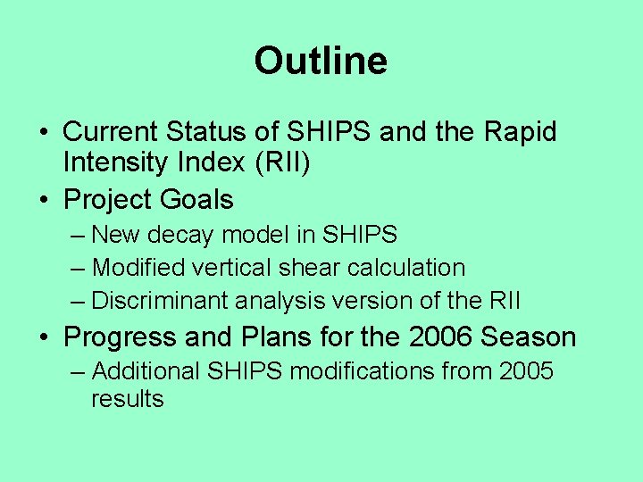
Outline • Current Status of SHIPS and the Rapid Intensity Index (RII) • Project Goals – New decay model in SHIPS – Modified vertical shear calculation – Discriminant analysis version of the RII • Progress and Plans for the 2006 Season – Additional SHIPS modifications from 2005 results

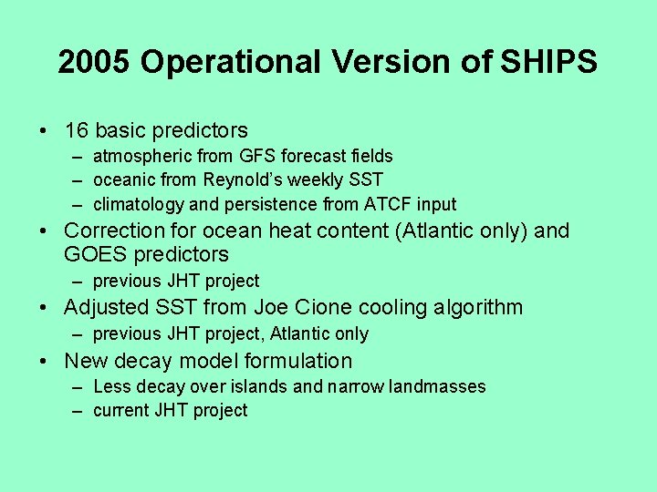
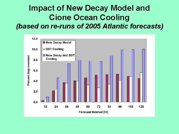
2005 Operational Version of SHIPS • 16 basic predictors – atmospheric from GFS forecast fields – oceanic from Reynold’s weekly SST – climatology and persistence from ATCF input • Correction for ocean heat content (Atlantic only) and GOES predictors – previous JHT project • Adjusted SST from Joe Cione cooling algorithm – previous JHT project, Atlantic only • New decay model formulation – Less decay over islands and narrow landmasses – current JHT project

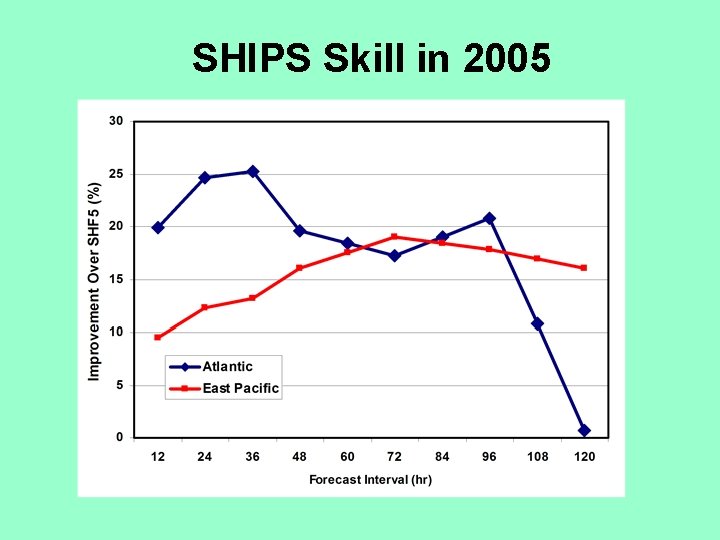
SHIPS Skill in 2005

Impact of New Decay Model and Cione Ocean Cooling (based on re-runs of 2005 Atlantic forecasts)

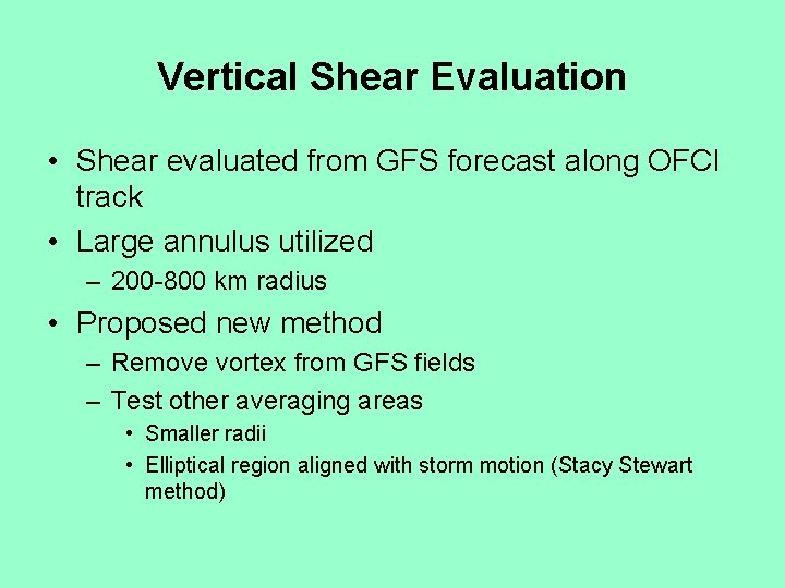
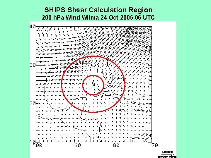
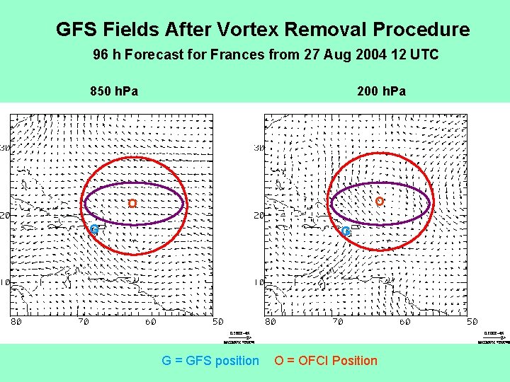
Vertical Shear Evaluation • Shear evaluated from GFS forecast along OFCI track • Large annulus utilized – 200 -800 km radius • Proposed new method – Remove vortex from GFS fields – Test other averaging areas • Smaller radii • Elliptical region aligned with storm motion (Stacy Stewart method)

SHIPS Shear Calculation Region 200 h. Pa Wind Wilma 24 Oct 2005 06 UTC

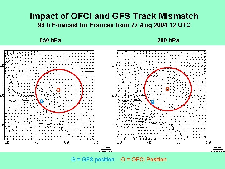
Impact of OFCI and GFS Track Mismatch 96 h Forecast for Frances from 27 Aug 2004 12 UTC 850 h. Pa 200 h. Pa O O G G G = GFS position O = OFCI Position

GFS Fields After Vortex Removal Procedure 96 h Forecast for Frances from 27 Aug 2004 12 UTC 850 h. Pa 200 h. Pa O O G G G = GFS position O = OFCI Position

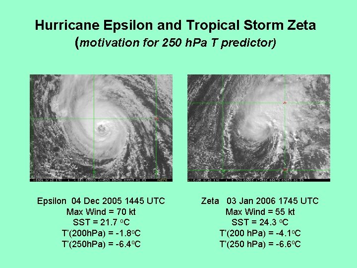
Additional Changes based on 2005 Season • Add storm translation to MPI calculation – Wilma (2005), Florence (1994) • Add 250 h. Pa temperature predictor for cold upper atmosphere, but low tropopause – Epsilon and Zeta (2005) • Print recon variables for qualitative use – GRIP model sample too small • Test forecast with more general predictive equation – Will be run after SHIPS run, but saved for evaluation

Storm Translational Speed and MPI – Current version adds constant 12 kt to DK (1994) and WH (1997) formulas – Acceleration not accounted for – Add fraction of translational speed from Schwerdt formula (a = 1. 5 c 0. 63) to MPI – Improves fit to 1982 -2005 sample

Hurricane Epsilon and Tropical Storm Zeta (motivation for 250 h. Pa T predictor) Epsilon 04 Dec 2005 1445 UTC Max Wind = 70 kt SST = 21. 7 o. C T’(200 h. Pa) = -1. 8 o. C T’(250 h. Pa) = -6. 4 o. C Zeta 03 Jan 2006 1745 UTC Max Wind = 55 kt SST = 24. 3 o. C T’(200 h. Pa) = -4. 1 o. C T’(250 h. Pa) = -6. 6 o. C

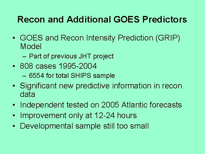
Recon and Additional GOES Predictors • GOES and Recon Intensity Prediction (GRIP) Model – Part of previous JHT project • 808 cases 1995 -2004 – 6554 for total SHIPS sample • Significant new predictive information in recon data • Independent tested on 2005 Atlantic forecasts • Improvement only at 12 -24 hours • Developmental sample still too small

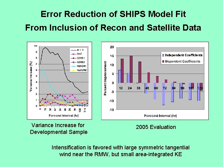
Error Reduction of SHIPS Model Fit From Inclusion of Recon and Satellite Data Variance Increase for Developmental Sample 2005 Evaluation Intensification is favored with large symmetric tangential wind near the RMW, but small area-integrated KE

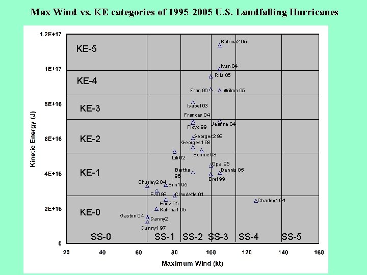
Max Wind vs. KE categories of 1995 -2005 U. S. Landfalling Hurricanes Katrina 2 05 KE-5 Ivan 04 Rita 05 KE-4 Fran 96 Isabel 03 KE-3 Frances 04 Floyd 99 Jeanne 04 Georges 2 98 Georges 1 98 KE-2 Lili 02 Bonnie 98 Bertha 96 KE-1 Charley 2 04 Erin 1 95 Earl 98 KE-0 Wilma 05 Opal 95 Dennis 05 Bret 99 Claudette 01 Erin 2 95 Katrina 1 05 Gaston 04 Charley 1 04 Danny 2 Danny 1 97 SS-0 SS-1 SS-2 SS-3 SS-4 SS-5

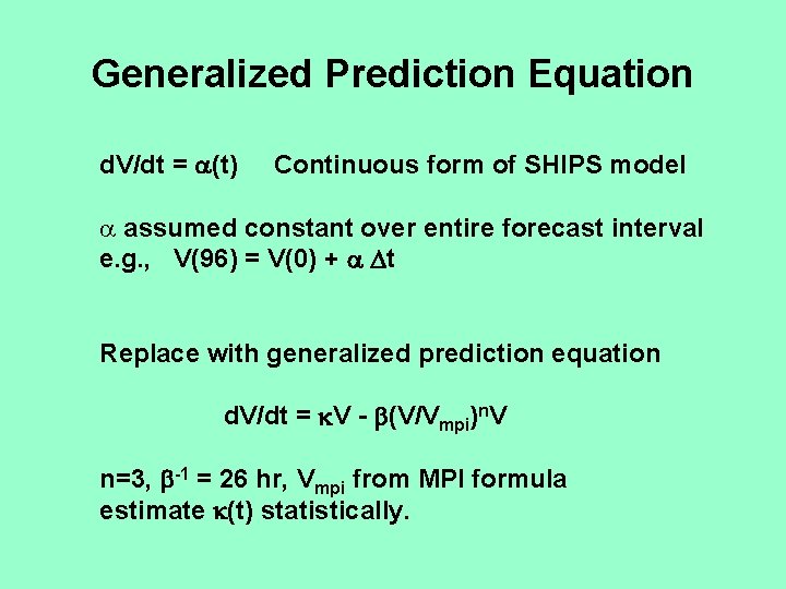
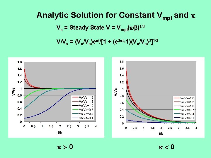
Generalized Prediction Equation d. V/dt = (t) Continuous form of SHIPS model a assumed constant over entire forecast interval e. g. , V(96) = V(0) + t Replace with generalized prediction equation d. V/dt = V - (V/Vmpi)n. V n=3, -1 = 26 hr, Vmpi from MPI formula estimate (t) statistically.

Analytic Solution for Constant Vmpi and Vs = Steady State V = Vmpi( / )1/3 V/Vs = (Vo/Vs)e t/[1 + (e 3 t-1)(Vo/Vs)3]1/3 0 0

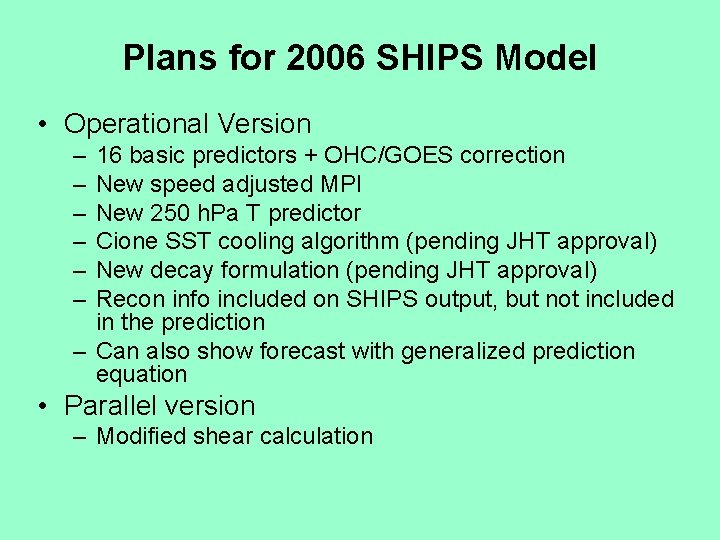
Plans for 2006 SHIPS Model • Operational Version – – – 16 basic predictors + OHC/GOES correction New speed adjusted MPI New 250 h. Pa T predictor Cione SST cooling algorithm (pending JHT approval) New decay formulation (pending JHT approval) Recon info included on SHIPS output, but not included in the prediction – Can also show forecast with generalized prediction equation • Parallel version – Modified shear calculation

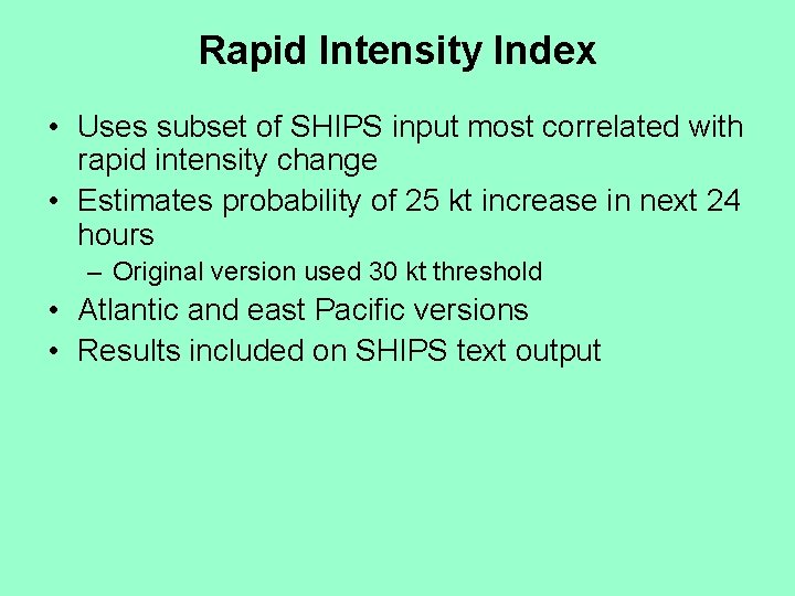
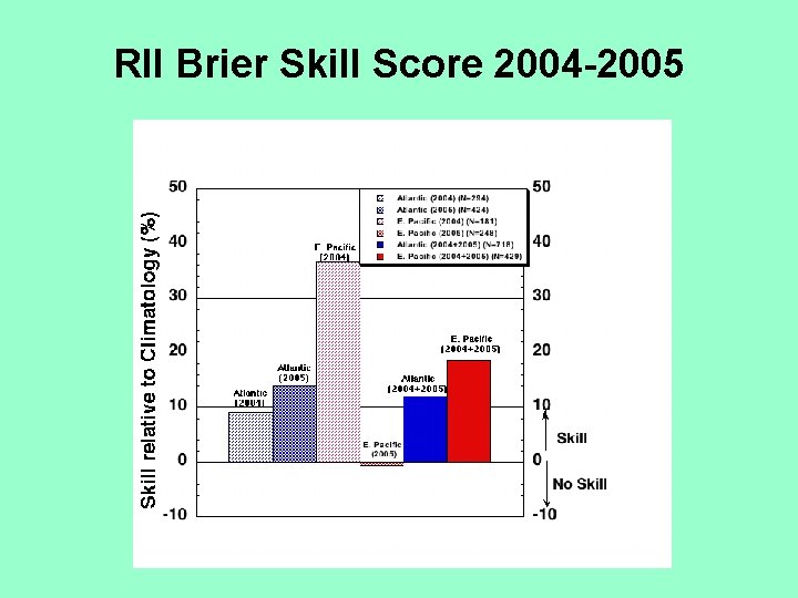
Rapid Intensity Index • Uses subset of SHIPS input most correlated with rapid intensity change • Estimates probability of 25 kt increase in next 24 hours – Original version used 30 kt threshold • Atlantic and east Pacific versions • Results included on SHIPS text output

RII Brier Skill Score 2004 -2005

RII Improvements • Original version used binary method – 0 or 1 depending on if predictor exceeded threshold • Updated version scales predictors between 0 and 1 • Current project – Use discriminant analysis to determine optimal weights for combining predictors – To be developed during J. Kaplan visit to CIRA April 10 -14 th – Will be evaluated on independent 2006 cases

Acknowledgments • Thanks to the TPC and JHT support staff – Chris Sisko – Alison Krautkramer – Chris Lauer – Jim Gross – Michelle Mainelli