Important Geographical Instruments By Teacher Neil Libiano Geography

Important Geographical Instruments By: Teacher Neil Libiano

Geography • Geography is the subject that studies about the management of land human’s habitat, including the study of human’s social factors, by the use of geographic techniques and tools. The basic instruments that students should be familiar with are globes, maps, compass, aerial photographs, and satellite images.

Globe • Characteristics and advantages of globes: a globe is a scaled model of the Earth, which has a spherical shape. It shows locations and territories of the countries, the continents, the seas, and the oceans. It can be made from several types of material, such as paper, plastic, and rubber.

Usage of globes • • • 1. To study the direction of the Earth’s rotation To study the 7 continents To study the location of each country To study the orbit of the earth To study the meridian lines To study the parallel lines or the parallel of latitudes

Maps • Map is a scaled down diagram drawn on a flat surface showing physical features and locations of places that are on earth’s surface. Sometimes symbols are used to represents real features on the earth.

Importance and advantages of the maps • 1. Information contained in a map can be studied without visiting the actual places; therefore, it saves time and money. • Studying from a map can give us both the information of a specific location and the information of other locations. • Information contained in a map helps in management of the land shows how to navigate through the areas correctly.

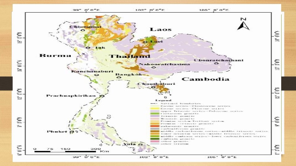
Types of maps • 1. General reference map- is the map that shows general information of physical features of an area; both natural and manmade. These maps are, for example, geographical maps with the scales of 1: 50, 000 and 1: 250, 000. • 2. Thematical Map- is the map that shows specific features, such as population map, geographic map, weather map, road map, and travelling map.

Usage of maps • Directions • Symbols

Compasses • A compass is a geographical instrument that gives information about direction. It works by the attraction force between the Earth magnetic field and the compass needle.

Aerial Photographs • An aerial photograph is a photograph obtained from a camera that is attached to an aircraft, such as an airplane or a balloon, and is taken vertically or obliquely to the earth’s surface.

Satellite images • Unlike the normal cameras, the cameras on the satellites can capture light in a wide range of frequencies.
- Slides: 13