
Illinois Height Modernization Program Goals Accomplishments and Challenges
- Slides: 17
Illinois Height Modernization Program Goals, Accomplishments, and Challenges Sheena K. Beaverson Amy Eller
Illinois Height Modernization Goals • Illinois Geodetic Control – Install surveying benchmarks to establish a comprehensive vertical control network. • Light Detection and Ranging (Li. DAR) data. – Establish data sharing agreements for existing, or acquire new, airborne Li. DAR. • CORS, RTK – Share information on commercial CORS, RTK coverage in Illinois.
Illinois Height Modernization Federal Funding • Years 1 -3: funded by federal appropriations. – Year 1: 2008 -2009 funded $300, 000 – Year 2: 2009 -2010 funded $725, 000 – Year 3: 2010 -2011 funded $800, 000 • Years 4 -8: Federal Highway Administration, State Planning and Research (SPR) funding – Year 4: 2011 -2012 funded $3, 500, 000 – Year 5: 2012 -2013 funded $3, 500, 000 – Year 6: 2013 -2014 funded $3, 500, 000
Illinois Height Modernization Federal Funding • Years 4 -8: FHWA SPR funding – Year 4: 2011 -2012 funded $3, 500, 000 • option to renew up to 4 times at same rate. – IDOT required to provide 20% in-kind match. • $875, 000 in staff time or Li. DAR data acquisition.
Illinois Height Modernization State Funding • No direct funding provided by the state, or any state agency, at this time. – Li. DAR data contributions from IDOT, IDOT Districts, IDNR, counties, NRCS, USACE, USGS. – Surveying reconnaissance by IDOT, IDOT Districts
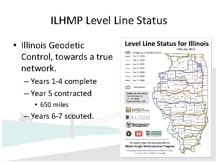
ILHMP Level Line Status • Illinois Geodetic Control, towards a true network. – Years 1 -4 complete – Year 5 contracted • 650 miles – Years 6 -7 scouted.
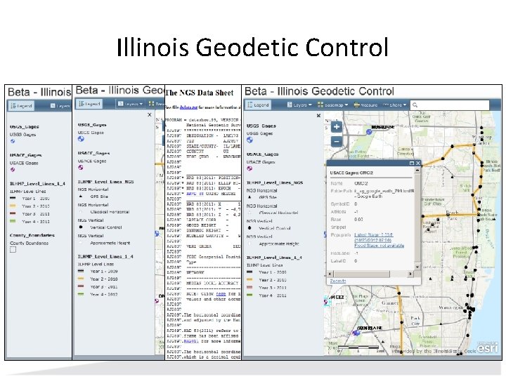
Illinois Height Modernization Accomplishments • Illinois Geodetic Control, Years 1 -4 – Install 890 new benchmarks; visit 222 monuments • Three counties with no 1 st or 2 nd order vertical marks gained 25+ new 2 nd order 1 st class marks in Year 4. – Illinois Geodetic Control (beta v. 1. 0) released
Illinois Geodetic Control
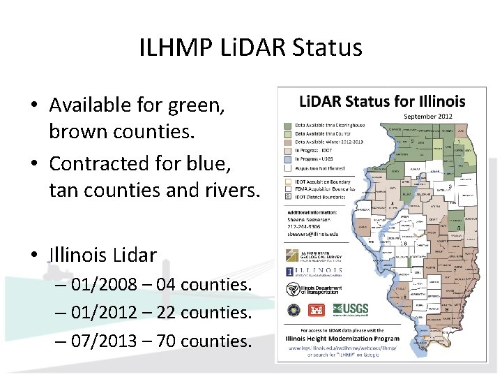
ILHMP Li. DAR Status • Available for green, brown counties. • Contracted for blue, tan counties and rivers. • Illinois Lidar – 01/2008 – 04 counties. – 01/2012 – 22 counties. – 07/2013 – 70 counties.
Illinois Height Modernization Accomplishments • Light Detection and Ranging (Li. DAR) data. – QA/QC newly acquired data – Share standards and specifications. – Manage and provide access to data. • Establish map services for digital elevation models by county (anticipate Fall 2013 release)
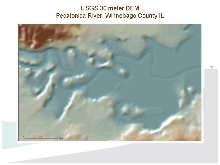
USGS 30 meter DEM Pecatonica River, Winnebago County IL
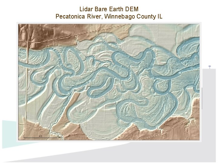
Lidar Bare Earth DEM Pecatonica River, Winnebago County IL
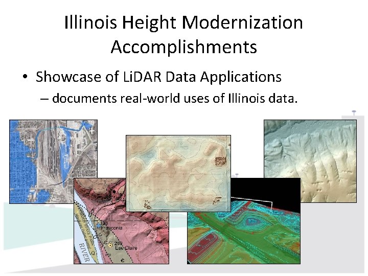
Illinois Height Modernization Accomplishments • Showcase of Li. DAR Data Applications – documents real-world uses of Illinois data.
Illinois Height Modernization Challenges • Maintain momentum – Activities require staff, hardware, software. • Future funding – NGS funding for HM not currently option. – SPR funding is limited in duration. – State of Illinois budget situation is dire. – IDOT and ISGS agency budgets support a wide range of other activities, not HM.
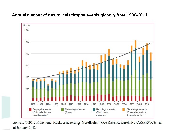
Annual number of natural catastrophe events globally from 1980 -2011 15
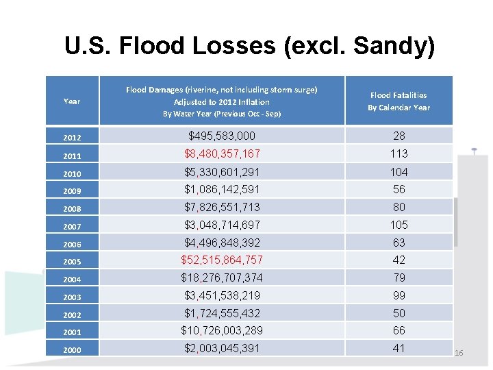
U. S. Flood Losses (excl. Sandy) Year Flood Damages (riverine, not including storm surge) Adjusted to 2012 Inflation By Water Year (Previous Oct - Sep) Flood Fatalities By Calendar Year 2012 $495, 583, 000 28 2011 $8, 480, 357, 167 113 2010 $5, 330, 601, 291 104 2009 $1, 086, 142, 591 56 2008 $7, 826, 551, 713 80 2007 $3, 048, 714, 697 105 2006 $4, 496, 848, 392 63 2005 $52, 515, 864, 757 42 2004 $18, 276, 707, 374 79 2003 $3, 451, 538, 219 99 2002 $1, 724, 555, 432 50 2001 $10, 726, 003, 289 66 2000 $2, 003, 045, 391 41 16
Questions?