Identifying Sensitive Aquifers in Ohio Chris Kenah Michael


- Slides: 20
Identifying Sensitive Aquifers in Ohio Chris Kenah, Michael. W. Slattery, Linda. D. Slattery, and Michael Eggert Ohio EPA, Division of Drinking and Ground Waters DMT’ 06
Outline • • Logic for identifying sensitive aquifers Suspected sensitive aquifers Water Quality/SWAP data - Impacted PWSs Analysis of ODNR glacial aquifer attributes and location of impacted PWSs – Differences between geologic setting and lithologic attributes • Ohio Sensitive Aquifers
Data Sources • Geologic Information – Recharge Pathways – ODNR Aquifer Maps • PWS Compliance and Ambient Data – Nitrate, VOC, SOC • Special Study Knowledge
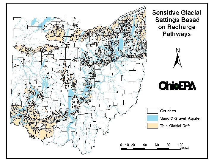
Logic for Sensitive Aquifer ID • Short or Rapid Recharge Pathways • Areas of Ground Water - Surface Water Interaction • Recharge through Glacial Drift – Identify glacial settings with rapid recharge
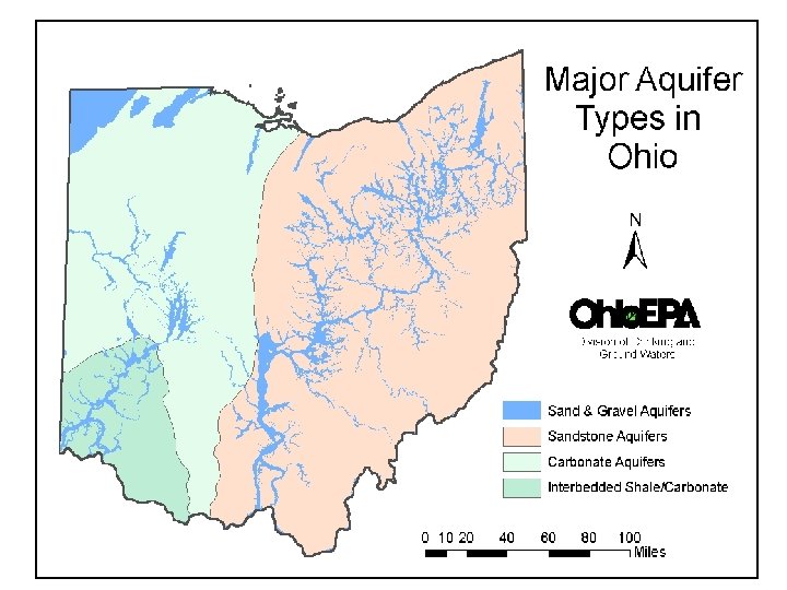
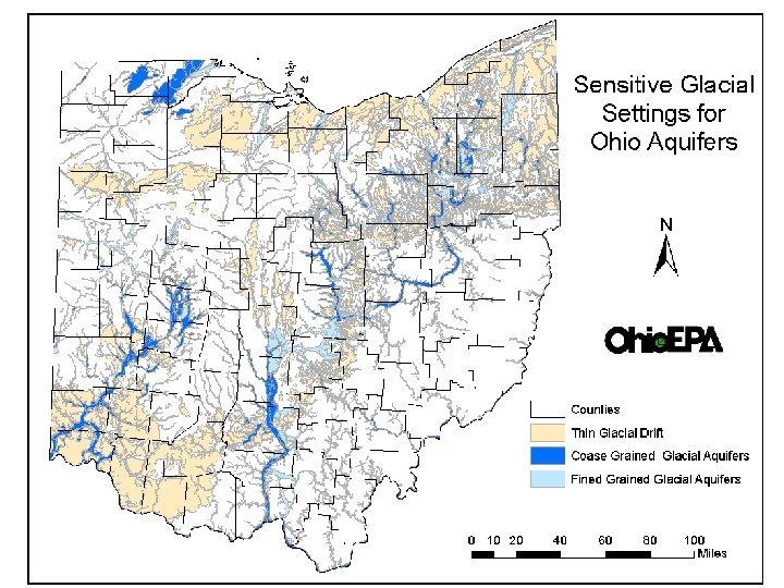
Sensitive Glacial Settings • Buried Valleys - sand & gravel aquifers – Fine to coarse grained material – Buried valley, alluvial, out wash/kame, and beach ridge geologic settings • Thin Glacial Drift - over bedrock aquifers – Fined grained - tills and lacustrine deposits – Lacustrine, ground and end moraine settings
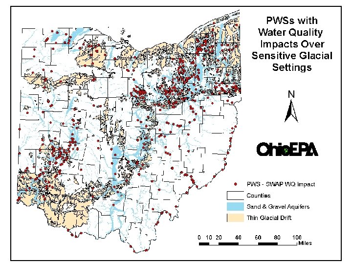
Ohio SWAP Program • SWAP Susceptibility Analysis – Includes evaluation of compliance data; • 516 PWSs Highly Susceptible – Based on water quality compliance data • Nitrate > 2. 0 mg/L • VOC or SVOC detections
WQ Impacts in Sensitive Aquifers? • Attach glacial aquifer attributes to PWS locations • Evaluate PWS WQ impact association with: – Glacial geologic settings – Glacial lithologies • Compare percentage of PWSs impacted
Data Limitations • ODNR aquifer maps thickness are ranges not well depths – If glacial drift < 25’, bedrock production well likely – If glacial drift > 25’, production may be in drift • In thicker glacial sand gravels, well depth may not approach glacial drift thickness • In thicker till lithologies, production may come from sand lenses or bedrock • Utilizing statewide generalizations
Rapid Recharge to Fractured Bedrock
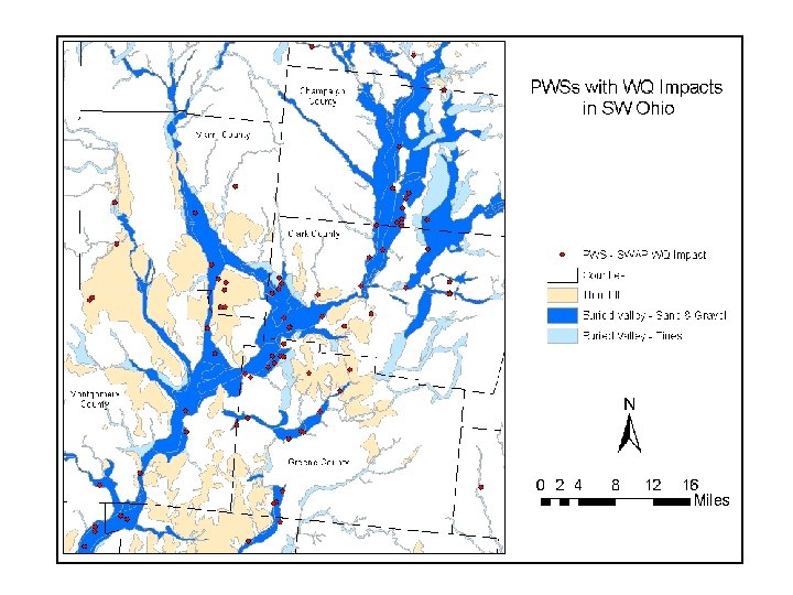
PWS Water Quality Impacts - Geologic Settings
PWS Water Quality Impacts – Lithologic Association
Sensitive Aquifers • PWSs with WQ impacts associated with: – Coarse S&G aquifers – Thin Tills (0 -25 ‘) • Aquifers composed of fines provide more protection than S&G aquifers and thin tills over bedrock aquifers; • Thick tills are associated with low % of PWSs with WQ impacts (3 -4 %)
Future Activities - Sensitive Aquifers • Attach glacial drift thickness, DRASTIC ranking, and soil properties to PWS locations for analysis of WQ impacts • Incorporate well casing length and depth as analysis factors • Evaluate dissolved vs particulate sensitivity • Identify areas where horizontal flow provides rapid recharge • Short term sampling in sensitive aquifers
Rapid Horizontal Recharge Linked with Flooding
Acknowledgments Data: • Ohio EPA Staff • PWS Operators • ODNR Aquifer Map GIS Support: • Ohio EPA, DDAGW GIS Unit