
Identifying Grocery Gaps in Surrey BC BY ADLE
Identifying Grocery Gaps in Surrey, BC BY ADÈLE THER IAS GEOB 370
Contents Context and Research Question Data Methods Findings Uncertainty
Research Question Where should a new produce box program be located in Surrey in order to reach the maximum number of people who do not have access to healthy affordable food within a reasonable walking time?
Data Residential Areas Walking Paths Route. Logistics (DMTI) Food Premise Geocoding Statistics Canada Population Data (2011)
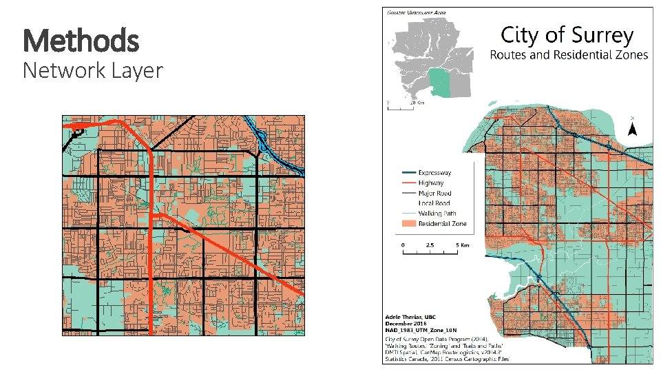
Methods Network Layer
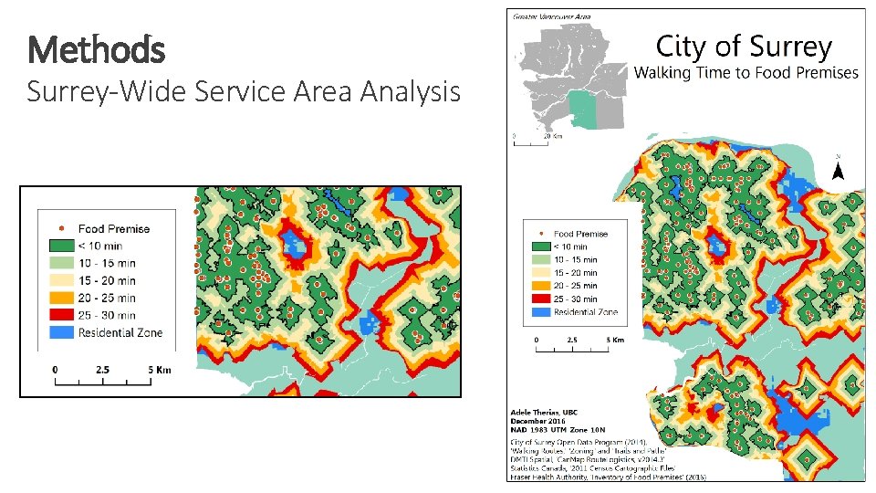
Methods Surrey-Wide Service Area Analysis
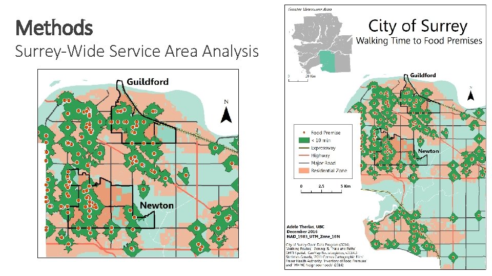
Methods Surrey-Wide Service Area Analysis
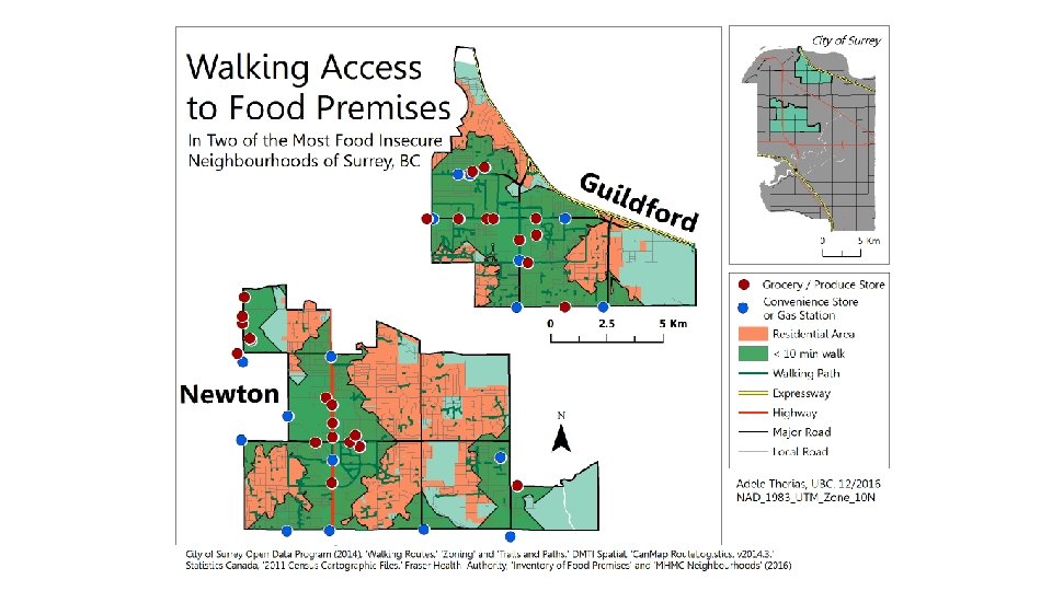
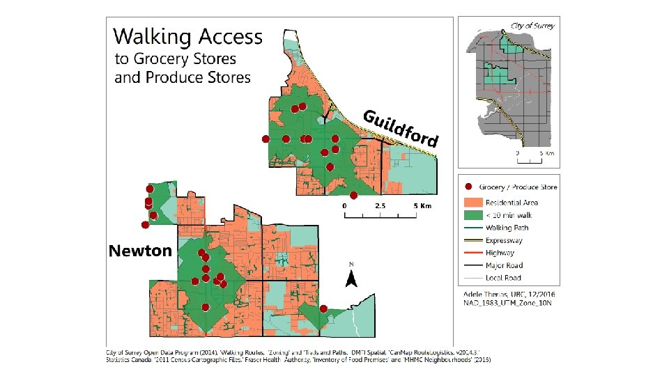
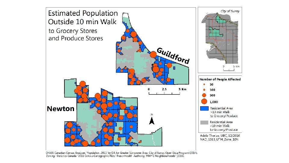
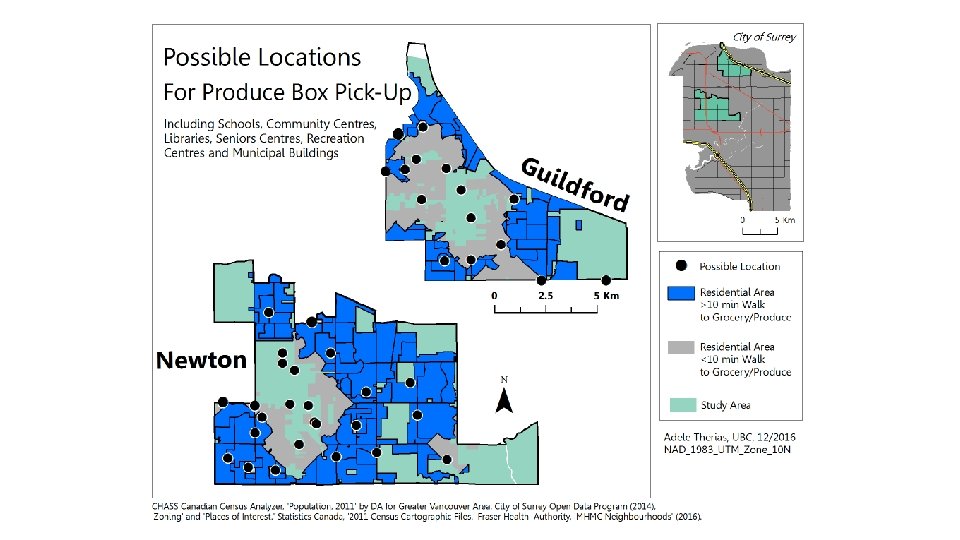
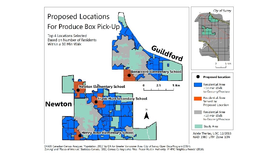
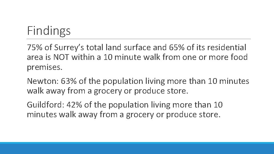
Findings 75% of Surrey’s total land surface and 65% of its residential area is NOT within a 10 minute walk from one or more food premises. Newton: 63% of the population living more than 10 minutes walk away from a grocery or produce store. Guildford: 42% of the population living more than 10 minutes walk away from a grocery or produce store.
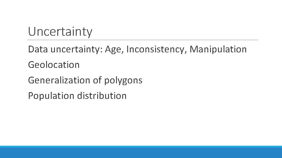
Uncertainty Data uncertainty: Age, Inconsistency, Manipulation Geolocation Generalization of polygons Population distribution
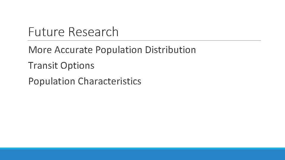
Future Research More Accurate Population Distribution Transit Options Population Characteristics
Thank you! http: //atherias. wixsite. com/grocerygaps
- Slides: 16