Ideas for using Digimap for Schools Darren Bailey

Ideas for using Digimap for Schools Darren Bailey Schools Manager Ordnance Survey

6 Different tasks • Grid reference quiz (4/6/8 figure grid reference, finding places, identifying features) • Flags game (locating countries/continents) • Who’s got the biggest football pitch (Grid reference, finding places, measuring shapes) • What time is it? (Time zones, locating countries/continents, and Maths) • Who’s got the nosiest Street? (Field work, collecting data and digital technologies) • Titanic Journey, story telling with maps!

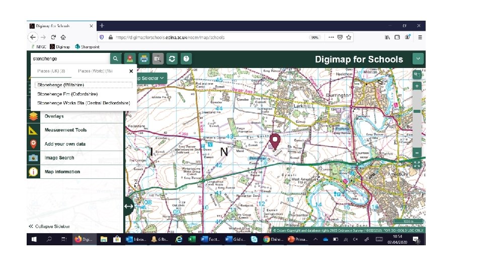
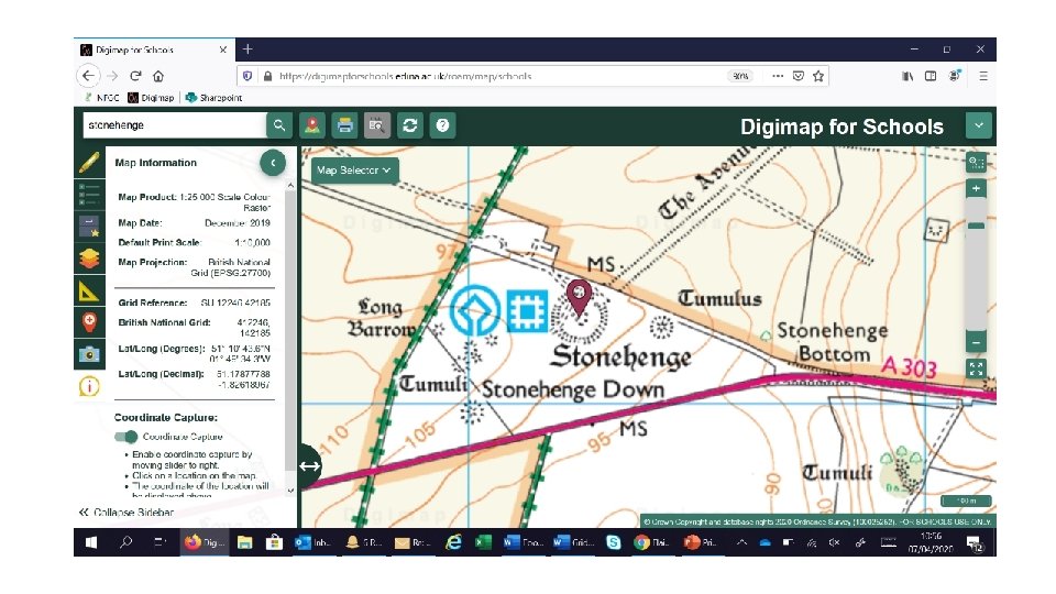
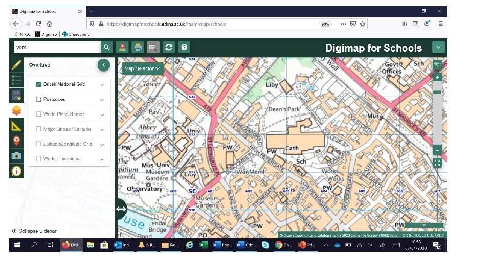
Grid reference quiz; Finding place, 4/6/8 figure grid reference, identifying features 10 sites or places around Britain, find and record the grid reference To make it more difficult add the National Grid overlay and work out the 6 figure grid ref

Grid reference quiz - 10 places in the UK, can you find them and the grid reference Place Clue Stonehenge none Tower of London none Roman Baths Bath York Minster York Welsh Assembly Cardiff Bay Canterbury Cathedral Canterbury Warwick Castle Warwick Edinburgh Castle Old Town Chester Zoo Look north to Upton Eden Project North East from St Austell Grid Ref easy Grid Ref hard

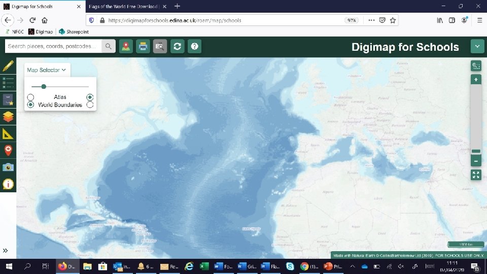
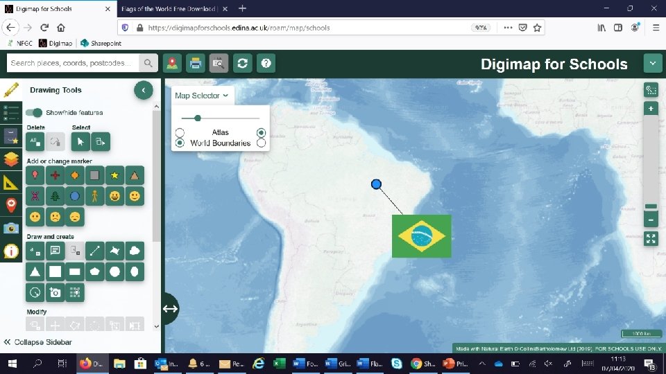
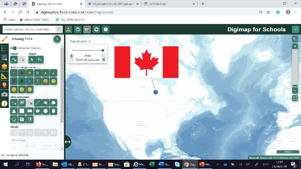
Flags Game; Here are ten flags from around the world can you place them on the map? Clues can be the country name or the continent it’s found on. Jpegs for each flag can be downloaded here - https: //www. craigedmonds. com/flags-of-the-world/ Create a folder (perhaps on the desktop) and save your 10 flags into this. You can either keep the country name attached, or to make it more difficult rename the images to flags 1 -10

Brazil Canada Ivory Coast Ecuador France Greece New Zealand Pakistan South Africa Sri Lanka

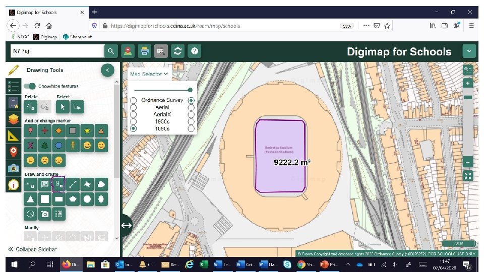
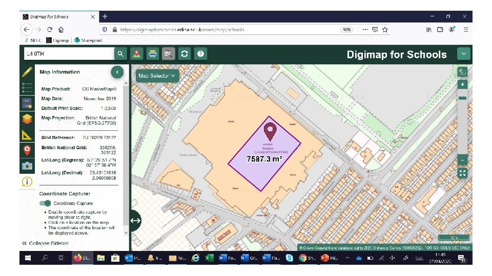
Who’s got the biggest football pitch? Find all 20 premier league grounds and measure the playing area size Extra – Add the grid references as well. Can be tailored to just the teams near you.

Team Postcode Arsenal N 7 7 AJ Aston Villa B 6 6 HE Brighton BN 1 9 BL Bournemouth BH 7 7 AF Chelsea SW 6 1 HS Crystal Palace SE 25 6 PU Burnley BB 10 4 BX Everton L 4 4 EL Leicester LE 2 7 FL Liverpool L 4 0 TH Manchester City M 11 3 FF Manchester Utd M 16 0 RA Newcastle Utd NE 1 4 ST Norwich City NR 1 1 JE Sheffield Utd S 2 4 SU Southampton SO 14 5 FP Tottenham N 17 0 BX Watford WD 18 0 ER West Ham Utd E 20 2 ST Wolverhampton Wanderers WV 1 4 QR Size of playing area Grid Ref for Ground

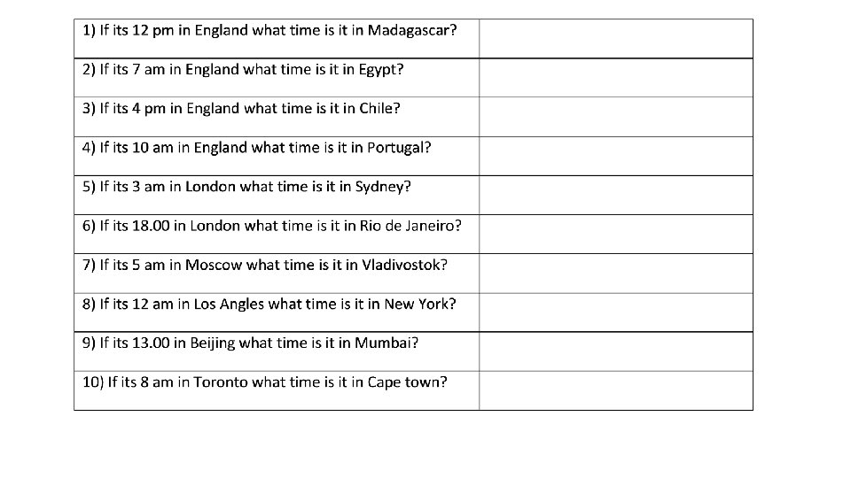
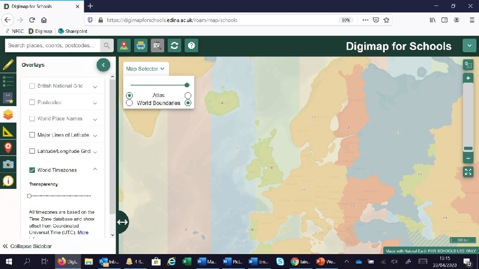
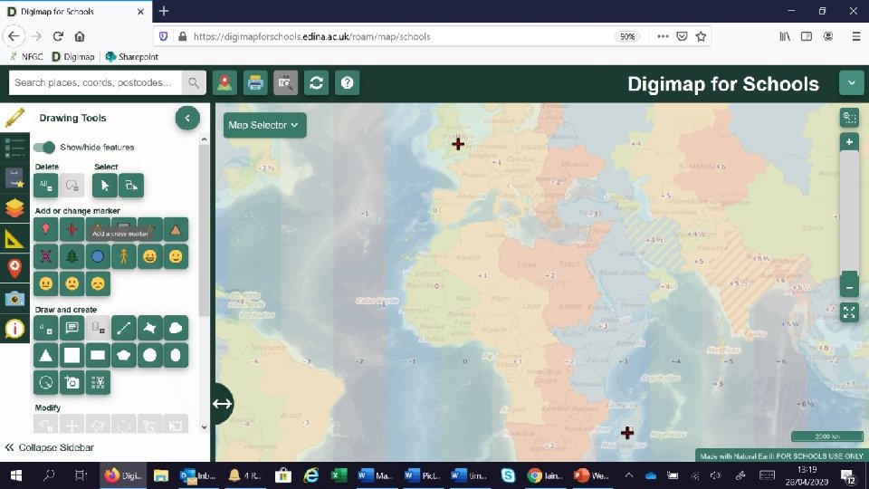
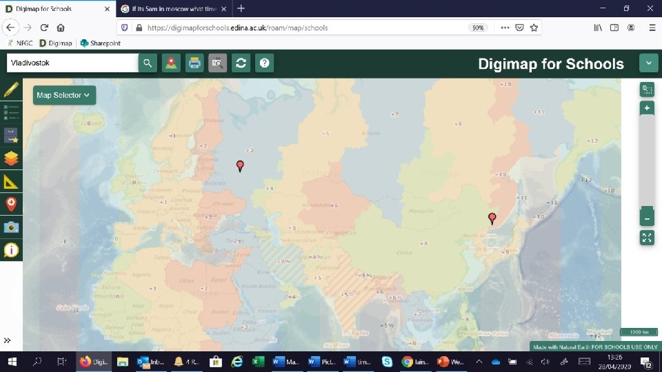
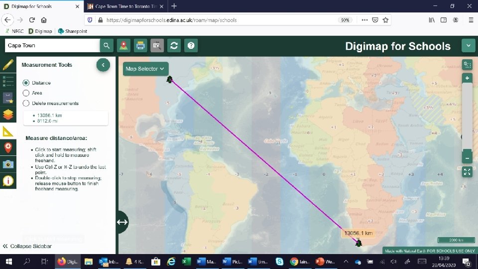
What time is it? Using the time zone layer, can we work out the times in different places. You can start with easy ones and get progressively harder. Covers; place, location, time zones and maths! Extra; measure the distance between places.

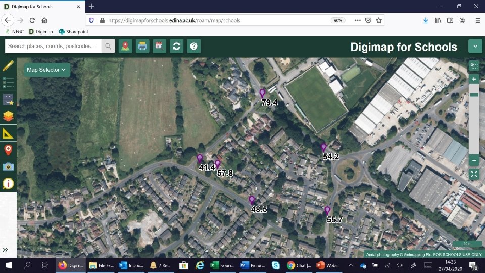
Who’s got the noisiest street? Using location and decibel apps, where is the nosiest place Fieldwork, place and collecting data

You will need; A smart phone Two apps; Decibel X and either Gridpoint GB (iphone) or OS Locate (Android) Excel to record your data.

Gridpoint GB OS Locate Decibel X

Each pupil will record their location using Gridpoint GB or OS Locate And the decibel level By taking a screen shot of each one, they record both pieces of data You can collate all the data together in a spreadsheet and upload it in to Digimap for Schools
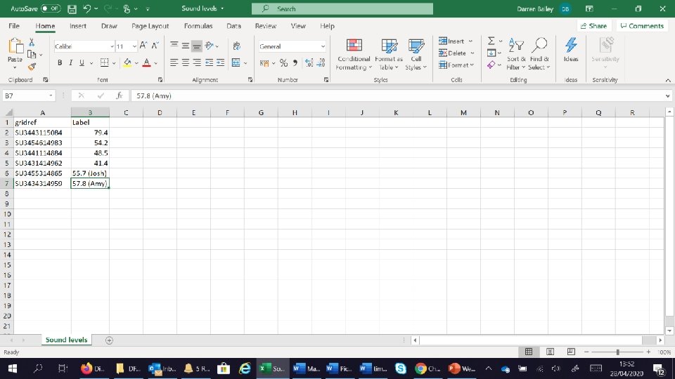

IMPORTANT INFORMATION! Format of location field– Click the ? for the help files Your spreadsheet must be saved as. CSV file
; Temperature Wind Speed")
Other things you could record (could be around the school site); Temperature Wind Speed Rain fall Height

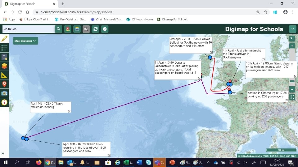
Titanic Journey, story telling with maps Using world maps, Lat and Long, line drawing tool, text boxes and measurement
- Slides: 32