ICTs for eEnvironment adapting to climate change and


- Slides: 30

ICTs for e-Environment: adapting to climate change and resource depletion Richard Labelle (rlab@sympatico. ca) ICT Strategist & ITU-D Consultant The Aylmer Group Gatineau, Canada

Presentation prepared with help of previous presentations prepared by: • Robert Shaw, ITU • Kerstin Ludwig, ITU • Leila Perez-Chavolla, ITU

Overview of technologies

ICTs for e-Environment Report • Objective: – Provide guidelines for developing countries on the use of ICTs for better management and protection of the environment as a key part of their development process, with particular focus on climate change • Examines six areas of ICT use: – – – Environmental Observation Analysis Planning Management and Protection ICT Mitigation and Capacity Building http: //www. itu. int/ITU-D/cyb 44


Key ICT capabilities • Increasingly powerful micro processors: – Computational power as well as increasingly intelligent algorithms for modeling of environmental systems; • Geographic information systems (GIS): – For visualization and interpretation of the datasets from observation systems; • Increasing bandwidth and networked communications, processing and storage capabilities: – Facilitate data sharing and undertaking computationally-intensive tasks through the use of Grid and Cloud computing. • Satellite and direct sensor technology applications: – For recording and storing massive amounts of geographical and historical information with increasing resolution and geographic coverage.

ICTs for managing the environment • To help observe, understand learn about the environment • To share information and data as well as processing power: – Data warehouses, clearing houses and data/information servers; environmental networks and grids; etc. • To facilitate and help coordinate environmental decision-making and management: – including environmental early warning, risk assessment, mitigation and management, etc. • To help mitigate environmental impact.


ICTs • Software such as database management systems (DBMSs) (GIS) • Fibre optic technologies • Intelligent physical and embedded devices connected to the Internet: smart sensors, sensor networks, etc. • Rapid and sophisticated chip sets and processors • Rapid, inexpensive and increasingly high capacity storage devices • Wireless technologies


ICTs: Web based services (SOA) Grid Connectivity • Building applications that span organizations; • Creating virtual organizations; • Seamless integration of datasets and processing capabilities; • Hiding (virtualising) or sharing use of resources, network, infrastructure;

ICTs: Web based services (SOA) – cont’d (1) Web Services • Glue for heterogeneous platforms/applications/systems; • Cross- and intra-organization integration; • Standards-based distributed computing; • Interoperability; • Composability; • Based on the idea of Service Orientation.

ICTs: Web based services (SOA) – cont’d (2) Web Applications • • Blogging, social networking; Data processing/transformation; Content upload, sharing, discovery; Storage, computation, messaging; Identity and presence management; Mashups for data sharing; Wikis and innovative user-based data entry.

Key applications • • • LANDSAT (USA), Spot Satellite (France), etc. World Weather Watch (WMO) Global Observing System (WMO) World Database for Protected Areas (UNEP-WCMC) Global Biodiversity Information Facility (UNEPWCMC) ARC-Info (ESRI) Google Earth (Google maps) - geomapping Microsoft Virtual Earth - geomapping Global Earth Observation System of Systems (GEOSS)

Key applications • Clearing house mechanism (CHM) for environmental agreements: biodiversity, climate change, etc. • Online Access to Research in the Environment (OARE): Yale, UNEP, major publishers (PPP)


Google Earth, Quito, 20090709

Google Earth, Quito, 20090709


 Climate change 2014 mitigation of climate change
 Icts dublin airport
 Vergaderen in leuven
 What is adopting materials
 How well are we adapting
 How to adapt marketing to the new economy
 Adapting the message to your audience.’
 Adapting to challenges of the micro environment
 Adapting the price
 The process of adapting borrowed cultural traits.
 Adapting the price
 Audience analysis example
 How well are we adapting
 Adapting curriculum to bridge equity gaps
 Climate change meaning and definition
 Atmosphere
 Chapter 13 atmosphere and climate change
 Persuasive essay about global warming
 Karnataka state action plan on climate change
 What impact does the ocean have on climate brainpop
 Unit 9 climate change
 Conclusion of climate change
 Conclusion of climate change
 Conclusion of climate change
 Mathematics of climate change
 Globalization definition ap world history
 Climate change mitigation
 Pc 414
 Conclusion of climate change
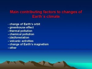
 Factors of climate change
 Conclusion of climate change

