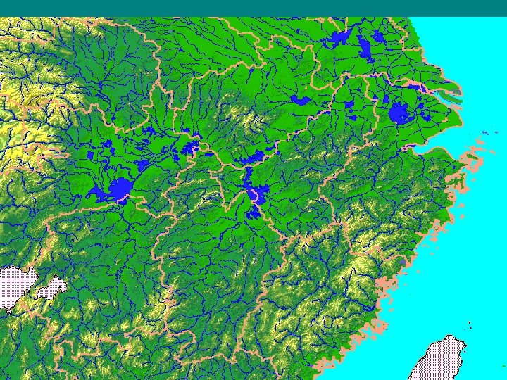
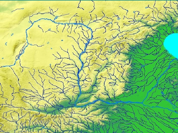
I Rivers Yangzi Yangtze River Yellow River Huanghe
 III.")


- Slides: 27
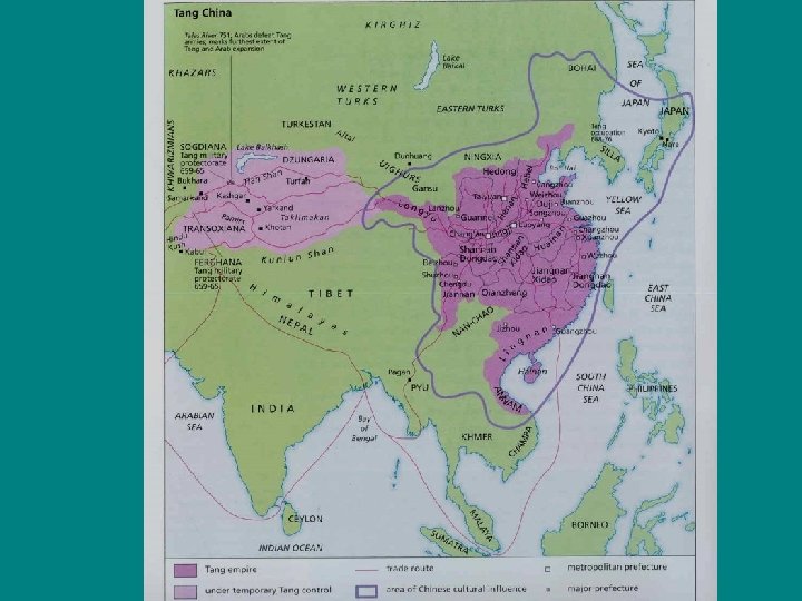
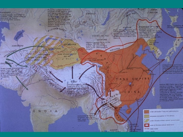
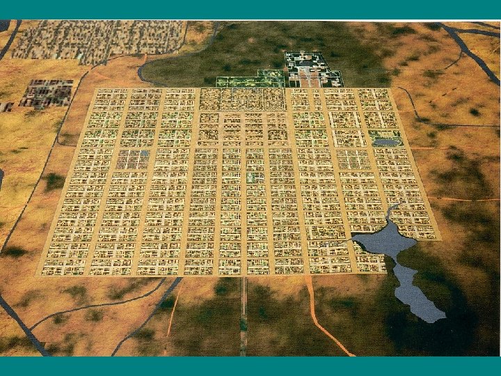
• I. Rivers • Yangzi / Yangtze River • Yellow River (Huanghe) III. Routes The “Silk Road” The route along which Mahayana Buddhism entered China the Grand Canal before 1250 IV. Other Features Gobi Desert The North China Plain Tibetan Plateau Sichuan Basin Korean Peninsula Xiongnu territory II. Cities Luoyang / Loyang Jiankang (modern Nanjing / Nanking) Chang’an (modern Xi’an) Kaifeng/K’ai-feng
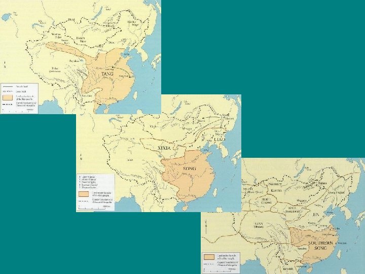
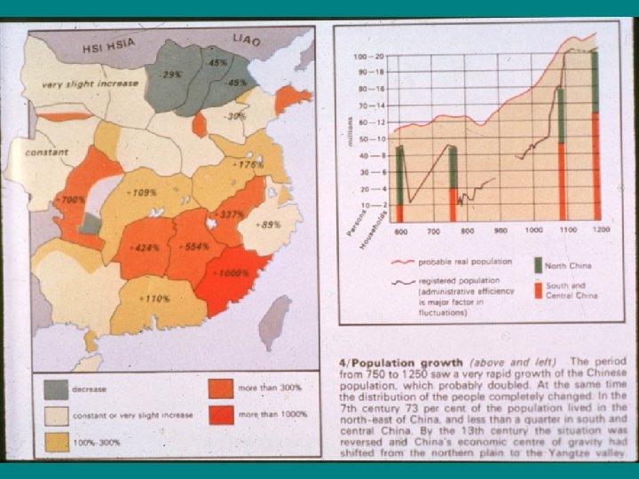
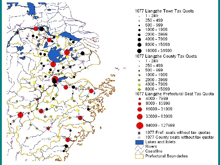
The transformation of society 750 and 1050 compared
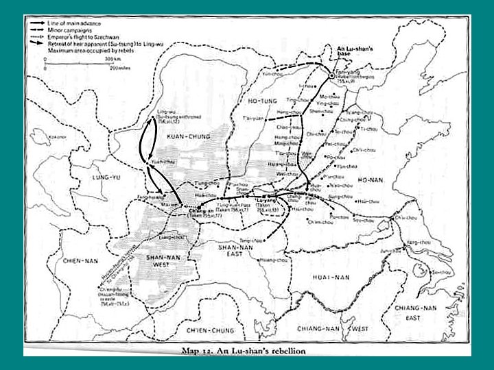
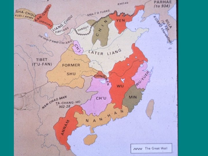
• Tang 618 -907 • The An Lushan rebellion 755 -757 • Five Dynasties (in the north) 907 -960 • Ten Kingdoms (in the south) 907 -980 • Liao (the Khitans) 915 -1125 • Song 960 -1279
Telling Time • 12 hours per day beginning in the Warring States period • 10 day weeks • 12 months of 30 days. Beginning in Eastern Han named by number, 1 st moon, 2 nd moon, etc. • four seasons (defined by the solstices and equinoxes) • year (beginning and ending at the winter solstice) • 12 animals (rat, ox, etc. ) already by the Qin dynasty • 60 year cycles (10 “heavenly stems” and 12 “earthly branches”) beginning in the Western Han (a 1, b 2… a 11, b 12, c 1… i 11, j 12) counting years: from the first year of a ruler’s accession (Shang, Zhou, early Han) by the “reign period” within the reign of a ruler (beginning in 110 BC)
example When was January 1, 755 in Tang terms? In Chinese it was 大唐 玄宗天寶 13年(甲午)閏 11月14日 Which translates as: Great Tang the emperor (posthumously known as) Xuanzong (Mysterious-Ancestor) his reign period named Tianbao (Heavenly Treasure) the 13 th year (the jiawu year ) intercalary 11 th month 14 th day
Liao Song and surrounding states, ca. 1100
Tang Song Transport networks, Tang and Song compared
Huai River as the dividing line between north and south
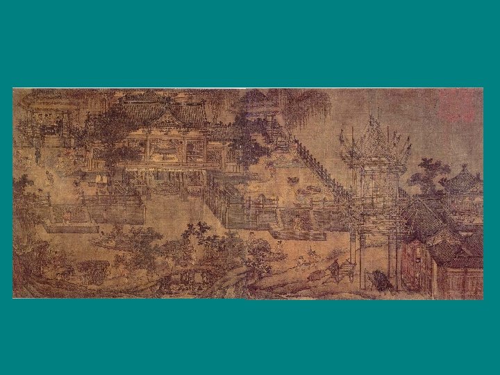
Scroll of Kaifeng in the 11 th century: Website: tutorials, slide shows, and scrolls View the scroll “Qingming shanghe tu” (Going up the River during the Qingming Festival)