Hydrosphere Atmosphere Hydrosphere the Earths water ice layer


- Slides: 12

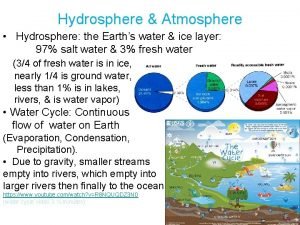
Hydrosphere & Atmosphere • Hydrosphere: the Earth’s water & ice layer: 97% salt water & 3% fresh water (3/4 of fresh water is in ice, nearly 1/4 is ground water, less than 1% is in lakes, rivers, & is water vapor) • Water Cycle: Continuous flow of water on Earth (Evaporation, Condensation, Precipitation). • Due to gravity, smaller streams empty into rivers, which empty into larger rivers then finally to the ocean. https: //www. youtube. com/watch? v=R 8 NQUQDZ 3 N 0 (water cycle video 3 ½ minutes)

Ocean Features • • Continental Shelf: gradual incline into the ocean from land. Continental Slope: Steep incline into deep ocean. Abyssal Plain: Smooth, nearly flat ocean floor. Mid-Ocean Ridge: mountain range in mid-ocean created at divergent plate boundaries. • Ocean Trench: Steep canyons at convergent plate boundaries. • Volcanic Islands, Seamounts, & Guyots.

Salty Oceans • Most salt gets into the ocean through runoff; it gets removed through biological processes, chemical reactions, & sea spray. • Thermohaline currents. deep-ocean currents driven by differences in the water's density, which is controlled by temperature (thermo) and salinity (haline). • Tropical water is more salty due to more evaporation. • • https: //www. youtube. com/watch? v=Uu. Gr. Bh. K 2 c 7 U Thermohaline current video ( 5 minutes)

Longshore Drift & Rip Currents https: //www. youtube. com/watch? v=-z 7_2 J 7 d. GL 0 (1 minute rip current video)

Tides https: //www. youtube. com/watch? v=n. A 5 Nz 3 EXi. Fo (39 second video) • Tides are caused by the alignment of the Sun-Earth. Moon system: • Spring Tide: higher than normal high tide when the Sun, Earth, & Moon are in a straight line. • Neap Tide: lower than normal high tide when the Sun, Earth, & Moon are at right angles to each other.

Glaciers & Icebergs • Glacier: A huge mass of ice and snow that moves slowly over land due to gravity. - 2 types: Continental & Valley - Glaciers change land through erosion & deposition. • Icebergs form when the leading edge of a glacier breaks off as it reaches the ocean. • 90% of an iceberg is underwater. • • https: //www. youtube. com/watch? v=Pb. YXi. Js. F 5 mw (4 minute video)

River Basins (Watersheds): - In the United States, all rivers between the Rocky Mountains & Appalachian Mountains empty into the Gulf of Mexico. (with the exception of rivers around the Great Lakes) - Rivers west of the Continental Divide (highest elevation of the Rockies) empty into the Pacific Ocean. (Great Salt Lake basin is exception) - Rivers to the east of the Appalachians empty into the Atlantic Ocean. -Due to gravity water flows down hill from the headwaters to the ocean, carrying dissolved minerals and gases to the ocean. https: //www. youtube. com/watch? v=f 63 pwr. MXk. V 4 (1 minute video)

Movement and Storage of Groundwater • • Infiltration: movement of water through soil & rock. Permeability: the ability of water to penetrate. Zone of Aeration: soil pore spaces with water & air. Zone of Saturation: all pore spaces are filled with water. Water table: top of the zone of saturation (varies with rainfall rates). Aquifer: place underground where water is stored. Aquiclude: impermeable rock layer that prevents infiltration. Spring: water coming out of a perched aquifer on an aquiclude.

Stream Development • Stream Channel: a narrow pathway carved into sediment or rock by moving water. • Meander: bend or curve in a stream channel caused by moving water. • In a meandering stream, erosion occurs on the outside curve because water is moving faster at that point, deposition occurs on the inside curve because water is moving slower at that point. • An ox bow lake is created over time as erosion and deposition changes the river's course. • Delta is a landform that forms from deposition of sediment carried by a river as the flow leaves its mouth and enters slower-moving or standing water. https: //www. youtube. com/watch? v=4 q. KS_Nk 7 Um. Y Meanders & Ox-Bow lakes video 2 ¼ minutes)

Karst topography is characterized by caves & sinkholes. Cave Development: 1. As water infiltrates the ground it chemically reacts with sedimentary rock to dissolve it. 2. A small underground stream forms which expands the stream channel. 3. The stream drops through openings dissolved in the rock leaving a cave. 4. Infiltration continues to dissolve the roof of the cave until it eventually collapses due to the weight above creating a sinkhole. Anything that goes into a cave or sinkhole quickly enters the water supply without filtration of pollutants! DO NOT dispose of trash in sinkholes! https: //www. youtube. com/watch? v=QLRl. J 4 Ja. C 9 s (3 minute Karst video)

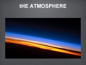
Atmosphere: the thin mixture of gases that surround the Earth • 78% Nitrogen, 21% Oxygen, 1% trace gases (carbon dioxide, argon, water vapor, etc. ) • Type and percentages of gases remains the same, but density decreases as elevation increases. • Temperature and Pressure decrease with elevation (temp. ↓ 6. 5°C per 1 km) (14. 7 PSI at sea level)

Layers of the atmosphere • Thermosphere (heat): Ionosphere & Exosphere. From 80 km into outer space. • Mesosphere (middle): From 50 – 80 km up. • Stratosphere (spreading out): From 12 – 50 km. • Troposphere (turning): From 0 to 12 km. Temperatures ↓ at a rate of 6. 5°C per km. (weather layer)
 Earths early atmosphere contained
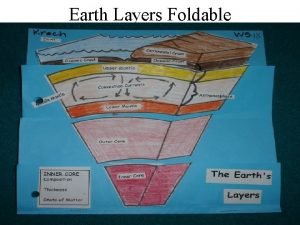
 The earths layer foldable
 Which layer of the earth slowly moves like putty
 Earth layers foldable
 Biosphere
 Geosphere
 Earth systems
 Images of lithosphere hydrosphere atmosphere biosphere
 5 spheres of earth
 Water and water and water water
 Hydrosphere layer
 Hottest layer of atmosphere
 Hottest layer of atmosphere
