
Hydrographic Services and Standards Committee INTo GIS PROJECT
- Slides: 13
Hydrographic Services and Standards Committee INTo. GIS PROJECT II KHOA / IHO Sec. Presented by KHOA (Yong BAEK) International Hydrographic Organization Organisation Hydrographique Internationale HSSC-9, Ottawa, Canada 6 – 10 November 2017
Back ground(1/2) • Purpose of the INTo. GIS Project - Support International Chart Scheme of S-11 - Provide systematic management procedures and functionality - Share the digital data among the IHO MSs and other parties with common data format such as EXL, SHP and GML(S-100 based) • Main outcomes of Project 1(2014~2015) - S-11 Part B INT chart DB modelling S-11 Part B GIS Database Tool for Management rules according to the S-11 INT chart Web-service for the Management system and Cat… International Hydrographic Organization Organisation Hydrographique Internationale HSSC-9, Ottawa, Canada 6 – 10 November 2017
Back ground(2/2) • Requirements • • Base map for Polar regions (Artic & Antarctic) ENC scheme management procedures (S-11) Additional layers for 500 world ports and AIS traffic information. . Connection between IHO ENC catalogue and INTo. GIS systems Improve the chart display functions User Feedbacks from HO, regional coordinator … And other improvements International Hydrographic Organization Organisation Hydrographique Internationale HSSC-9, Ottawa, Canada 6 – 10 November 2017
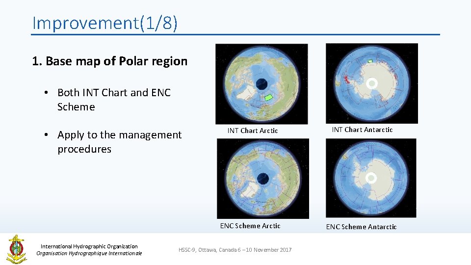
Improvement(1/8) 1. Base map of Polar region • Both INT Chart and ENC Scheme • Apply to the management procedures INT Chart Arctic ENC Scheme Arctic International Hydrographic Organization Organisation Hydrographique Internationale HSSC-9, Ottawa, Canada 6 – 10 November 2017 INT Chart Antarctic ENC Scheme Antarctic
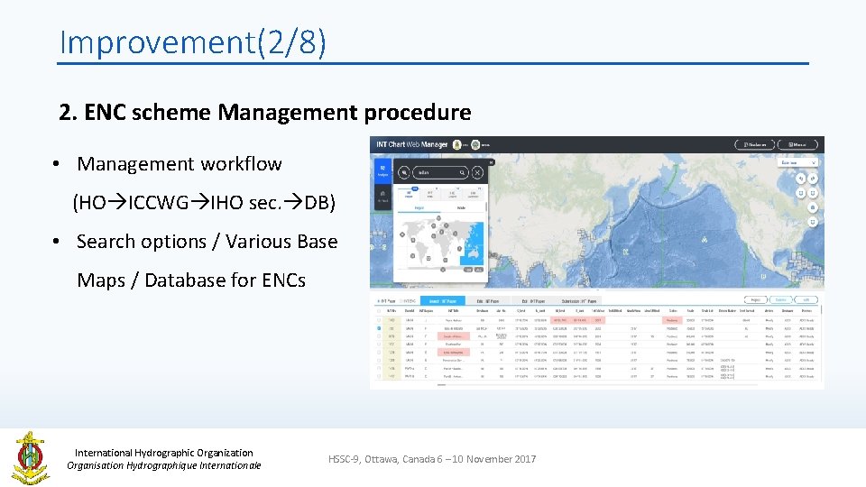
Improvement(2/8) 2. ENC scheme Management procedure • Management workflow (HO ICCWG IHO sec. DB) • Search options / Various Base Maps / Database for ENCs International Hydrographic Organization Organisation Hydrographique Internationale HSSC-9, Ottawa, Canada 6 – 10 November 2017
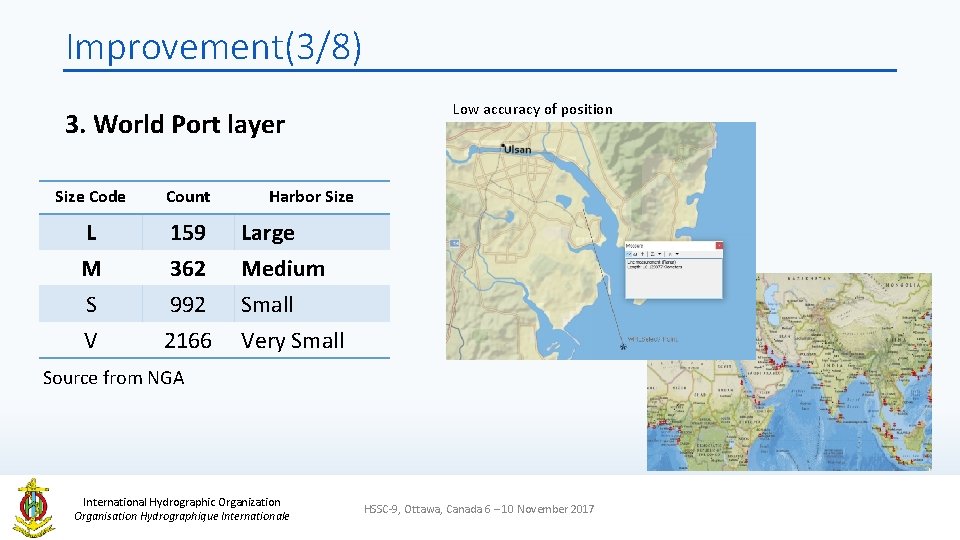
Improvement(3/8) 3. World Port layer Size Code Count L M S 159 362 992 Large Medium Small V 2166 Very Small Low accuracy of position Harbor Size Source from NGA International Hydrographic Organization Organisation Hydrographique Internationale HSSC-9, Ottawa, Canada 6 – 10 November 2017
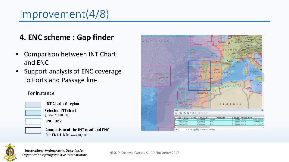
Improvement(4/8) 4. ENC scheme : Gap finder • Comparison between INT Chart and ENC • Support analysis of ENC coverage to Ports and Passage line For instance INT Chart : G region Selected INT chart (Scale : 1, 000) ENC: UB 2 Comparison of the INT chart and ENC For ENC UB 2(Scale: 700, 000) International Hydrographic Organization Organisation Hydrographique Internationale HSSC-9, Ottawa, Canada 6 – 10 November 2017
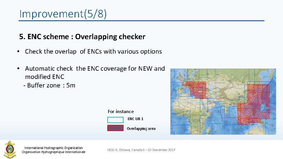
Improvement(5/8) 5. ENC scheme : Overlapping checker • Check the overlap of ENCs with various options • Automatic check the ENC coverage for NEW and modified ENC - Buffer zone : 5 m For instance ENC UB 1 Overlapping area International Hydrographic Organization Organisation Hydrographique Internationale HSSC-9, Ottawa, Canada 6 – 10 November 2017
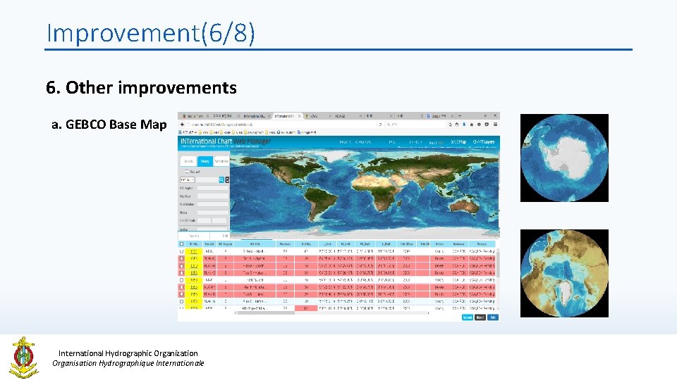
Improvement(6/8) 6. Other improvements a. GEBCO Base Map a) GEBCO base map International Hydrographic Organization Organisation Hydrographique Internationale
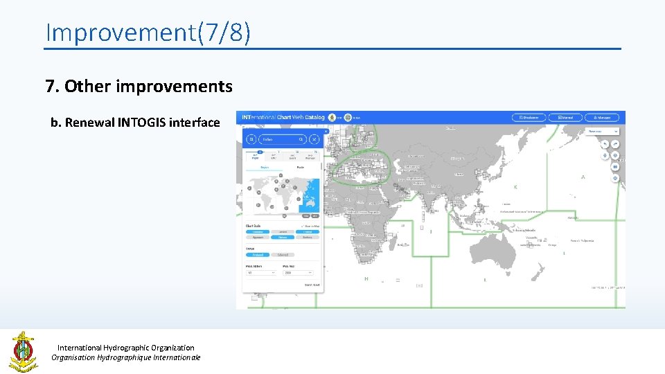
Improvement(7/8) 7. Other improvements b. Renewal INTOGIS interface International Hydrographic Organization Organisation Hydrographique Internationale
Improvement(8/8) 8. Other improvements c. Additional layers • AIS traffic history layer • IHO meeting & event layer • IHO member states layer • Undersea Feature Names layer International Hydrographic Organization Organisation Hydrographique Internationale d. Functions • Email notification • Update the manuals and …
Plans • Design and develop DB (Oct. 2017) • Develop the new interface and functions (Nov. 2017) • Create additional layers (Nov. 2017) • Test operation (Nov. 2017 ~ Jan. 2018) • Run the New INTo. GIS system (early 2018 ~, t. b. d ) International Hydrographic Organization Organisation Hydrographique Internationale HSSC-9, Ottawa, Canada 6 – 10 November 2017
Action requested of HSSC • Note the report. • Request to provide recommendations and feedbacks if any. International Hydrographic Organization Organisation Hydrographique Internationale HSSC-9, Ottawa, Canada 6 – 10 November 2017