Hurricane Storm Surge Modeling Session 10 Hurricane Storm
- Slides: 29

Hurricane Storm Surge Modeling Session 10: Hurricane Storm Surge Modeling and Analysis 1

Objectives • Define the characteristics of a hurricane and the hazards associated with a hurricane storm surge. • Explain the Saffir-Simpson Hurricane Scale • Clarify the uses, capabilities, limitations and outputs of the SLOSH Storm Surge Modeling Program Session 10: Hurricane Storm Surge Modeling and Analysis 2

A Hurricane • Is a tropical cyclone • Originates over warm tropical waters • Has sustained winds of at least 74 mph (64 knots) or greater for a duration of six to eight hours. • Occurs in the Northern Hemisphere Session 10: Hurricane Storm Surge Modeling and Analysis 3

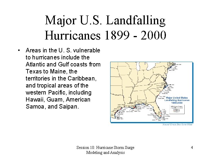
Major U. S. Landfalling Hurricanes 1899 - 2000 • Areas in the U. S. vulnerable to hurricanes include the Atlantic and Gulf coasts from Texas to Maine, the territories in the Caribbean, and tropical areas of the western Pacific, including Hawaii, Guam, American Samoa, and Saipan. Session 10: Hurricane Storm Surge Modeling and Analysis 4

Factors Impacting Storm Surge • Meteorological Parameters – – – 16 Intensity of storm Atmospheric pressure Tract of storm Forward speed Radius of maximum winds • Physical characteristics of the basin – – Slope of coast Roughness of coast Coastline Natural or man made barriers Session 10: Hurricane Storm Surge Modeling and Analysis

Meteorological Parameters • The intensity of the hurricane is measured by the central barometric pressure and maximum surface winds at the center of the storm. • Storm surge begins to build while the hurricane is still far out at sea over deep water. • The low pressure near the center of the storm causes the water to rise. • The storm size or radius of maximum winds can vary from as little as 4 miles to over 50. 17 Session 10: Hurricane Storm Surge Modeling and Analysis

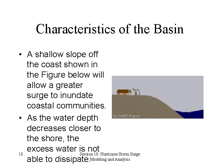
Characteristics of the Basin • A shallow slope off the coast shown in the Figure below will allow a greater surge to inundate coastal communities. • As the water depth decreases closer to the shore, the excess water is not 18 Session 10: Hurricane Storm Surge able to dissipate. Modeling and Analysis

Hurricane Uncertainty • Uncertainty about how intense the storm will be when it makes landfall • Uncertainty associated with the hurricane storm tract. 21 Session 10: Hurricane Storm Surge Modeling and Analysis

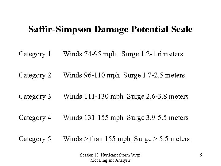
Saffir-Simpson Damage Potential Scale Category 1 Winds 74 -95 mph Surge 1. 2 -1. 6 meters Category 2 Winds 96 -110 mph Surge 1. 7 -2. 5 meters Category 3 Winds 111 -130 mph Surge 2. 6 -3. 8 meters Category 4 Winds 131 -155 mph Surge 3. 9 -5. 5 meters Category 5 Winds > than 155 mph Surge > 5. 5 meters Session 10: Hurricane Storm Surge Modeling and Analysis 9

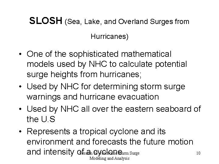
SLOSH (Sea, Lake, and Overland Surges from Hurricanes) • One of the sophisticated mathematical models used by NHC to calculate potential surge heights from hurricanes; • Used by NHC for determining storm surge warnings and hurricane evacuation • Used by NHC all over the eastern seaboard of the U. S • Represents a tropical cyclone and its environment and forecasts the future motion Session 10: Hurricane Storm Surge 10 and intensity of a cyclone. Modeling and Analysis

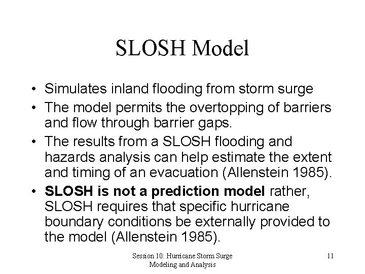
SLOSH Model • Simulates inland flooding from storm surge • The model permits the overtopping of barriers and flow through barrier gaps. • The results from a SLOSH flooding and hazards analysis can help estimate the extent and timing of an evacuation (Allenstein 1985). • SLOSH is not a prediction model rather, SLOSH requires that specific hurricane boundary conditions be externally provided to the model (Allenstein 1985). Session 10: Hurricane Storm Surge Modeling and Analysis 11

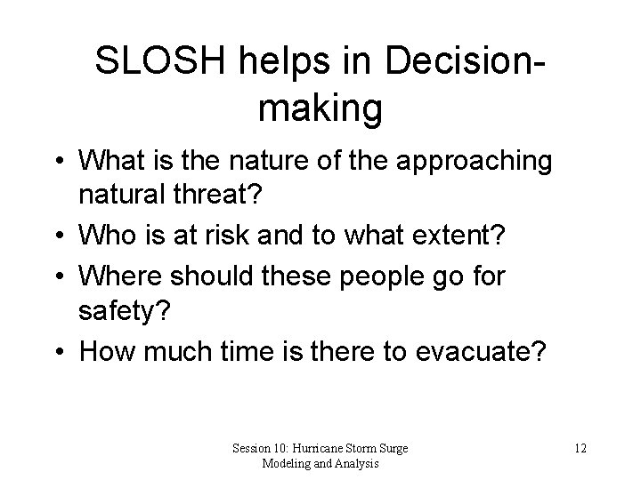
SLOSH helps in Decisionmaking • What is the nature of the approaching natural threat? • Who is at risk and to what extent? • Where should these people go for safety? • How much time is there to evacuate? Session 10: Hurricane Storm Surge Modeling and Analysis 12

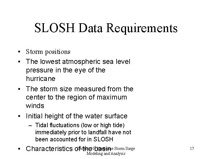
SLOSH Model Requirements • A hurricane track, • Central sea level pressure, and • Radius of maximum wind into a distribution of sea surface wind stress and pressure forces. Session 10: Hurricane Storm Surge Modeling and Analysis 13

NHC Models • Statistical Models: forecast the future by using current information about the hurricane and comparing it to historical knowledge about the behavior of similar tropical cyclones • Dynamical Models: use the results of global atmospheric model forecasts, taking current wind, temperature, pressure and humidity observations to make forecasts of the actual atmosphere in which the cyclone exists. • Combination. Session Models: incorporate numerically 10: Hurricane Storm Surge 14 forecast data into a Modeling statistical prediction framework and Analysis

Uses of SLOSH • Real time forecasting of surges from actual hurricanes within selected Gulf and Atlantic coastal basins – Furnishes surge heights for open coast, – Computes the routing of storm surge into bays, estuaries, or coastal river basins as well as calculating surge heights for over land locations • Evacuation planning – Flood areas are determined by combining peak model surge values using input parameters from 200 to 300 hypothetical hurricanes – SLOSH is able to estimate the overland tidal surge heights and winds that result from hypothetical hurricanes – Model tidal surge outputs are applied to a specific locale's shoreline Session 10: Hurricane Storm Surge Modeling and Analysis • SLOSH model is also designed for use in an 15

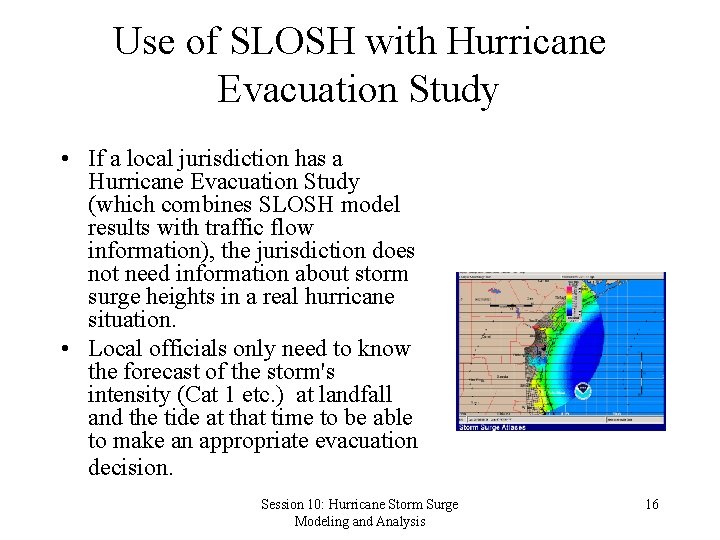
Use of SLOSH with Hurricane Evacuation Study • If a local jurisdiction has a Hurricane Evacuation Study (which combines SLOSH model results with traffic flow information), the jurisdiction does not need information about storm surge heights in a real hurricane situation. • Local officials only need to know the forecast of the storm's intensity (Cat 1 etc. ) at landfall and the tide at that time to be able to make an appropriate evacuation decision. Session 10: Hurricane Storm Surge Modeling and Analysis 16

SLOSH Data Requirements • Storm positions • The lowest atmospheric sea level pressure in the eye of the hurricane • The storm size measured from the center to the region of maximum winds • Initial height of the water surface – Tidal fluctuations (low or high tide) immediately prior to landfall have not been accounted for in SLOSH Hurricane Storm Surge • Characteristics of. Session the 10: basin Modeling and Analysis 17

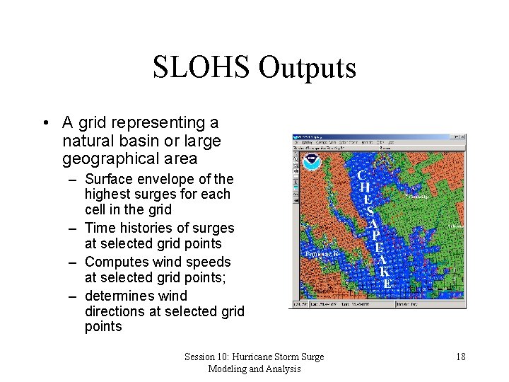
SLOHS Outputs • A grid representing a natural basin or large geographical area – Surface envelope of the highest surges for each cell in the grid – Time histories of surges at selected grid points – Computes wind speeds at selected grid points; – determines wind directions at selected grid points Session 10: Hurricane Storm Surge Modeling and Analysis 18

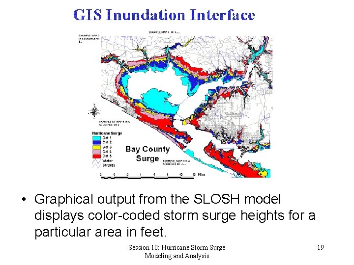
• Graphical output from the SLOSH model displays color-coded storm surge heights for a particular area in feet. Session 10: Hurricane Storm Surge Modeling and Analysis 19

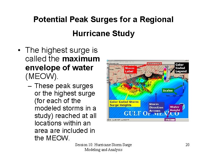
Potential Peak Surges for a Regional Hurricane Study • The highest surge is called the maximum envelope of water (MEOW). – These peak surges or the highest surge (for each of the modeled storms in a study) reached at all locations within an area are included in the MEOW. Session 10: Hurricane Storm Surge Modeling and Analysis 20

Limitations of the MEOW • The MEOW does not predict the limits of inundation from a single storm • Delineates the areas that are threatened by storm surge from all hurricane scenarios modeled in the study. • The multiple storms included in a MEOW do not necessarily occur at the same time. • The maximum surge for one location may differ by several hours from another location. • The MEOW does not represent a “snapshot” of the storm surge at a given instant of time. • It represents the highest water level at each grid cell Session 10: Hurricane Storm Surge 21 during a hurricane irrespective of the actual time of Modeling and Analysis

SLOSH Model Accuracy • The SLOSH model is generally accurate within plus or minus 20 percent. – For example, if the model calculates a peak 10 foot storm surge for the event, you can expect the observed peak to range from 8 to 12 feet. • To account for inaccuracies in forecasting the behavior of approaching hurricanes, the National Hurricane Center recommends that public officials faced with an eminent evacuation prepare for the evacuation as if the approaching hurricane will intensify one Session 10: Hurricane Storm Surge 22 category above the strength forecast for Modeling and Analysis

Model Limitations and Use • SLOSH accounts for astronomical tides • SLOSH does not account for rainfall amounts, river-flow, or wind-driven waves. This information is however, combined with the model results in the final analysis of at-riskareas. • The point of a hurricane's landfall is crucial to determining which areas will be inundated by the storm surge. Where the hurricane forecast track is inaccurate, SLOSH model results will be inaccurate. Session 10: Hurricane Storm Surge is best used for 23 • The SLOSH model, therefore, Modeling and Analysis

Slosh Calibration and Verification • Verification is performed in a “hind-cast” mode, using the real-time operational model code and storm parameters and an initial observed sea surface height. • The computed surge heights are compared with those measured from historical storms. • The computed surge heights are compared with those measured from historic storms. • Adjustments are not made to force agreement between computed and measured surge heights from historical storms. • When necessary, further analysis and subjective decisions are employed to amend the track or other parameters of the historic storms used in the verification process. Session 10: Hurricane Storm Surge 24 Modeling and Analysis

Calibration and Verification (continued) • Ideally there would be a large number of actual storm events with well documented meteorology and storm surge histories. • Hurricanes are rare for any given region. • It is even rarer to find adequate, reliable measurement of storm surge elevations. Session 10: Hurricane Storm Surge Modeling and Analysis 25

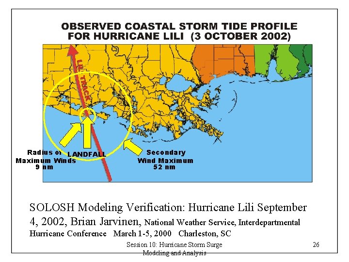
Radius of LANDFALL Maximum Winds 9 nm Secondary Wind Maximum 52 nm SOLOSH Modeling Verification: Hurricane Lili September 4, 2002, Brian Jarvinen, National Weather Service, Interdepartmental Hurricane Conference March 1 -5, 2000 Charleston, SC Session 10: Hurricane Storm Surge Modeling and Analysis 26

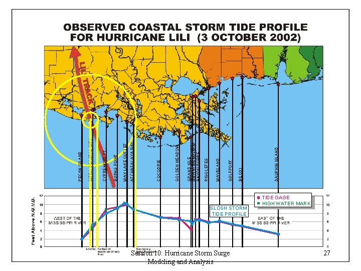
SLOSH STORM TIDE PROFILE Session 10: Hurricane Storm Surge Modeling and Analysis TIDE GAGE HIGH WATER MARK 27 DAUPHIN ISLAND BILOXI GULFPORT WAVELAND RIGOLETES GRAND ISLE INDUSTRIAL CANAL BAYOU BIENVENUE BAYOU DUPRE GOLDEN MEADOW COCODRIE ATCHAFALAYA BAY WAX LAKE OUTLET BURNS POINT CYPREMORT PT. INTRA COASTAL CITY PECAN ISLAND

SLOSH Model Verification Conclusions • The values or functions for the coefficients within the SLOSH model are generalized to serve for modeling all storms within all basins and are set empirically through comparisons of computed and observed meteorological and surge height data from numerous historical hurricanes. Session 10: Hurricane Storm Surge Modeling and Analysis 28

Possible Sources of Error in SLOSH • Noise in surge observations often exceeding = or – 20%. • The bathymetry given to SLOSH is not accurate. • The topography given to SLOSH is not accurate. • Errors in the initial water height. • Wind wave effects, astronomical tidal effects, storm rainfall, and riverine flooding. • Noise in observed meteorological parameters or the storm track which is a source of error. Session 10: Hurricane Storm Surge Modeling and Analysis Mercado (1994). On the use of NOAA's storm surge model, SLOSH, in managing 29