
http www ucmp berkeley edugeologytectonics html Plate Tectonics
http: //www. ucmp. berkeley. edu/geology/tectonics. html Plate Tectonics 2 Making oceans and continents
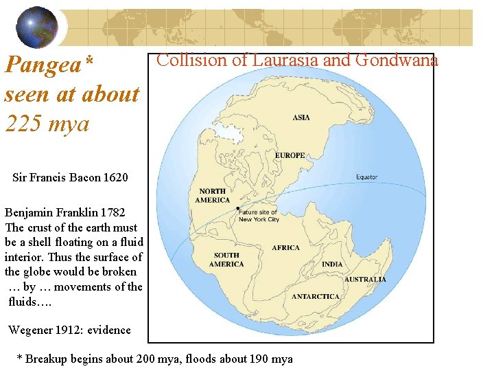
Pangea* seen at about 225 mya Collision of Laurasia and Gondwana Sir Francis Bacon 1620 Benjamin Franklin 1782 The crust of the earth must be a shell floating on a fluid interior. Thus the surface of the globe would be broken … by … movements of the fluids…. Wegener 1912: evidence * Breakup begins about 200 mya, floods about 190 mya
Alfred Wegener 1912 • Continental drift hypothesis • Continents "drifted" to present positions • Evidence used in support of continental drift hypothesis • Fit of continents • Fossil evidence • Rock type and mountain belts • Paleoclimatic evidence
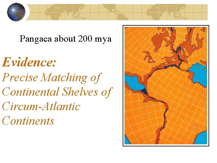
Pangaea about 200 mya Evidence: Precise Matching of Continental Shelves of Circum-Atlantic Continents
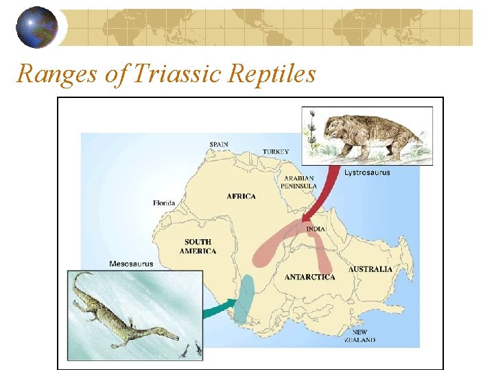
Ranges of Triassic Reptiles
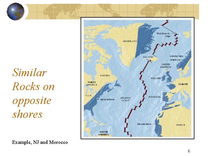
Similar Rocks on opposite shores Example, NJ and Morocco 6
Why wasn’t Wegener’s idea accepted? • Objections to drift hypothesis • Inability to provide a mechanism capable of moving continents across globe • Wegener suggested that continents broke through the ocean crust, much like ice breakers cut through ice
Continental drift and paleomagnetism In 1950’s there was renewed interest in Wegener’s continental drift idea. New data came from seafloor topography and paleomagnetics. Magnetized minerals in rocks • Show direction to Earth’s magnetic poles • Provide a means of determining their original latitude • Horizontal Magnetite = at equator, • vertical = at pole • In between latitude can also be calculated Identical fossils show proximity
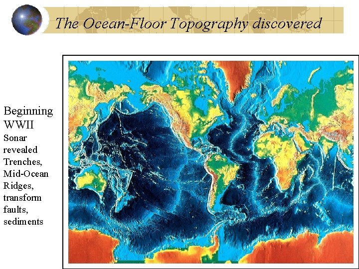
The Ocean-Floor Topography discovered Beginning WWII Sonar revealed Trenches, Mid-Ocean Ridges, transform faults, sediments
The scientific revolution begins Extensive mapping of the ocean floor revealed the mid-ocean ridges in great detail Recall that Seafloor spreading hypothesis was proposed by Harry Hess in the early 1960 s
Geomagnetics tested Hess’ idea • Geomagnetic reversals are recorded in the ocean crust pillow lavas • Data from towed magnetometers, record North or South pointing minerals • Hess’s concept of seafloor spreading predicts matching bands of lava polarity on either side of mid-ocean ridges. • In early 60’s Fred Vine and D. Matthews looked for symmetric magnetic stripes in the ocean crust data near ridges.

Maps of Magnetic Stripes in Oceanic Crust Paleomagnetic data were the most convincing evidence to support the concept of seafloor spreading
Recall the tests Geomagnetic reversals • Magnetic North and South exchange places at irregular intervals, average ~100 K years but with large variance • Dates when polarity of Earth’s magnetism changed were determined from radiometric dating of lava.
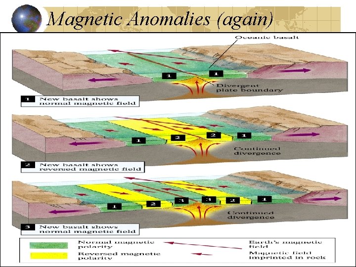
Magnetic Anomalies (again)
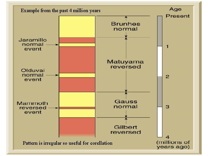
Example from the past 4 million years Pattern is irregular so useful for corellation
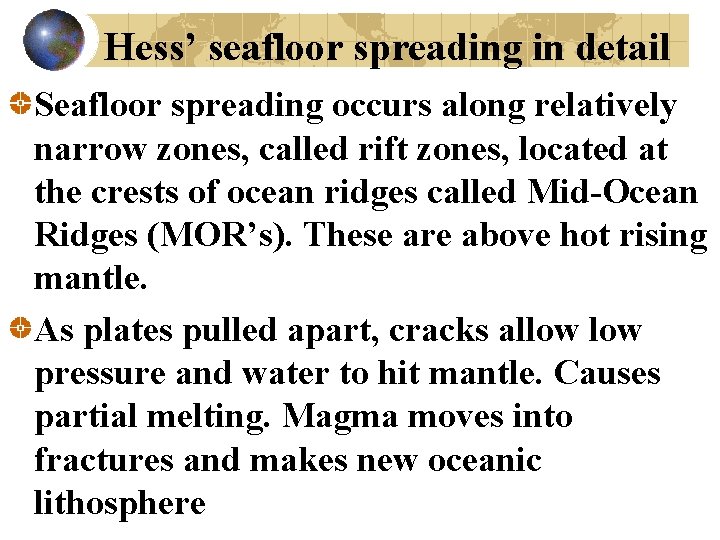
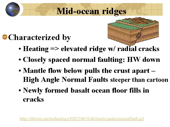
Hess’ seafloor spreading in detail Seafloor spreading occurs along relatively narrow zones, called rift zones, located at the crests of ocean ridges called Mid-Ocean Ridges (MOR’s). These are above hot rising mantle. As plates pulled apart, cracks allow pressure and water to hit mantle. Causes partial melting. Magma moves into fractures and makes new oceanic lithosphere
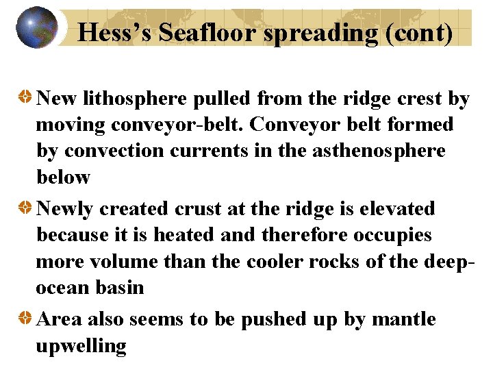
Hess’s Seafloor spreading (cont) New lithosphere pulled from the ridge crest by moving conveyor-belt. Conveyor belt formed by convection currents in the asthenosphere below Newly created crust at the ridge is elevated because it is heated and therefore occupies more volume than the cooler rocks of the deepocean basin Area also seems to be pushed up by mantle upwelling
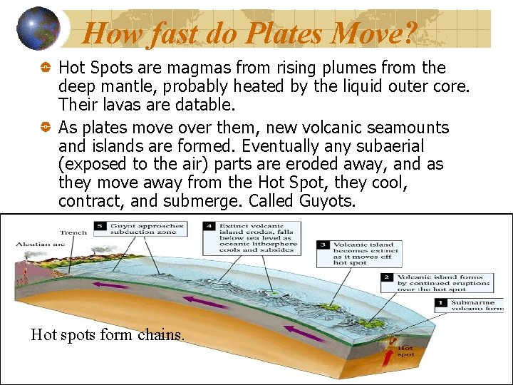
How fast do Plates Move? Hot Spots are magmas from rising plumes from the deep mantle, probably heated by the liquid outer core. Their lavas are datable. As plates move over them, new volcanic seamounts and islands are formed. Eventually any subaerial (exposed to the air) parts are eroded away, and as they move away from the Hot Spot, they cool, contract, and submerge. Called Guyots. Hot spots form chains.
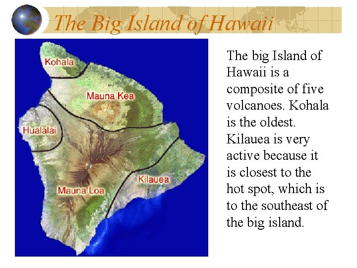
The Big Island of Hawaii The big Island of Hawaii is a composite of five volcanoes. Kohala is the oldest. Kilauea is very active because it is closest to the hot spot, which is to the southeast of the big island.
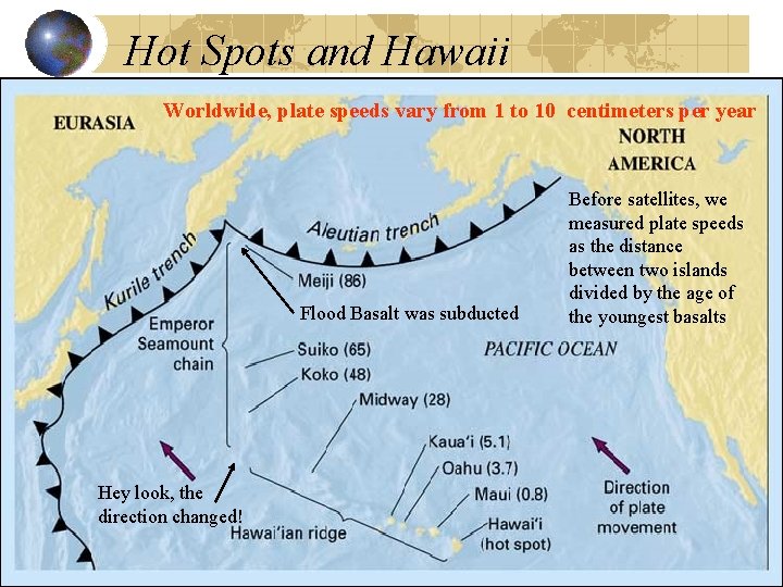
Hot Spots and Hawaii Worldwide, plate speeds vary from 1 to 10 centimeters per year Flood Basalt was subducted Hey look, the direction changed! Before satellites, we measured plate speeds as the distance between two islands divided by the age of the youngest basalts
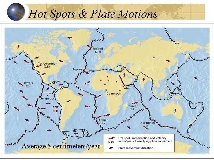
Hot Spots & Plate Motions Average 5 centimeters/year
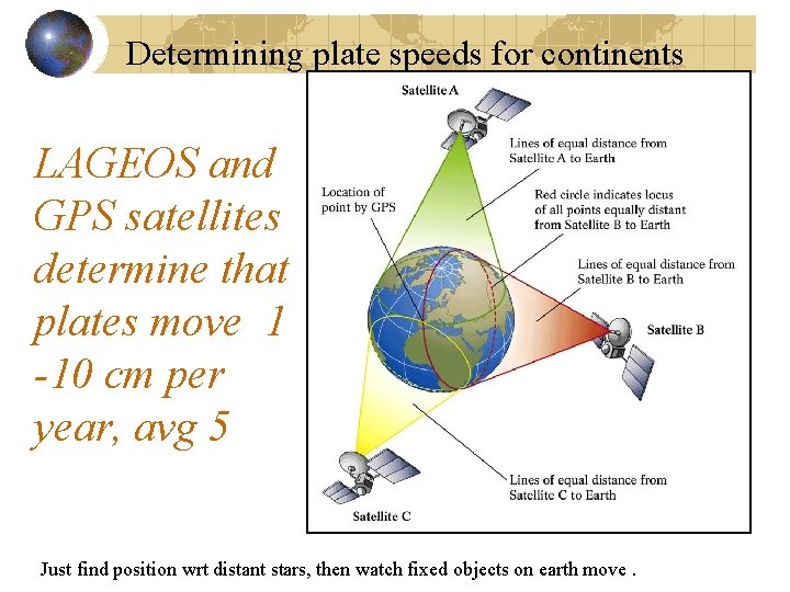
Determining plate speeds for continents LAGEOS and GPS satellites determine that plates move 1 -10 cm per year, avg 5 Just find position wrt distant stars, then watch fixed objects on earth move.
Latitude for ocean floor • Orientation of magnetic minerals gives latitude (north or south of equator) • Radiometric dates of ocean floor basalts, plus distance from ridge, gives paleolongitude since 200 million years ago, when Pangaea began to break apart.
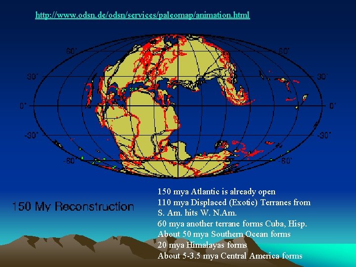
http: //www. odsn. de/odsn/services/paleomap/animation. html 150 mya Atlantic is already open 110 mya Displaced (Exotic) Terranes from S. Am. hits W. N. Am. 60 mya another terrane forms Cuba, Hisp. About 50 mya Southern Ocean forms 20 mya Himalayas forms About 5 -3. 5 mya Central America forms
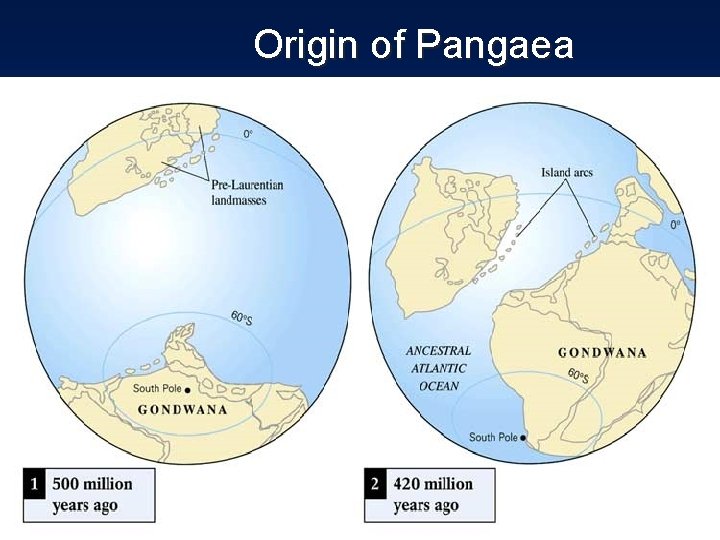
Origin of Pangaea
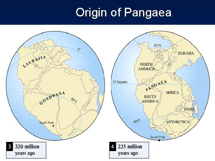
Origin of Pangaea
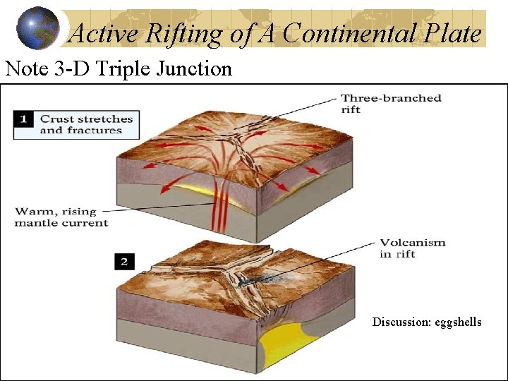
Active Rifting of A Continental Plate Note 3 -D Triple Junction Discussion: eggshells
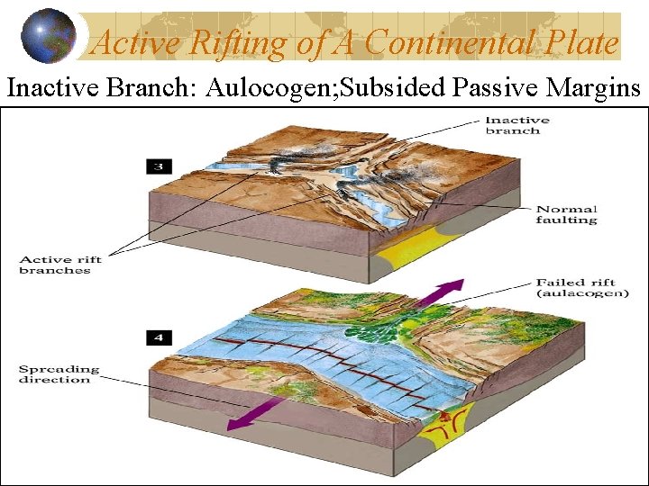
Active Rifting of A Continental Plate Inactive Branch: Aulocogen; Subsided Passive Margins
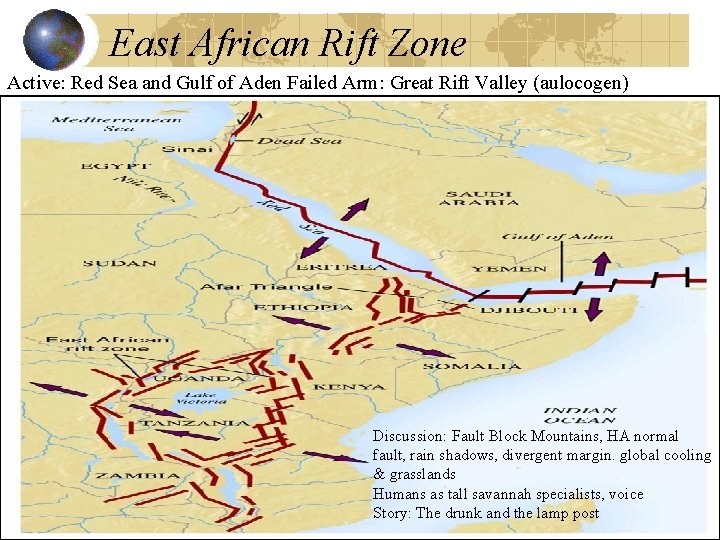
East African Rift Zone Active: Red Sea and Gulf of Aden Failed Arm: Great Rift Valley (aulocogen) Discussion: Fault Block Mountains, HA normal fault, rain shadows, divergent margin. global cooling & grasslands Humans as tall savannah specialists, voice Story: The drunk and the lamp post
Mid-Ocean Ridge dimensions Total 65000 kilometers (40, 000 miles) long As wide as 1500 km (900 miles) Some more than 3 km high above ocean floor.

Mid-Ocean Ridge System Motion Fracture Zones and Transform Faults Shallow weak earthquakes
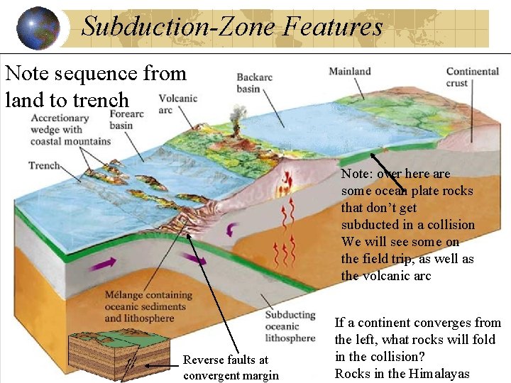
Subduction-Zone Features Note sequence from land to trench Note: over here are some ocean plate rocks that don’t get subducted in a collision We will see some on the field trip, as well as the volcanic arc Reverse faults at convergent margin If a continent converges from the left, what rocks will fold in the collision? Rocks in the Himalayas
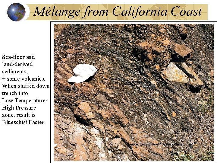
Mélange from California Coast Sea-floor and land-derived sediments, + some volcanics. When stuffed down trench into Low Temperature. High Pressure zone, result is Blueschist Facies Source: Betty Crowell/Faraway Places
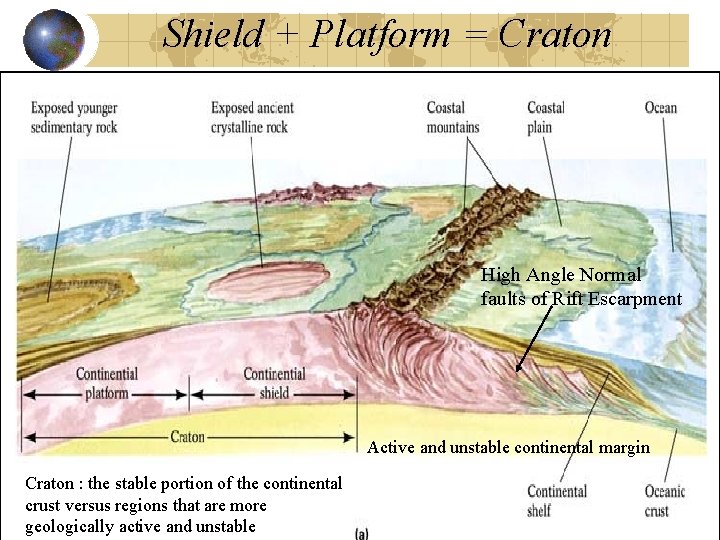
Shield + Platform = Craton High Angle Normal faults of Rift Escarpment Active and unstable continental margin Craton : the stable portion of the continental crust versus regions that are more geologically active and unstable
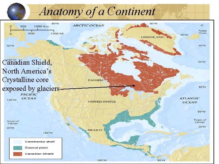
Anatomy of a Continent Canadian Shield, North America’s Crystalline core exposed by glaciers
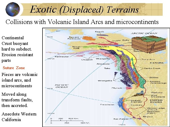
Exotic (Displaced) Terrains Collisions with Volcanic Island Arcs and microcontinents Continental Crust buoyant hard to subduct. Erosion resistant parts Suture Zone Pieces are volcanic island arcs, and microcontinents Moved along transform faults, then accreted. Anecdote Western California
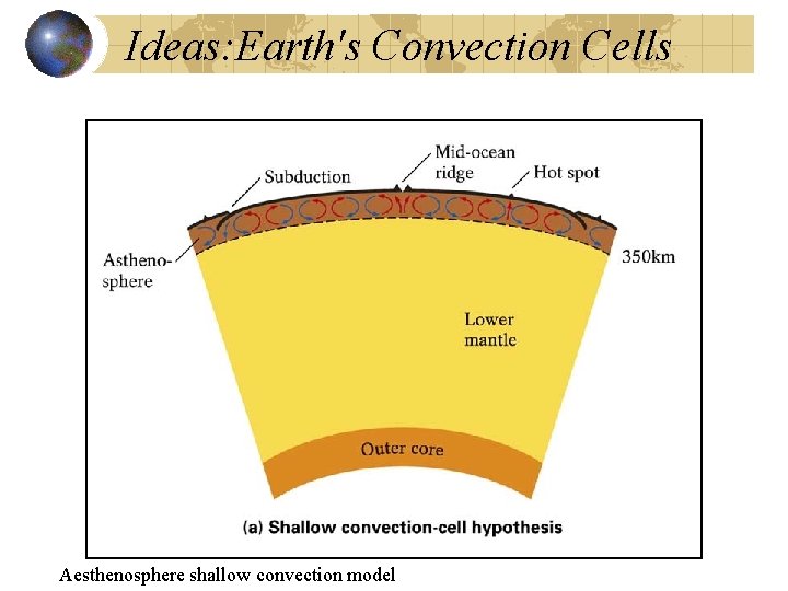
Ideas: Earth's Convection Cells Aesthenosphere shallow convection model
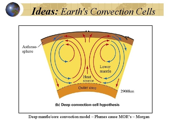
Ideas: Earth's Convection Cells Deep mantle/core convection model – Plumes cause MOR’s – Morgan
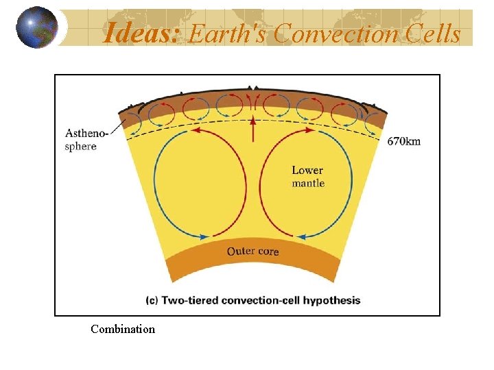
Ideas: Earth's Convection Cells Combination
Mapping the ocean floor Three major topographic units of the ocean floor • Continental margins • Deep-ocean basins • Mid-ocean ridges
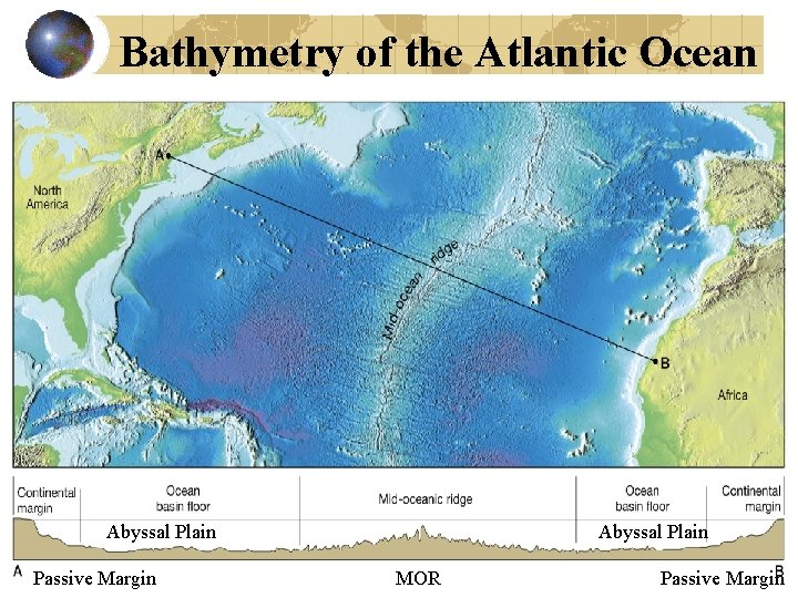
Continental margins Passive continental margins • Found along coastal areas that surround oceans w central MOR • Not near active plate boundaries because MOR is far offshore • Little volcanism and few earthquakes • East Coast of US an example
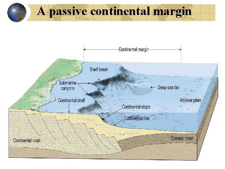
A passive continental margin
Active continental margins • Continental slope descends abruptly into a deep-oceanic trench • Located primarily around the Pacific Ocean • sediment and oceanic crust scraped off ocean crust to form accretionary wedges
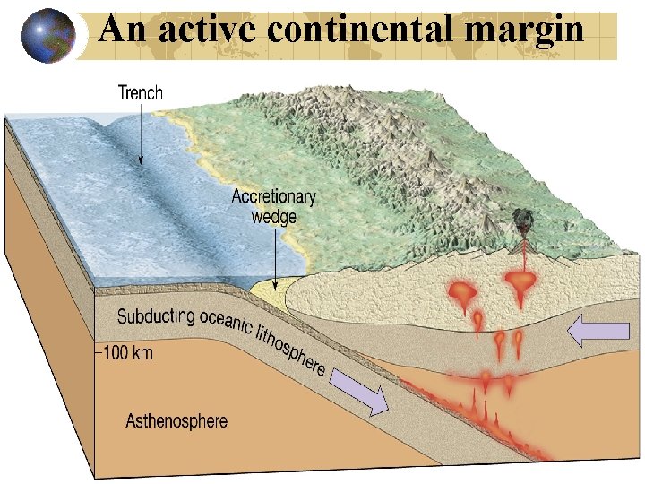
An active continental margin
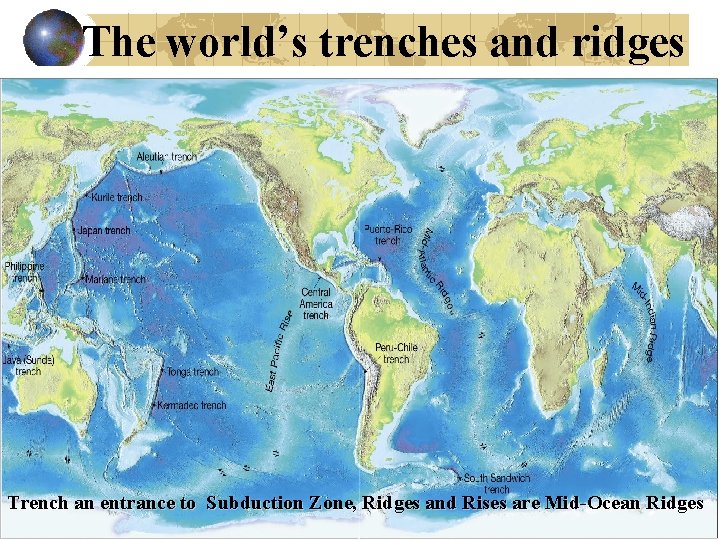
The world’s trenches and ridges Trench an entrance to Subduction Zone, Ridges and Rises are Mid-Ocean Ridges
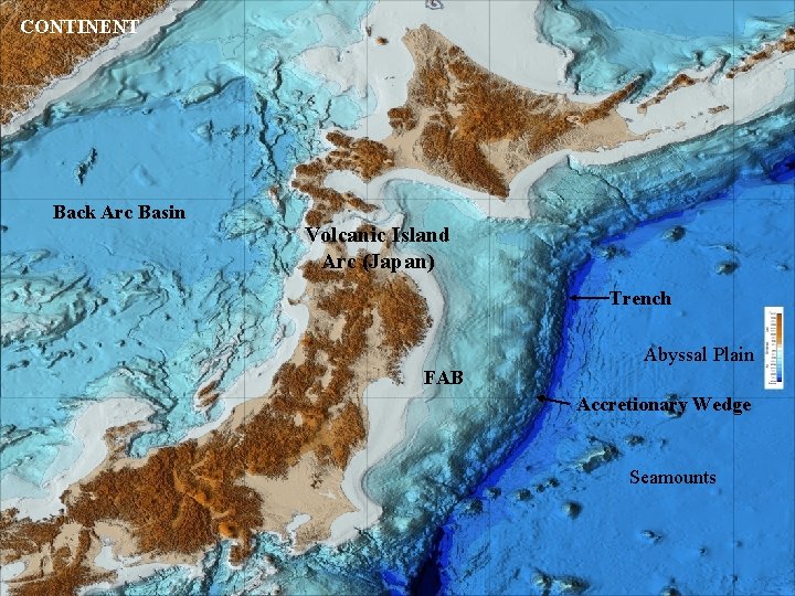
CONTINENT Back Arc Basin Volcanic Island Arc (Japan) Trench Abyssal Plain FAB Accretionary Wedge Seamounts
Features of the deep-ocean basin Abyssal plains • Can be sites of thick accumulations of sediment • Found in all oceans • Studded by old cold seamounts and ridges See previous slide
Seafloor sediment Ocean floor is mantled with sediment Sources • Turbidity currents on continent margins • Sediment that slowly settles to the bottom from above – fine mud and plankton Thickness varies • Thickest in trenches – accumulations may exceed 9 kilometers there
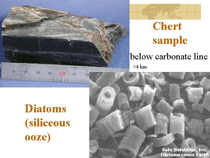
Types of sediment • Biogenous sediment – Shells and skeletons of marine animals and plants – Calcareous oozes from microscopic organisms (only in shallow water) – Siliceous oozes composed of opaline skeletons of diatoms and radiolarians (only in deep water) – Carbonate compensation depth - 4 km
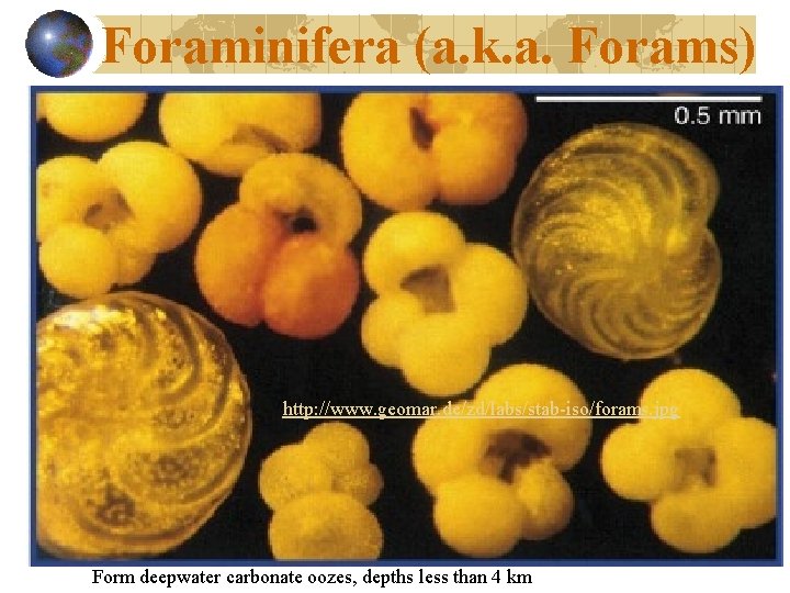
Foraminifera (a. k. a. Forams) http: //www. geomar. de/zd/labs/stab-iso/forams. jpg Form deepwater carbonate oozes, depths less than 4 km
Chert sample below carbonate line >4 km Diatoms (siliceous ooze)
Mid-ocean ridges Characterized by • Heating => elevated ridge w/ radial cracks • Closely spaced normal faulting: HW down • Mantle flow below pulls the crust apart – High Angle Normal Faults steeper than cartoon • Newly formed basalt ocean floor fills in cracks http: //rblewis. net/technology/EDU 506/Web. Quests/quake/normalfault. gif
Bathymetry of the Atlantic Ocean Abyssal Plain Passive Margin Abyssal Plain MOR Passive Margin
The structure of oceanic crust
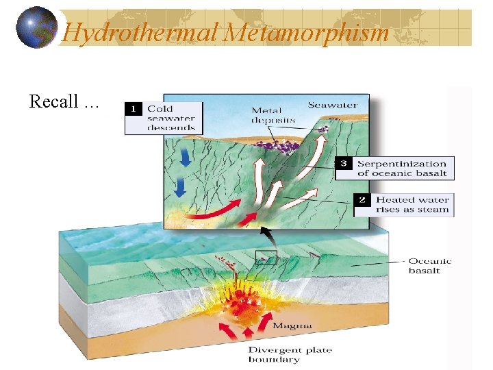
Hydrothermal Metamorphism Recall …
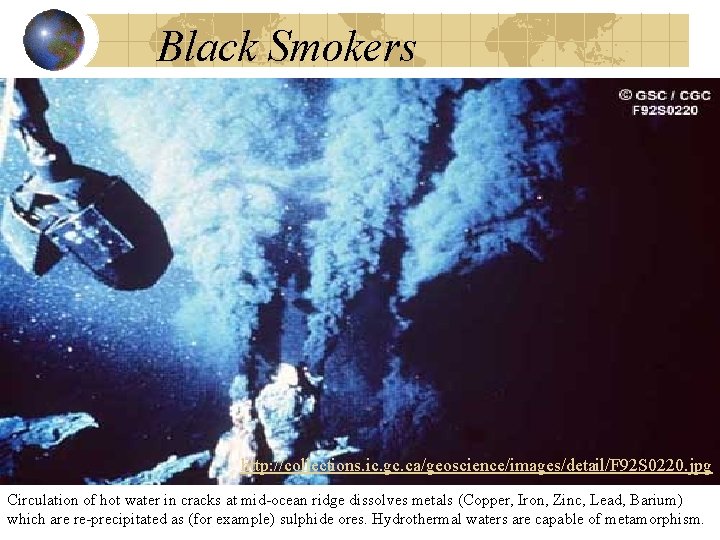
Black Smokers http: //collections. ic. gc. ca/geoscience/images/detail/F 92 S 0220. jpg Circulation of hot water in cracks at mid-ocean ridge dissolves metals (Copper, Iron, Zinc, Lead, Barium) which are re-precipitated as (for example) sulphide ores. Hydrothermal waters are capable of metamorphism.
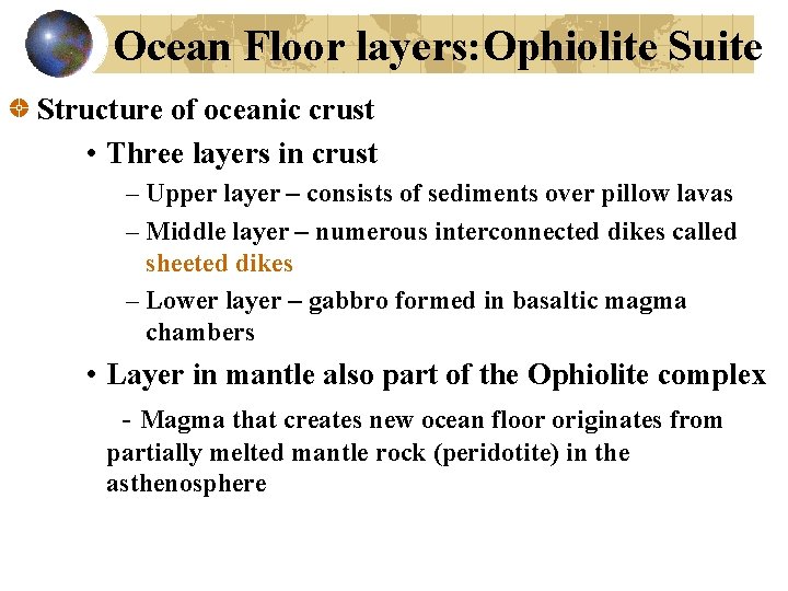
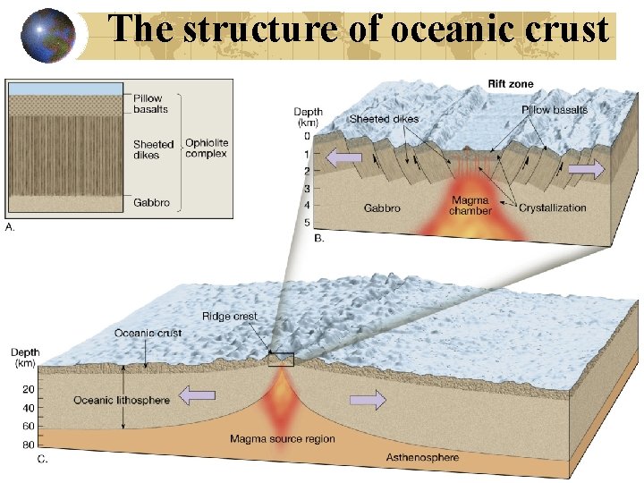
Ocean Floor layers: Ophiolite Suite Structure of oceanic crust • Three layers in crust – Upper layer – consists of sediments over pillow lavas – Middle layer – numerous interconnected dikes called sheeted dikes – Lower layer – gabbro formed in basaltic magma chambers • Layer in mantle also part of the Ophiolite complex - Magma that creates new ocean floor originates from partially melted mantle rock (peridotite) in the asthenosphere
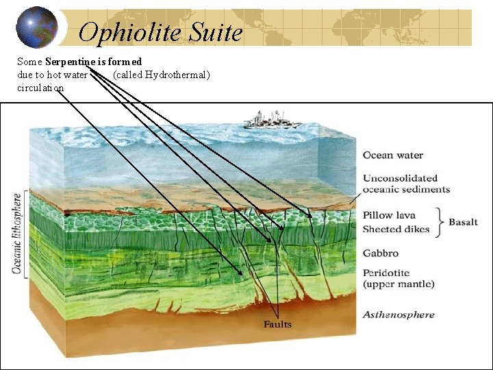
Ophiolite Suite Some Serpentine is formed due to hot water (called Hydrothermal) circulation
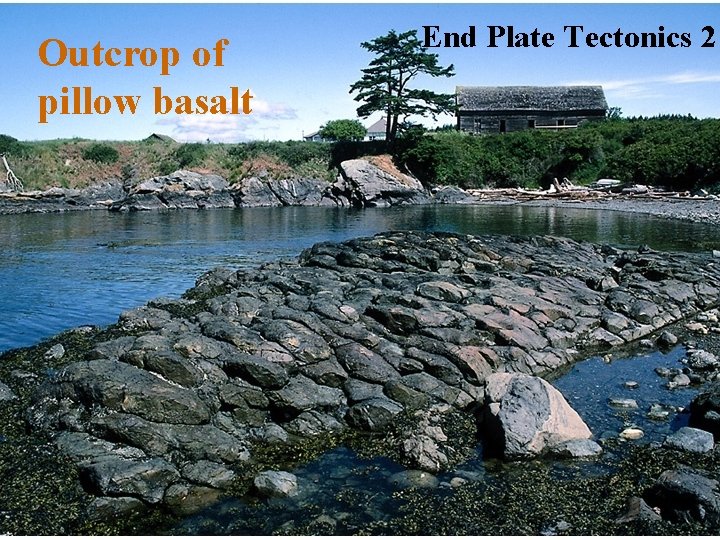
Outcrop of pillow basalt End Plate Tectonics 2
- Slides: 59