
http www estofex org Convective basics and ESTOFEX

http: //www. estofex. org/ Convective basics and ESTOFEX Speaker: Helge Tuschy http: //www. dwd. de/ 1
Short vita Ø studied Meteorology / Geophysics at the Leopold-Franzens University of Innsbruck, Austria Ø 2002, 2007 internship National Weather Service Amarillo, Texas Ø 2004, internship Storm Prediction Center ( SPC ) Ø talks: ECSS, ICAM, media … Ø forecaster at ESTOFEX / member of ESSL Ø Since 2010 working at the DWD (RZ Leipzig, E-Germany) Ø favorite sport: baseball and soccer Ø favorite food: Italian style 2
The outline Ø Basics about organized convection • Overview about ESTOFEX • Case study (15 th August 2008) • Future of ESTOFEX 3
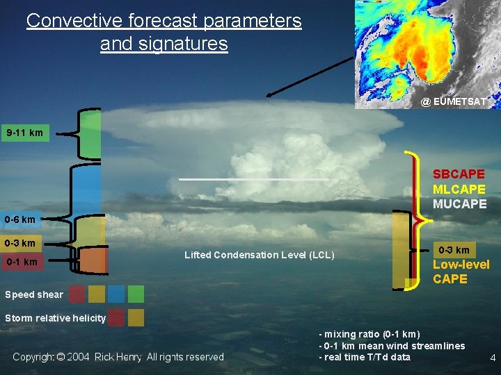
Convective forecast parameters and signatures @ EUMETSAT 9 -11 km SBCAPE MLCAPE MUCAPE 0 -6 km 0 -3 km 0 -1 km Lifted Condensation Level (LCL) 0 -3 km Low-level CAPE Speed shear Storm relative helicity - mixing ratio (0 -1 km) - 0 -1 km mean wind streamlines - real time T/Td data 4
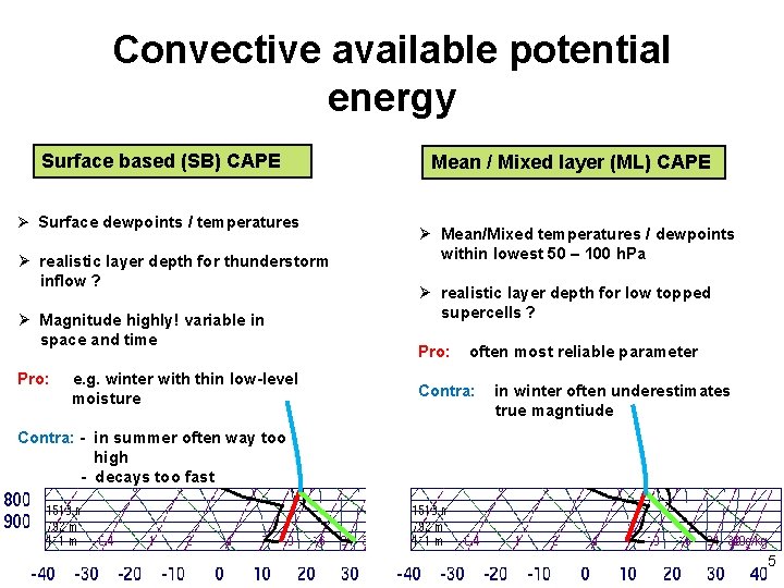
Convective available potential energy Surface based (SB) CAPE Ø Surface dewpoints / temperatures Ø realistic layer depth for thunderstorm inflow ? Ø Magnitude highly! variable in space and time Pro: e. g. winter with thin low-level moisture Mean / Mixed layer (ML) CAPE Ø Mean/Mixed temperatures / dewpoints within lowest 50 – 100 h. Pa Ø realistic layer depth for low topped supercells ? Pro: often most reliable parameter Contra: in winter often underestimates true magntiude Contra: - in summer often way too high - decays too fast 5
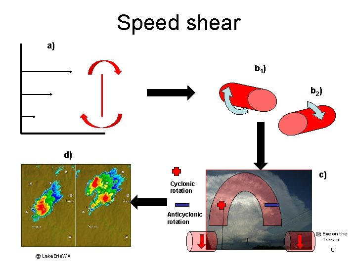
Speed shear a) b 1 ) b 2 ) d) c) Cyclonic rotation Anticyclonic rotation @ Eye on the Twister @ Lake. Erie. WX 6
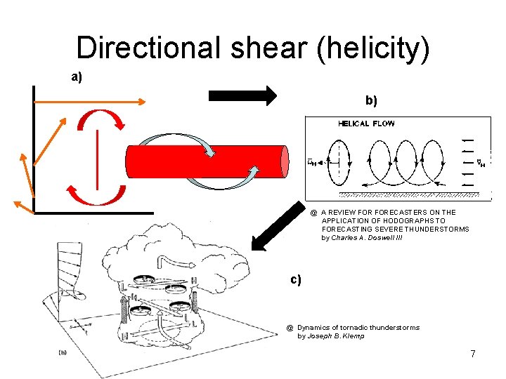
Directional shear (helicity) a) b) @ A REVIEW FORECASTERS ON THE APPLICATION OF HODOGRAPHS TO FORECASTING SEVERE THUNDERSTORMS by Charles A. Doswell III c) @ Dynamics of tornadic thunderstorms by Joseph B. Klemp 7
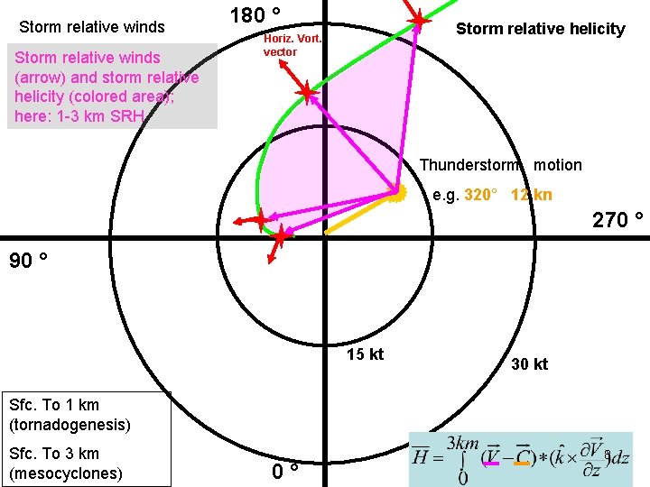
Storm relative winds (arrow) and storm relative helicity (colored area); here: 1 -3 km SRH 180 ° Storm relative helicity Horiz. Vort. vector Thunderstorm motion e. g. 320° 12 kn 270 ° 90 ° 15 kt 30 kt Sfc. To 1 km (tornadogenesis) Sfc. To 3 km (mesocyclones) 0° 8
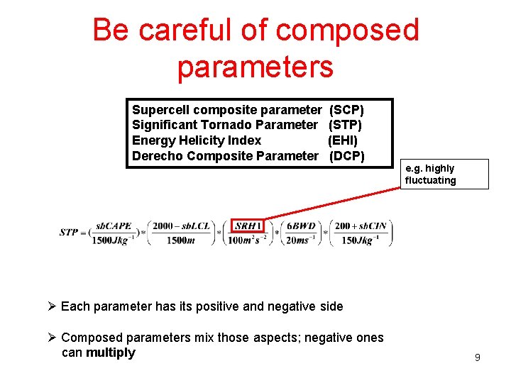
Be careful of composed parameters Supercell composite parameter Significant Tornado Parameter Energy Helicity Index Derecho Composite Parameter (SCP) (STP) (EHI) (DCP) e. g. highly fluctuating Ø Each parameter has its positive and negative side Ø Composed parameters mix those aspects; negative ones can multiply 9
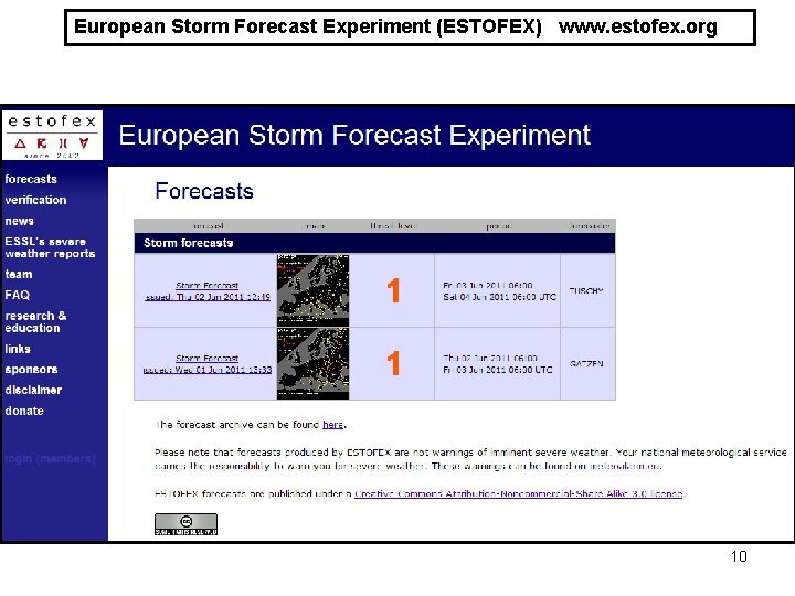
European Storm Forecast Experiment (ESTOFEX) www. estofex. org 10
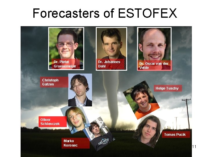
Forecasters of ESTOFEX Dr. Pieter Groenemeijer Dr. Johannes Dahl Dr. Oscar van der Velde Christoph Gatzen Helge Tuschy Oliver Schlenczek Tomas Pucik Marko Korosec 11
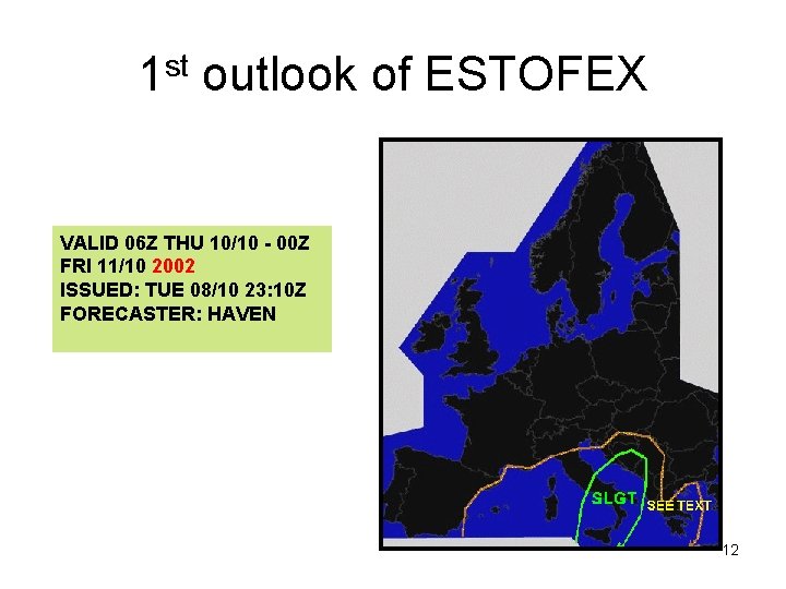
1 st outlook of ESTOFEX VALID 06 Z THU 10/10 - 00 Z FRI 11/10 2002 ISSUED: TUE 08/10 23: 10 Z FORECASTER: HAVEN 12
European Storm Forecast Experiment (ESTOFEX) What is ESTOFEX? An initiative of a team of European meteorologists and students in meteorology and serves as a platform for exchange of knowledge about severe convective storms in Europe and elsewhere. ! ESTOFEX offers a GUIDANCE where organized convection is forecast. This guidance can be used by local forecast offices for daily warning preparation. ! 13
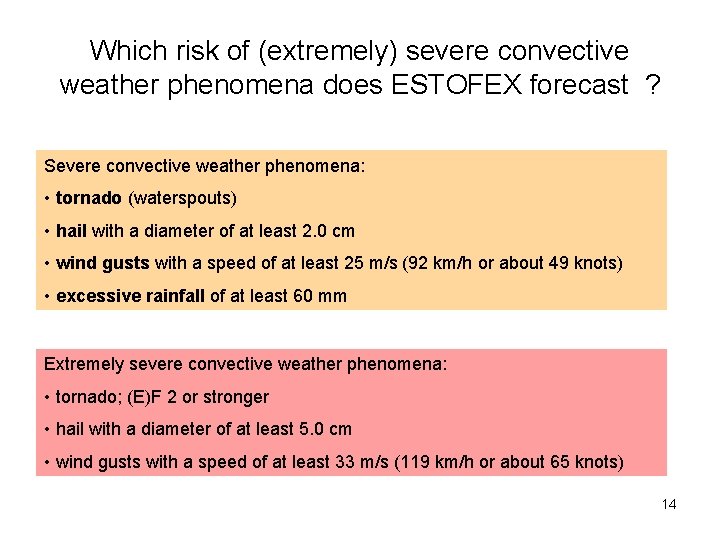
Which risk of (extremely) severe convective weather phenomena does ESTOFEX forecast ? Severe convective weather phenomena: • tornado (waterspouts) • hail with a diameter of at least 2. 0 cm • wind gusts with a speed of at least 25 m/s (92 km/h or about 49 knots) • excessive rainfall of at least 60 mm Extremely severe convective weather phenomena: • tornado; (E)F 2 or stronger • hail with a diameter of at least 5. 0 cm • wind gusts with a speed of at least 33 m/s (119 km/h or about 65 knots) 14
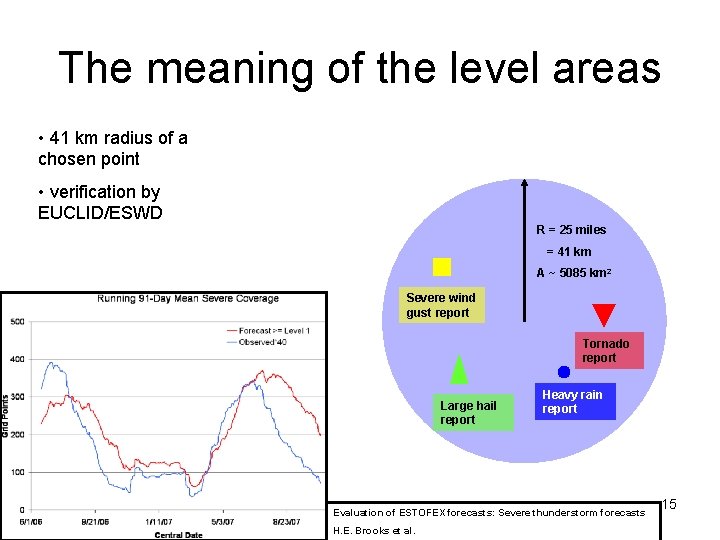
The meaning of the level areas • 41 km radius of a chosen point • verification by EUCLID/ESWD R = 25 miles = 41 km A ~ 5085 km 2 Severe wind gust report Tornado report Large hail report Heavy rain report Evaluation of ESTOFEX forecasts: Severe thunderstorm forecasts H. E. Brooks et al. 15
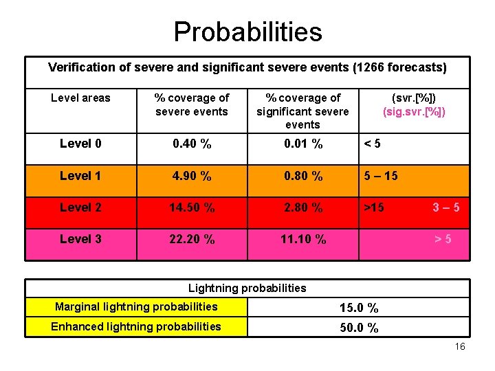
Probabilities Verification of severe and significant severe events (1266 forecasts) Level areas % coverage of severe events % coverage of significant severe events (svr. [%]) (sig. svr. [%]) Level 0 0. 40 % 0. 01 % <5 Level 1 4. 90 % 0. 80 % 5 – 15 Level 2 14. 50 % 2. 80 % >15 Level 3 22. 20 % 11. 10 % 3– 5 >5 Lightning probabilities Marginal lightning probabilities 15. 0 % Enhanced lightning probabilities 50. 0 % 16
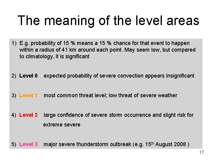
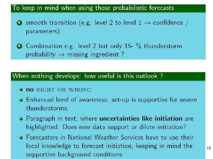
The meaning of the level areas 1) E. g. probability of 15 % means a 15 % chance for that event to happen within a radius of 41 km around each point. May seem low, but compared to climatology, it is significant 2) Level 0 expected probability of severe convection appears insignificant 3) Level 1 most common threat level; low threat of severe weather 4) Level 2 large confidence of severe storm occurrence and slight risk for extreme severe 5) Level 3 major severe thunderstorm outbreak (e. g. 15 th August 2008 ) 17
18

How do we prepare our outlooks? 19
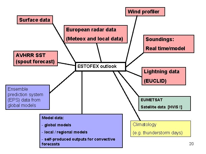
Wind profiler Surface data European radar data (Meteox and local data) Soundings: Real time/model AVHRR SST (spout forecast) ESTOFEX outlook Lightning data (EUCLID) Ensemble prediction system (EPS) data from global models EUMETSAT Satellite data [HVIS !] Model data: - global models Climatology - local / regional models (e. g. thunderstorm days) - self-produced outputs for convective forecasts 20
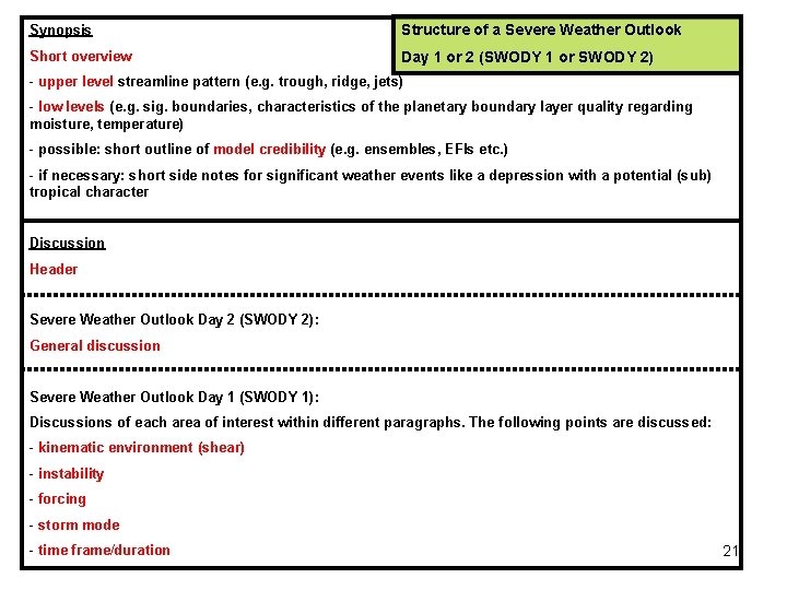
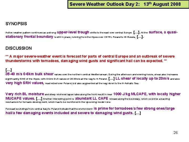
Synopsis Structure of a Severe Weather Outlook Short overview Day 1 or 2 (SWODY 1 or SWODY 2) - upper level streamline pattern (e. g. trough, ridge, jets) - low levels (e. g. sig. boundaries, characteristics of the planetary boundary layer quality regarding moisture, temperature) - possible: short outline of model credibility (e. g. ensembles, EFIs etc. ) - if necessary: short side notes for significant weather events like a depression with a potential (sub) tropical character Discussion Header Severe Weather Outlook Day 2 (SWODY 2): General discussion Severe Weather Outlook Day 1 (SWODY 1): Discussions of each area of interest within different paragraphs. The following points are discussed: - kinematic environment (shear) - instability - forcing - storm mode - time frame/duration 21
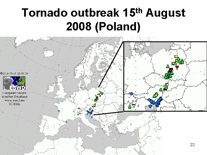
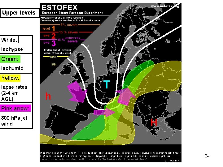
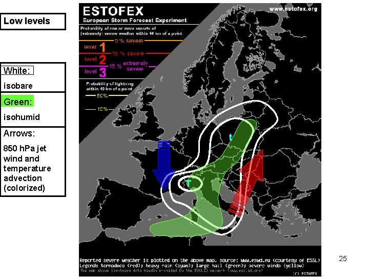
Tornado outbreak 15 th August 2008 (Poland) 22
Pattern recognition ! 23
Upper levels White: isohypse Green: isohumid Yellow: lapse rates (2 -4 km AGL) h T Pink arrow: 300 h. Pa jet wind H 24
Low levels White: isobare Green: isohumid Arrows: 850 h. Pa jet wind and temperature advection (colorized) t T 25
Severe Weather Outlook Day 2: 13 th August 2008 SYNOPSIS upper-level trough shifts to the east over central Europe. […]. At the surface, a quasistationary frontal boundary is still in place, running from the Alpes over CNTRL Poland to W-Russia, […]. Active weather pattern continues as a strong DISCUSSION ** A major severe-weather event is forecast for parts of central Europe and an outbreak of severe thunderstorms with tornadoes, damaging wind gusts and significant hail can be expected. ** […] 35 -40 m/s 0 -6 km bulk shear values over the northern central Mediterranean. During the afternoon and evening hours, shear also increases significantly E/NE of the Alpes, with 0 -6 km DLS values of 25 -35 m/s all the way to N-Poland. […] LL shear of locally up to 20 m/s and also very high SRH values, maximized over Poland, but also augmented all the way down to the N-Adriatic Sea. Very rich BL moisture and steep mid-level lapse rates along the front result in near 1000 J/kg MLCAPE, with locally higher MUCAPE values. […] Another interesting point is abundant LL CAPE release along the boundary, which could be a backing mechanism for tornado development, which has to be monitored in the upcoming model runs. is prime for tornadoes/a few strong ones/large hail/a few damaging events included and severe to damaging wind gusts. […] Forecast soundings from central Italy to Poland indicate that the environment 26
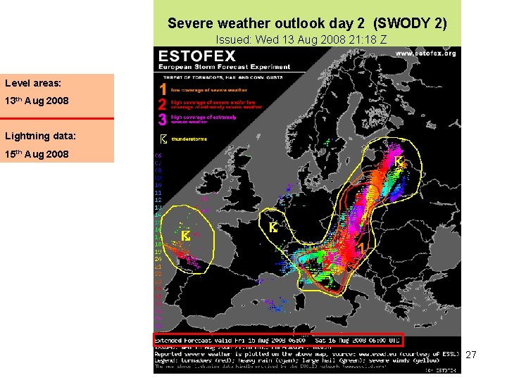
Severe weather outlook day 2 (SWODY 2) Issued: Wed 13 Aug 2008 21: 18 Z Level areas: 13 th Aug 2008 Lightning data: 15 th Aug 2008 27
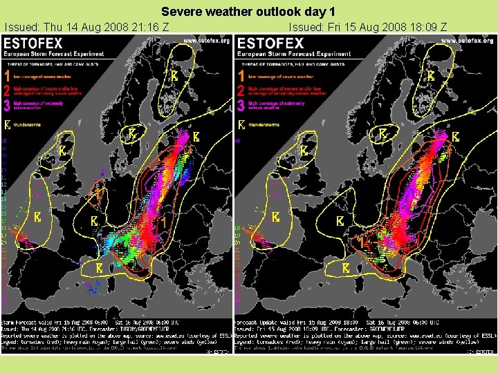
Severe weather outlook day 1 Issued: Thu 14 Aug 2008 21: 16 Z Issued: Fri 15 Aug 2008 18: 09 Z 28
Future of ESTOFEX - More forecasters participating in this experiment, e. g. from the Mediterranean or E/SE Europe - Platform forecasters to discuss realtime / past events - To bring more meteorological students on board - Creation of a detailed climatology about European convection (also push verification of outlooks) - In the long term future: maybe an institution for European convective forecasts ? 29
Thank you very much for your attention ! Email: helge. tuschy@dwd. de 30
- Slides: 30