Here a TC There a TC Everywhere a



- Slides: 55

Here a TC, There a TC, Everywhere a TC: The "Spin" on the Active Part of the North Atlantic 2008 TC Season Lance F. Bosart, Thomas J. Galarneau, Jr. , and Jason M. Cordeira Department of Earth and Atmospheric Sciences University at Albany SUNY, Albany, NY Tenth Northeast Regional Operational Workshop Albany, New York 6 November 2008

MOTIVATION: The many United States tropical cyclone (TC) landfalls during the 2008 North Atlantic TC season provided a serendipitous opportunity to study: • Multiple TC interactions. • A potpourri of TC-related mesoscale precipitation features.

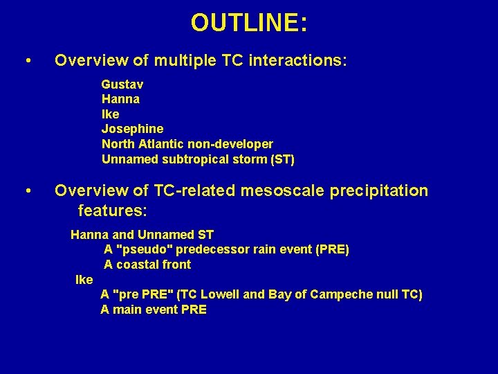
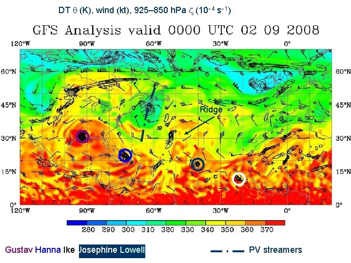
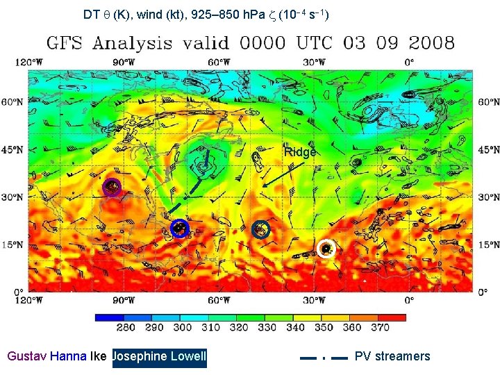
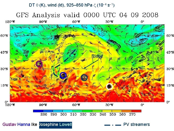
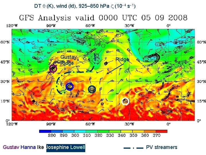
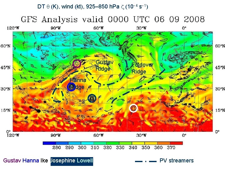
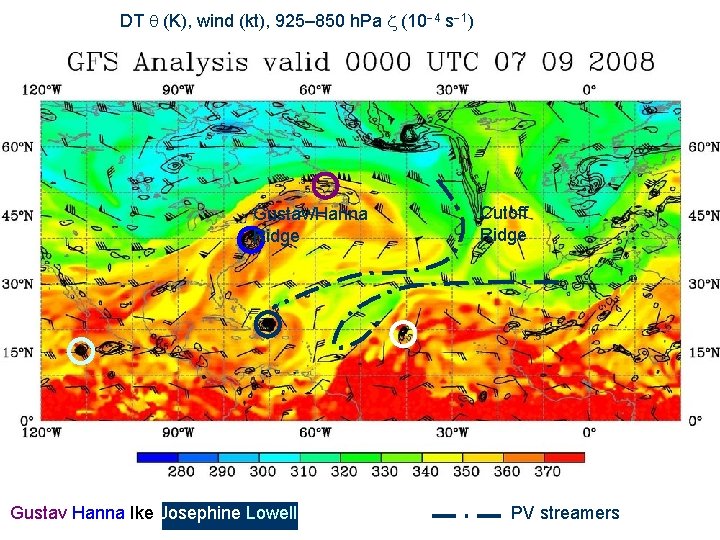
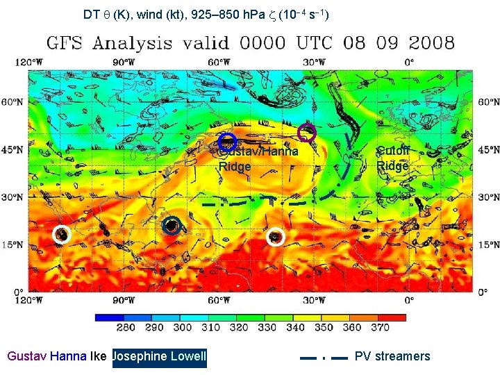
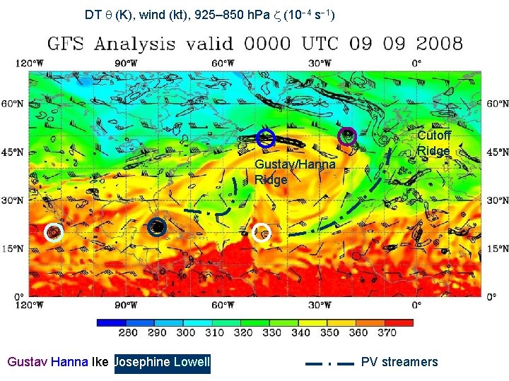
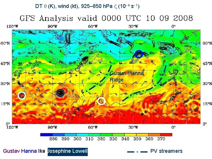
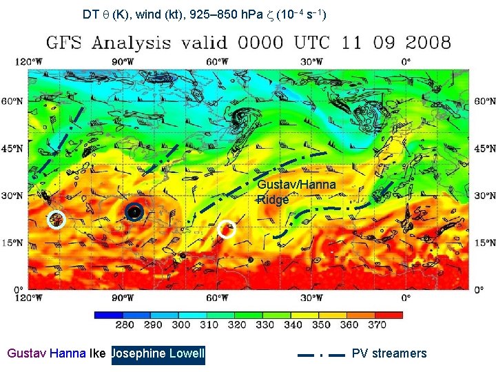
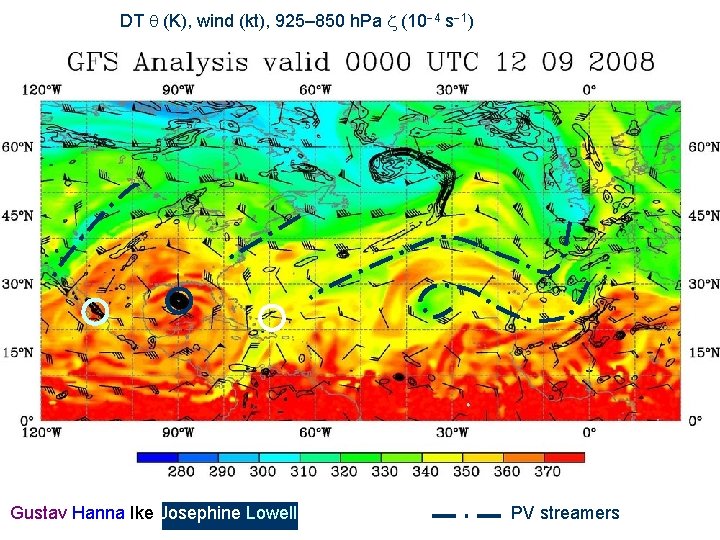
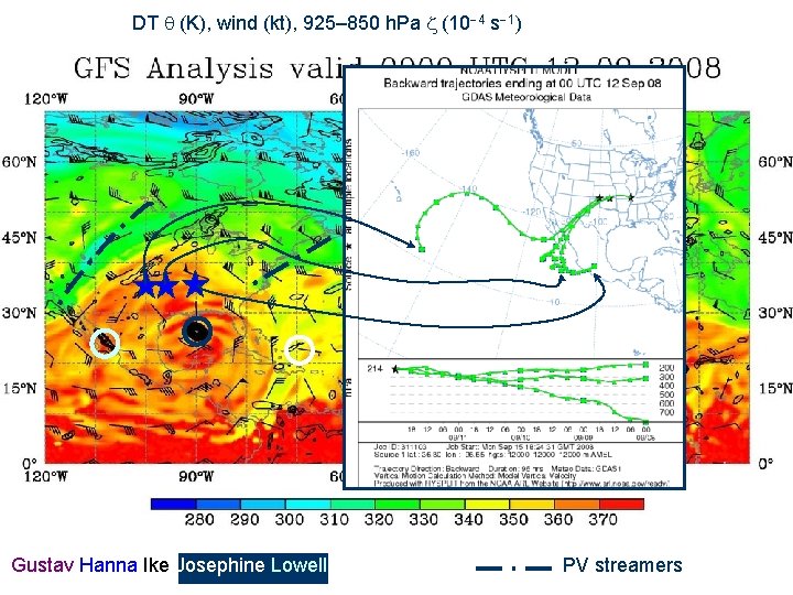
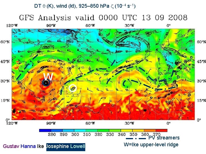
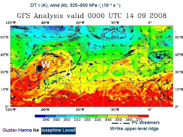
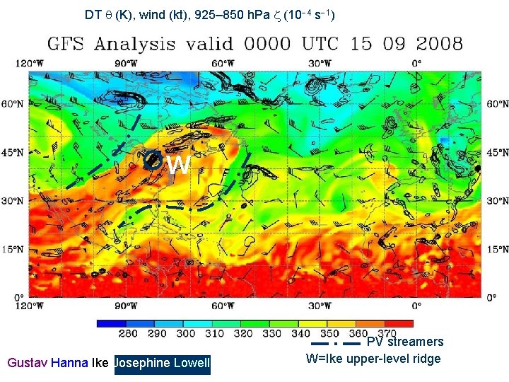
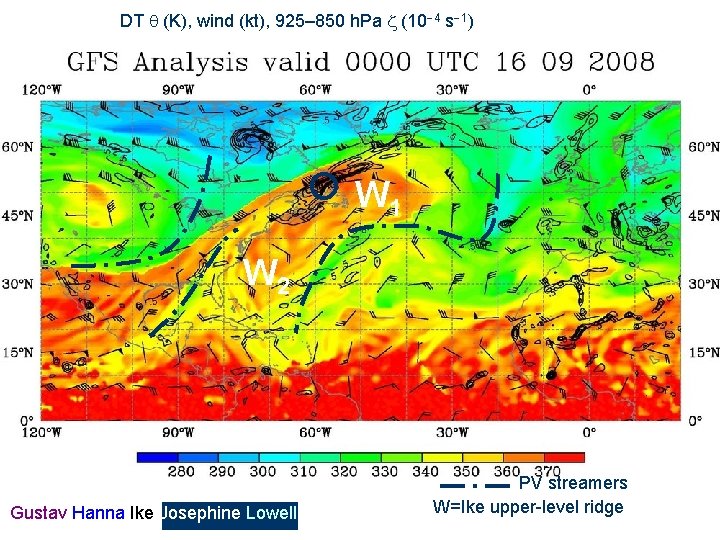
OUTLINE: • Overview of multiple TC interactions: Gustav Hanna Ike Josephine North Atlantic non-developer Unnamed subtropical storm (ST) • Overview of TC-related mesoscale precipitation features: Hanna and Unnamed ST A "pseudo" predecessor rain event (PRE) A coastal front Ike A "pre PRE" (TC Lowell and Bay of Campeche null TC) A main event PRE

Interacting TCs

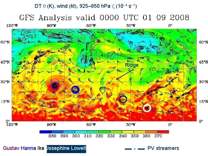
DT (K), wind (kt), 925– 850 h. Pa (10 4 s 1) Ridge Gustav Hanna Ike Josephine Lowell PV streamers

DT (K), wind (kt), 925– 850 h. Pa (10 4 s 1) Ridge Gustav Hanna Ike Josephine Lowell PV streamers

DT (K), wind (kt), 925– 850 h. Pa (10 4 s 1) Ridge Gustav Hanna Ike Josephine Lowell PV streamers

DT (K), wind (kt), 925– 850 h. Pa (10 4 s 1) Ridge Gustav Hanna Ike Josephine Lowell PV streamers

DT (K), wind (kt), 925– 850 h. Pa (10 4 s 1) Gustav Ridge Gustav Hanna Ike Josephine Lowell Ridge PV streamers

DT (K), wind (kt), 925– 850 h. Pa (10 4 s 1) Gustav Ridge Foldover Ridge Hanna Ridge Gustav Hanna Ike Josephine Lowell PV streamers

DT (K), wind (kt), 925– 850 h. Pa (10 4 s 1) Gustav/Hanna Ridge Gustav Hanna Ike Josephine Lowell Cutoff Ridge PV streamers

DT (K), wind (kt), 925– 850 h. Pa (10 4 s 1) Gustav/Hanna Ridge Gustav Hanna Ike Josephine Lowell Cutoff Ridge PV streamers

DT (K), wind (kt), 925– 850 h. Pa (10 4 s 1) Gustav/Hanna Ridge Gustav Hanna Ike Josephine Lowell Cutoff Ridge PV streamers

DT (K), wind (kt), 925– 850 h. Pa (10 4 s 1) Gustav/Hanna Ridge Gustav Hanna Ike Josephine Lowell PV streamers

DT (K), wind (kt), 925– 850 h. Pa (10 4 s 1) Gustav/Hanna Ridge Gustav Hanna Ike Josephine Lowell PV streamers

DT (K), wind (kt), 925– 850 h. Pa (10 4 s 1) Gustav Hanna Ike Josephine Lowell PV streamers

DT (K), wind (kt), 925– 850 h. Pa (10 4 s 1) Gustav Hanna Ike Josephine Lowell PV streamers

DT (K), wind (kt), 925– 850 h. Pa (10 4 s 1) W Gustav Hanna Ike Josephine Lowell PV streamers W=Ike upper-level ridge

DT (K), wind (kt), 925– 850 h. Pa (10 4 s 1) W Gustav Hanna Ike Josephine Lowell PV streamers W=Ike upper-level ridge

DT (K), wind (kt), 925– 850 h. Pa (10 4 s 1) W Gustav Hanna Ike Josephine Lowell PV streamers W=Ike upper-level ridge

DT (K), wind (kt), 925– 850 h. Pa (10 4 s 1) W 1 W 2 Gustav Hanna Ike Josephine Lowell PV streamers W=Ike upper-level ridge

Overview of Predecessor Rain Events (PREs) Cote (2007)

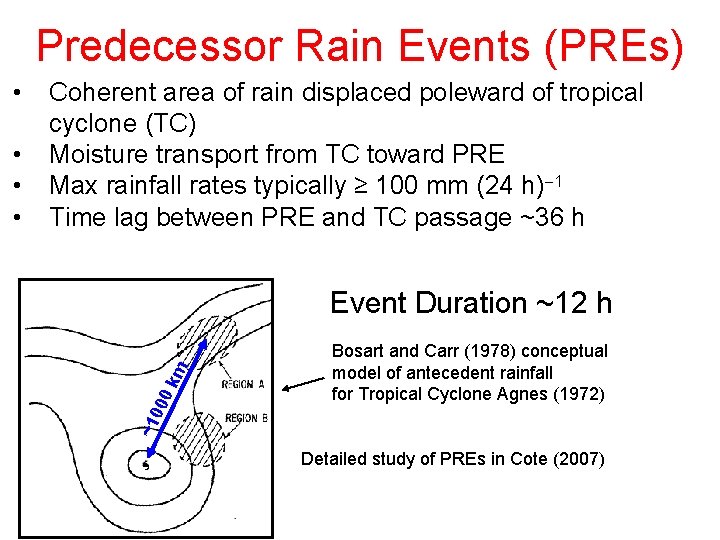
Predecessor Rain Events (PREs) Event Duration ~12 h 0 k m • • • Coherent area of rain displaced poleward of tropical cyclone (TC) Moisture transport from TC toward PRE Max rainfall rates typically ≥ 100 mm (24 h) 1 Time lag between PRE and TC passage ~36 h ~1 00 • Bosart and Carr (1978) conceptual model of antecedent rainfall for Tropical Cyclone Agnes (1972) Detailed study of PREs in Cote (2007)

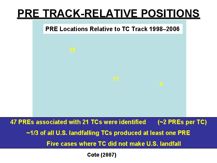
PRE TRACK-RELATIVE POSITIONS PRE Locations Relative to TC Track 1998– 2006 26 12 47 PREs associated with 21 TCs were identified 9 (~2 PREs per TC) ~1/3 of all U. S. landfalling TCs produced at least one PRE Five cases where TC did not make U. S. landfall Cote (2007)

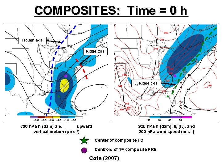
COMPOSITES: Time = 0 h Trough axis Ridge axis θe-Ridge axis 700 h. Pa h (dam) and upward vertical motion (μb s-1) 925 h. Pa h (dam), θe (K), and 200 h. Pa wind speed (m s-1) Center of composite TC Centroid of 1 st composite PRE Cote (2007)

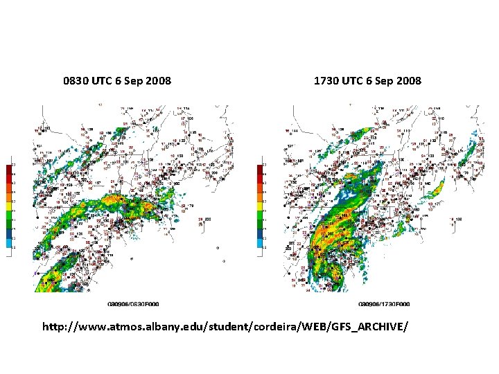
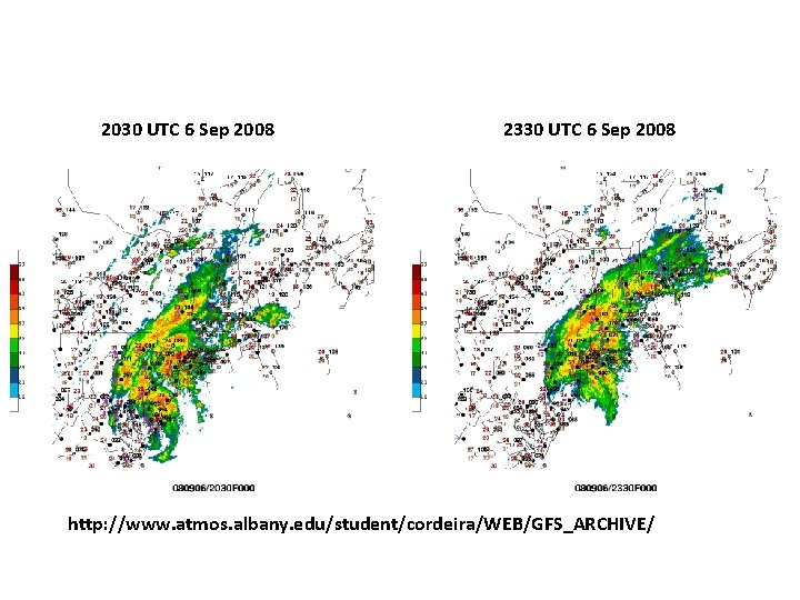
Hanna: 28 Aug - 7 Sep 2008 Coastal Front and "Pseudo-PRE" in Hanna

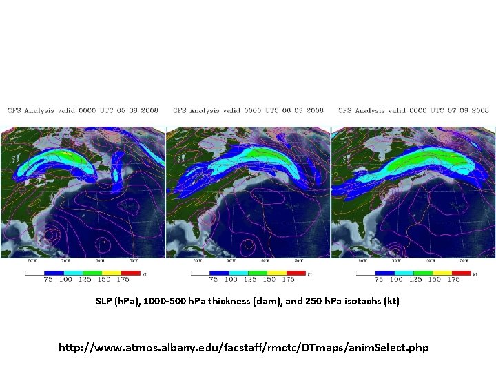
SLP (h. Pa), 1000 -500 h. Pa thickness (dam), and 250 h. Pa isotachs (kt) http: //www. atmos. albany. edu/facstaff/rmctc/DTmaps/anim. Select. php

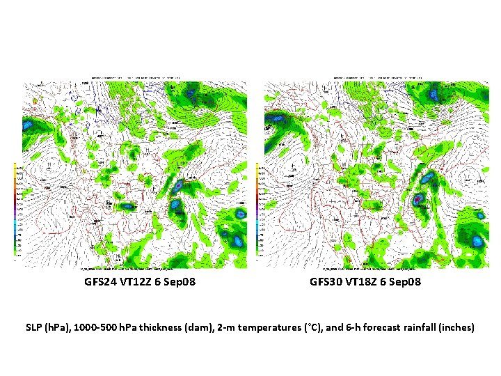
GFS 24 VT 12 Z 6 Sep 08 GFS 30 VT 18 Z 6 Sep 08 SLP (h. Pa), 1000 -500 h. Pa thickness (dam), 2 -m temperatures (°C), and 6 -h forecast rainfall (inches)

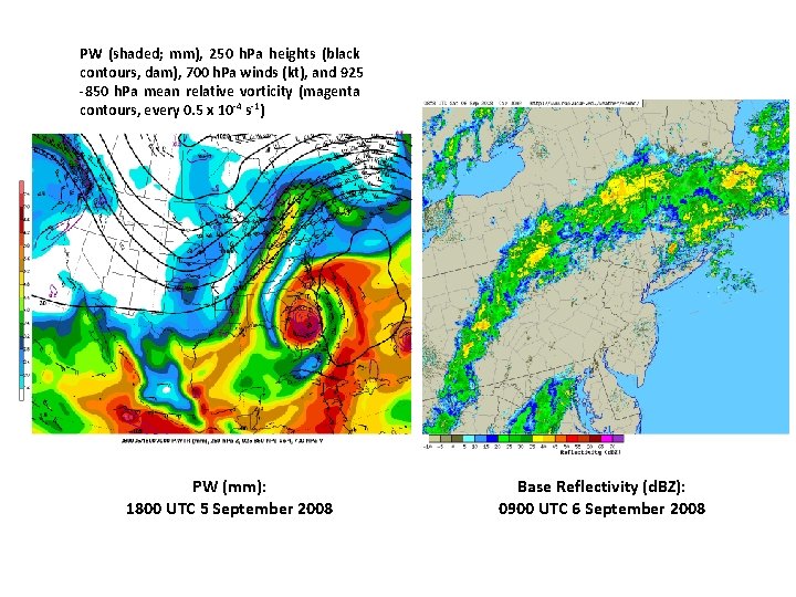
PW (shaded; mm), 250 h. Pa heights (black contours, dam), 700 h. Pa winds (kt), and 925 -850 h. Pa mean relative vorticity (magenta contours, every 0. 5 x 10 -4 s-1) PW (mm): 1800 UTC 5 September 2008 Base Reflectivity (d. BZ): 0900 UTC 6 September 2008

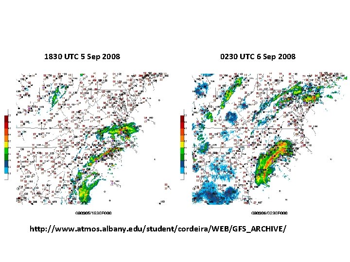
1830 UTC 5 Sep 2008 0230 UTC 6 Sep 2008 http: //www. atmos. albany. edu/student/cordeira/WEB/GFS_ARCHIVE/

0830 UTC 6 Sep 2008 1730 UTC 6 Sep 2008 http: //www. atmos. albany. edu/student/cordeira/WEB/GFS_ARCHIVE/

2030 UTC 6 Sep 2008 2330 UTC 6 Sep 2008 http: //www. atmos. albany. edu/student/cordeira/WEB/GFS_ARCHIVE/

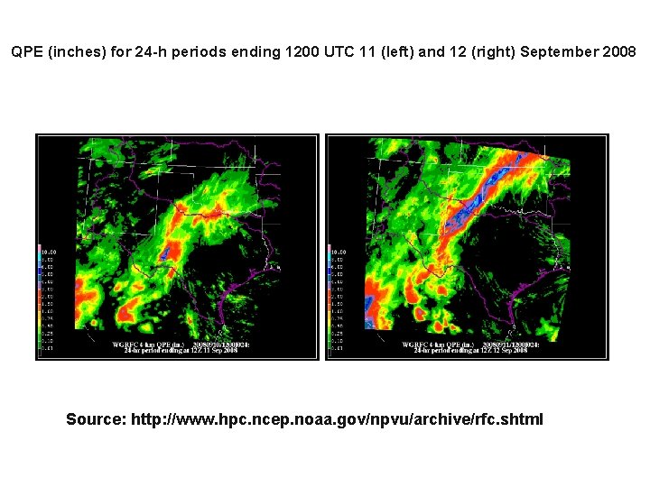
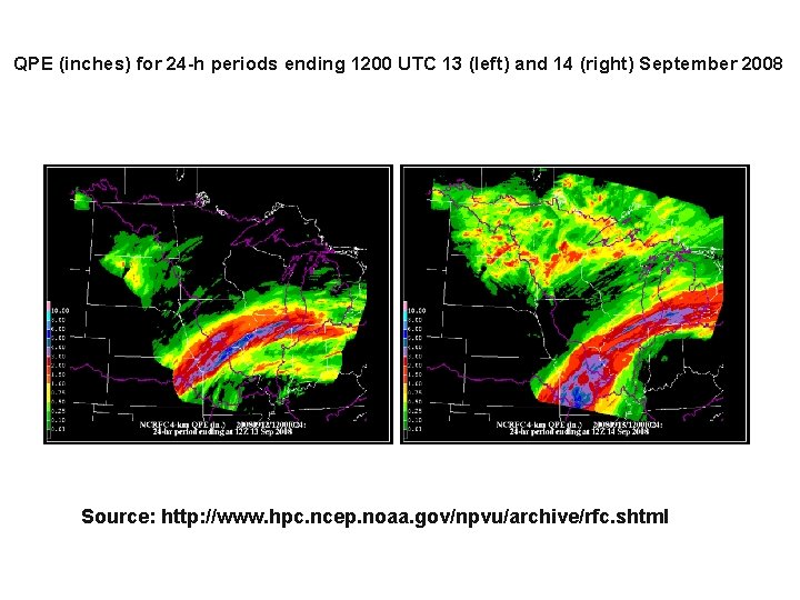
Midwest PRE with TC Ike: 11 -14 September 2008

QPE (inches) for 24 -h periods ending 1200 UTC 11 (left) and 12 (right) September 2008 Source: http: //www. hpc. ncep. noaa. gov/npvu/archive/rfc. shtml

QPE (inches) for 24 -h periods ending 1200 UTC 13 (left) and 14 (right) September 2008 Source: http: //www. hpc. ncep. noaa. gov/npvu/archive/rfc. shtml

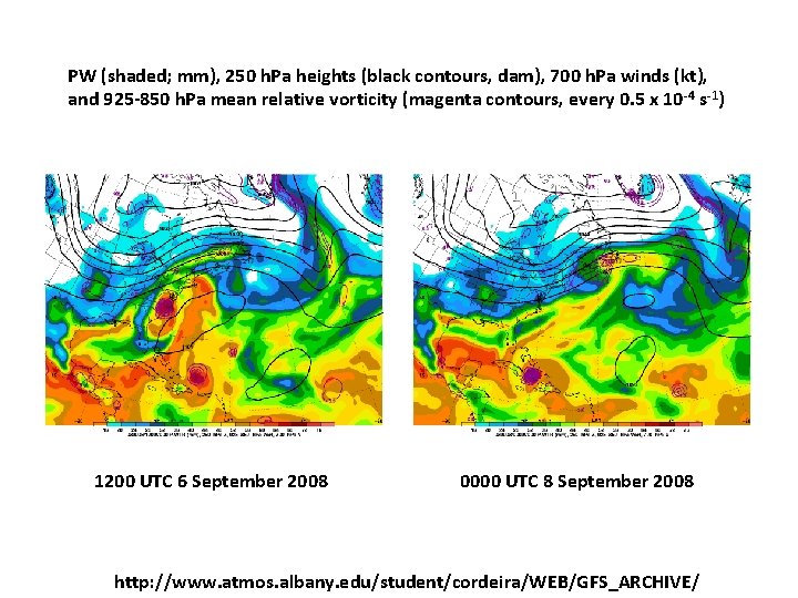
PW (shaded; mm), 250 h. Pa heights (black contours, dam), 700 h. Pa winds (kt), and 925 -850 h. Pa mean relative vorticity (magenta contours, every 0. 5 x 10 -4 s-1) 1200 UTC 6 September 2008 0000 UTC 8 September 2008 http: //www. atmos. albany. edu/student/cordeira/WEB/GFS_ARCHIVE/

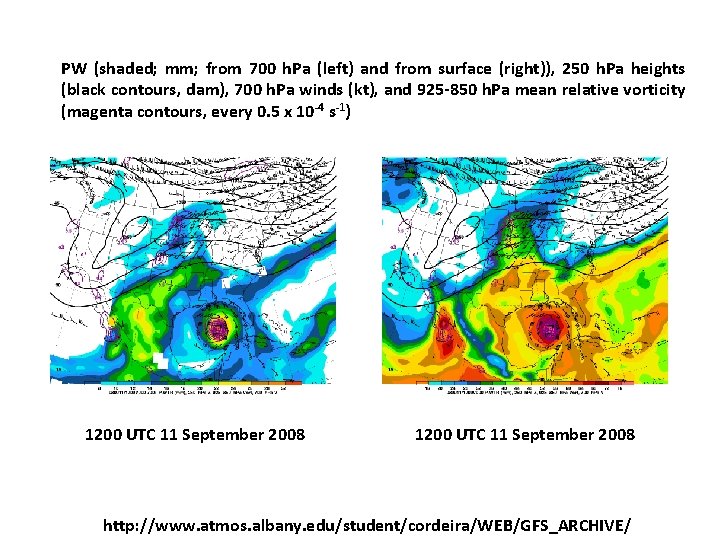
PW (shaded; mm; from 700 h. Pa (left) and from surface (right)), 250 h. Pa heights (black contours, dam), 700 h. Pa winds (kt), and 925 -850 h. Pa mean relative vorticity (magenta contours, every 0. 5 x 10 -4 s-1) 1200 UTC 11 September 2008 http: //www. atmos. albany. edu/student/cordeira/WEB/GFS_ARCHIVE/

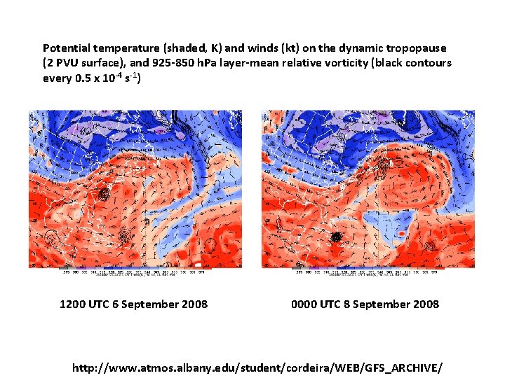
Potential temperature (shaded, K) and winds (kt) on the dynamic tropopause (2 PVU surface), and 925 -850 h. Pa layer-mean relative vorticity (black contours every 0. 5 x 10 -4 s-1) 1200 UTC 6 September 2008 0000 UTC 8 September 2008 http: //www. atmos. albany. edu/student/cordeira/WEB/GFS_ARCHIVE/

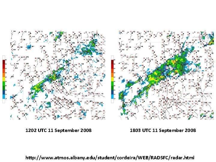
1202 UTC 11 September 2008 1803 UTC 11 September 2008 http: //www. atmos. albany. edu/student/cordeira/WEB/RADSFC/radar. html

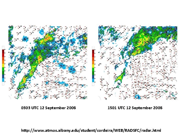
0303 UTC 12 September 2008 1501 UTC 12 September 2008 http: //www. atmos. albany. edu/student/cordeira/WEB/RADSFC/radar. html

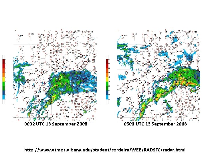
0002 UTC 13 September 2008 0600 UTC 13 September 2008 http: //www. atmos. albany. edu/student/cordeira/WEB/RADSFC/radar. html

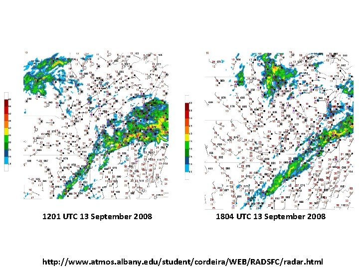
1201 UTC 13 September 2008 1804 UTC 13 September 2008 http: //www. atmos. albany. edu/student/cordeira/WEB/RADSFC/radar. html

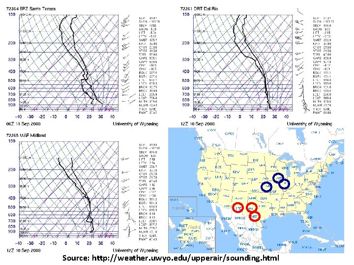
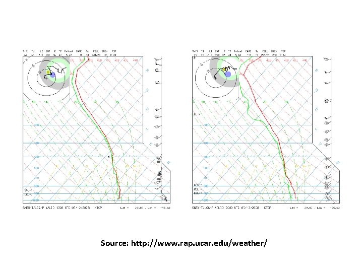
Source: http: //weather. uwyo. edu/upperair/sounding. html

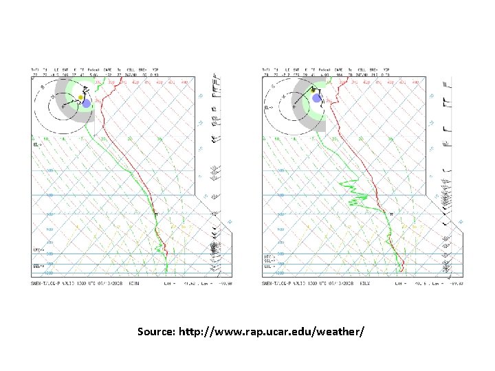
Source: http: //www. rap. ucar. edu/weather/

Source: http: //www. rap. ucar. edu/weather/

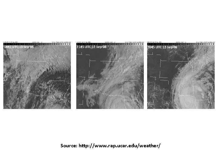
1445 UTC 13 Sep'08 2145 UTC 12 Sep'08 2045 UTC 13 Sep'08 Source: http: //www. rap. ucar. edu/weather/

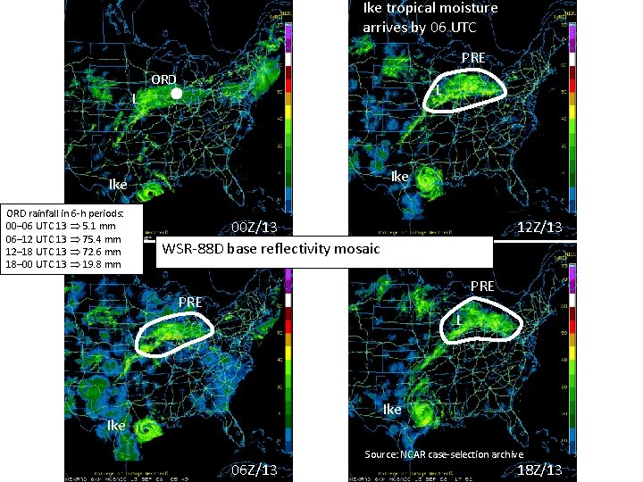
Ike tropical moisture arrives by 06 UTC PRE ORD L L Ike ORD rainfall in 6 -h periods: 00– 06 UTC 13 5. 1 mm 06– 12 UTC 13 75. 4 mm 12– 18 UTC 13 72. 6 mm 18– 00 UTC 13 19. 8 mm 00 Z/13 WSR-88 D base reflectivity mosaic 12 Z/13 PRE L L Ike 06 Z/13 Source: NCAR case-selection archive 18 Z/13

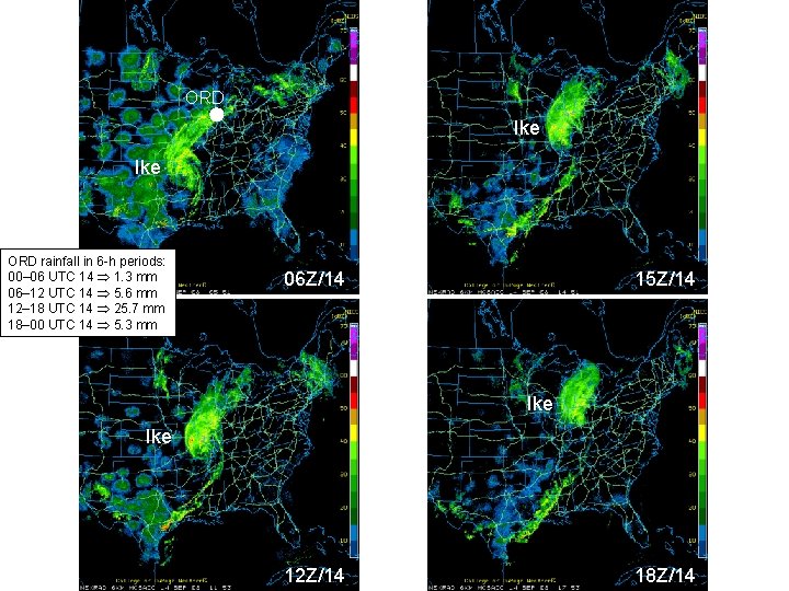
ORD Ike ORD rainfall in 6 -h periods: 00– 06 UTC 14 1. 3 mm 06– 12 UTC 14 5. 6 mm 12– 18 UTC 14 25. 7 mm 18– 00 UTC 14 5. 3 mm 06 Z/14 15 Z/14 Ike 12 Z/14 18 Z/14

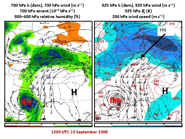
700 h. Pa h (dam), 700 h. Pa wind (m s 1) 700 h. Pa ascent (10 3 h. Pa s 1) 900– 400 h. Pa relative humidity (%) 925 h. Pa h (dam), 925 h. Pa wind (m s 1) 925 h. Pa e (K) 200 h. Pa wind speed (m s 1) PRE Ike H 1200 UTC 13 September 2008 Ike H

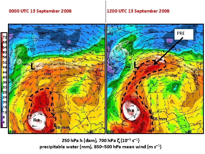
0000 UTC 13 September 2008 1200 UTC 13 September 2008 PRE L L Ike 56 mm Ike 925 h. Pa h (dam) 925 h. Pa 56 emm (K) 200 h. Pa wind speed (m s 1) 250 h. Pa h (dam), 700 h. Pa (10 5 s 1) precipitable water (mm), 850– 500 h. Pa mean wind (m s 1)

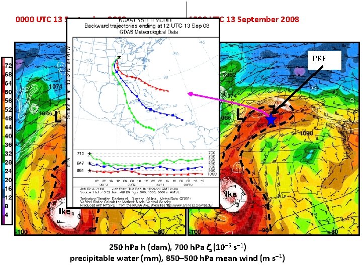
0000 UTC 13 September 2008 1200 UTC 13 September 2008 PRE L L Ike 925 h. Pa h (dam) 925 h. Pa e (K) 200 h. Pa wind speed (m s 1) 250 h. Pa h (dam), 700 h. Pa (10 5 s 1) precipitable water (mm), 850– 500 h. Pa mean wind (m s 1)

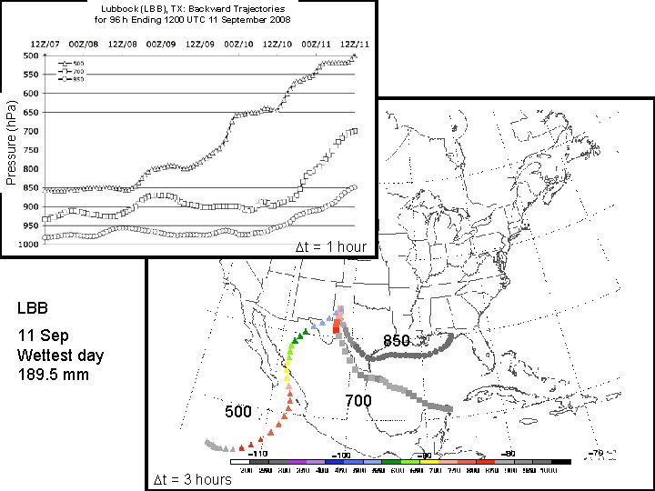
Pressure (h. Pa) Lubbock (LBB), TX: Backward Trajectories for 96 h Ending 1200 UTC 11 September 2008 t = 1 hour LBB 11 Sep Wettest day 189. 5 mm 850 500 t = 3 hours 700

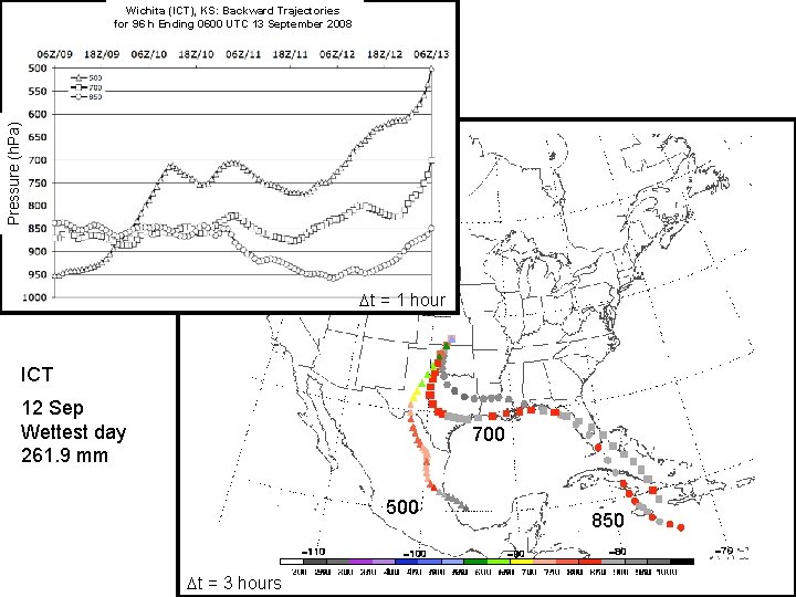
Pressure (h. Pa) Wichita (ICT), KS: Backward Trajectories for 96 h Ending 0600 UTC 13 September 2008 t = 1 hour ICT 12 Sep Wettest day 261. 9 mm 700 500 t = 3 hours 850

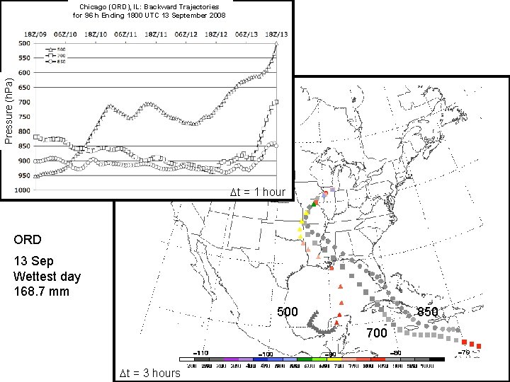
Pressure (h. Pa) Chicago (ORD), IL: Backward Trajectories for 96 h Ending 1800 UTC 13 September 2008 t = 1 hour ORD 13 Sep Wettest day 168. 7 mm 500 850 700 t = 3 hours

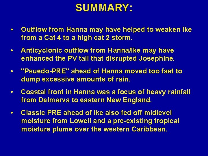
SUMMARY: • Outflow from Hanna may have helped to weaken Ike from a Cat 4 to a high cat 2 storm. • Anticyclonic outflow from Hanna/Ike may have enhanced the PV tail that disrupted Josephine. • "Psuedo-PRE" ahead of Hanna moved too fast to dump excessive amounts of rain. • Coastal front in Hanna was a focus of heavy rainfall from Delmarva to eastern New England. • Classic PRE ahead of Ike also fed off midlevel moisture from Lowell and a pre-existing tropical moisture plume over the western Caribbean.