Henan University Kaifeng December 1 st 2013 GEO

Henan University, Kaifeng. December 1 st. 2013 GEO INFO STRATEGY IN BIG DATA ERA Milan Konecny Masaryk University, Brno, Henan University, Kaifeng? ? Czech Republic
 - Vltava (Moldau)")
Czech Rep. Main catchment areas of the Czech Republic: Labe (Elbe) - Vltava (Moldau) - Morava - Odra (Oder)

Praha – Vltava river PRAHA – capital of Czech Rep. 57 districts • Area 496 km 2 • Amount of Inhabitants 1, 16 mil.

CONTENT 1. Big Data: USA and EU 2. What is it Geo Info Strategy and why we need it? 3. Where we are now? 4. Spatial Data Infrastructure Concepts 5. Spatially-Enabled Society 6. Geo. Info. Strategy - Integral Component of Czech e. Government 7. Conclusions

1. Big Data: USA and EU

Obama Administration Releases Historic Open Data Rules to Enhance Government Efficiency and Fuel Economic Growth - groundbreaking new steps to make information generated and stored by the Federal Government more open and accessible to innovators and the public, to fuel entrepreneurship and economic growth while increasing government transparency and efficiency.

President Obama said: “One of the things we’re doing to fuel more private sector innovation and discovery is to make vast amounts of America’s data open and easy to access for the first time in history. And talented entrepreneurs are doing some pretty amazing things with it. ” “Starting today, we’re making even more government data available online, which will help launch even more new startups. And we’re making it easier for people to find the data and use it, so that entrepreneurs can build products and services we haven’t even imagined yet. ”

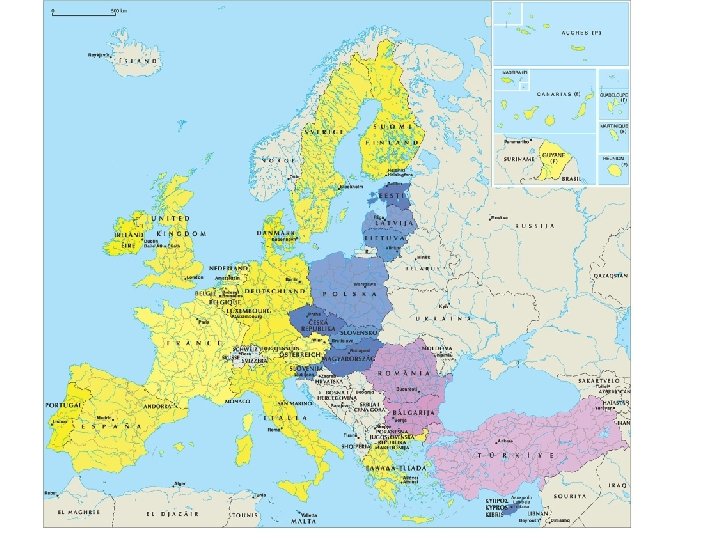
European Union Big Data is an emerging field where innovative technology offers alternatives to resolve the inherent problems that appear when working with huge amounts of data, providing new ways to reuse and extract value from information. Three main dimensions characterize Big Data: huge variety of data format, often time-sensitive and large. Big Data offers tremendous untapped potential value for many sectors but no specific intelligent-large-datahandling/brokering industrial sector exists.

2. What is it Geo Info Strategy and why we need it?
 data and information and,")
Geo. Info. Strategy: Complex system ensuring management of spatial (geographic) data and information and, contemporary defining the position, tasks, methods of realization and specifications of geospatial community in the very wide ICT stream (visualization, standardisation, georeferencicing, object classifications, …. )
")
Geo Info strategy of Czech Rep. should be based on 4 principles (Konečný, 2009) Management: Design of management structure necessary for optimization of the benefits of geospatial resources paid by the government. Data: to collect, maintain and protect fundamental (priority) geospatial datasets and create directives for nonfundamental (other) geospatial data.

Access: ensure that geospatial information and services paid by the state were easily available , accesible, and evaluable; Interoperabilita: Ministry of Interior should ensure continuity of Geospatial Strategy for the development of strategic plans in information, knowledge - based society. Creating a panel led by non-political expert. Ensure the sustainability of the processes in the GI regardless of political changes.

3. Where we are now? • Global Mapping • GMES and INSPIRE: step ahead than GOOGLE, offering data (not only showing) • GEO, GEOSS • Digital Earth (Annoni and JRC) • Concepts and strategies (Spatial-Enabled Society, e-Government, …. ) • But also privacy data problems

Understanding Digital Earth Cloud Earth Surface El Nino Earthquake Sea water temperature Volcano Vegetation Plate Boundary (http: //www. nasm. si. edu/Earth. Today)

Understanding Digital Earth Applications Enabling Citizens and Communities Private Public Tools & & Technology Interoperability EARTH Digital Resources Collecting Data (White paper by NASA Digital Earth office, 2000)

4. Spatial Data Infrastructure Concepts

I Spatial Data Infrastructures sources databases metadata network institutional agreements policy & standards users technology
 is used to encapsulate the technologies, policies, institutional")
The term Spatial Data Infrastructure (SDI) is used to encapsulate the technologies, policies, institutional arrangements, financial and human resources that facilitate the availability, access and effective usage of geographic data. The SDI provides the means for discovery, access and application of spatial data for policymakers, planners and managers, citizens and their organizations.

SDI technologies consist of a set of data services that provide geographic data and their attributes. Services and data are documented with metadata which that subsequently offer the means to discover, visualise and evaluate the data through the Web. Additionally, methods are provided to access the data. Applications are built to solve specific needs on the data service layer.
")
Global Monitoring for Environment and Security (INSPIRE/ESDI)

Overall GMES objectives to provide information services to policy-makers and other users EARTH OBSERVING SYSTEMS (space, airborne, insitu) Space Agencies In-situ Observing systems Scientific Community EO Value Adding Industry Information Needs (policy driven) PUBLIC POLICIES (Environment & Security) National Governments and Agencies European Union Institutions Inter-Governmental Organisations (IGOs) Non Governmental Organisations (NGOs) Virginia PUZZOLO, EC DG Enterprise-GMES Burreau, Prague Symposium, 2009

Overall architecture Space Infrastructure Users Security Emergency Atmosphere Farming ICZM Air quality DOWNSTREAM SERVICES Marine Land Added Value Chain CORE SERVICES In Situ Infrastructure

Four main types of products: Early warning Reference maps Assessment maps Thematic maps For headquarters, decision-makers and in-field operatives In Europe and worldwide

ERCS 1 st priority Rapid mapping on demand in case of humanitarian crises, natural disasters, and man-made emergency situations within & outside Europe Ø Reference maps available within 6 hours over crisis area Ø Damage assessment maps available within 24 hours & daily updated Ø Situation maps and forecasts of evolution of situations within the few days-weeks after crisis

Relationship between the first and second generations of SDIs. (by Williamson Rajabifard, Binns, 2007, reprinted from Rajabifard at al. 2006 with permission of the International Journal of GIS)

Roles of national governments, subnational governments and the private sector in SDI development over the part decade. (by Williamson Rajabifard, Binns, 2007 reprinted from Rajabifard at al. 2006 with permission of the International Journal of GIS)

Current roles of national governments, subnational governments, and the private sector in SDI development (by Williamson Rajabifard, Binns, 2007, reprinted from Rajabifard at al. 2006 with permission of the International Journal of GIS).

5. Spatially-Enabled Society

Australian Government, Ministerial Online and Communications Council 8 September, 2006 “…spatially-enabled government is an exciting area for government. Spatially-enabled government uses place or location to manage and integrate government services and enhance business opportunities. ” The Hon Gary Nairn MP, Special Minister for State, Australian Government

The answer: Provide the systems and people use them!!!

Three visions to support spatially enabled government as part of e-government • A land management vision: incorporating spatially enabled land administration • A spatial data infrastructure (SDI) vision: SDI as an enabling platform • A vision for a spatially enabled society

But first understand three fundamental concepts • Land in society • Spatial information in society • Importance of integration of natural and built environment in delivering sustainable development

Land in Society Land policy Land management Land administration system Cadastre Land parcel

Spatial Information in Society Spatial enablement of society and government Spatial information policy as part of e-government SDI Spatial Data layers Objects
 and Natural (topographic) Environmental Datasets Sustainable")
The challenge is the relationship between Built (cadastral) and Natural (topographic) Environmental Datasets Sustainable Development Built Dataset Natural Dataset

Vision of spatially enabled government

Governments are spatially enabled when - Location is used to organise their information and Location and spatial information are common goods available to citizens and businesses to encourage creativity and product development.

Challenges and Issues for spatially enabled society • SDI to facilitate spatially enabled government as part of an e-government strategy • SDI to facilitate integration of natural and built environment datasets • Development of SDI vision, mission and road map – where are we heading? • Role of government, private and academic sectors • Capacity building

Conclusion • SDI is a new and evolving concept • SDI development is multi-disciplinary with policy, legal, institutional and technical dimensions • SDI will be a virtual environment supported by an enabling platform - spatially enabling society and government within an e-government environment • Innovations in use of information will involve private and government sectors. • Research is central to SDI development

5. Geo. Info. Strategy- Integral Component of Czech e. Government Eva Kubatova, M. Rada, M. Konecny Ministry of the Interior of the Czech Republic

Content • • • Czech Mo. I Role in ICT Czech e. Government System of PA Basic Registers - RUIAN Czech NSDI Towards Geoinformation Strategy Key PA Authorities Agreement Geo. Info. Strategy Project of Geo. Info. Strategy Conclusion 44

Czech Mo. I Role in ICT • since 2007 – central state administration body in charge of public administration information systems – coordination body for information and communication technologies • fundamental objectives – modernization of public administration – reaching an efficient public administration by use of ICT üe. Government 45

Czech e. Government PA Basic Registers − smart public administration – – better laws functional authorities professional public servants effective information technologies • „the document has to circulate instead e. Gov Act of the citizen“ • four measures Czech. Point 1. Czech Point 2. Public Administration Communication Infrastructure 3. e. Government Act (2008) 4. Public Administration Basic Registers (2012) PA Communication Infrastructure 46
 – definition of the")
Czech e. Government Strategies • Smart Administration (2007 – 2013) – definition of the process of Czech PA modernization and improving • by effective use of ICT • via provision of high-quality public services • e. Gov 2014+ (2014 – 2020) – strategic framework for the development of public administration and e. Government 2014+ • modern PA is designed as transparent and efficient „service to the citizen“ • the main principle is „sharing“ data and services 47

PA Basic Registers System − Act No. 111/2009 Coll. , on basic registers − 4 basic registers of public administration – – Register of Inhabitants (Mo. I) Register of Corporations (Czech Statistical Office) Register of Rights and Obligations (Mo. I) Register of Territorial Identification, Addresses and Real Estates (Czech Office for Surveying, Mapping and Cadastre) • Basic Registers Information System (Mo. I) • ORG (The Office for Personal Data Protection) • fully operational in July 2012 48
 − content")
RUIAN − Basic Register of Territorial Identification, Addresses and Real Estates (RUIAN) − content of RUIAN – administration units (country, regions, …cadastral units, parcels, buildings) – entities of land administration (municipality districts, streets, …) – addresses – location data (centroids of parcels, buildings, …) – other data (building features, …) • no personal data • the crucial pillar of the Czech NSDI • administrated by Czech Office for Surveying, Mapping and Cadaster (COSMC) • edited by Municipal and Building Authorities, Czech Statistical Office (CSO) and Local Cadastral Authorities 49
 spatial data on territory (COSMC) – RUIAN – cadastral")
The Czech NSDI • (reference) spatial data on territory (COSMC) – RUIAN – cadastral maps, state maps, Fundamental Base of Geographic Data, … • thematic spatial data (both public and private) • • national INSPIRE infrastructure (Mo. E) statistical spatial data (CSO) spatial data on technical infrastructures … • systematic, transparent and formal determination of the Czech NSDI is missing up to now • lack of – – coordination of PA authorities activities legislation coherent concept of spatial data handling National Geoinformation spatial data and services standards Strategy 50

Conference INSPIRE 2011, Edinburgh Towards Geoinformation Strategy • first analysis of NSDI in 2001 (Nemoforum) • then the Ministry of Informatics tried hard to go on but with no success • first turning point was 2007 • INSPIRE adoption • Mo. I assumed the responsibility for ICT • INSPIRE transpozition in the course of 2007 and 2009 51

INSPIRE • INSPIRE transposition and implementation is in responsibility of Ministry of the Environment (Mo. E) – transposition was executed by updating of Act No. 123/1998 Coll. , on right of environmental information – www. geoportal. gov. cz – INSPIRE coordination body (KOVIN) • INSPIRE becomes real Mo. I inspiration in the way towards national geoinformation strategy 52

Key PA Authorities Agreement - after election in 2010 unstable political situation - second key point in mid-2012 - agreement on cooperation in the process of national geoinformation strategy drawing up • under Mo. I coordination • without any public money - Minister of the Interior submitted the joint proposal for Czech Government´s approval in October 2012 53

Geo. Info. Strategy − Czech Government – approved the proposal of working out of the „Strategy of spatial information infrastructure development in the Czech Republic up to 2020“ (Geo. Info. Strategy) by Resolution No. 837 on the 14 th November 2012 – ordered to submit the Geo. Info. Strategy draft for approval to the end of February 2014 – ordered to cooperate to all central state administration bodies – recommend to cooperate to regions and cities 54

Geo. Info. Strategy Main Goals • to set up effective coordination and integration of public bodies and commercial sector activities in the field of spatial data • to help to set up conditions for – major improvement of e. Government services regarding spatial data – reduction of costs of public administration – enhancing of the overall competitiveness of the Czech economy 55

Geo. Info. Strategy Inspiration • European – INSPIRE – existing geoinformation strategies (Wales, Netherland, Sweden, Nothern Ireland…) • National – development e. Government strategy – INPIRE Implementation Strategy – existing departmental development strategies – points of view of • relevant PA bodies • professional associations • … 56

Geo. Info. Strategy Content. Implemetation Plan • description of NSDI current state, list of key problems and analysis of their causes • setting up target state that contains clear priorities and measurable goals (SMART) • proposal of concrete arrangements and tasks to reaching target state • • Legislative and organization arrangements Arrangement administrators Time schedule of future tasks performance Costs and Benefits of the arrangement realization • specification of roles of relevant PA bodies and user groups • institutional designation of suitable coordination structure 57

Project of Geo. Info. Strategy • project Geo. Info. Strategy has been set up – Administrator is Mo. I – Managing Committee (COSMD, Mo. E, Mo. LD, Mo. T) – Processing Team (experts from PA and academic sphere) – Consulting Team (PA bodies, professional associations (Nemoforum, CAGI, …, universities) – Working Groups • http: //www. geoinfostrategie. gov. cz • geoinfostrategie@mvcr. cz 58

Project Rough Time Framework Period Phase 01 – 02 / 2013 Project Setting up 03 – 05 / 2013 Analytic and Prognostic Phase 06 / 2013 Vision, Global Goal and Strategic Goals Proposal 07 – 11/2013 Start of working on Geo. Info. Strategy Draft 12 / 2013 Proposal of Implementation Plan 01 – 02 / 2014 Consulting of the Geo. Info. Strategy Draft 59

Geo. Info. Strategy – Where we are - Working and Organisational Plan is approved by Managing Committee - work in compliance with Cooperation and Communication Plan (workshops, presentations, articles in specialized magazins, …) - collection of • information for analysis • impulses for proposal - worked out • document structure • vision and global goal • strategic nd specific goals 60

6. Conclusion - important is • intention to work out the national geoinformation strategy (Geo. Info. Strategy) has governmental support o Governmental Resolution No. 837/2012 • future Geo. Info. Strategie is seen as the e. Gov 2014 + subsequent strategy o Geo. Info. Strategy is going to be an integral component of Czech e. Government • Czech Republic makes efforts to o coordinate national geoactivites o activate huge spatial data economic potencial 61

Thanks for your attention! http: //www. geoinfostrategie. gov. cz geoinfostrategie@mvcr. cz eva. kubatova@mvcr. cz 62


Xie, Xie!!!!! Bardzo Dziekuje Chvala THANK YOU Muchas Gracias Terima Kasim. O Brigada Kammsa Hamida Aligator SHUKRAN BLAGODARJA DĚKUJI ( in Czech)
- Slides: 66