
HARDMAN RESOURCES LTD OFFSHORE GUYANE EXCLUSIVE EXPLORATION LICENCE


- Slides: 15
HARDMAN RESOURCES LTD OFFSHORE GUYANE EXCLUSIVE EXPLORATION LICENCE AAPG Annual Convention and Exhibition April 2004
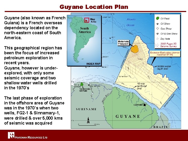
Guyane Location Plan Guyane (also known as French Guiana) is a French overseas dependency located on the north-eastern coast of South America. This geographical region has been the focus of increased petroleum exploration in recent years. Guyane, however is underexplored, with only some seismic coverage and two shallow water wells drilled in the 1970’s The last phase of exploration in the offshore area of Guyane was in the 1970’s when two wells, FG 2 -1 & Sinnamary-1, were drilled & over 5, 000 kms of seismic was acquired
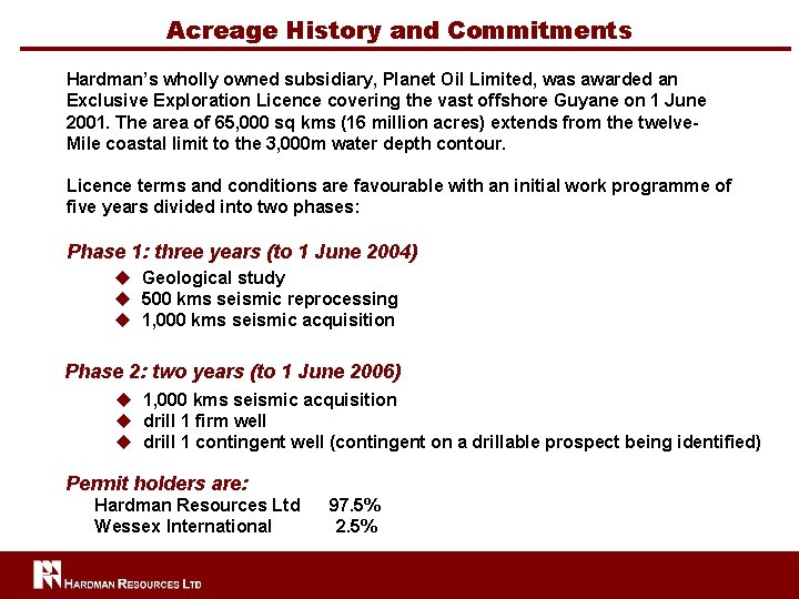
Acreage History and Commitments Hardman’s wholly owned subsidiary, Planet Oil Limited, was awarded an Exclusive Exploration Licence covering the vast offshore Guyane on 1 June 2001. The area of 65, 000 sq kms (16 million acres) extends from the twelve. Mile coastal limit to the 3, 000 m water depth contour. Licence terms and conditions are favourable with an initial work programme of five years divided into two phases: Phase 1: three years (to 1 June 2004) u Geological study u 500 kms seismic reprocessing u 1, 000 kms seismic acquisition Phase 2: two years (to 1 June 2006) u 1, 000 kms seismic acquisition u drill 1 firm well u drill 1 contingent well (contingent on a drillable prospect being identified) Permit holders are: Hardman Resources Ltd Wessex International 97. 5% 2. 5%
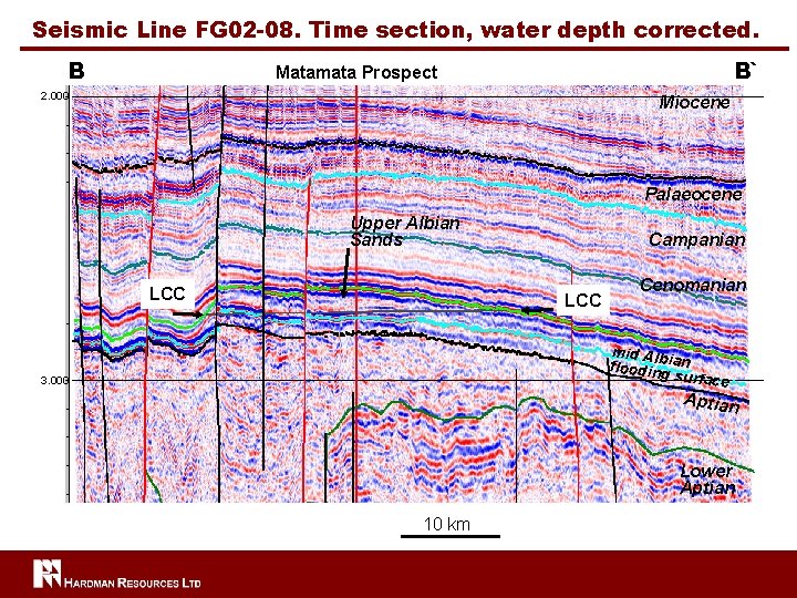
Acreage History and Commitments continued Hardman’s initial phase of work included geological/geochemical studies and the interpretation of well and 3, 945 kms of scanned seismic data. This work confirmed the: u presence of excellent mature Cretaceous source rock which is connected by faults to reservoir objectives u reservoir potential in sandstones of Cretaceous and Tertiary age; u presence of numerous un-drilled structural and stratigraphic traps. Phase 1 of the initial work programme is now nearing completion u 7, 500 kms of new seismic was acquired early 2003 u fully processed data has been mapped & interpreted by Hardman’s technical team New seismic is of excellent quality and has confirmed the existence of a thicker sedimentary section in the basin than previously identified from the 1970’s data u A number of hydrocarbon leads, both structural & stratigraphic, have been identified in the EEL u technical work has confirmed the major structural leads of the area u of particular interest is a giant structure with multiple objectives, which is referred to as the “Matamata Prospect”
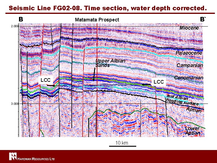
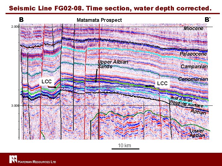
Seismic Line FG 02 -08. Time section, water depth corrected. B B` Matamata Prospect 2. 000 Miocene Palaeocene Upper Albian Sands LCC Campanian LCC Cenomanian mid Alb floodingian su 3. 000 rface Aptian Lower Aptian 10 km
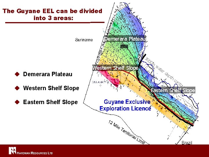
The Guyane EEL can be divided into 3 areas: Demerara Plateau FG 2 -1 30 u Demerara Plateau u Western Shelf Slope u Eastern Shelf Slope Western Shelf Slope 00 m wa t er de pt h co nt o ur Eastern Shelf Slope
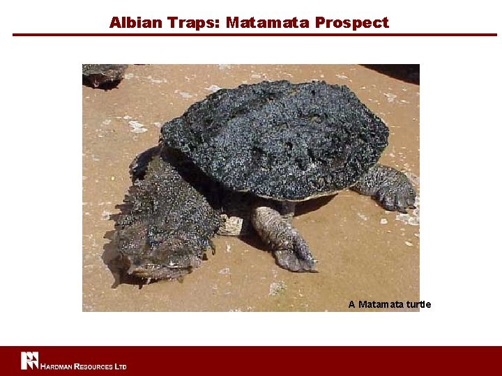
Albian Traps: Matamata Prospect A Matamata turtle
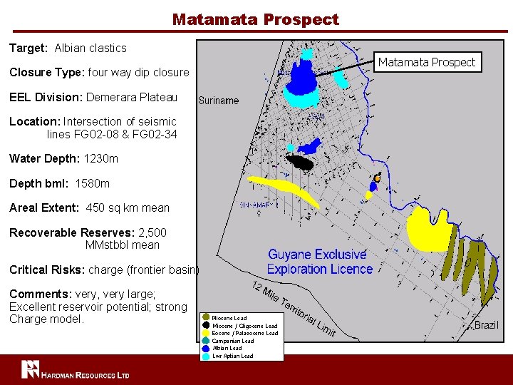
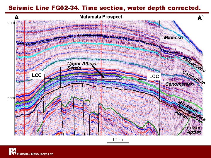
Matamata Prospect Target: Albian clastics Matamata Prospect Closure Type: four way dip closure EEL Division: Demerara Plateau Location: Intersection of seismic lines FG 02 -08 & FG 02 -34 Water Depth: 1230 m Depth bml: 1580 m Areal Extent: 450 sq km mean Recoverable Reserves: 2, 500 MMstbbl mean Critical Risks: charge (frontier basin) Comments: very, very large; Excellent reservoir potential; strong Charge model. Pliocene Lead Miocene / Oligocene Lead Eocene / Palaeocene Lead Campanian Lead Albian Lead Lwr Aptian Lead
Seismic Line FG 02 -08. Time section, water depth corrected. B B` Matamata Prospect 2. 000 Miocene Palaeocene Upper Albian Sands LCC Campanian LCC Cenomanian mid Alb floodingian su 3. 000 rface Aptian Lower Aptian 10 km
Seismic Line FG 02 -34. Time section, water depth corrected. A A` Matamata Prospect 2. 000 Miocene Pa la eo Upper Albian Sands LCC Ca e mp Cenomanian 3. 000 ce n an ian M flo id Al od bia Ap ing s n urf tia a n ce Lower Aptian 10 km
Seismic Line FG 02 -08. Time section, water depth corrected. B B` Matamata Prospect 2. 000 Miocene Palaeocene Upper Albian Sands LCC Campanian LCC Cenomanian mid Alb floodingian su 3. 000 rface Aptian Lower Aptian 10 km
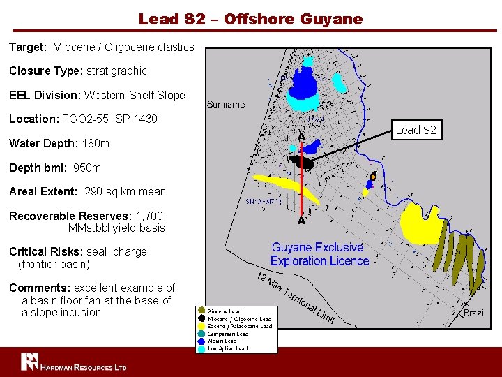
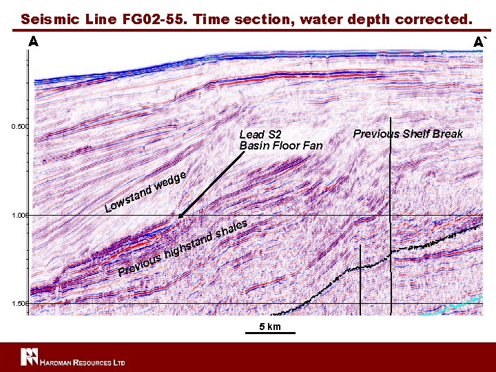
Lead S 2 – Offshore Guyane Target: Miocene / Oligocene clastics Closure Type: stratigraphic EEL Division: Western Shelf Slope Location: FGO 2 -55 SP 1430 A Water Depth: 180 m Depth bml: 950 m Areal Extent: 290 sq km mean Recoverable Reserves: 1, 700 MMstbbl yield basis A` Critical Risks: seal, charge (frontier basin) Comments: excellent example of a basin floor fan at the base of a slope incusion Pliocene Lead Miocene / Oligocene Lead Eocene / Palaeocene Lead Campanian Lead Albian Lead Lwr Aptian Lead S 2
Seismic Line FG 02 -55. Time section, water depth corrected. A A` 0. 500 Lead S 2 Basin Floor Fan e d 1. 000 tan s Low dg we i sh iou nd ta ghs les a h s v Pre 1. 500 5 km Previous Shelf Break
Prospects / Leads: Recoverable Reserves Estimates