Halau makes offering to Pele at Kilauea Volcano


 that resemble")

")


 is the volcano’s longest rift-zone eruption")


 Carbondioxide CO")


- Slides: 68
Halau makes offering to Pele at Kilauea Volcano lookout : Dancers with Halau Ka Liko Pua O Kalaniakea, under the direction of Kumu Kapua Dalire-Moe danced and chanted to pay their respects to Pele on April 2, 2008. Volcanic fumes spewed from Halemaumau in the background. After the halau danced and chanted, they threw all their leis into the crater, returning them back to the earth
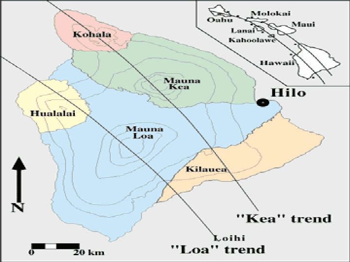
Location 19. 425 N 155. 292 W Elev. Above Sea Level 1, 277 m 4, 190 ft Area 1, 430 km 2 552 mi 2 (13. 7% of Hawai`i) Volume 25, 000 -35, 000 km 3 6, 000 -8, 500 mi 3
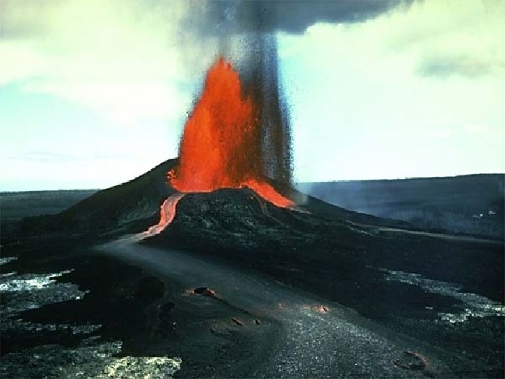
1. 2. 3. 4. 5. Location Map Shield Volcano Most active Volcano Geologic Features Volcanic Hazards 6. Kilauea's Pu'u O'o vent erupted in July 1983, sending a river of lava from Kilauea's east rift zone
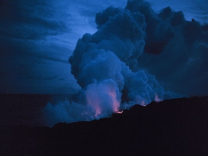
Halema'u as a cloud of ash and sulfur dioxide rushes into the air March 26, 2008.
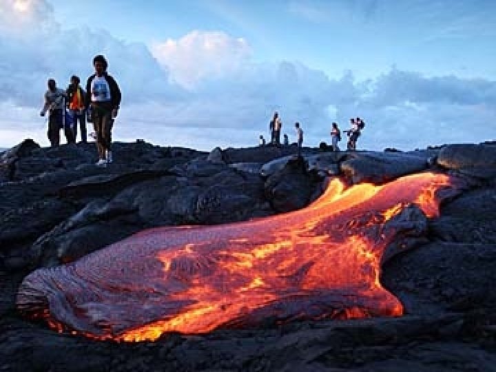
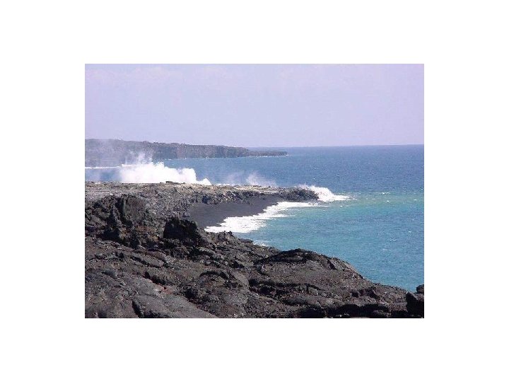
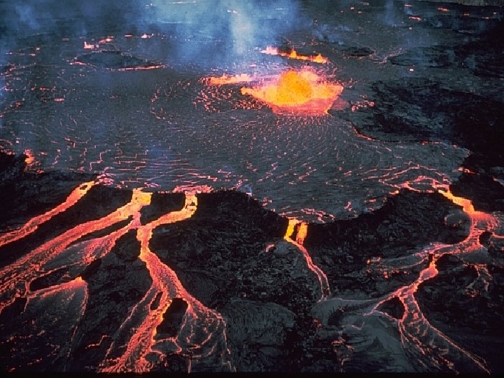
Kilauea is Hawaii's youngest volcano and one of the world's most active. Over 90 percent of Kilauea's surface is covered by lava less than 1, 100 years old. In historical time, all of Kilauea's eruptions have occurred either in or near its summit caldera, or along the east or southwest rift zones. For the foreseeable future, we can assume that active vents will be limited to these areas. Kilauea's daily lava production averages between 300, 000 to 600, 000 square meters (358, 000 to 717, 000 square yards). Over the past two decades the eruption has added more than 540 acres (219 hectares) of new land to the big island of Hawaii's south shore. March 6, 2008 Lava completed its trip down the slopes of Kilauea volcano and has begun flowing into the ocean in the remote Puna coastline to see Madame Pele's handiwork. Laze, lava haze and steamy vapors from the sea are hazardous.
March 6, 2008 Lava Flow
New vent in Halema'u crater 3/27/2008.
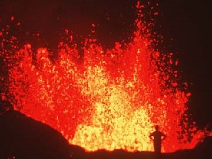
The Three V’s of Volcanology: Viscosity, Volatiles, Volume Kilauea – Explosive Eruption Event of 1790 • Kilauea killer pyroclastic events – Hawaii’s King Keoua’s army passing through Kilauea area was stopped by eruptions and split into three groups to escape area – Base surge overtook middle group, killing all 80 • Explosion column burst upward as dense basal cloud swept downhill • Cloud of hot water and gases sometimes with magma fragments
The island of Hawaii is divided into zones according to the degree of hazard from lava flows. Zone 1 is the area of the greatest hazard, Zone 9 of the least.
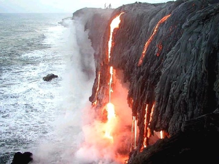
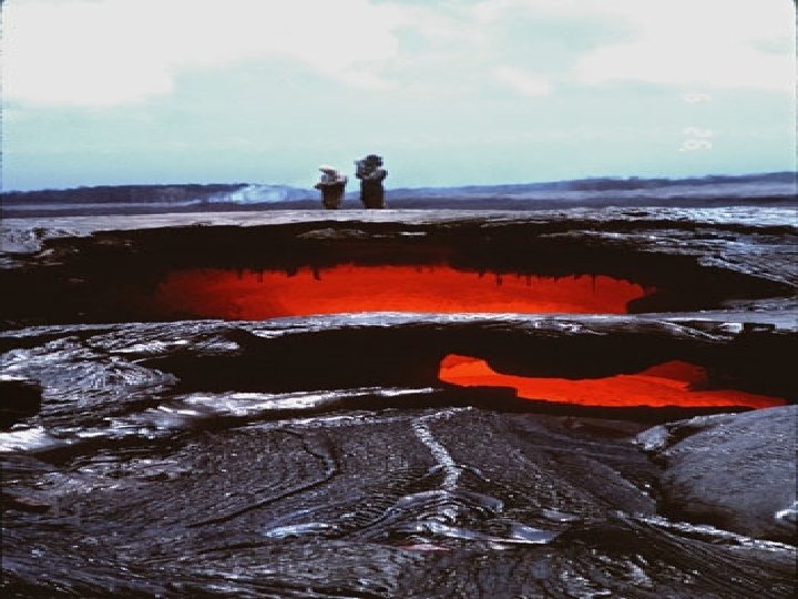
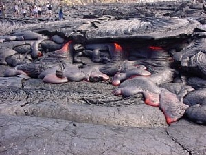
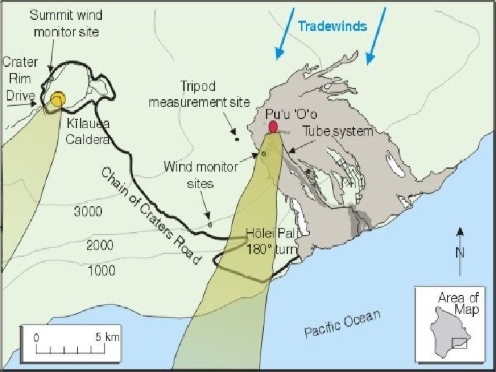
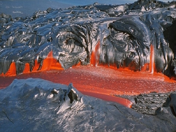
The current vent at Kilauea consists of a small lava lake about 100 meters (330 feet) across that produces a relatively small thermal hot spot. From this vent, lava is transported 10 kilometers (6 miles) in lava tubes to the Pacific Ocean where large steam plumes are generated by the interaction between the hot lava and the ocean
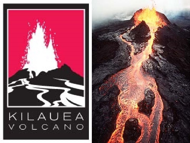
Kilauea Volcano, Hawai`i
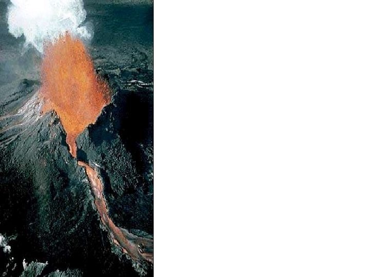
The eruption of Kilauea Volcano that began in 1983 continues at the cinder-and-spatter cone of Pu`u `O`o (high point on skyline). Lava erupting from the cone flows through a tube system down Pulama Pali about 11 km to the sea (lower left). Oct 11, 2002, HVO
Kilauea Volcanoe’s pathway of molten rock during the eruption of Pu`u `O`o, located on the east rift zone about 20 km from the caldera. (Modified after J. Johnson, 1984 -2004)
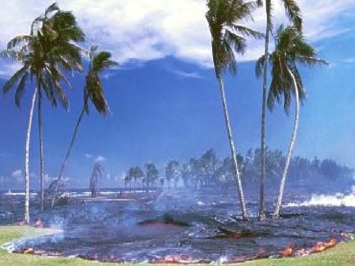
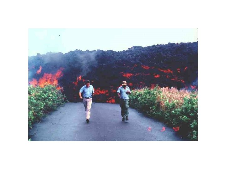
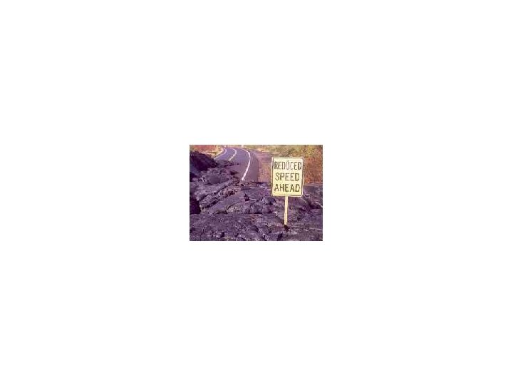
4/23/90 6/9/90 In June 1990, Walter's Kalapana Store and Drive Inn (sign in photo above) was burned and covered by lava in early June as flows moved relentlessly through the Kalapana area. During this difficult period, scientists of the USGS Hawaiian Volcano Observatory provided detailed information on lava movement to the Hawai`i County Civil Defense, which made decisions regarding evacuation, road closures, and safe vantage points for residents and visitors.
Oblique map of Kilauea Volcano: Most lava flows erupted from Kilauea since A. D. 1790 (shown in red) originated from the east rift zone, which extends 34 miles (55 km) from the summit caldera to the eastern tip of the Island of Hawai`i. Lava flows from the present eruption (shown in yellow) span more than 9 miles (15 km) along the coast. USGS
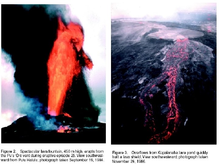
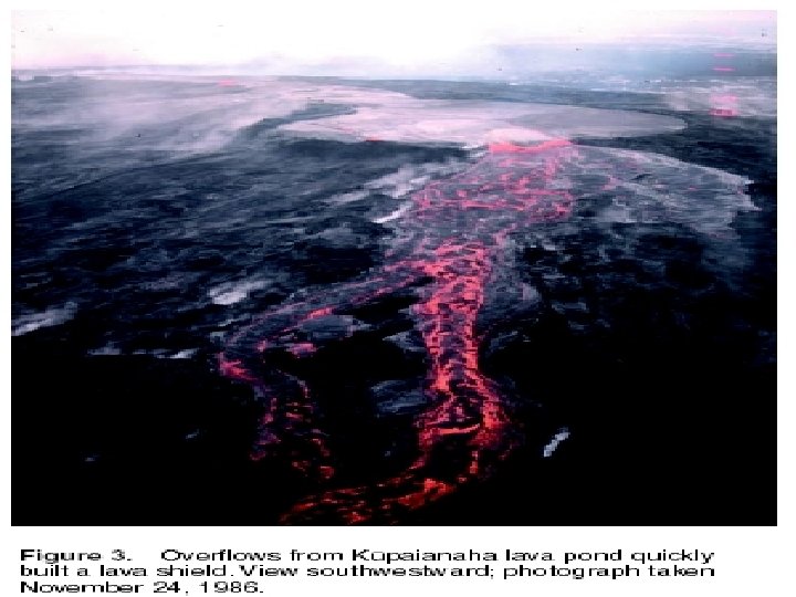
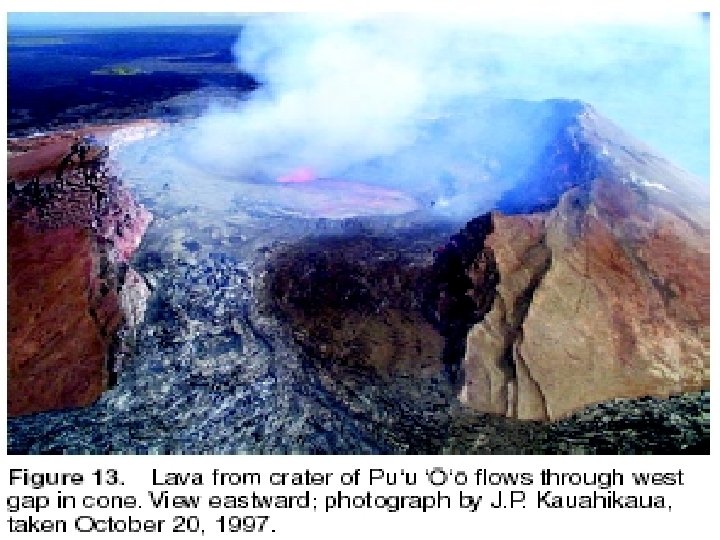
During the first 3 1/2 years of the eruption, fallout from lava fountains at Pu`u `O`o built a cinderand-spatter cone 835 feet (255 m) high, more than twice as high as any other cone on Kilauea's east rift zone. Cone growth ceased after the activity shifted to Kupaianaha in mid-1986. When the eruption returned to Pu`u `O`o in 1992, lava flows from flank vents built a shield against the west flank of the cone (left). in 1993, collapse pits appeared on the west flank of Pu`u `O`o as subsidence over the flank vents undermined the cone. When the floor dropped in January 1997, the weakened flank also failed, leaving the prominent "west gap. " Note growth of the shield (right). USGS photos by Tari Mattox and Christina Heliker
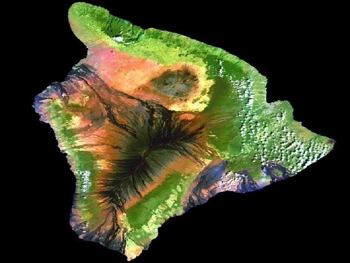
Hawaii, 6/1/2001 NASA: The black areas on the island (in this scene) that resemble a pair of sun-baked palm fronds are hardened lava flows formed by the active Mauna Loa Volcano. Just to the north of Mauna Loa is the dormant grayish Mauna Kea Volcano, which hasn’t erupted in an estimated 3, 500 years. A thin greyish plume of smoke is visible near the island’s southeastern shore, rising from Kilauea—the most active volcano on Earth. Heavy rainfall and fertile volcanic soil have given rise to Hawaii’s lush tropical forests, which appear as solid dark green areas in the image. The light green, patchy areas near the coasts are likely sugar cane plantations, pineapple farms, and human settlements. The black areas on the island (in this scene) that resemble a pair of sun-baked palm fronds are hardened lava flows formed by the active Mauna Loa Volcano. Just to the north of Mauna Loa is the dormant grayish Mauna Kea Volcano, which hasn’t erupted in an estimated 3, 500 years. A thin greyish plume of smoke is visible near the island’s southeastern shore, rising from Kilauea—the most active volcano on Earth. Heavy rainfall and fertile volcanic soil have given rise to Hawaii’s lush tropical forests, which appear as solid dark green areas in the image. The light green,
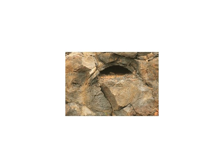
Kilauea erption strated on Jan 3, 1983, and continues on presently. Pu'u O'o is the longest -lived eruption in the 200 -year record of the Kilauea Volcano. Lava production rates are hard to determine, but scientists estimate that Pu'u O'o produces between 300, 000 and 600, 000 cubic meters of lava per day. In fact, Pu'u O'o's broad field of lava flows have buried more than 130 square km of Kilauea's southern flank and have added more than 300 hectares (860 acres) of new land to the island. The bottom image is a false-color composite using the ETM+ infrared detectors (channels 6, 7, and 5), which are sensitive to heat. The red regions show solidified rock from previous lava flows. Notice thin yellow ribbon snaking toward the ocean away from where the steam is venting. This yellow ribbon shows the location of a river of molten rock running beneath the surface--called a lava tube. Such areas are particularly dangerous to hikers and explorers as these tubes may collapse without warning
Lava Tubes on Mt. Kilauea's caldera is located toward the northwestern corner (upper left) of the image. The brown hues show volcanic rock, while dark browns and black show relatively recent lava flows that have cooled and solidified into rock. The green hues show forest canopy, white pixels are clouds, and the blue to the south and east is the open Pacific Ocean. Notice thin plume of steam streaming from one of Pu'u O'o's active lava tubes.
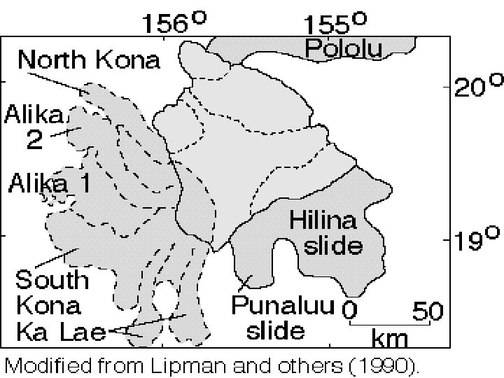
Kilauea 1994 Space Radar Image Map: Deformation map of the south flank of Kilauea volcano on the big island of Hawaii, centered at 19. 5 degrees north latitude and 155. 25 degrees west longitude. The south flank of the Kilauea volcano is among the most rapidly deforming terrains on Earth. Several regions show motions over the six-month time period. Most obvious is at the base of Hilina Pali, where 10 centimeters (4 inches) or more of crustal deformation can be seen in a concentrated area near the coastline. On a more localized scale, the currently active Pu'u O'o summit also shows about 10 centimeters (4 inches) of change near the vent area. Finally, there are indications of additional movement along the upper southwest rift zone, just below the Kilauea caldera in the image. Deformation of the south flank is believed to be the result of movements along faults deep beneath the surface of the volcano, as well as injections of magma, or molten rock, into the volcano's "plumbing" system. Detection of ground motions by GPS.
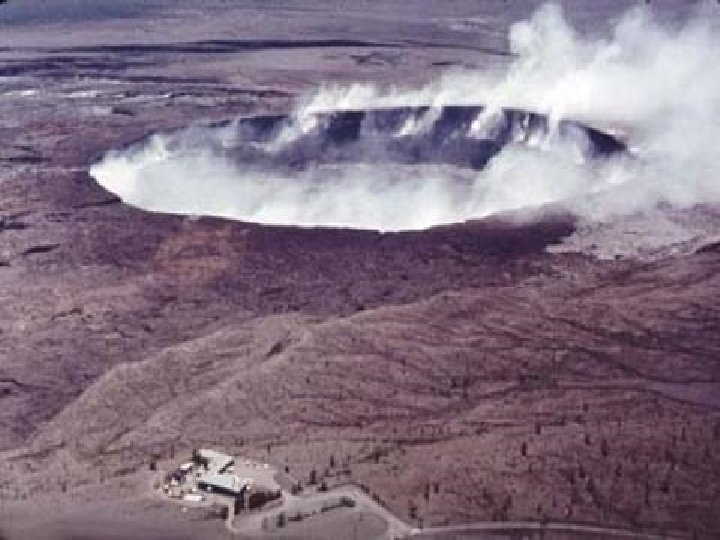
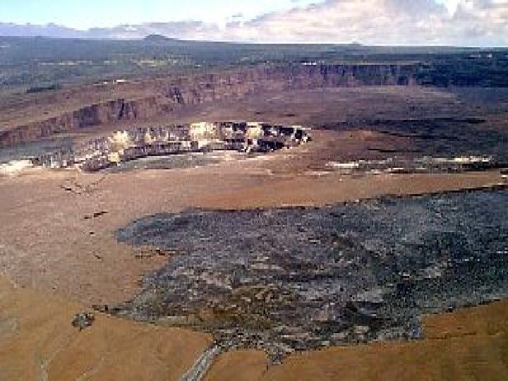
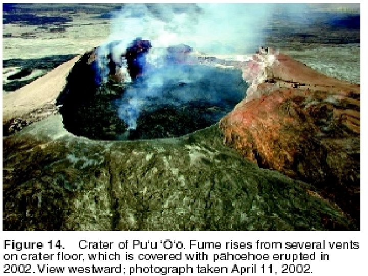
Volcanic gases escape from vents on the crater floor of the Pu`u `O`o cone, located 12 miles (19 km) east of the summit of Kilauea Volcano. Since 1987, repeated collapses of the cone have resulted in a crater more than 1, 300 feet (400 m) long. The crater floor is 40 feet (13 m) below the lowest part of the rim. In the distance (upper left), steam plumes rise where lava flows pour into the sea, about 7 miles (11 km) south of Pu`u
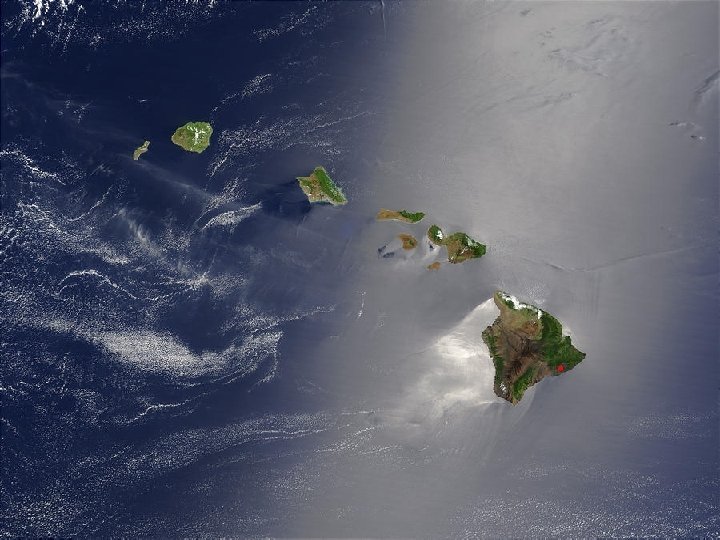
The Hawaiian archipelago, the most isolated island group of comparable size and topographic diversity on Earth, is about 4, 000 kilometers from the nearest continent and 3, 200 kilometers from the nearest high-island group (the Marquesas Islands of French Polynesia). The state of Hawaii consists of 132 islands, reefs, and shoals stretching 2, 400 kilometers in a northwest-southeast direction between latitudes 28°N and 19°N (Price 1983). The eight major high islands, located at the southeast end of the chain (Fig. 2), make up more than 99% of the total land area. The youngest island, Hawaii, has an area of more than 10, 000 square kilometers (63% of the total area of the state) and has elevations of more than 4, 000 meters. The island of Hawaii has five volcanoes, two of which are highly active. These islands are part of a longer chain that was produced during at least a 43 -million-year period by the northwestward movement of the ocean floor over a hot spot below the Earth's crust (Fig. 3). The oldest rocks of the eight high islands range from 420, 000 years old (the island of Hawaii) to about 5 million years old (Kauai). The relatively tiny eroded and submerged islands and reefs extending to the northwest are remnants of high islands that existed millions of years ago
Kilauea volcano, which overlaps the east flank of the massive Mauna Loa shield volcano, has been Hawaii's most active volcano during historical time. Eruptions of Kilauea are prominent in Polynesian legends; written documentation extending back to only 1820 records frequent summit and flank lava flow eruptions that were interspersed with periods of long-term lava lake activity that lasted until 1924 at Halemaumau crater, within the summit caldera. The 3 x 5 km caldera was formed in several stages about 1500 years ago and during the 18 th century; eruptions have also originated from the lengthy East and SW rift zones, which extend to the sea on both sides of the volcano. About 90% of the surface of the basaltic shield volcano is formed of lava flows less than about 1100 years old; 70% of the volcano's surface is younger than 600 years. A longterm eruption from the East rift zone that began in 1983 has produced lava flows covering more than 100 sq km, destroying nearly 200 houses and adding new coastline to the island.
The Pu`u `O`o-Kupaianaha eruption of Kilauea (1983 -present) is the volcano’s longest rift-zone eruption in more than 600 years. Lava flows have buried 43 square miles (111 km 2) of the volcano and added 544 acres (220 ha) to the Island of Hawai`i. Pu`u `O`o-Kupaianaha Eruption Statistics, 1983 to 2003 Lava flows Area covered: 42. 6 square miles (110. 4 km 3 )New land: 544 acres (220 ha) Volume: 0. 6 cubic miles (2. 3 km 3) Thickness along coast: 33 -115 feet (10 -35 m) Highway covered: 8 miles (13 km) Structures destroyed: 189 Pu`u `O`o Maximum height, 1987: 835 feet (255 m) Height (September 2002): 613 feet (187 m) Crater size: 820 x 1, 312 feet (250 x 400 m) Height of west flank shield: 260 feet (80 m)
Hawaiian Meaning: The Hawaiian name "Kilauea" means "spewing" or "much spreading, " apparently in reference to the lava flows that it erupts. Most Recent Eruption: Continuous since January 3, 1983 Number of Historical Eruptions : 61, not counting the continuous lava-lake activity in Halema`u crater Summit Caldera: The caldera itself has no Hawaiian name other than Kilauea but houses the famous crater, Halema`u; "hale" is a house, "ma`u" a type of fern. Kamapua`a, a jilted suitor of Pele, is said to have built a house of ferns over Halema`u to keep Pele from escaping her home and causing eruptions. The ploy failed. Dimension: 6 x 6 km (outermost faults), 3 x 5 km (main depression) Depth: 165 m deep Age: probably several incremental collapses 500 -210 years ago Oldest Dated Rocks 23, 000 years old Estimated Age of Earliest Subaerial Eruptions: 50, 000 -100, 000 years Estimated Age of First Eruption of Kilauea: 300, 000 -600, 000 years BP Hawaiian Volcano Stage: Shield-forming stage
Much of Earth's internal heat comes from the radioactive decay of heavy elements. showing that a large portion of the volcano has shifted seaward more than 5 meters since 1970. These motions may presage a catastrophic collapse of Kilauea into the sea
Mount Rainier has 25 times as much ice as Mount St. Helens did. It can cause catastrophic debris slides known as lahars, which in the past have reached Puget Sound. The cutaway shows how infiltrating water is heated; it melts glacier bottoms and, with hydrogen sulfide added, turns rock to clay.
The chronology of the first 2 decades of the Pu‘u ‘Ö‘öKüpaianaha eruption lacks a final chapter. Our ability to predict the onset of a Kïlauea eruption far exceeds our ability to predict its end. In the early years of this eruption, we speculated that a large earthquake might disrupt the rift-zone plumbing and bring the activity to a close. Although the eruption has not yet been tested by an M>7 earthquake, the activity has proven remarkably impervious to lesser tectonic and magmatic events. In its first decade, the eruption weathered the M 6. 6 Ka‘öiki earthquake of 1983 and the M 6. 1 Kalapana earthquake of 1989. In March–April 1984, Mauna Loa erupted for 3 weeks, while at Pu‘u ‘Ö‘ö, episode 17 occurred on schedule, and the two volcanoes erupted simultaneously (Wolfe and others, 1988). In 1997, Pu‘u ‘Ö‘ö revived after substantial edifice collapse and a prolonged hiatus in activity. Thus far, the Pu‘u ‘Ö‘ö-Küpaianaha eruption has withstood all of these events and shows no sign of faltering; the eruption continues
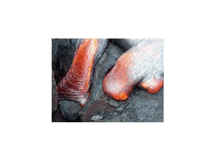
Steam is formed from rainwater dripping down the crack onto the hot rocks of the volcano. Some plants are thriving in the mist.
Kilauea currently emits over 2, 000 tons of sulfur dioxide each day. Hawaii’s trade winds disperse these volcanic gases however it’s not wise to get too close to these concentrated fumes
Volcanic Emissions Wet deposition, Gases and Vapors Water H 2 O (70%) Carbondioxide CO 2 (15%) N 2 and nitrogen compounds (5%) sulfur compounds (H 2 S, SO 4, SO 2, etc. ) (5%) minor amounts of Cl, H 2, Ar, etc. NO free oxygen Between 100 and 2000 metric tons of sulfur dioxide (SO 2) are released per day from Kilauea. The rain is so acidic that a desert has formed downwind from the summit of the volcano.
SO 2, 2002
Carbon dioxide is released when magma rises on its way to the surface. Our studies here at Kilauea show that the eruption discharges between 8, 000 and 30, 000 metric tonnes of CO 2 into the atmosphere each day. Actively erupting volcanoes release much more CO 2 than sleeping ones do. Gas studies at volcanoes worldwide have helped volcanologists tally up a global volcanic CO 2 budget in the same way that nations around the globe have cooperated to determine how much CO 2 is released by human activity through the burning of fossil fuels. Studies show that globally, volcanoes on land under the sea release a total of about 200 million tonnes of CO 2 annually.
Side Note: British Airways Flight 9 • 1982 flight from Kuala Lumpur, Malaysia to Perth, Australia lost all four engines at 37, 000 feet • Plane descended to 12, 000 feet before engines started again • Emergency landing in Jakarta • Plane had flown through eruption cloud of hot volcanic ash and pyroclastic debris from Mount Galunggung