Hail Forecasting 1 Outline Hail Formation Processes n


 Dime")


 n n Refers to the positive area between a lifted parcel")


 * (Mixing Ratio of MU PARCEL g/kg)")
 * (Mixing Ratio of MU PARCEL g/kg) *")


 divided by depth")


- Slides: 39
Hail Forecasting 1
Outline Hail Formation Processes n Convective Storm Types n Hail Prediction n Hail Detection n References n 2
Hail Formation Processes n Conditions for Hailstone Formation – Adequate updraft to keep aloft long enough – Supercooled water content to enable it to grow fast enough before falling out – A piece of ice for it to grow upon n Requires solid understanding of cloud physics and convective weather 3
A few Cloud Physic Terms n Coalescence : merging of two hydrometeors into a single n n Graupel: Heavily rimed snow particles, often called snow pellets Hailstone: a single unit of hail ranging in size from that of a pea n Hydrometeors: Liquid or solid water particle formed and n Riming- rapid freezing of supercooled water droplets as they n Terminal Fall Velocity: constant fall speed of a one to that of a grapefruit. They can be spherical, conical or irregular in shape. remaining suspended in the air. impinge upon an object (Hailstone or snowflake) hydrometeor given balance of gravitational and drag forces of atmosphere 4
HAIL GROWTH FROM FIRST PRINCIPLES • Difference between TS and TC critical • Amount of intercepted supercooled water critical • For max. growth most of accreted water and ice remains on hailstone • Wet growth preferred in warm and moist regions • Dry growth preferred in cold and less moist regions HEAT EXCHANGE Accretion of ice Conduction TS > TC TS < TC TS TC Deposition Accretion of water 5 Sublimation
Hailstone Evolution n Hail Embryo concept n Formation of embryos distinct from hailstones and are created in different dynamic environment – Ludlam 1958 Hail embryo grows by accretion as it is recycled in a Knight and Knight - Meteorological Monographs convective updraft n Feeder Clouds for Embryos – hailstones must have been small before they became large – Typically considered to be 5 mm diameter 6
Hail. Storm Evolution n n n Hail size dependant on residence time in convective cell, cloud growth mechanisms Hail trajectories deviate greatly from trajectory of air parcels (result of gravity, VT) Most hailstone growth in updraft between -10 C and -30 C Precipitation efficiency an interplay between available accretors and cloud water available – hail seeding introduces competition (more accretors competing for same volume of cloud water) Severe hail more prevalent over midwest plains vs east coast and deep south Stronger and more organized persistent the thunderstorm the greater the likelihood for large 7 hail
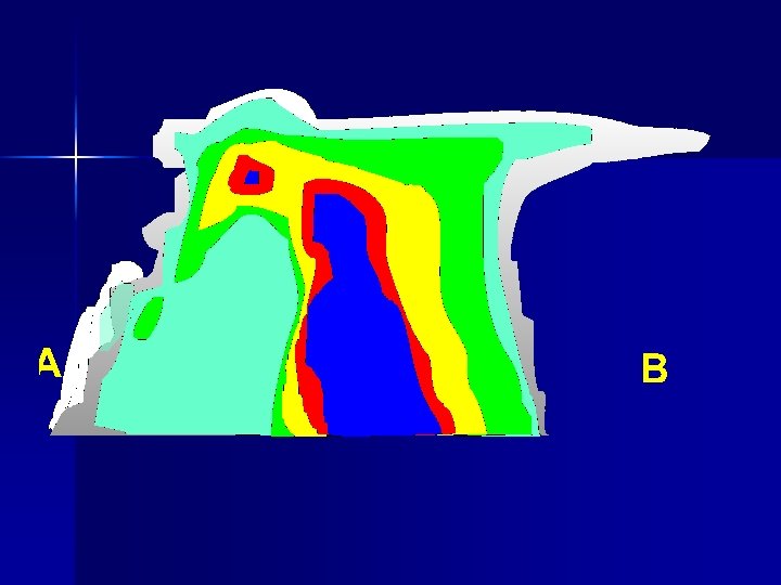
WHERE DOES HAIL GROW? UPDRAFT CORE 2 ms-1 30 ms-1 8 Hail grows near updraft core along a simple up and down trajectory
Hail 9
Favourable Ingredients for Hail n n n Strong updraft (to support hailstones long enough to become large) due to large CAPE or “fat” CAPE resulting in strong vertical accelerations Almost guaranteed in supercells due vertical perturbation pressure gradients strengthening updraft Deep vertical shear to increase storm organization and prolong updraft (stones advected across updraft aid in growth) Low wet bulb temperature freezing levels (reduces melting during descent) Low temperature downdraft air (reduce melting) 10
Hail Sizes Diameter n n n Pea 6. 4 millimetres (0. 25 in) Dime 17. 9 millimetres (0. 70 in) Penny 19 millimetres (0. 75 in) Nickel 21. 2 millimetres (0. 83 in) Quarter 24. 26 millimetres (0. 955 in) Half dollar 30. 6 millimetres (1. 20 in) n n n Walnut 38 millimetres (1. 5 in) Golf ball 44 millimetres (1. 7 in) Tennis ball 64 millimetres (2. 5 in) Cricket ball 71 millimetres (2. 8 in) Baseball 73 millimetres (2. 9 in) Softball 114 millimetres (4. 5 in) 11
Hail Forecasting Typically weather radar is the ultimate observation and short range forecasting tool n Various hail size algorithms exist which utilize parcel lift from a given sounding to generate hail size estimates n Note there is often a spread of hail sizes for a given thunderstorm n 12
Convective Storm Types Averses de pluie déluge
Pulse Thunderstorm 14
Airflow Cold pool needs to be deep enough and near speed of winds at cloud base, LFC needs to be near depth of cold pool Oldest Cell Mean wind and 0 -3 km shear vector in same direction (cells move in same direction as storm system) 1 2 3 Updraft and downdraft are separated (c. f. single cell) and WER interact constructively for prolonged storm lifetime DOWNDRAFT Newest Cell 4 5 UPDRAFT 15
Severe Multicell/MCS orage multi-cellulaire/SCM sommet en dépassement déplacement de l’orage / grêle /déluge
Mature Classic Supercell 17
Moderate to large hail / grêle de dimension moyenne à grosse Heavy downpours / déluge Strong winds / macro-rafale, micro-rafale
19 P. Mc. Carthy
P. Mc. Carthy 21
CAPE (Buoyant Energy) n n Refers to the positive area between a lifted parcel curve and the environmental curve Integrated from the LFC to the Equilibrium level Gives estimate of potential updraft strength Mix lowest 50 mb 22
UPDRAFT VELOCITY & HAIL SIZE n n Umax governed mainly by buoyancy Quantify buoyancy i. t. o (CAPE) It can be shown that: n n n Wmax ~ ½ √ 2 CAPE VT = Wmax CAPE = 2500 J kg-1 VT ~ 35. 0 m s-1 Dmax ~ 7. 0 cm This is the max. hail size one would predict from a hailstorm with this CAPE Brimelowe slides from 2006 Community of Practice 23
“Shape of the CAPE” T=27 o. C High EQ. level Td=17. 5 o. C LCL=~6 kft Eq”skinny”=~34 kft weak buoyancy throughout Low EQ. level Eq”fat”=~25 kft T 5”skinny”=-9 o. C stronger buoyancy T 5”fat”=-14. 5 o. C LI”skinny”=-4 o. C LI”fat”=-9 o. C Weak Thunderstorm Updraft Similar CAPEs Strong Thunderstorm Updraft 24
The Hodograph 10 kft 8 kft 4 kft 2 kft 6 kft SFC 4 kft 8 kft 10 20 30 40 10 kft 2 kft SFC 25
Wind Shear shear vector is the hodograph itself n |shear| between 6 kft and 8 kft is 20 kt n total shear is length of hodograph (60 kt) n 4 kft 2 kft 6 kft SFC 8 kft 10 20 30 40 10 kft 26
Significant Hail Parameter SHIP = [(MUCAPE J/kg) * (Mixing Ratio of MU PARCEL g/kg) * (700500 mb LAPSE RATE c/km) * (-500 mb TEMP C) * (0 -6 km Shear m/s) ] / 44, 000 n The Sig. Hail Parameter (SHIP) was developed using a large database of surface-modified, observed severe hail proximity soundings. It is based on 5 parameters, and is meant to delineate between SIG (>=2" diameter) and NON-SIG (<2" diameter) hail environments. 27
Ingredients-based approach SHIP = [(MUCAPE J/kg) * (Mixing Ratio of MU PARCEL g/kg) * (700 -500 mb LAPSE RATE c/km) * (-500 mb TEMP C) * (0 -6 km Shear m/s) ] / 44, 000 One can also use mulivariate regression analysis (using observed 28 sounding data)-- only valid for location where developed.
Hail. Cast – Julian Brimelow U of Alberta/Manitoba n One Dimensional Model which ingests model data – Looks at water loading, cloud entrainment, profiles of LWC, Wind, Temperature Model is time dependant, simulates wet and dry hail growth, melting and shedding of hail stone n Used at PASPC and Norman Oklahoma n 29
HAILCAST MAPS FORECAST FOR 12 AUGUST 2003 30
CONCLUSIONS n n n HAILCAST skillful in identifying a hail day versus a non-hail day up to 12 hours in advance. HAILCAST shows skill at distinguishing between non-severe and severe hail events. HAILCAST has limited skill in predicting the distribution of hail on spatial scales less than ~60 km. n HAILCAST skillful at predicting the main threat areas. n HAILCAST skillful in predicting the maximum hail diameter. n Applying forecast GEM rainfall mask appears to hold most promise for reducing FAR n Please try and incorporate HAILCAST into your workup 31
Hail Forecasting - Radar VIL Density n VIL (Vertically Integrated Liquid) divided by depth of radar echoes – Will partially account for a distant cell that is substantially below the lowest scan angle n n Used in URP storm cell ranking but not actually displayed anywhere … although we could if we want to Amburn and Wolf indicate substantial increase in severe hail(> 19 mm) with VIL density >3. 5 gm-3. At values of 4 gm-3 severe hail virtually guaranteed. 32
URP 2 Svr Wx Algorithms Hail n n Uses an algorithm developed in Southeastern Australia Height of 50 d. BZ and freezing level are empirically correlated to hail diameter VIL and freezing level are also empirically correlated to hail diameter Given hgt 50 d. BZ, VIL and freezing level, calculate hail diameter using both methods and choose the larger of the two. 34
URP 2 Svr Wx Algorithms Hail Observed Hail Size vs. Height 50 d. BZ & Freezing Level 35
URP 2 Svr Wx Algorithms Hail Observed Hail Size vs. VIL & Freezing Level 36
URP 2 Svr Wx Algorithms URP identifies cells as objects with attributes and creates Storm Rank weight is an even weighting of the following 7 attributes: • BWER, Meso, Hail, WDraft, VILDensity, Max. Z, ETop 45 d. BZ • supposedly maxes out at 10 Green, yellow, red thresholds are all configurable. 37
URP 2 Svr Wx Algorithms Hail Max Hail Size 8. 2 cm 38
Radar Hail Spike 39
A few References n n n n Amburn and Wolf, 1997, VIL Density as a Hail Indicator, Weather and Forecasting Brimelow and Reuter, 2002, Hailcast in Alberta Knight and Knight, Hailstorms Chapter 6 – Meteorological Monographs MOIP Notes, Module 6. 4 Convective Weather Rogers and Yau 1989: A Short Course in Cloud Physics Edwards and Thompson, 1998 Nationwide Comparisons of Hail Size with WSR-88 D Vertically Integrated Liquid Water and Thermodynamic Sounding Data, Weather and Forecasting Wiesman and Klemp, 1986 Characteristics of 40 Isolated Convective Storms, Mesoscale Meteorology and Forecasting