
Groundwater models for the Meadow Village alluvial aquifer

- Slides: 27
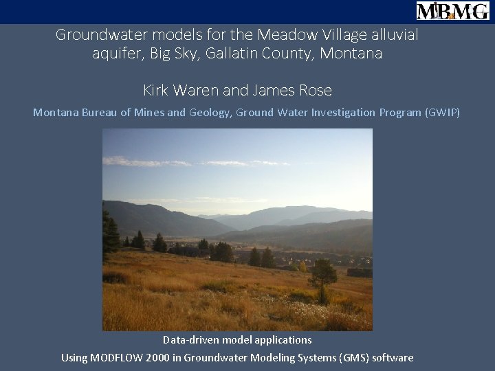
Groundwater models for the Meadow Village alluvial aquifer, Big Sky, Gallatin County, Montana Kirk Waren and James Rose Montana Bureau of Mines and Geology, Ground Water Investigation Program (GWIP) Data-driven model applications Using MODFLOW 2000 in Groundwater Modeling Systems (GMS) software
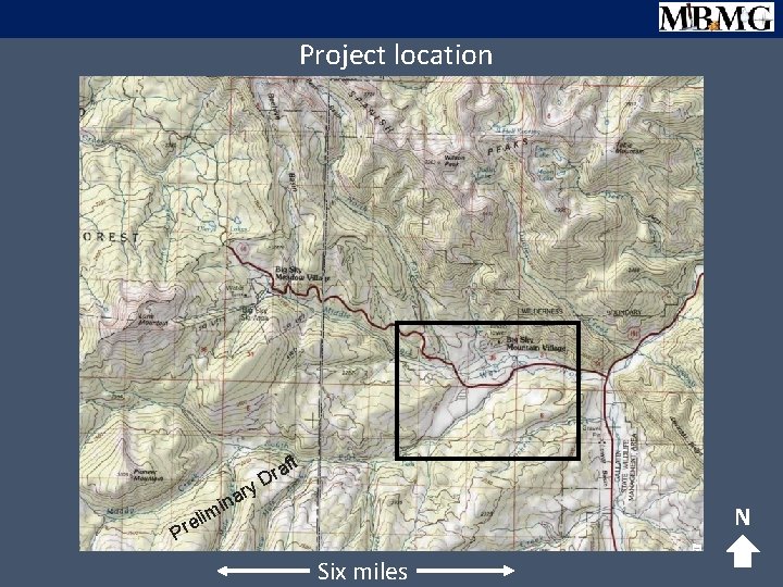
Project location t af r y. D r na i m N eli r P Six miles
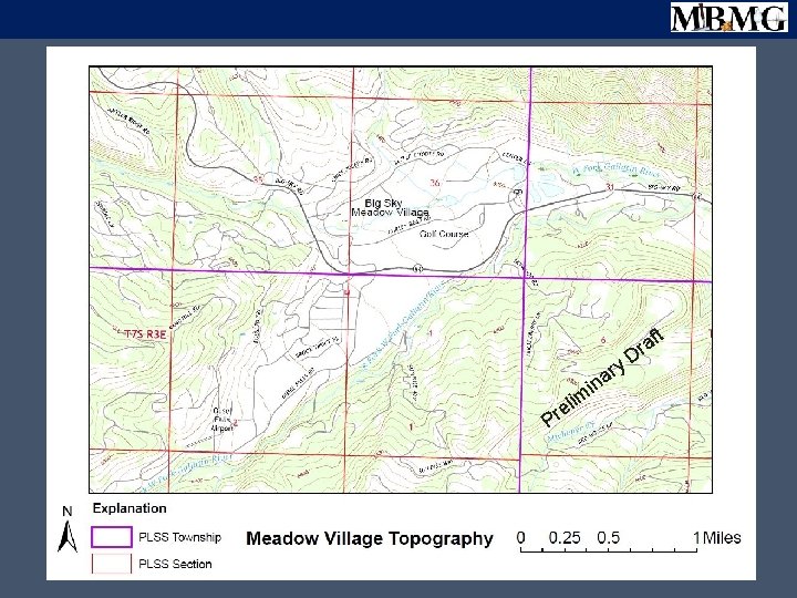
t y m eli r P r ina af r D
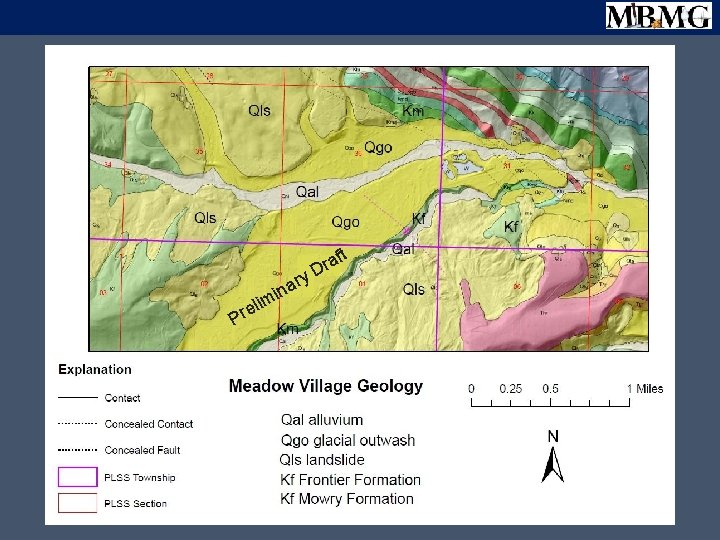
aft r y. D el r P i r na i m
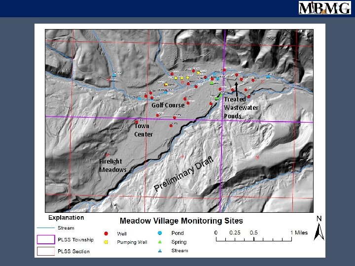
Treated Wastewater Ponds Golf Course Town Center t Firelight Meadows im l Pre ry ina af r D
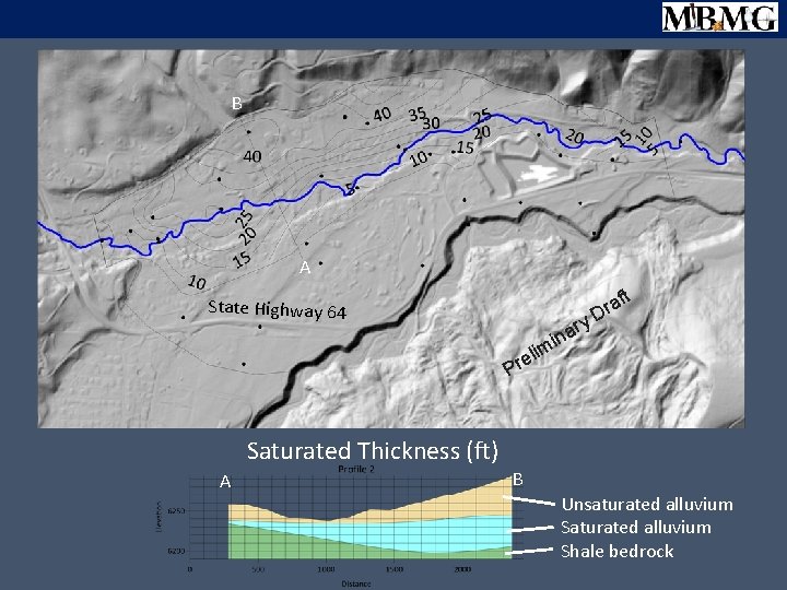
B A t State Highway 64 ry na i m af r D eli r P Saturated Thickness (ft) A B Unsaturated alluvium Shale bedrock
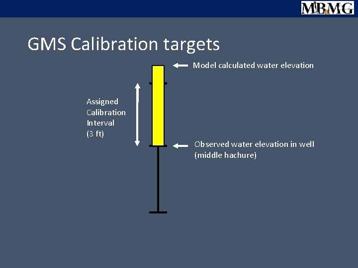
GMS Calibration targets Assigned Calibration Interval (3 ft) Model calculated water elevation Observed water elevation in well (middle hachure)
GMS Calibration targets Model calculated water elevation Assigned Calibration Interval (3 ft) Observed water elevation in well (middle hachure)
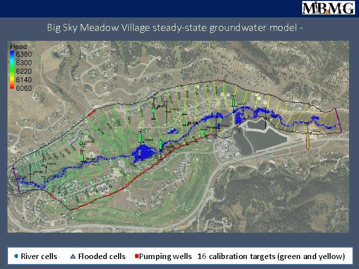
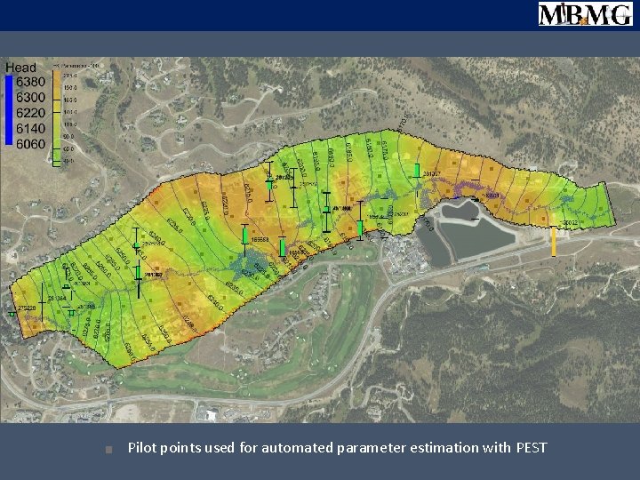
Big Sky Meadow Village steady-state groundwater model - na mi reli P River cells Flooded cells ft ra ry D N Pumping wells 16 calibration targets (green and yellow)
na mi reli P ft ra ry D N Pilot points used for automated parameter estimation with PEST
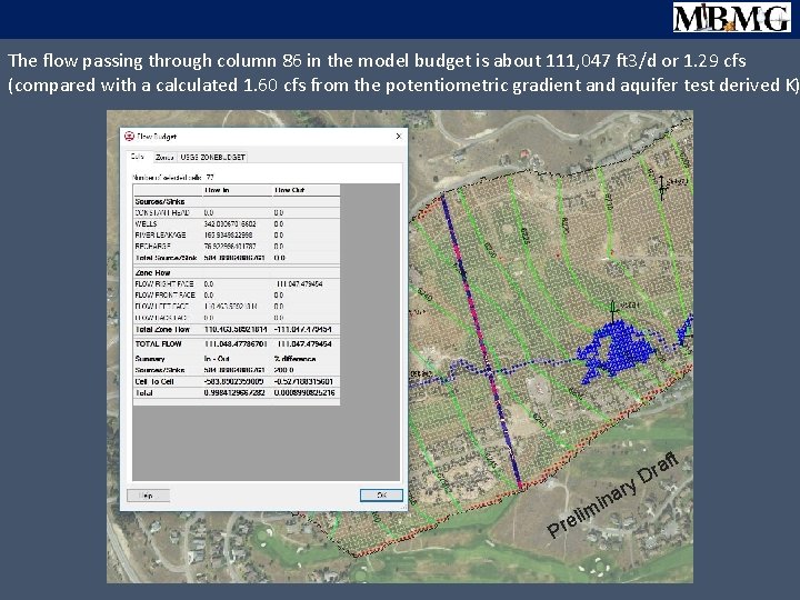
The flow passing through column 86 in the model budget is about 111, 047 ft 3/d or 1. 29 cfs (compared with a calculated 1. 60 cfs from the potentiometric gradient and aquifer test derived K) t el r P im ry a in af r D
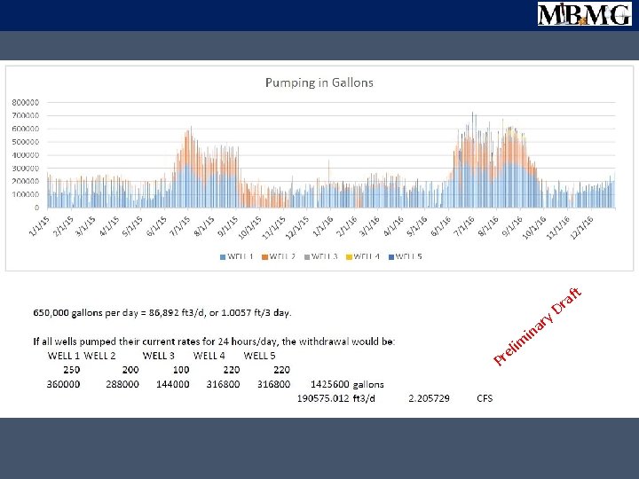
ft a r eli r P m in y. D r a
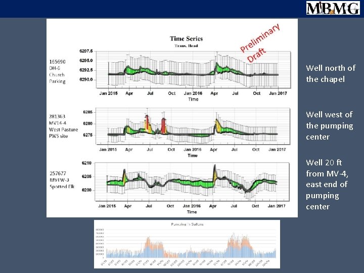
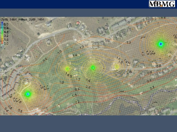
Well north of the chapel Well west of the pumping center Well 20 ft from MV-4, east end of pumping center
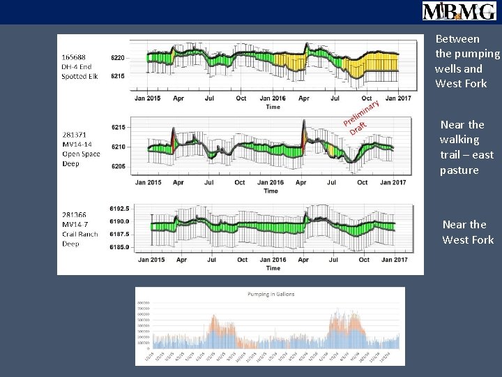
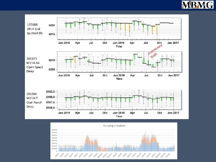
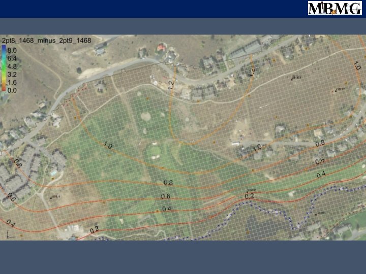
Between the pumping wells and West Fork Near the walking trail – east pasture Near the West Fork
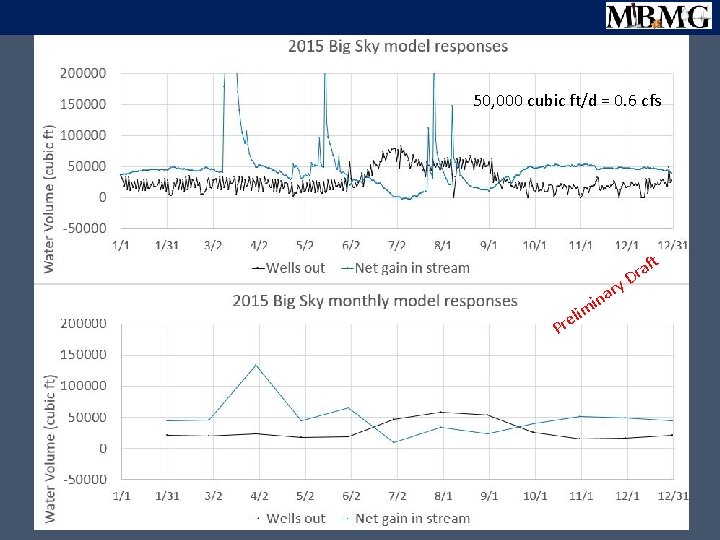
50, 000 cubic ft/d = 0. 6 cfs li e r P m ry a in aft r D
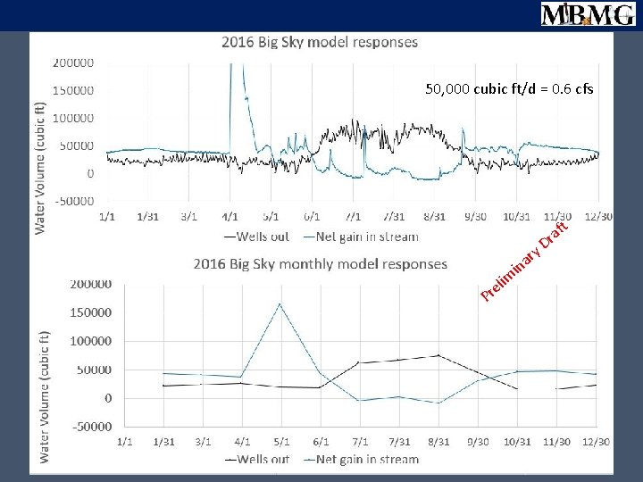
50, 000 cubic ft/d = 0. 6 cfs t f ra in Pr m eli D y ar
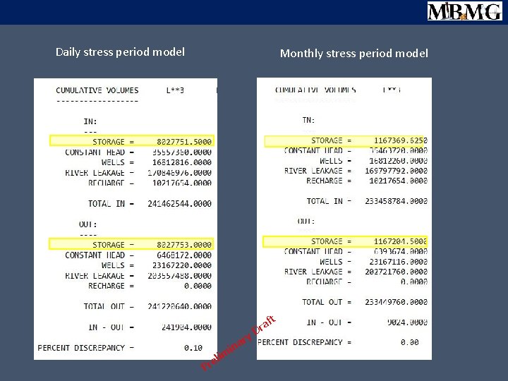
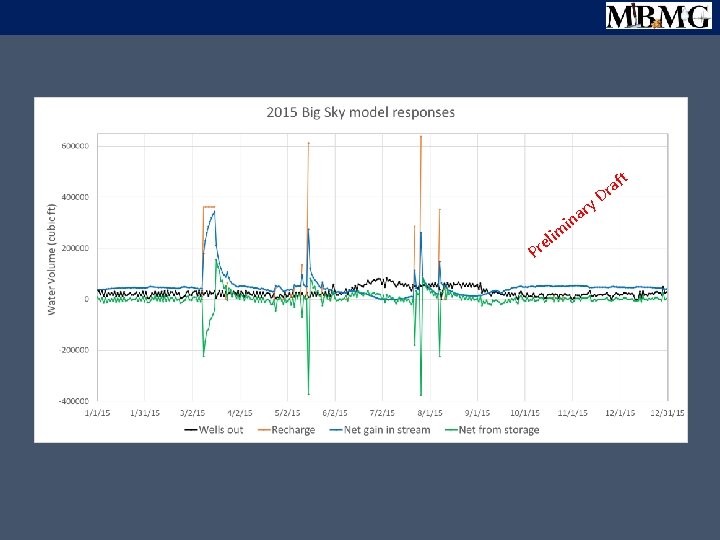
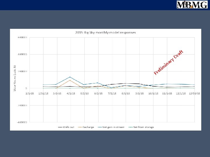
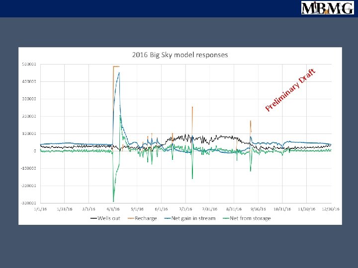
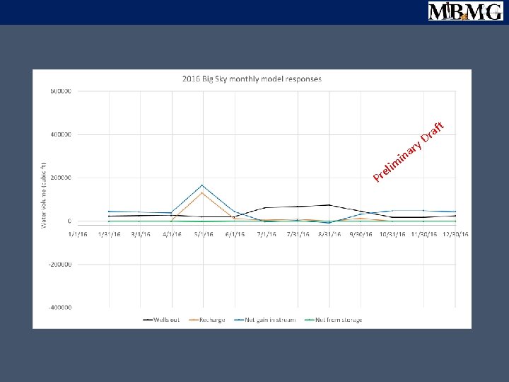
Daily stress period model Monthly stress period model t eli r P ry a n mi af Dr
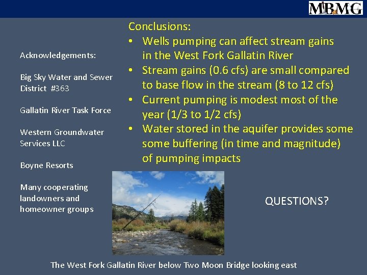
Acknowledgements: Big Sky Water and Sewer District #363 Gallatin River Task Force Western Groundwater Services LLC Boyne Resorts Many cooperating landowners and homeowner groups Conclusions: • Wells pumping can affect stream gains in the West Fork Gallatin River • Stream gains (0. 6 cfs) are small compared to base flow in the stream (8 to 12 cfs) • Current pumping is modest most of the year (1/3 to 1/2 cfs) • Water stored in the aquifer provides some buffering (in time and magnitude) of pumping impacts QUESTIONS? The West Fork Gallatin River below Two Moon Bridge looking east
im el r P ry ina aft r D
ry ina m li e r P ft Dra
ry a n i lim e r P aft Dr
Net stream depletion (cfs) in Pr m eli y ar D ft a r
P li re m ry a in t D f ra
ry ina m eli r P P ry a in m li re aft r D t D f ra
ft P li e r m r ina y a Dr
ft a Dr t ry a y. D in r a lim min e Pr eli r P f ra