Ground School Meteorology Terminal Area Forecast TAF References

- Slides: 22

Ground School: Meteorology Terminal Area Forecast (TAF) References: FTGU pg 160 -163 AWWS: www. flightplanning. navcanada. ca 40 Minutes

5. 12 Meteorology - Review Ø How often are METARs issued? Every hour on the hour or when the weather has changed significantly within the hour Ø How long are METARs valid for? Until the next METAR come out or until there is a SPECI issued Ø Decode the following METAR Ø METAR CYMO 251700 Z AUTO 31017 G 24 KT 9 SM OVC 035 05/M 02 A 2994 RMK SLP 139 MAX WND 30026 KT AT 1615 Z= Ø SPECI CYNM 251739 Z AUTO 30015 G 21 KT 9 SM -RA FEW 015 SCT 020 OVC 026 04/02 A 2986 RMK SLP 127 MAX WND 29023 KT AT 1707 Z=

5. 12 Meteorology - TAFs Ø MTPs Ø Terminal Area Forecasts Ø Decoding TAFs ØWhat we already know ØWhat is new

5. 12 Meteorology - TAFs Ø A Terminal Area Forecast (TAF) is a coded prediction of the surface weather expected that will affect landing and take-off at the aerodrome; Ø It gives the same information as in a METAR except it does not forecast temperature, dewpoint, altimeter setting, type of clouds, or sea level pressure

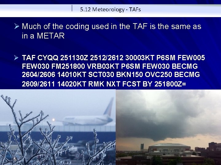
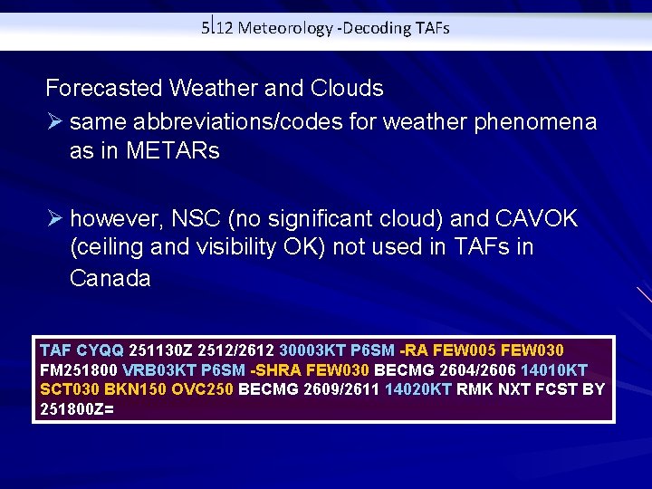
5. 12 Meteorology - TAFs Ø Much of the coding used in the TAF is the same as in a METAR Ø TAF CYQQ 251130 Z 2512/2612 30003 KT P 6 SM FEW 005 FEW 030 FM 251800 VRB 03 KT P 6 SM FEW 030 BECMG 2604/2606 14010 KT SCT 030 BKN 150 OVC 250 BECMG 2609/2611 14020 KT RMK NXT FCST BY 251800 Z=

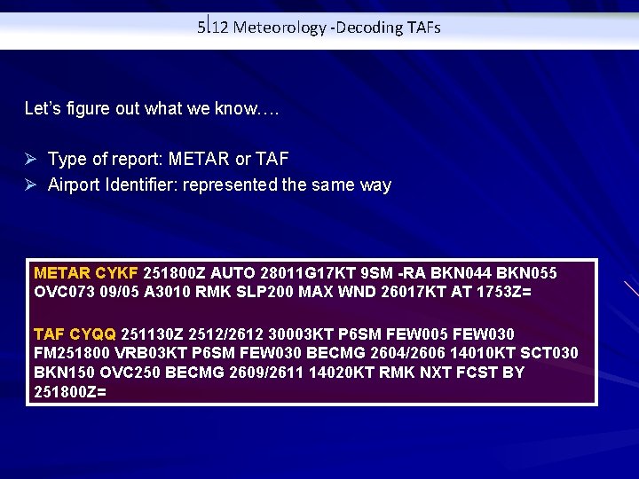
5. 12 Meteorology -Decoding TAFs Let’s figure out what we know…. Ø Type of report: METAR or TAF Ø Airport Identifier: represented the same way METAR CYKF 251800 Z AUTO 28011 G 17 KT 9 SM -RA BKN 044 BKN 055 OVC 073 09/05 A 3010 RMK SLP 200 MAX WND 26017 KT AT 1753 Z= TAF CYQQ 251130 Z 2512/2612 30003 KT P 6 SM FEW 005 FEW 030 FM 251800 VRB 03 KT P 6 SM FEW 030 BECMG 2604/2606 14010 KT SCT 030 BKN 150 OVC 250 BECMG 2609/2611 14020 KT RMK NXT FCST BY 251800 Z=

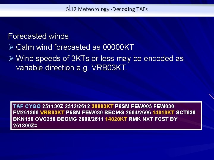
5. 12 Meteorology -Decoding TAFs Forecasted winds Ø Calm wind forecasted as 00000 KT Ø Wind speeds of 3 KTs or less may be encoded as variable direction e. g. VRB 03 KT. TAF CYQQ 251130 Z 2512/2612 30003 KT P 6 SM FEW 005 FEW 030 FM 251800 VRB 03 KT P 6 SM FEW 030 BECMG 2604/2606 14010 KT SCT 030 BKN 150 OVC 250 BECMG 2609/2611 14020 KT RMK NXT FCST BY 251800 Z=

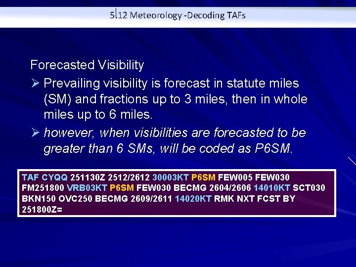
5. 12 Meteorology -Decoding TAFs Forecasted Visibility Ø Prevailing visibility is forecast in statute miles (SM) and fractions up to 3 miles, then in whole miles up to 6 miles. Ø however, when visibilities are forecasted to be greater than 6 SMs, will be coded as P 6 SM. TAF CYQQ 251130 Z 2512/2612 30003 KT P 6 SM FEW 005 FEW 030 FM 251800 VRB 03 KT P 6 SM FEW 030 BECMG 2604/2606 14010 KT SCT 030 BKN 150 OVC 250 BECMG 2609/2611 14020 KT RMK NXT FCST BY 251800 Z=

5. 12 Meteorology -Decoding TAFs Forecasted Weather and Clouds Ø same abbreviations/codes for weather phenomena as in METARs Ø however, NSC (no significant cloud) and CAVOK (ceiling and visibility OK) not used in TAFs in Canada TAF CYQQ 251130 Z 2512/2612 30003 KT P 6 SM -RA FEW 005 FEW 030 FM 251800 VRB 03 KT P 6 SM -SHRA FEW 030 BECMG 2604/2606 14010 KT SCT 030 BKN 150 OVC 250 BECMG 2609/2611 14020 KT RMK NXT FCST BY 251800 Z=

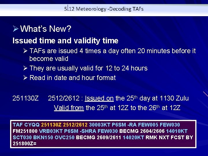
5. 12 Meteorology -Decoding TAFs Ø What’s New? Issued time and validity time Ø TAFs are issued 4 times a day often 20 minutes before it become valid Ø They are usually valid for 12 to 24 hours Ø Read in date and hour format 251130 Z 2512/2612 : Issued on the 25 th day at 1130 Zulu Valid from the 25 th at 12 Z to the 26 th at 12 Z TAF CYQQ 251130 Z 2512/2612 30003 KT P 6 SM -RA FEW 005 FEW 030 FM 251800 VRB 03 KT P 6 SM -SHRA FEW 030 BECMG 2604/2606 14010 KT SCT 030 BKN 150 OVC 250 BECMG 2609/2611 14020 KT RMK NXT FCST BY 251800 Z=

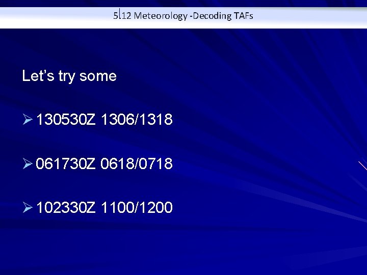
5. 12 Meteorology -Decoding TAFs Let’s try some Ø 130530 Z 1306/1318 Ø 061730 Z 0618/0718 Ø 102330 Z 1100/1200

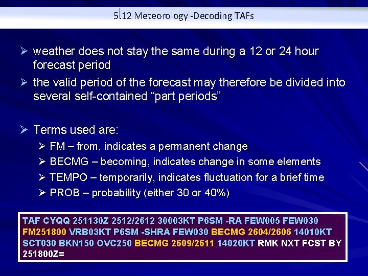
5. 12 Meteorology -Decoding TAFs Ø weather does not stay the same during a 12 or 24 hour forecast period Ø the valid period of the forecast may therefore be divided into several self-contained “part periods” Ø Terms used are: Ø FM – from, indicates a permanent change Ø BECMG – becoming, indicates change in some elements Ø TEMPO – temporarily, indicates fluctuation for a brief time Ø PROB – probability (either 30 or 40%) TAF CYQQ 251130 Z 2512/2612 30003 KT P 6 SM -RA FEW 005 FEW 030 FM 251800 VRB 03 KT P 6 SM -SHRA FEW 030 BECMG 2604/2606 14010 KT SCT 030 BKN 150 OVC 250 BECMG 2609/2611 14020 KT RMK NXT FCST BY 251800 Z=

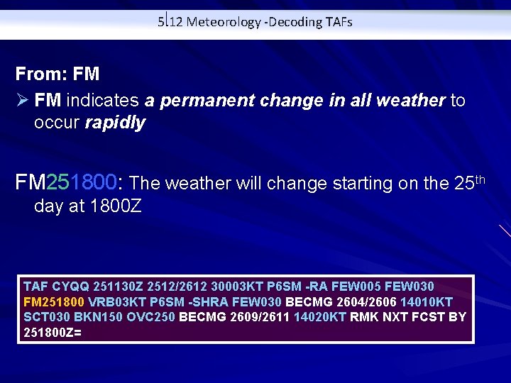
5. 12 Meteorology -Decoding TAFs From: FM Ø FM indicates a permanent change in all weather to occur rapidly FM 251800: The weather will change starting on the 25 th day at 1800 Z TAF CYQQ 251130 Z 2512/2612 30003 KT P 6 SM -RA FEW 005 FEW 030 FM 251800 VRB 03 KT P 6 SM -SHRA FEW 030 BECMG 2604/2606 14010 KT SCT 030 BKN 150 OVC 250 BECMG 2609/2611 14020 KT RMK NXT FCST BY 251800 Z=

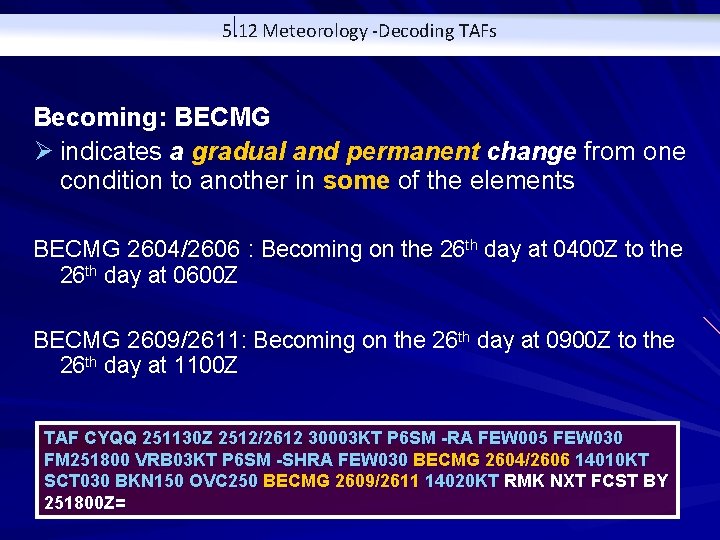
5. 12 Meteorology -Decoding TAFs Becoming: BECMG Ø indicates a gradual and permanent change from one condition to another in some of the elements BECMG 2604/2606 : Becoming on the 26 th day at 0400 Z to the 26 th day at 0600 Z BECMG 2609/2611: Becoming on the 26 th day at 0900 Z to the 26 th day at 1100 Z TAF CYQQ 251130 Z 2512/2612 30003 KT P 6 SM -RA FEW 005 FEW 030 FM 251800 VRB 03 KT P 6 SM -SHRA FEW 030 BECMG 2604/2606 14010 KT SCT 030 BKN 150 OVC 250 BECMG 2609/2611 14020 KT RMK NXT FCST BY 251800 Z=

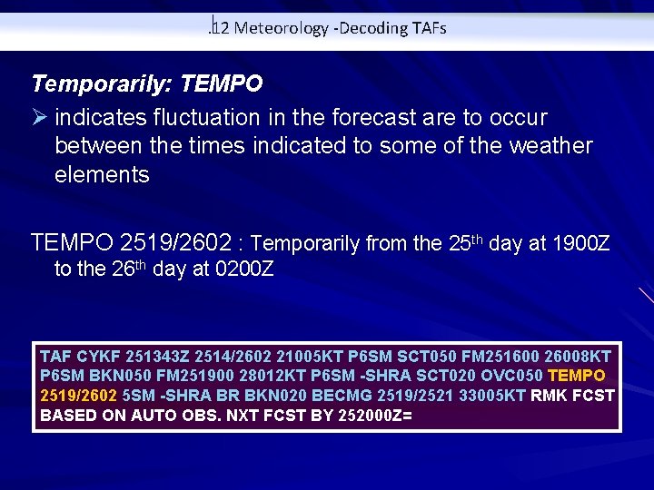
. 12 Meteorology -Decoding TAFs Temporarily: TEMPO Ø indicates fluctuation in the forecast are to occur between the times indicated to some of the weather elements TEMPO 2519/2602 : Temporarily from the 25 th day at 1900 Z to the 26 th day at 0200 Z TAF CYKF 251343 Z 2514/2602 21005 KT P 6 SM SCT 050 FM 251600 26008 KT P 6 SM BKN 050 FM 251900 28012 KT P 6 SM -SHRA SCT 020 OVC 050 TEMPO 2519/2602 5 SM -SHRA BR BKN 020 BECMG 2519/2521 33005 KT RMK FCST BASED ON AUTO OBS. NXT FCST BY 252000 Z=

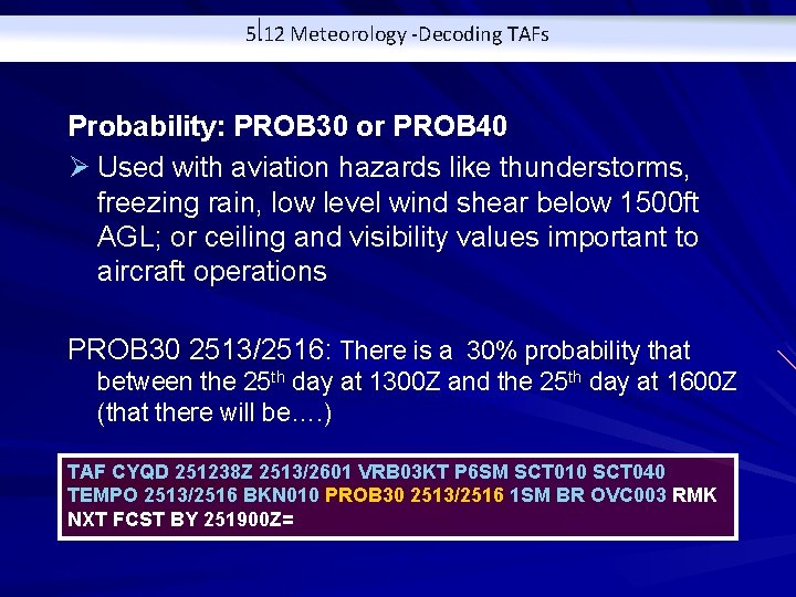
5. 12 Meteorology -Decoding TAFs Probability: PROB 30 or PROB 40 Ø Used with aviation hazards like thunderstorms, freezing rain, low level wind shear below 1500 ft AGL; or ceiling and visibility values important to aircraft operations PROB 30 2513/2516: There is a 30% probability that between the 25 th day at 1300 Z and the 25 th day at 1600 Z (that there will be…. ) TAF CYQD 251238 Z 2513/2601 VRB 03 KT P 6 SM SCT 010 SCT 040 TEMPO 2513/2516 BKN 010 PROB 30 2513/2516 1 SM BR OVC 003 RMK NXT FCST BY 251900 Z=

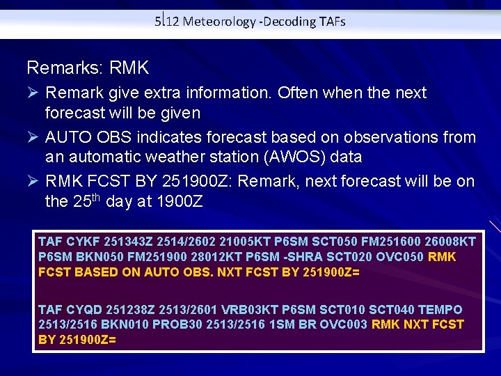
5. 12 Meteorology -Decoding TAFs Remarks: RMK Ø Remark give extra information. Often when the next forecast will be given Ø AUTO OBS indicates forecast based on observations from an automatic weather station (AWOS) data Ø RMK FCST BY 251900 Z: Remark, next forecast will be on the 25 th day at 1900 Z TAF CYKF 251343 Z 2514/2602 21005 KT P 6 SM SCT 050 FM 251600 26008 KT P 6 SM BKN 050 FM 251900 28012 KT P 6 SM -SHRA SCT 020 OVC 050 RMK FCST BASED ON AUTO OBS. NXT FCST BY 251900 Z= TAF CYQD 251238 Z 2513/2601 VRB 03 KT P 6 SM SCT 010 SCT 040 TEMPO 2513/2516 BKN 010 PROB 30 2513/2516 1 SM BR OVC 003 RMK NXT FCST BY 251900 Z=


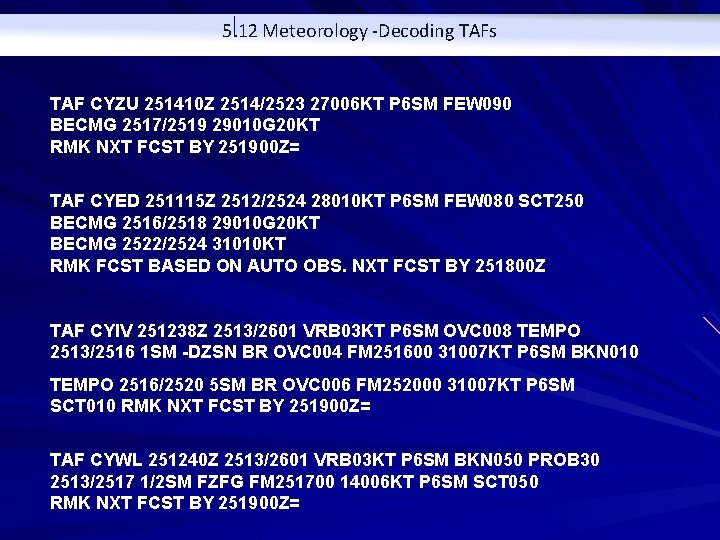
5. 12 Meteorology -Decoding TAFs TAF CYZU 251410 Z 2514/2523 27006 KT P 6 SM FEW 090 BECMG 2517/2519 29010 G 20 KT RMK NXT FCST BY 251900 Z= TAF CYED 251115 Z 2512/2524 28010 KT P 6 SM FEW 080 SCT 250 BECMG 2516/2518 29010 G 20 KT BECMG 2522/2524 31010 KT RMK FCST BASED ON AUTO OBS. NXT FCST BY 251800 Z TAF CYIV 251238 Z 2513/2601 VRB 03 KT P 6 SM OVC 008 TEMPO 2513/2516 1 SM -DZSN BR OVC 004 FM 251600 31007 KT P 6 SM BKN 010 TEMPO 2516/2520 5 SM BR OVC 006 FM 252000 31007 KT P 6 SM SCT 010 RMK NXT FCST BY 251900 Z= TAF CYWL 251240 Z 2513/2601 VRB 03 KT P 6 SM BKN 050 PROB 30 2513/2517 1/2 SM FZFG FM 251700 14006 KT P 6 SM SCT 050 RMK NXT FCST BY 251900 Z=

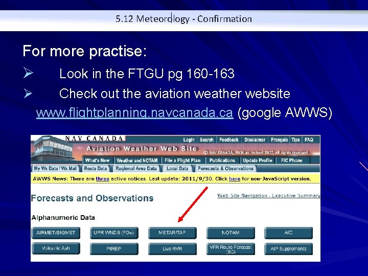
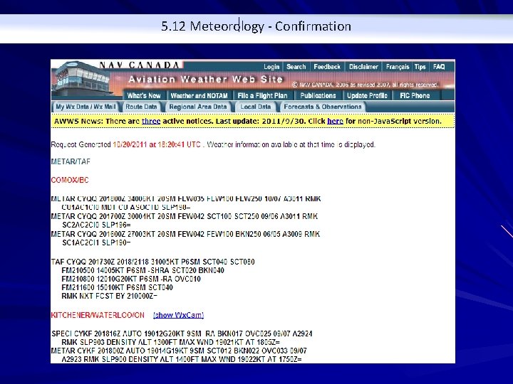
5. 12 Meteorology - Confirmation For more practise: Ø Look in the FTGU pg 160 -163 Ø Check out the aviation weather website www. flightplanning. navcanada. ca (google AWWS)

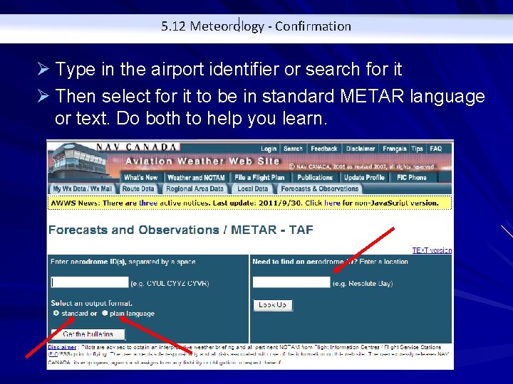
5. 12 Meteorology - Confirmation Ø Type in the airport identifier or search for it Ø Then select for it to be in standard METAR language or text. Do both to help you learn.

5. 12 Meteorology - Confirmation