GRID SYSTEMS Alphanumeric Grids Alphanumeric Grids Uses letters


 Grids • Grids of numbered blue lines on topographic maps • Vertical")
 Grids FOUR DIGIT GRID REFERENCE Combines the two digits from the easting")
 Grids SIX DIGIT GRID REFERENCE For more exact locations divide a grid")


- Slides: 9
GRID SYSTEMS
Alphanumeric Grids
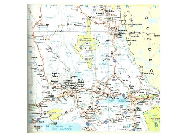
Alphanumeric Grids • Uses letters and numerals to identify squares in a grid pattern. • Often used on road maps. • Grid squares are identified by a letter along one edge and a number along the other.
Map (Military) Grids • Grids of numbered blue lines on topographic maps • Vertical Line Numbers increase from west to east (easting numbers) – Refers to the grid line and the column to the right. • Horizontal Line Numbers increase from south to north (northing numbers) – Refer to grid line and the row above it.
Map (Military) Grids FOUR DIGIT GRID REFERENCE Combines the two digits from the easting and the two digits from the northing to identify a grid square.
Map (Military) Grids SIX DIGIT GRID REFERENCE For more exact locations divide a grid square into tenths. Ex. Point A is 5 tenths of the way from 81 to 82 so it becomes 815. It is also 5 tenths of the way from 06 to 07, so it becomes 065. The six digit reference is: 815065
Latitude and Longitude • The world is divided into a series of grid squares using lines of latitude and longitude • Lines extend north-south and east-west • Location of a place is where a line of latitude and line of longitude meet • Latitude is measured north and south of the equator (0 degrees) • Longitude is measured east and west of the prime meridian (0 degrees)
Latitude and Longitude