GOES Imager Stray Light Correction Timothy J Schmit
 and Hyre")


. Smaller")
. Smaller")
. Original – too “cloudy” over some regions, but misses other clouds!")
. Corrected. In general, corrected both regions. Clear Low cloud High Cloud")
. Later image. Clear Low cloud High Cloud")


 Imager Coverage • JD=077; March 17, 2011 (04: 10 to 06: 15")
 Imager Coverage • JD=077; March 18, 2012 (04: 10 to 06: 15")
 Imager Coverage • JD=077; March 18, 2011 (08: 00 to 10: 11")
 Imager Coverage • JD=077; March 17, 2012 (08: 00 to 10: 11")


- Slides: 44
GOES Imager Stray Light Correction Timothy J. Schmit (tim. j. schmit@noaa. gov) and Hyre Bysal NOAA/NESDIS Steven Buford ITT Grant Matthews ITT Xiangqian Wu, Sam Chen NOAA/NESDIS Mike Weinreb Riverside Technology Inc. Tony Schreiner CIMSS Madison, WI Many Others (Zhenping Li, Paul Douglas, Ken Mitchell, etc)! Calibration Working Group 27 March 2012 1 UW-Madison
GOES Imager Stray Light correction • GOES-13/14/15 imagers and sounders are capable of scanning the sun without health and safety issues. However, in the past, NOAA had to cancel or replace all imaging within 6 degrees due to intolerable sun intrusion. • Annual loss: Equivalent to 6 days of imaging. • The sun intrusion is more detectable on shorter wavelength IR channels (especially Channel 2) of the imager with the effect increasing as the scan mirror line-of-sight (LOS) gets closer to the sun. • NOAA and ITT Industries have characterized the effect of the sun intrusion and developed a correction algorithm to claim >95% of lost images. 2
GOES Imager Stray Light correction • The ground system algorithm consists of: • Subtracting the known amount of additional stray light from the signal outside 6°. • Using the longer wavelength signal in combination with 3. 9 -um signal to estimate a truer 3. 9 -um signal in areas where the sun is within 6° of the pixel and the stray light effect is overwhelming (hybrid). 3
GOES Imager Stray Light correction • GOES Imager Operational as of February 22, 2012 at 04 UTC. • Currently, GOES-13 Imager only is being corrected for stray light. • Mostly affects imager band 2 (4 micrometer), but all bands can be affected. • Allows extra images to be scanned around satellite midnight. • Corrects most of the ‘extra’ or stray radiation in the earth scenes • Algorithm from ITT • Stray Light correction status bits sent out over GVAR and are now part of the Mc. IDAS area line prefix • Enabled, performed relative position of the sun, etc. • GOES-15 Imager stray light correction is planned for the fall of 2012 • The GOES-R ABI can’t scan as close to the sun as the GOES-13/14/15
5
6
7
8
9
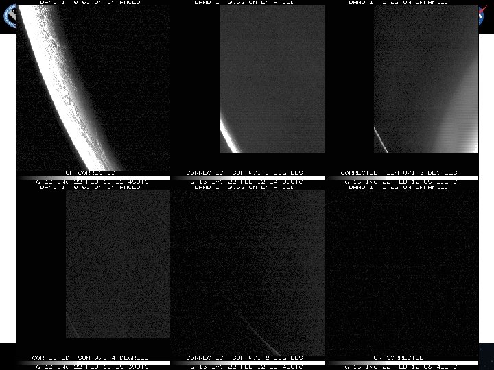
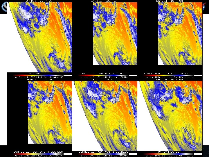
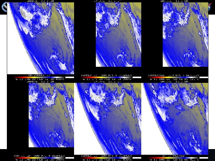
Stray Light Correction Original Corrected GOES-13 Imager Band 2 Later image
Band 2, Original – too hot by several K! Band 2, Original – too hot by 50 K! 11
Band 2, Corrected
Band 2, later image 13
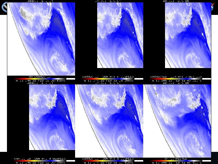
Band 2 Difference N=14342 Mean= 4. 0 K Band 2, difference image (org-eclipse). Smaller range.
Band 2 Difference N=14342 Mean= 0. 6 K Band 2, difference image (corrected-eclipse). Smaller range.
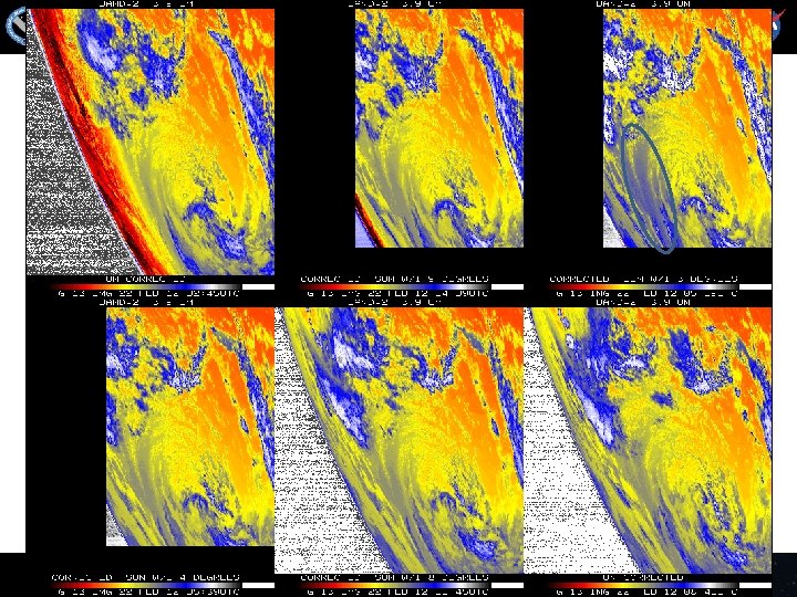
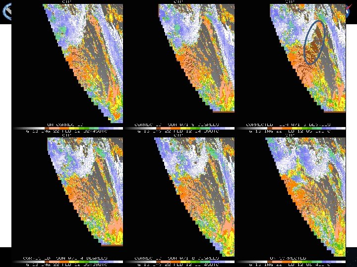
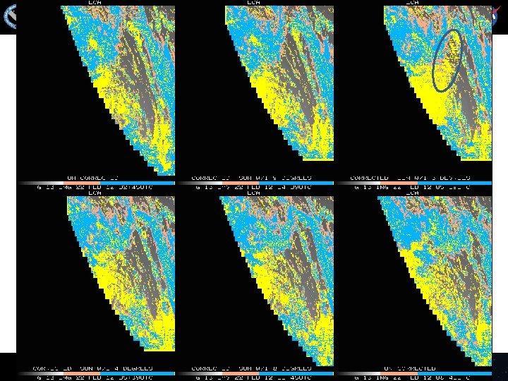
Cloud-top Pressure (color-range). Original – too “cloudy” over some regions, but misses other clouds! Clear Low cloud High Cloud
Cloud-top Pressure (color-range). Corrected. In general, corrected both regions. Clear Low cloud High Cloud
Cloud-top Pressure (color-range). Later image. Clear Low cloud High Cloud
GOES-13 Imager 12/053/04: 39 Southern Hemi, Channel 2 Uncorrected for SL SL Corrected J. Paul Douglas 19
GOES-13 Imager 12/053/05: 09 Southern Hemi, Channel 2 Uncorrected for SL SL Corrected J. Paul Douglas 20
GOES-13 Imager 12/053/05: 39 Southern Hemi, Channel 2 Uncorrected for SL SL Corrected An artifact has been introduced J. Paul Douglas 21
GOES Imager Stray Light correction • Extra full disk image with the Stray light correction, compared to last year. March 3, 2011 March 3, 2012
GOES-13 (East) Imager Coverage • JD=077; March 17, 2011 (04: 10 to 06: 15 UTC); GOES-13 Imager
GOES-13 (East) Imager Coverage • JD=077; March 18, 2012 (04: 10 to 06: 15 UTC); GOES-13 Imager
GOES-11 (West) Imager Coverage • JD=077; March 18, 2011 (08: 00 to 10: 11 UTC); GOES-11 Imager
GOES-15 (West) Imager Coverage • JD=077; March 17, 2012 (08: 00 to 10: 11 UTC); GOES-15 Imager
SLC info found the GVAR stream • An example of the type of output of Stray Light Correction information found the GVAR stream, in the area line prefix for the GOES-13 Imager data is shown below. This provides a summary of how each image is modified depending on the time of year (i. e. relative declination of the sun and GOES platform). • • • • Directory information (sensor #, image ccyyddd, image hhmmss): 180, 2012068, 54500 SLCE (# lines w/SLC enabled) = 2705 SLCD (# lines w/SLC disabled) = 0 SLCP (# lines w/SLC performed) = 2705 SLCNP (# lines w/SLC not performed) = 0 SLC_FRST (1 st ln w/SLC performed) = 1 SLC_LST (last ln w/SLC performed) = 2705 SUNE (# lines w/sun on e/side earth) = 2705 SUNW (# lines w/sun on w/side earth) = 0 SUNN (# lines w/sun on n/side earth) = 0 SUNS (# lines w/sun on s/side earth) = 2705 nonzero values were found for parameter: min_sun_angle Smallest sun angle value = 5 found at line # 1419 Largest sun angle value = 15 found at line # 1 34
Links • http: //cimss. ssec. wisc. edu/goes/blog/archives/9816 • http: //www. osd. noaa. gov/GVAR_Downloads/ documents/SLC_GVAR_White_Paper_V 1. doc • http: //www. ssd. noaa. gov/PS/SATS/MESS/MS G 0522058. 01. txt 35
GOES Imager Stray Light correction • http: //cimss. ssec. wisc. edu/goes/blog/archives/9816
Back-up • Back-up 37
Uncorrected
Corrected
Corrected - Sun within 1 degree
Corrected - Sun within 2 degrees
Corrected
Uncorrected
Uncorrected