Global Winds Ocean Currents 2018 2019 Winds Remember

Global Winds & Ocean Currents 2018 -2019

Winds Remember Wind forms because of the unequal heating of the earth’s surface This causes the air to move from high pressure to low pressure (cold air to warm air) creating a movement of air which we call wind

Winds Remember: Air Mass Movements change local weather day to day

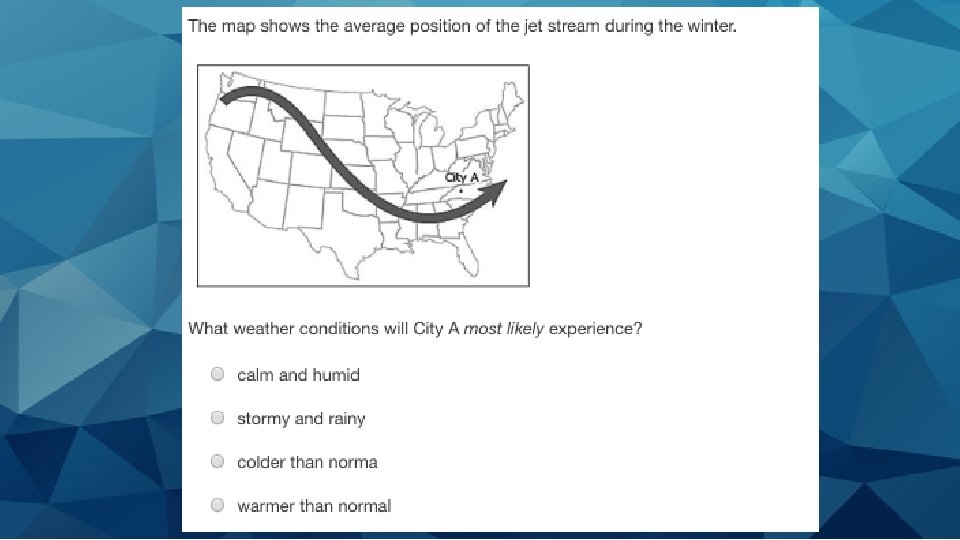
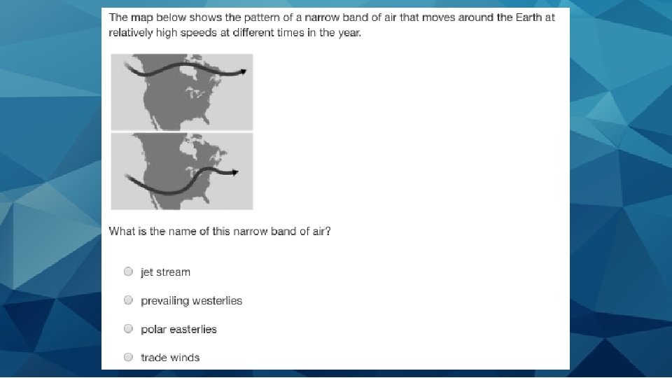
Jet Stream • STRONG cold fast moving winds high in the atmosphere that travel through the United States (they are like “rivers of wind” high above in the atmosphere) • Usually separate colder air and warmer air • Push air masses around moving weather systems to new areas

Jet Stream

Jet Stream • Form where large temperature differences exist = the winds are faster in the winter when the temperature difference between the polar and tropical regions are greater • Flows WEST to EAST

Jet Stream

Jet Stream

Jet Stream

Jet Stream The location of the jet stream affects the weather system in the United States The location of pressure systems determine the shape of the jet stream

Jet Stream

Jet Stream

Coriolis Effect The force acting on wind because of the earths rotation AKA: Because the earth is spinning the wind does not travel in a straight line

Coriolis Effect

Coriolis Effect

Coriolis Effect

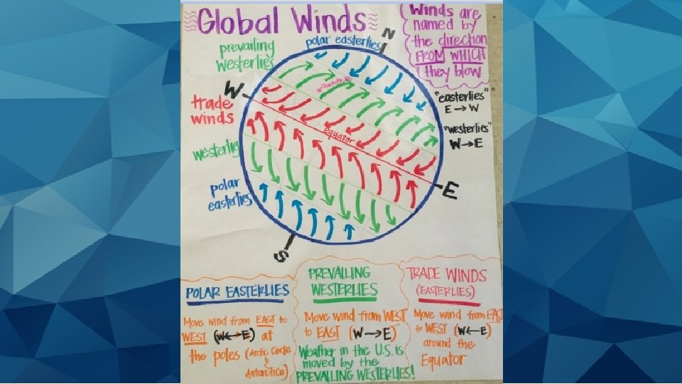
Global Winds 3 Types Prevailing Westerlies Polar Easterlies Trade Winds

Global Winds We classify these winds based on the direction that they COME FROM Air Pressure and Winds
 • Travel from")
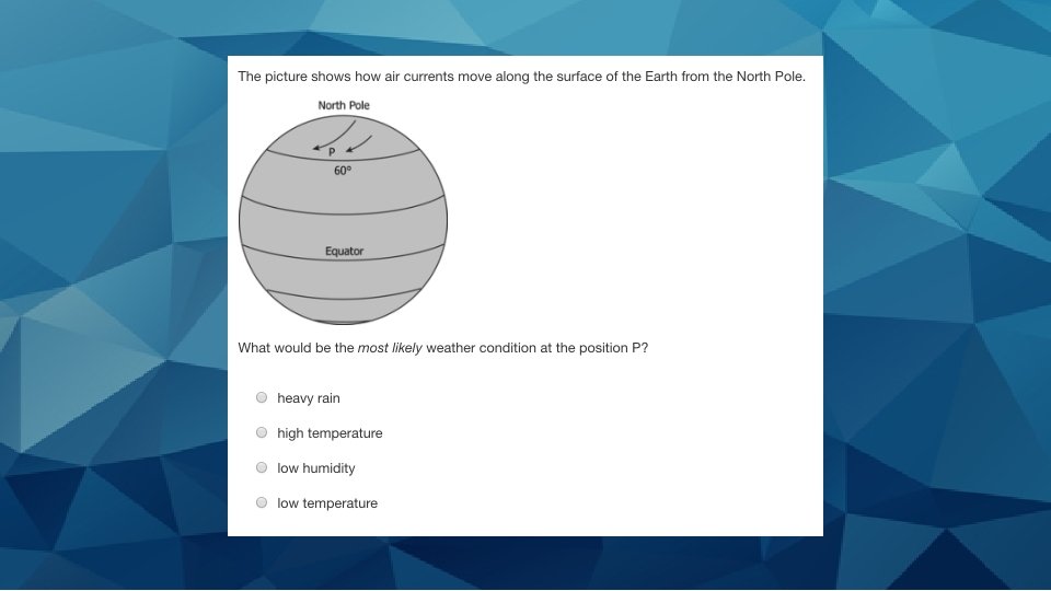
Polar Easterlies These winds come in from the POLES (hence polar) • Travel from EAST to WEST (hence “Easterlies”) • These are the dry, cold winds that blow from high pressure areas of the north and south poles towards the low-pressure areas of the Westerlies

Polar Easterlies

Prevailing Westerlies These are OUR WINDS that we experience!!! • Blow near the mid latitude regions • Go from WEST to EAST (hence “Westerlies”) • These winds move towards the poles

Prevailing Westerlies

Prevailing Westerlies

Trade Winds These winds blow near the equator • Blow from EAST to WEST • These winds move towards the equator and are warm steady breezes

Trade Winds

Global Winds
 are responsible for pushing air masses around")
Remember--- These winds (including the Jet Stream) are responsible for pushing air masses around

Ocean Currents Continuous movement of sea water created by factors such as: wind, Coriolis effect, temperatures, salinity Ocean currents coming from the poles will usually bring cooler weather Ocean Currents moving from the equator will usually bring warmer weather

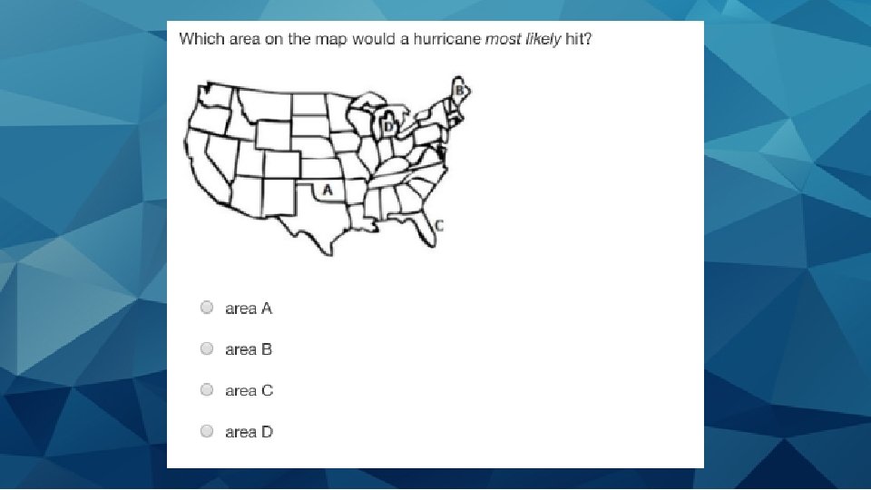
Hurricanes Large rotating storm with high wind speed that forms over warm waters We call them Hurricanes (but in other places they can be called “cyclones” and “typhoons”) Form over the Atlantic Ocean (Our hurricanes in NC form from tropical storms in the Atlantic) Can cause lots of damage and floods to areas

Hurricanes Form when moist air over the water rises and is replaced with cool air that then warms up and rises as well. This cycle creates huge storm clouds. If there is enough warm water then the storm clouds build up and wind speeds grow to create a hurricane The storm clouds rotate with the spin of the earth Hurricanes

Ocean Currents

El Nino and La Nina Watch Me

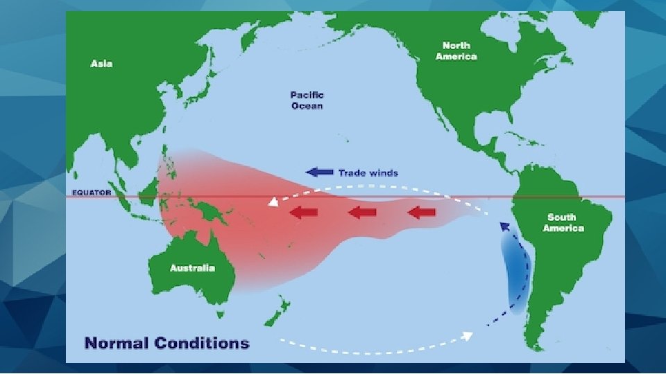
El Nino and La Nina These both occur in the Pacific Ocean and can affect climates in North and South America for long periods of time Trade winds push the water from eastern Pacific to Western Pacific

See where the Pacific and Atlantic is
")
El Nino • When the temperatures in the pacific ocean increase (get warmer)

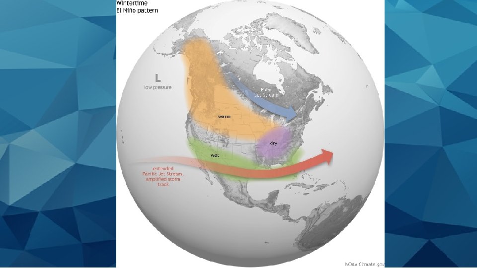
El Nino • Mostly affects winter months • Increased Temperatures and Increased Rainfall • Happens about every 2 -7 years • Waters move East to West from the trade winds
 of the U. S")
Affects on U. S • In the gulf (south parts) of the U. S it is wetter (more precipitation) • In the North of the U. S it is warmer and drier and can have droughts Includes - Northern Rockies, Northern Great Plains, Great Lakes

Affects on U. S • Moves the jet stream south which can lead to southern tornados

Affects on South America • Floods occur on the coast of South America • Many fish move away to find cooler water or die

El Nino • Causes floods on coast of South America and the gulf of the U. S • During an El Nino Hurricanes over the Atlantic decrease while in the Pacific the storms increase!! (Because the water is warmer in Pacific) • Can cause tornadoes in Florida and Southeast parts of U. S

El Nino

El Nino
")
La Nina • When the temperatures in the pacific ocean decrease (get colder)

La Nina • Take a look at a normal year versus La Nina on the next slides • Notice the warm water in the La Nina is pushed heavily to Asia and Australia (so now they are the ones with a lot more rain)
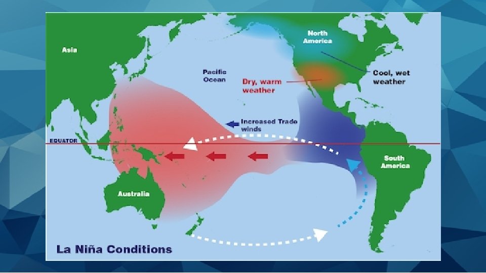

La Nina • Bring colder weather and more precipitation than normal in the North of United States • In the South it is warmer and drier • In NC we would have less rainfall and colder winters

La Nina Pacific Jet Stream is now North Where as when you look at El Nino it is south

La Nina

La Nina • Notice the Jet stream is far north so the north has more of a chance for tornados • Jet stream bring high winds and extreme weather during La Nina • Most La Nina (and El Nino) die out before tornado season though

La Nina • La Nina reduces hurricanes in the Pacific and now increases the hurricanes in the Atlantic (which isn’t good news for the east coast of the U. S) • We would have an “active” hurricane season

La Nina

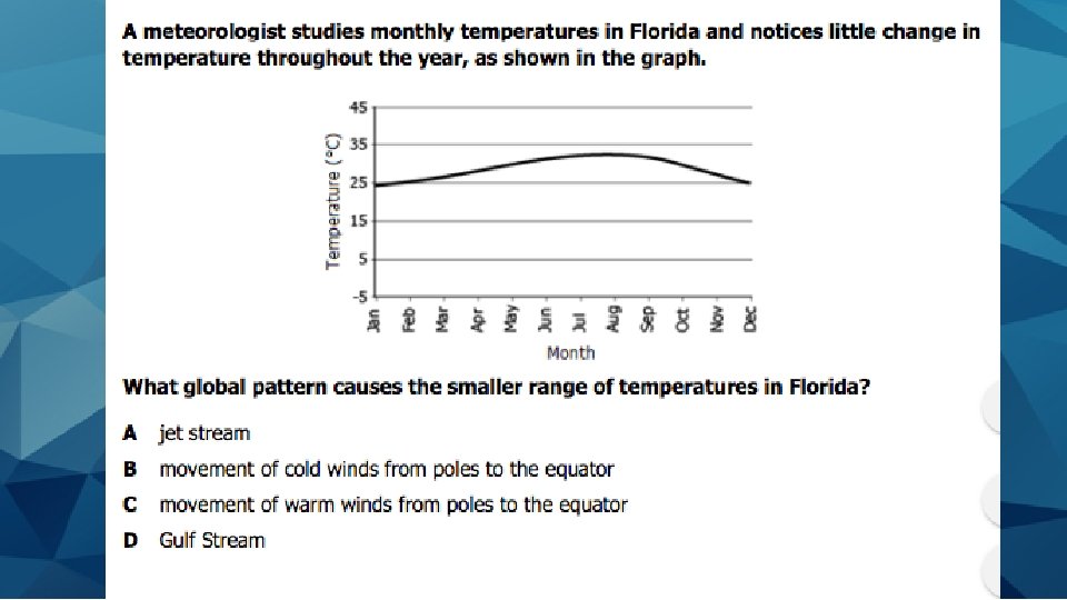
Gulf Stream A warm ocean current in the Atlantic Ocean that flows north from the equator along the eastern coast of the U. S. ** Keeps the eastern coast of the U. S warm/mild

Gulf Stream Moves up the eastern coastlines and then across the Atlantic
 during the winter on the southeast coast of")
Gulf Stream Keeps temperatures warmer (moderate) during the winter on the southeast coast of U. S and to England (because warmer waters bring warmer air which bring warmer temperatures) Less range of temperature happen in places like Florida
- Slides: 67