
GISBased Tuna Database in East Indonesia Audrie J
GIS-Based Tuna Database in East Indonesia Audrie J. Siahainenia, Ph. D. FGD: Rancangan Basis Data Untuk Mendukung PUI Konservasi Tuna, P 2 LD-LIPI Durian Patah, Ambon, March 24 th, 2017
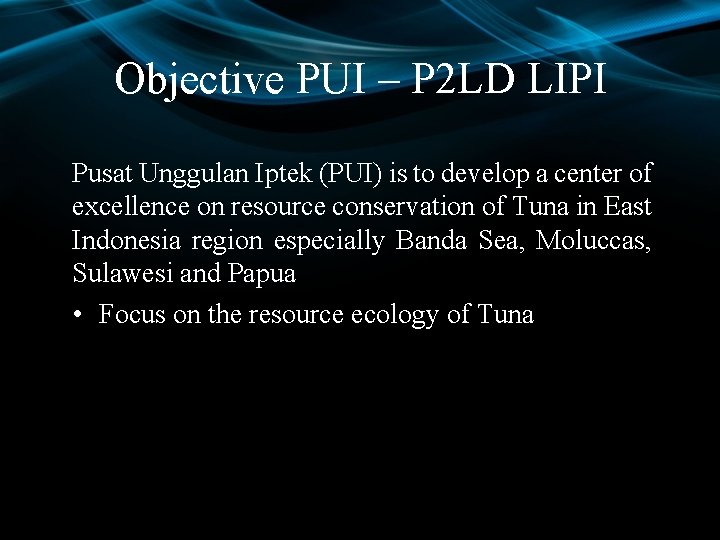
Objective PUI – P 2 LD LIPI Pusat Unggulan Iptek (PUI) is to develop a center of excellence on resource conservation of Tuna in East Indonesia region especially Banda Sea, Moluccas, Sulawesi and Papua • Focus on the resource ecology of Tuna
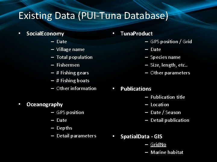
Existing Data (PUI-Tuna Database) • Social. Economy – – – – Date Village name Total population Fishermen # Fishing gears # Fishing boats Other information • Oceanography – – GPS position Date Depths Detail parameters • Tuna. Product – – – GPS position / Grid Date Species name Size, length, etc. . Other parameters • Publications – – Publication title Location Date / Season Detail publication • Spatial. Data - GIS – Grid. No – Marine habitat
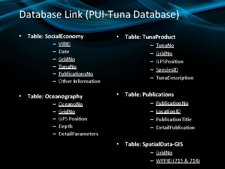
Database Link (PUI-Tuna Database) • Table: Social. Economy – – – Vill. ID Date Grid. No Tuna. No Publications. No Other Information • Table: Oceanography – – – Oceano. No Grid. No GPS Position Depth Detail. Parameters • Table: Tuna. Product – – – Tuna. No Grid. No GPSPosition Species. ID Tuna. Description • Table: Publications – – Publication. No Location. ID Publication. Title Detail. Publication • Table: Spatial. Data-GIS – Grid. No – WPPID (715 & 714)
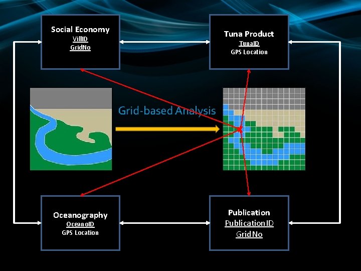
Social Economy Vill. ID Grid. No Oceanography Oceano. ID GPS Location Tuna Product Tuna. ID GPS Location Publication. ID Grid. No
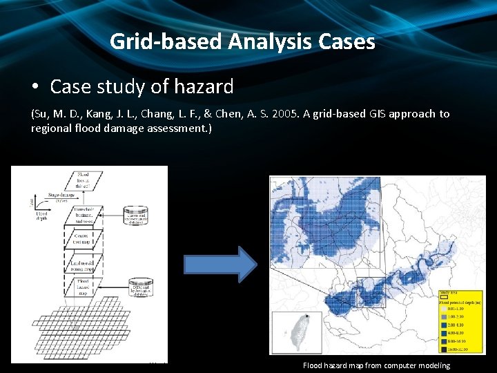
Grid-based Analysis Cases • Case study of hazard (Su, M. D. , Kang, J. L. , Chang, L. F. , & Chen, A. S. 2005. A grid-based GIS approach to regional flood damage assessment. ) Work Flow Flood hazard map from computer modeling
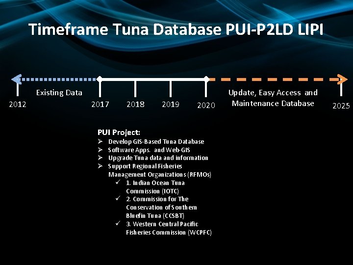
Timeframe Tuna Database PUI-P 2 LD LIPI Existing Data 2012 2017 2018 PUI Project: Ø Ø 2019 2020 Develop GIS-Based Tuna Database Software Apps. and Web-GIS Upgrade Tuna data and information Support Regional Fisheries Management Organizations (RFMOs) ü 1. Indian Ocean Tuna Commission (IOTC) ü 2. Commission for The Conservation of Southern Bluefin Tuna (CCSBT) ü 3. Western Central Pacific Fisheries Commission (WCPFC) Update, Easy Access and Maintenance Database 2025
Advantages of PUI – Tuna Database • Provides a view for the tuna resources and social aspect including their habitat and distribution pattern • Offers Geo-referenced information, metadata and updated Tuna database • Informative and Interactive Tuna Web-GIS P 2 LD LIPI
Software Needed Database: MS Access My. SQL – Oracle http: //www. mysql. com Postgre. SQL – Barkley Geography Information System - GIS: ESRI – Arc. GIS QGIS
Outputs Papers and Journal / Makalah Ilmiah Reports: Technical Report User manual Help Section Policy / Tuna Conservation
References • Ramez Elmasri, Sam Navathe, Fundamentals of Database Systems, 4 rd Edition, Addison Wesley Publishing Company, 2000. • Raghu Ramakrisnan, Gherke, Database Management System, 3 rd Edition, Mc. Graw-Hill, 2001. • Abraham Silberschatz, Henry F. Korth, Database System Concepts, 3 rd Edition, 1999. • Su, M. D. , Kang, J. L. , Chang, L. F. , & Chen, A. S. 2005. A grid-based GIS approach to regional flood damage assessment • P 2 LD-LIPI Team, 2017. Masterplan Pengembangan Pusat Unggulan IPTEK Konservasi Sumberdaya Tuna • Matthew Mac. Donald, Access 2013 – The Missing Manual, 1 st Edition, O’Reilly Media, Inc. , 2013.

What Next…. . ?
Step – 01 Summary of Tuna Database • Existing Dataset (4 main components) – – Social Economy (Villages) “Gaps” Oceanography (P 2 LD-LIPI) Tuna Products (KKP, Landing Station, Fishing Port) Publications (UNPATTI, Darusalam, others) • GIS Applications – GIS Software (Arc. GIS or QGIS) – Additional GIS Data Included (Base map and Grid Map) – Conversion spatial data to Arc. Map Documents (Geodatabase)
Step – 02 Selection of Applications and Design for the GIS-Based Tuna Database • Selection of Database Applications – MS Access – My. SQL (Oracle) • Database Design – Description of Database Structure – Description of Database Relationships
Step – 03 Description of the Contents of the GISBased Tuna Database • Criteria for Evaluating Tuna Resources Data Sets • Data Types and Data Sets Incorporated into the GISBased Tuna Database • Tuna Database Quality Assurance/Quality Control (QA/QC)
Step – 04 Options for Data Treatment • Treatment of Undetected Data • Treatment of Data for QA/QC Samples • Non-Numerical and Zero Results
Step – 05 Special Considerations Regarding Data Management • Categorizing Samples • Methods Used to Determine Calculated Values • Special Treatment of Tuna Distribution Test Statistical Designations • Adaptation of Geographical Coordinates Unit (WGS 84/UTM) • Methods for Recording Station Identification Codes (GRID Based)
Step – 06 Description of the GIS Components of the Tuna Database Project • Methods for Compiling Data • Organization of GIS Data – Arc. Map or QGIS Documents – Accessory Information • Base map WPP -714 Banda & WPP-715 Moluccas Sea – Theme Metadata • Approach Used for Dealing with Known Errors in the GIS Data – Errors in Attribute Data – Modifying the Base map
Step – 07 Linking the Tuna Database with GIS Applications • Connected Tuna Database and GIS Software to Web. GIS Apps.
Step – 08 Administrative Details • Distribution of the MS Access Tuna Database and GIS Attributes • Distribution of Metadata PUI-Tuna Database (www. deepsea. lipi. go. id and website Fisheries) • Distribution of PUI-Tuna Database (website intra LIPI, intra. lipi. go. id) • Access to Database Update (SOP) • Maintenance Database (Monthly or annually)
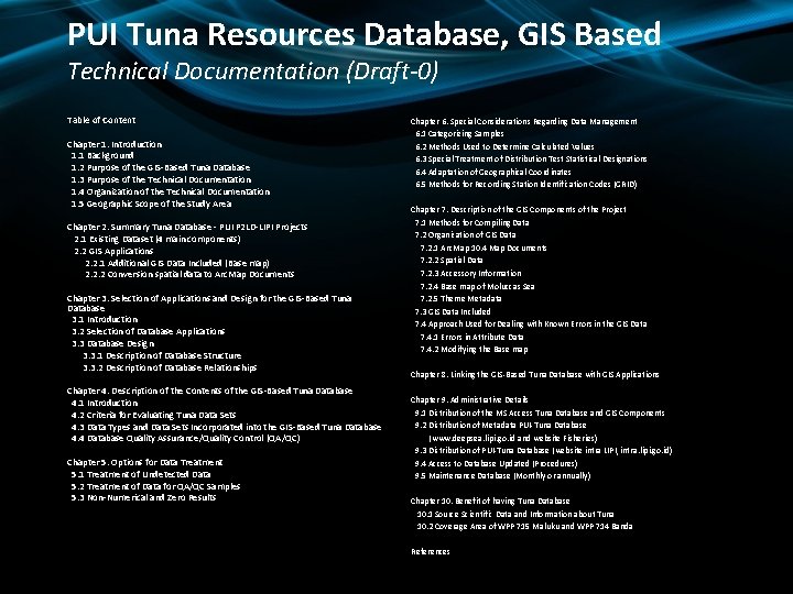
PUI Tuna Resources Database, GIS Based Technical Documentation (Draft-0) Table of Content Chapter 1. Introduction 1. 1 Background 1. 2 Purpose of the GIS-Based Tuna Database 1. 3 Purpose of the Technical Documentation 1. 4 Organization of the Technical Documentation 1. 5 Geographic Scope of the Study Area Chapter 2. Summary Tuna Database - PUI P 2 LD-LIPI Projects 2. 1 Existing Dataset (4 main components) 2. 2 GIS Applications 2. 2. 1 Additional GIS Data Included (Base map) 2. 2. 2 Conversion spatial data to Arc. Map Documents Chapter 3. Selection of Applications and Design for the GIS-Based Tuna Database 3. 1 Introduction 3. 2 Selection of Database Applications 3. 3 Database Design 3. 3. 1 Description of Database Structure 3. 3. 2 Description of Database Relationships Chapter 4. Description of the Contents of the GIS-Based Tuna Database 4. 1 Introduction 4. 2 Criteria for Evaluating Tuna Data Sets 4. 3 Data Types and Data Sets Incorporated into the GIS-Based Tuna Database 4. 4 Database Quality Assurance/Quality Control (QA/QC) Chapter 5. Options for Data Treatment 5. 1 Treatment of Undetected Data 5. 2 Treatment of Data for QA/QC Samples 5. 3 Non-Numerical and Zero Results Chapter 6. Special Considerations Regarding Data Management 6. 1 Categorizing Samples 6. 2 Methods Used to Determine Calculated Values 6. 3 Special Treatment of Distribution Test Statistical Designations 6. 4 Adaptation of Geographical Coordinates 6. 5 Methods for Recording Station Identification Codes (GRID) Chapter 7. Description of the GIS Components of the Project 7. 1 Methods for Compiling Data 7. 2 Organization of GIS Data 7. 2. 1 Arc. Map 10. 4 Map Documents 7. 2. 2 Spatial Data 7. 2. 3 Accessory Information 7. 2. 4 Base map of Moluccas Sea 7. 2. 5 Theme Metadata 7. 3 GIS Data Included 7. 4 Approach Used for Dealing with Known Errors in the GIS Data 7. 4. 1 Errors in Attribute Data 7. 4. 2 Modifying the Base map Chapter 8. Linking the GIS-Based Tuna Database with GIS Applications Chapter 9. Administrative Details 9. 1 Distribution of the MS Access Tuna Database and GIS Components 9. 2 Distribution of Metadata PUI-Tuna Database (www. deepsea. lipi. go. id and website Fisheries) 9. 3 Distribution of PUI-Tuna Database (website intra LIPI, intra. lipi. go. id) 9. 4 Access to Database Updated (Procedures) 9. 5 Maintenance Database (Monthly or annually) Chapter 10. Benefit of having Tuna Database 10. 1 Source Scientific Data and Information about Tuna 10. 2 Coverage Area of WPP 715 Maluku and WPP 714 Banda References

THE END
- Slides: 22