GIS in Chula Vista San Diego Regional GIS

 – current n n population (230,")


- Slides: 8
GIS in Chula Vista San Diego Regional GIS Council Meeting January 2011
About Chula Vista n 2000 population (174, 000) – current n n population (230, 000) Number of city employees increased from 775 to 1200 during same period. Over 65, 000 parcels within City Approx 430 linear street miles Chula Vista centennial
Chula Vista GIS … History n 1994 – GIS started in Engineering Dept. A number of layers (curb, gutter, sidewalk) created from 6” digital orthophoto n 1998 – Desktop application development using Arc. View / Map. Objects n 2002 – Arc. IMS development n 2005 – Begin migration to Enterprise Geodatabase (SQL-Server)
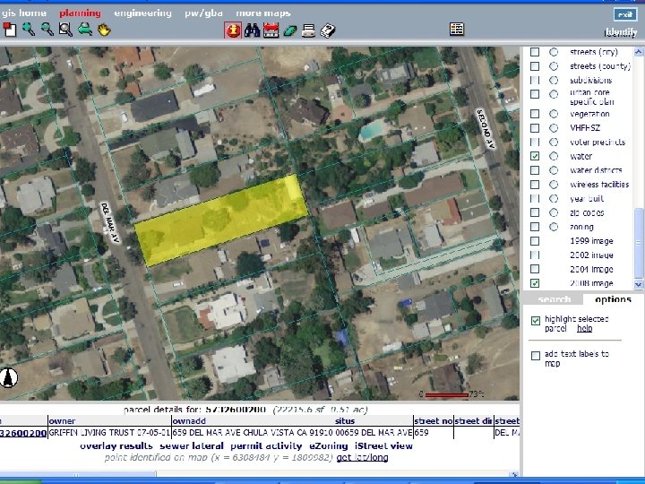
Chula Vista GIS … Today n GIS used by all Departments n GIS Manager / 3 GIS Specialists / 1 part time intern (Fire Plan) n Arc. Map used by GIS staff and approximately 20 “core” GIS users throughout the city (Arc. View 3. 3 removed from network Jan. 1 st) n Arc. IMS application (CVMapper) used by city staff to access GIS
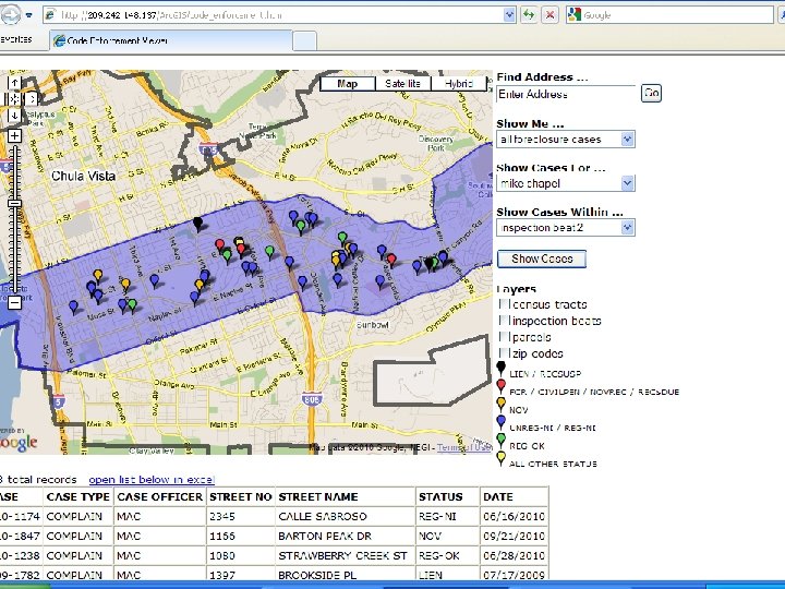
Ongoing Projects. . n Regional Fire Plan mapping n Parcel layer / Permits-Plus synchronization n Work Management System (GBA) synchronization n Creating 3 -D building models within redevelopment areas
What’s next ? n Migrate Arc. IMS viewer to Arc. Server using Silverlight API (eliminate Arc. IMS by 1/1/2012) n Participate in ESRI’s Community Basemap Program n More with Arc. Server Provide web based editing capabilities to staff ? n Create enterprise “search” service to find maps / data throughout the organization n Create Geoprocessing services. (Example: generate list of all resident addresses within 500’ of proposed rezone) n