GIS A planning and decision making tool Case


- Slides: 31
GIS – A planning and decision making tool: Case studies Presented by Jonathan Tsoka
Watpro Consulting u Offers advisory services in the fields of: – water management – environmental management – agriculture; and – geospatial www. watpro. co. za
Outline of Presentation 1. Overview of Case studies 2. Case 1 – Dam counting 3. Case 2 – Mapping Public Open Spaces 4. Case 3 - Education 5. Case 4 – Pollution remediation 6. Conclusion
Overview of Case studies
Areas of application u Water resources planning - Dam Counting using GIS and remote sensing u Urban planning - City-wide assessment of green Open Public Spaces (OPS) in regions of Johannesburg using the Kobo toolbox u Education – market entry strategy for an education provider u Environmental resources management - Pollution remediation – GIS desk study u Water resources management - Ground water mapping (using GLDAS NOAH Land surface model and GRACE satellite imagery data)
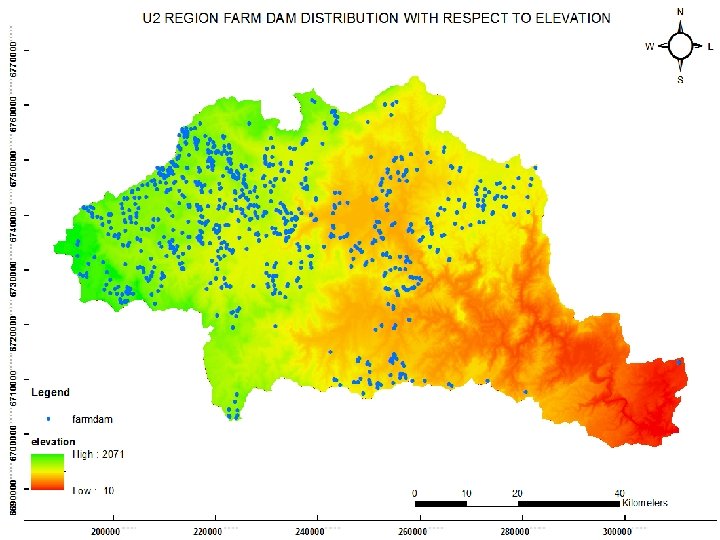
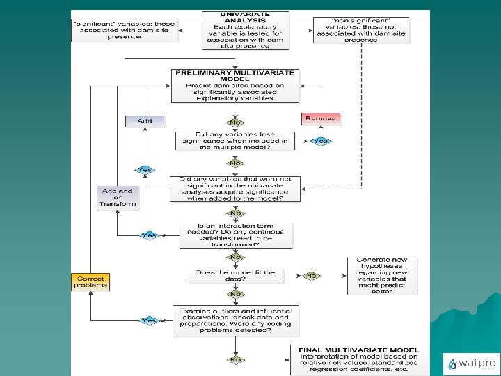
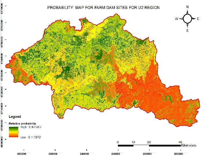
Case 1 - Dam counting
Overview u The need for efficient management and sound planning of water resources u Hinderance – inadequate information on farm data u Collection of planning data – expensive and time consuming u Mapping the distribution of farm dams and determine their spatial distribution pattern (R- Studio); u Determination by Principal Component Analysis the factors influencing the spatial distribution of farm dams u Development of a spatial predictive model for farm dam sites (RStudio) – Probability map u Landsat imagery, DEM, soil, and geology datasets were used
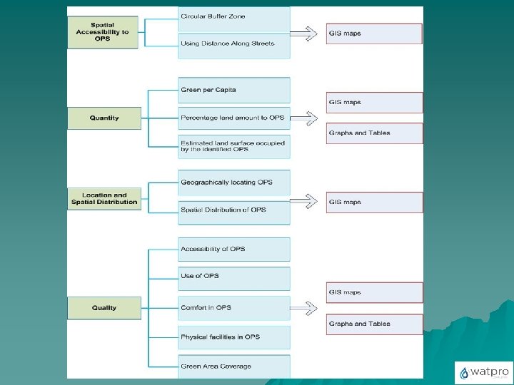
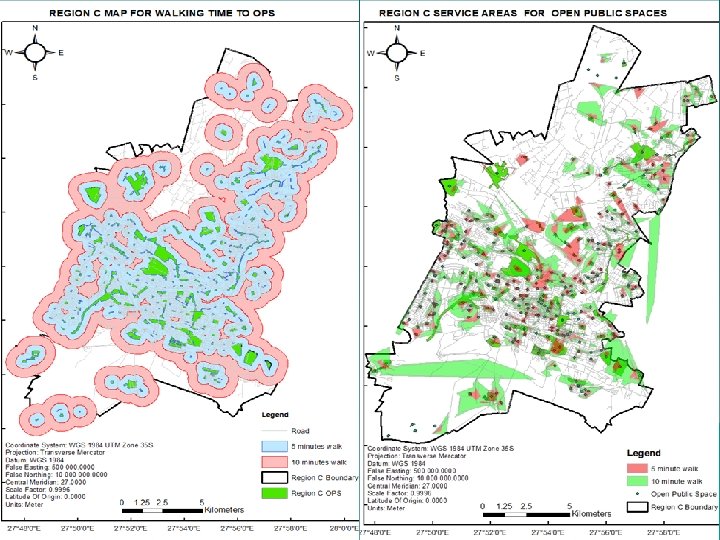
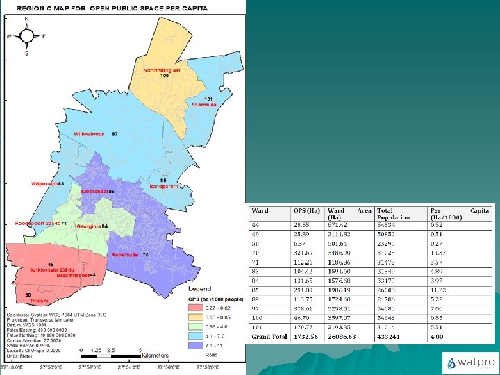
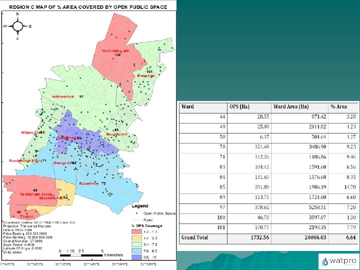
Case 2 - Green Open Public Spaces
Overview u The project was funded by the UNHABITAT u Aim - ensure safe, clean, enjoyable, accessible and interconnected public open spaces u Investigating how accessible the OPS in Regions C and F are; u Establishing the quantity of OPS in Regions C and F; u Determination of the spatial distribution of OPS in the Regions C and F; u Understanding the network and interconnectedness of OPS in Regions C and F. u Mapping safety
u Ko. Bo toolbox was used for the survey u e-data collection tool used for mainly collecting field data in challenging environments u Open-source and web-browser based form creation, deployment and collection tool u Form is created through online tools and can create elaborate forms with skip logic and validation criteria
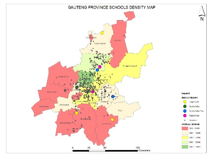
Case 3 - Education
Overview u Market entry strategy for a low-cost education provider to establish potential locations for schools based on demographic data – (income distribution, population distribution, learners’ safety, the competitor landscape) and schools catchment radius (based on a network analysis). u Living Standard Measures (LSM) - used to size the demand potential u LSM 8 – 10 were selected u White spaces –areas where identified in Greater Randburg and Pretoria
Network Analysis Service area approach Service Area
Service area approach
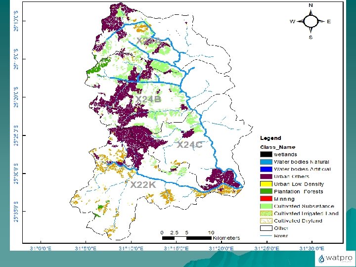
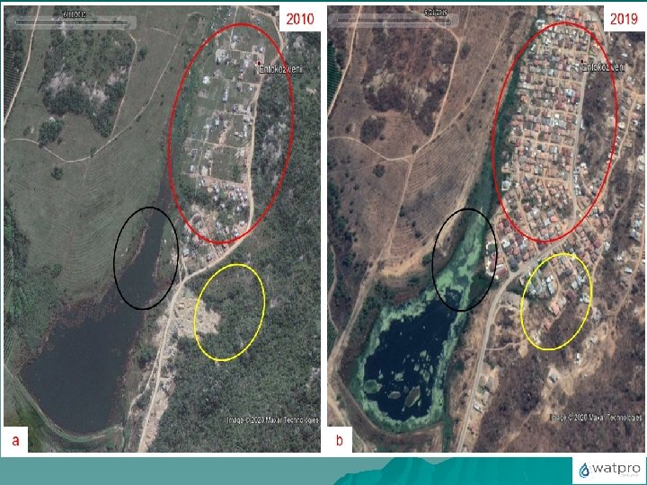
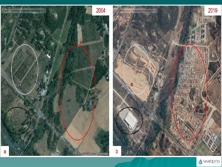
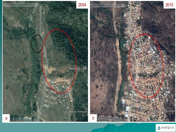
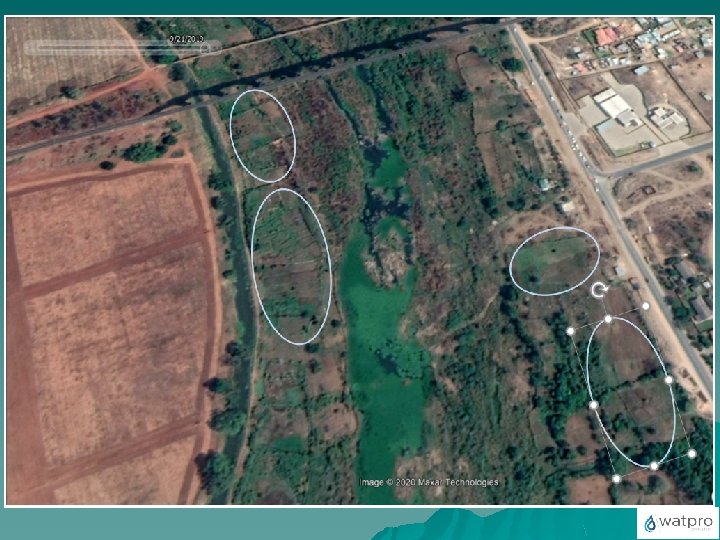
Case 4 - Pollution remediation
Overview u Problem - Water pollution in the Crocodile River catchment u Need for using GIS and remote sensing to identify potential pollution sources (point and non-point sources) u Land use land cover map u Provision of preventative, control and remedial measures for water pollution for the Middle Crocodile B river system
Conclusion u GIS is a powerful decision support tool. u The use of GIS data - profound impact on business and industry, as well as on the general public – If the technology were eliminated, we would realize to a great extent the overarching importance of GIS data in our daily lives and in work u GIS data helps organizations become more efficient with finite resources. – With an understanding of the population at risk, planners can allocate resources more efficiently.