Giordano Giorgi Niels Kinneging Gerben de Boer A

Giordano Giorgi Niels Kinneging Gerben de Boer A rapid assessment of the My. Ocean catalogue 3. 0 products for application to environmental issues (WFD, MSFD, WG DIKE, EEA): nutrients and eutrophication only
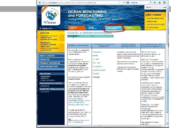

What My. Ocean catalogue offers for MSFD

Example search result North Atlantic

Example search result Mediterranean Sea

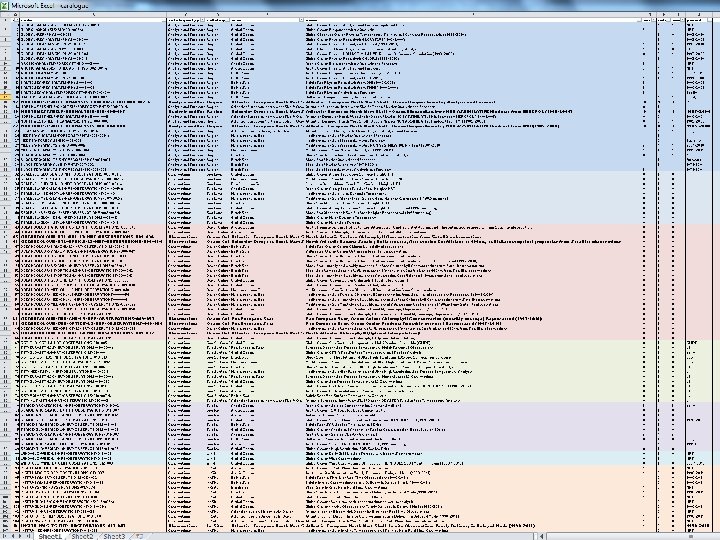
My. Ocean catalogue: 107 products • • • All 1 -line descriptions would fit on 2 A 4 Excel pages (next slide) Catalogue offers also texts + plan views preview to form a booklet 9 products for optical/biological North Sea (4 products multiyear) 8 products for optical/biological Med Sea (2 products multiyear) No easy drilling down on all properties of the models like • Spatial and vertical resolution • Time span Example: North Sea model comparison Lenhart et al, 2010, JMS • Data source composition: model, in situ, satellite (previous slide)

My. Ocean data types My. Ocean offers 4 groups of products relevant for environment. Data source type is less important than being multi-year. Archived analyses/forecasts, hindcasts, reanalyses, reprocesing DEDUCTIVE METHODS 1. Non-assimilated model simulations model THEORY ONLY • without data assimilation (free runs) yes HYBRID METHODS 2. Assimilated model simulations THEORY AND DATA yes • data assimilation with in situ only yes • data assimilation with in situ + satellite yes • data assimilation with only satellite INDUCTIVE METHODS 3. Remote sensing collections ONLY DATA, NO THEORY • pure satellite collations • data assimilation (OI) with in situ 4. Aggregations of in situ data • Homogenized regional aggregations in situ satellite - - yes Yes yes - yes yes -

My. Ocean data services: 3 INSPIRE levels • INSPIRE requires a 3 -step availability of geospatial data 1. Discovery: without My. Ocean authentication > Yes: catalogue for interactive manual access > No: web service: OGC CSW machine-readable catalogue service 2. View: without My. Ocean authentication > Yes: view OGC WMS inside My. Ocean webviewer (next slides) > No: web service: OGC WMS layer into user applications. (next slides) Technically up-and-running, but not offered/supported. 3. Download: fully My. Ocean authenticated download mechanisms > Yes: manual OGC net. CDF files via internet browser (ftp or GUI) > Yes: automated OGC net. CDF file machine 2 machine (M 2 M) download (ftp or python client for experts) > No: INSPIRE and OGC download standards not offered: – – OPe. NDAP+ OGC WCS + OGC WFS + OGC SOS OPe. NDAP technically up-and-running but not offered/supported.

Inspire viewing service now offered in My. Ocean viewer

NOT offered in catalogue: viewing service for external clients (although it already works under the hood, without service) Example: My. Ocean WMS can be added to web. GIS viewer of Royal Dutch met office

Foster local models over single top-down product This North Sea OSPAR example shows: models and remote sensing need local refinements for ocean color: • My. Ocean now offers a few central models • Essential for boundary conditions for local models: continue • My. Ocean should also facilitate dissemination of local models: harvest models from all over Europe, like NOOS does • For MSFD local knowledge is essential: this local knowlegde is only in implemented in local models. • For science: improve discrepancies global and local models

My. Ocean: examples NOOS and ESA • NOOS approach is good example for what My. Ocean can offer MSFD: collect output from many tailored local models • ESA CCI projects with round robins are good example for what My. Ocean can offer MSFD: compare processing of many local remote sensing algorithms (Inherent Optical Properties, IOP) that differ per watermass, i. e. per area of 100 x 100 km 2 for turbid Case II waters like North Sea, Irish sea, Channel.

Example nitrate concentration for IT from My. Ocean

Example river discharge for Med Sea

Summary • My. Ocean already offers products useful for MSFD • My. Ocean should officially provide WMS service: • viewing My. Ocean products in client WMS viewers (INSPIRE requirement). Technically My. Ocean already offers this, but unsupported. • My. Ocean should provide INSPIRE web services for grids in addition to manual/batch download mechanisms (OPe. NDAP, OGC WCS, WFS). Technically My. Ocean already offers OPe. NDAP, but unsupported. • WCS allows for requesting data at tailored local grids for easy local DPSIR analysis. • Foster My. Ocean dissemination of dedicated models products already prepared for regional seas (e. g. NOOS, ESA, OSPAR) • Suite of model results support assessment • Suite of remote sensing algorithms support assessment • WG DIKE should play active role as end-user in My. Ocean/ECOMF

Proposal of Workshop Proposal: Organize a dedicated workshop to specifically discuss My. Ocean products applications to MSFD implementation of GES indicators Main topics • Overview of multiyear My. Ocean products with focus on resolution and level of confidence • Central vs local models for MSFD subregions: boundary conditions, downscaling • My. Ocean product output representation: OGC WMS and grid (INSPIRE: OGC WCS, OGC WFS) • MSFD GES indicator implementation • DPSIR approach and programs of measures
- Slides: 19