Geostationary Lightning Mapper Training Overview Presented by Geoffrey
Geostationary Lightning Mapper Training Overview Presented by Geoffrey Stano Numerous individuals are part of this effort GLM Science Meeting, 14 September 2018 Huntsville, Alabama
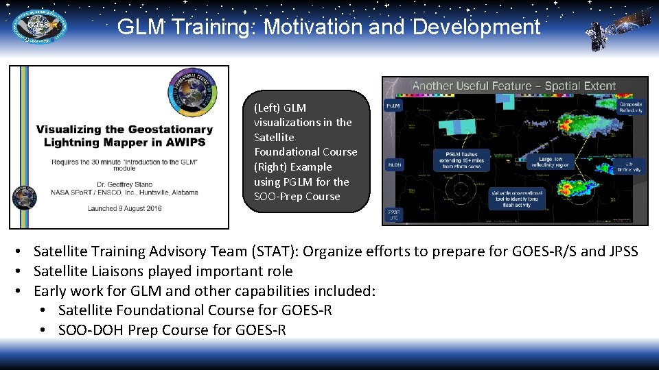
GLM Training: Motivation and Development (Left) GLM visualizations in the Satellite Foundational Course (Right) Example using PGLM for the SOO-Prep Course • Satellite Training Advisory Team (STAT): Organize efforts to prepare for GOES-R/S and JPSS • Satellite Liaisons played important role • Early work for GLM and other capabilities included: • Satellite Foundational Course for GOES-R • SOO-DOH Prep Course for GOES-R

GLM Training: Recent Product Changes Flashes Group s Events Original AWIPS concept Flash Extent Densit y Total Optica l Energy Averag e Flash Area Planned operational release • Large issue for GLM: Available data • ABI could use SEVIRI, Himawari, MODIS, and SNPP-VIIRS as demonstrations • GLM had no equivalent beyond the TRMM-Lightning Imaging Sensor • Major changes to proposed GLM products • Initial work: Event, Group, and Flash densities on the GLM grid • Current paradigm: Flash extent density (and others) on the ABI fixed grid (2× 2 km) • Had to rework training as initial baselines developed. Thanks HWT!!

GLM Training: Recent Developments • Current efforts: • Quick Guide: front and back page • Quick Brief: 5 -6 min overview • Focus: Basic familiarization • Availability: • AWIPS Integrated Reference (AIR) • STOR and Virtual Lab • NWS Commerce Learning Center • Scope: • Intended as initial piece of training • More to follow
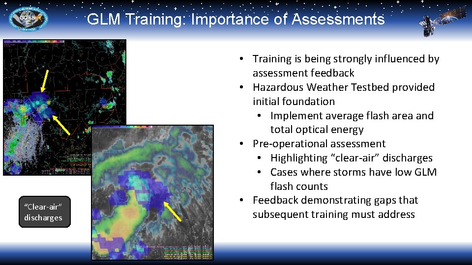
GLM Training: Importance of Assessments “Clear-air” discharges • Training is being strongly influenced by assessment feedback • Hazardous Weather Testbed provided initial foundation • Implement average flash area and total optical energy • Pre-operational assessment • Highlighting “clear-air” discharges • Cases where storms have low GLM flash counts • Feedback demonstrating gaps that subsequent training must address
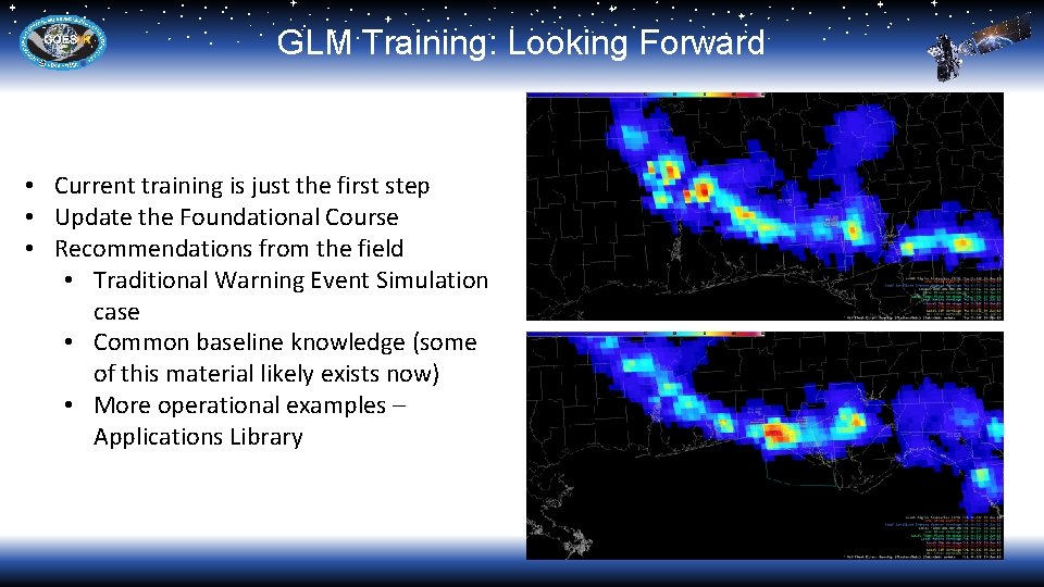
GLM Training: Looking Forward • Current training is just the first step • Update the Foundational Course • Recommendations from the field • Traditional Warning Event Simulation case • Common baseline knowledge (some of this material likely exists now) • More operational examples – Applications Library
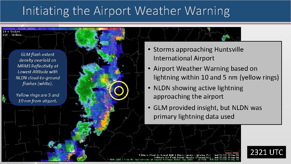
Initiating the Airport Weather Warning GLM flash extent density overlaid on MRMS Reflectivity at Lowest Altitude with NLDN cloud-to-ground flashes (white). Yellow rings are 5 and 10 nm from airport. • Storms approaching Huntsville International Airport • Airport Weather Warning based on lightning within 10 and 5 nm (yellow rings) • NLDN showing active lightning approaching the airport • GLM provided insight, but NLDN was primary lightning data used 2321 UTC
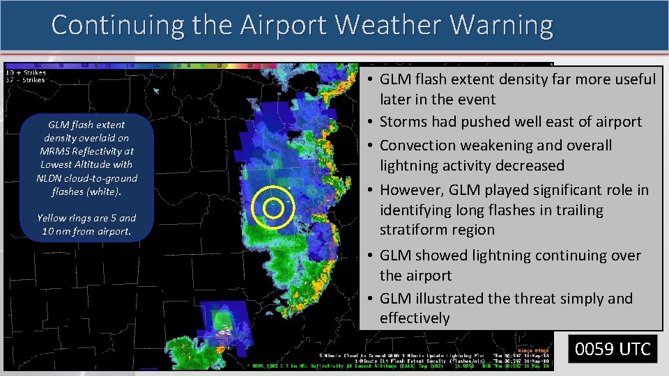
Continuing the Airport Weather Warning GLM flash extent density overlaid on MRMS Reflectivity at Lowest Altitude with NLDN cloud-to-ground flashes (white). Yellow rings are 5 and 10 nm from airport. • GLM flash extent density far more useful later in the event • Storms had pushed well east of airport • Convection weakening and overall lightning activity decreased • However, GLM played significant role in identifying long flashes in trailing stratiform region • GLM showed lightning continuing over the airport • GLM illustrated the threat simply and effectively 0059 UTC

Questions?
- Slides: 9