Georgias Geography Industry Transportation and Waterways Produce Products


- Slides: 16

Georgia’s Geography, Industry, Transportation, and Waterways

Produce, Products, and You! l Did you ever wonder how an apple gets to your ECMS lunchroom? Other Products? l What is a Seasonal item? How do we seem to have certain fruits all year? l Do they all come by the same mode of transportation? l What about the routes they travel?

Farm To Market l How did Georgia get its Crops to Market? In the 1700’s… In the 1800’s…

The Past - Trails to Roads l Walking Trails l 1810 - Old Federal Road – connected Nashville to Athens l Communities linked by gravel

Waterways as Highways l Native Canoes l 1700’s - Sail l 1800’s - Steam Power l What is a Navigable River? Where are they in Georgia?

Chattahoochee l The Chattahoochee River rises high in the Blue Ridge Mountains of Georgia and flows southwesterly toward the Alabama state line. From there the river tumbles for twenty miles over the fall line—the region of transition between the foothills of the Piedmont and the lower and flatter Coastal Plain. Below the fall line in Columbus, the river slows to ramble south toward Florida, where it is known as the Apalachicola.

Savannah River l Through the building of several locks and dams, and upstream reservoirs like Lake Hartwell, also, the Savannah River was once navigable by freight barges between Augusta, Georgia, (on the Fall Line) and the Atlantic Ocean; maintenance of this channel for commercial shipping ended in 1979 and the one lock below Augusta has been deactivated. [4] The Savannah River is tidal at Savannah, Georgia and downstream. From Savannah downstream, the river broadens into an estuary before flowing into the Atlantic Ocean. The area where the river's estuary meets the ocean is known as "Tybee Roads". The Intracoastal Waterway flows through a section of the Savannah River near the city of Savannah.

Atlantic Intracoastal Waterway l A man-made channel known as the Atlantic Intracoastal Waterway allows watercraft to navigate the marshes separating Georgia's barrier islands from the mainland. l Courtesy of Georgia Department of Economic Development

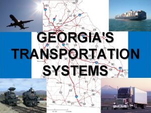
Modern Methods l Super Highways l Trucks l Trains l Cargo Ships

How does Transportation affect Cost? Send a Document… A Stamp costs 47¢ (7 -10 days) A Three-Day Delivery is $10 Overnight Costs $50 l Freight … Sent by Truck? Sent by Plane? Sent by Rail ? Taken by Cargo Ship? l

Advantages / Disadvantages l l l Fresh Food More Choices Timeliness Factory Efficiency Trade – local, national, and international Modern Economics depends on it! l l l Weather Affects Fuel Cost Pollution Maintenance Cost Accidents Modern Piracy

What Route does it Take? l l l l Fruit Lumber Coal Fuel Clothes Ipods Chocolate

Economic Impact l GAPorts. com FAQ’s

Economic Impact Page 60 in Your Text… Georgia’s two deep water ports – Savannah and Brunswick Generate over $1. 8 Billion in annual income. Provide over 81, 000 jobs and pay $585 million in taxes. Over 90 steamship lines serve Georgia Ports. 100 Trucking companies serve metropolitan Georgia. More than 25, 000 Interstate truckers serve the state. Two major rail lines operate in Georgia l From Georgia, goods are two truckload days from 82% Of the industrial and 79% of the largest consumer markets.

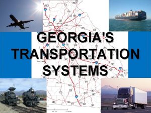
Map Project l On a Blank Georgia Map… Create a Key with 4 transportation symbols (1 color each) Rail (train), Truck (road) , Airplane, Cargo Ship Show the routes connect from the Apple Orchard in Ellijay through Atlanta to the Ports of Savannah and Brunswick. Some Roads may parallel Rail lines, but not all go exactly the same way. See the Transportation Map

Detailed Directions l Directions For Map Skills: Trace, color, label the Chattahoochee River/list one benefit 2. Trace, color and label the Savannah River/list one benefit 3. Trace, color and label the St. Mary’s River/list one benefit 4. Trace, color and label Georgia’s largest deep water ports, Savannah and Brunswick/list 2 benefits/Why are the ports successful? 5. Trace and color the fall line/describe 6. Trace, color and label the Barrier Islands 7. Trace, color and label Dalton Ga. ( hint northwest corner of Ga. Pg. 602)/list and draw a picture of what this it’s known for 8. Trace, color and label Georgia’s 5 border states 9. Put an * mark and label the approximate place where Kaolin can be found and draw one picture of a product that comes from this natural resource. 10. Anywhere on the Georgia Map, draw a picture of sunshine and list advantages we have due to climate. 1.
 Georgias geography
 Peninsulas and waterways in southwest asia
 Georgias regions
 Georgias colony
 Okefenokee swamp
 Georgias region
 People who own, operate, and take the risk of a business
 Generates fresh produce and other farm products
 Generates fresh produce and other farm products
 Aero transportation products
 Examples of functional and innovative products
 Transportation in geography
 Coke vs pepsi sales
 Sulphitation process in sugar industry
 Types of entertainment
 Fortified bakery products industry
 Biological products industry alliance
