Georgia Tech School of City and Regional Planning


 in fall or CP 6024")

 Methods - 92457 - CP 6025")


 • One foundational course: Advanced GIS • Two skills courses: Remote")


 Faculty advising (BD or")


- Slides: 34
Georgia Tech School of City and Regional Planning Master of Science in Geographic Information Science and Technology New Student Orientation
Who's important • Johnnie Sawyer: Academic Advisor for most registration, fees, visa, and other GT technical matters: • Bill Drummond: MS-GIST program director for course advice, career advice and educational issues • Subhro Guhathakurta: School Chair and ultimate authority on School issues
Where are MS-GIST online materials? • https: //sites. gatech. edu/msgist Materials include • MS-GIST Student Manual (latest version) • Full course syllabi from fall 2019 & spring 2020 • Program of Study spreadsheet • This orientation Power. Point
MS-GIST student curriculum options 1. CP 6025 (Statistical Methods) in fall or CP 6024 (Analytical Methods) in spring 2. Two specialized GIS classes from Environmental GIS, Socioeconomic GIS, Spatial Networks, Climate Change Analytics, Public Health Analytics(? ) 3. Two free electives, whatever you want!
Recommended Fall 2020 courses • Programming For GIS - 93426 – CP 6581 – C, Class 2: 00 pm - 3: 15 pm MW, Remote Synchronous, Required • Introduction to Remote Sensing - 87169 – CP 6531 – C, Class 6: 30 pm - 9: 15 pm, W, Remote Synchronous, Required • Environmental GIS - 88834 – CP 6541 - C , Class 3: 30 pm - 4: 45 pm TR, Hybrid Course, Specialized GIS class (two are required)
Recommended Fall 2020 courses • Advanced Planning (Statistical) Methods - 92457 - CP 6025 – C, Class 8: 00 am - 9: 15 am TR, Hybrid Course, Either CP 6025 in fall or CP 6024 in spring is required • Advanced Planning (Statistical) Methods Lab - 84375 - CP 6025 - C 01 Class 12: 30 pm - 3: 15 pm F, Hybrid Course, Either CP 6025 in fall or CP 6024 in spring is required
Recommended Fall 2020 courses • GIS Professional Seminar - 88101 – CP 6591 – A, Class 11: 00 am -11: 50 am M, Hybrid Course, Required • Visualization for Plan - 89067 – CP 6006 – C, Class 8: 00 am - 10: 45 am MW, Hybrid Course, Required
Georgia Tech School of City and Regional Planning Master of Science in Geographic Information Science and Technology New Student Orientation
New Student Orientation Part 2 Master of Science in Geographic Information Science and Technology
Why a GIS degree in a City Planning School? • Nick Faust, Georgia Tech Research Institute and ERDAS • Pat Crecine, ninth president of Georgia Tech
Why a GIS degree in a City Planning School? • David Sawicki, Director of the City Planning Program • Bill Drummond, secured first large GIS funded projects, founded Center for GIS
Why a GIS degree in a City Planning School? • Steve French, • Former Director of the Georgia Tech Center for GIS, now • Dean of the College of Design
Why a GIS degree in a City Planning School? • Subhro Guhathakurta • Director of the Georgia Tech Center for Spatial Planning Analytics and Visualization and • Chair, School of City and Regional Planning
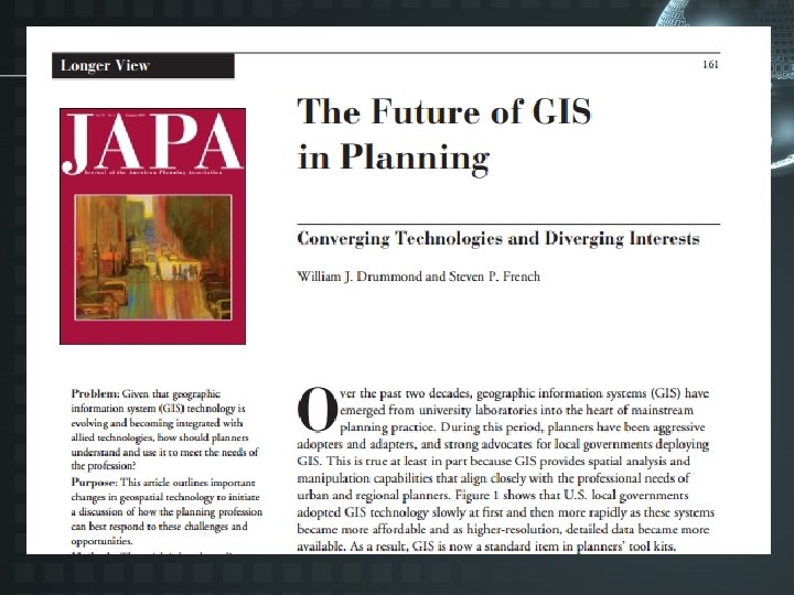
Why a GIS degree in a City Planning School?
A Brief History of GIS at Georgia Tech: 1980 s • 1988: Nick Faust, Mike Rowan, David Sawicki, and Bill Drummond propose GIS research center (unsuccessfully) • 1988: Drummond teaches first GIS course at Georgia Tech • 1989: Drummond and Rowan receive $90 k GT focused research proposal grant • 1990: Drummond, Faust, and Rowan develop strategic plan, receive $300 k from GT President Pat Crecine
A Brief History of GIS at Georgia Tech: early 1990 s • 1990: GIS center locates in Baker Building • 1990: USGS and Georgia DNR co-locate GIS units at GIS center • 1997: Drummond and Ray Argo (of UGA) propose Georgia GIS Clearinghouse, receive $300 k per year • 1997: Drummond and Argo propose University System strategic initiative in GIS, receive $250 k per year
A Brief History of GIS at Georgia Tech: to present • 1997: GIS center renovates and occupies Architecture annex building 1998: Steve French becomes full-time GIS Center director • 2000 s: Nick Faust continues teaching and research through Center • 2011: Subhro Guhathakurta becomes GIS Center director • 2012: MS-GIST degree approved • 2014: GIS Center moves to Tech Square
Why MS-GIST? • What does GIS stand for: geographic information systems or geographic information science? • UCGIS and AAG curriculum is called: Geographic Information Science and Technology Body of Knowledge (2006) • Classification of Instructional Programs: CIP 45. 0702 is ”Geographic Information Science and Cartography. ” • MS-GIST is a STEM program
Georgia Tech School of City and Regional Planning Master of Science in Geographic Information Science and Technology New Student Orientation
New Student Orientation Part 3 Master of Science in Geographic Information Science and Technology
Traditional required courses • • • CP 6581: GIS Programming CP 6531: Introduction to Remote Sensing CP 6006: Visualization CP 6591: Professional Seminar CP 6521: Advanced GIS CP 6024: Analytic Methods CP 6592: Capstone Preparation CP 6595: GIS Systems Design CP 6596: GIS Capstone
Recommended required courses • • • CP 6581: GIS Programming CP 6531: Introduction to Remote Sensing CP 6006: Visualization CP 6591: Professional Seminar CP 6025: Statistical Methods CP 6521: Advanced GIS CP 6592: Capstone Preparation CP 6595: GIS Systems Design CP 6596: GIS Capstone
Specialized GIS classes • Fall semester: – CP 6541: Environmental GIS • Spring semester: – CP 6570: Socioeconomic GIS – CP 8853 CA: Spatial Networks – CP 8853 BD: Climate Change Analytics – CP 8853 AR: Public Health Analytics (? )
GIS Certificate (MCRP) • One foundational course: Advanced GIS • Two skills courses: Remote Sensing Environmental GIS Transportation & GIS Socioeconomic GIS • One policy course from a list of six MCRP (required!) specialization courses
Program of study • Three semester plan for – All required courses – Two specialized GIS courses – Two electives • Approved and signed by faculty advisor • Later moved to graduation petition • Approved by Johnnie, faculty advisor, and registrar • You then graduate with MS-GIST
Sample Program of Study Form
Recommended methods class
Traditional methods class
MS-GIST Student Manual
MS-GIST Student Manual
A few last details • • Academic advising (Johnnie Sawyer) Faculty advising (BD or other GIS faculty) Financial aid sources Waiving required courses Effective writing primer Six MCRP specializations SPA representative Dual MCRP/MS-GIST degree
Questions for thought and discussion • Is geographic information science really a science? • Is GIS “just a tool like MS-Word” and planners should not offer GIS courses or planning-based GIS specializations/certificates? • City planning involves fundamental normative values such as sustainability, justice, and resilience. How compatible is geographic information science with ethical values such as sustainability?
Georgia Tech School of City and Regional Planning Master of Science in Geographic Information Science and Technology New Student Orientation