Geomorphology of Guam BI 201 Natural History of

Geomorphology of Guam BI 201 Natural History of Guam Class Presentation 17

• Geomorphology – Geomorphology includes the general configuration of the earth' s surface and the evolutionary and catastrophic changes that occur in the land forms – In an effort to quantify geomorphology, some geologists use the following model: Geomorphology = F (rock type × rock structure × tectonic stability × climate × time)

• Geomorphological Divisions of Guam – Guam can be subdivided into four or more physiographic divisions:


• Limestone plateau – This is the area north of the Adelup-Pago Point Fault (Rte. 4) and along the southeast coast from Yona to Malojloj, and the Orote Peninsula – The limestone plateau is composed of relatively soluble Upper Miocene-Pleistocene limestones and argillaceous limestones that dissolve to thin clayey soil atop cavernous bedrock – Solution of the bedrock is promoted and directed by hundreds of faults and joints


– Northern Guam has been moving generally upward for the past 25– 30 million years and has been totally emergent for at least the past one million years and partially emergent for probably 2– 3 million years – Guam has been tropical the entire time of its emergence – Karst and karren topography • Karst topography is highlighted by sink holes (sinks, dolines, cockpits) and uvalas, located probably at fracture intersections • Karst develops by focused corrosion • Sinks develop by corrosion (solution) or collapse or a combination
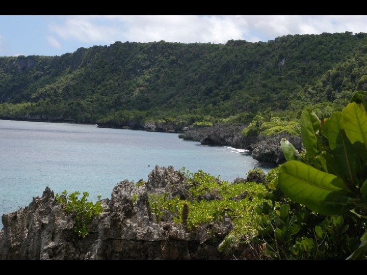
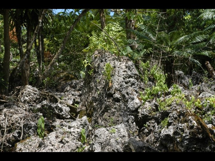

• Karren topography is defined by fretted pinnacles of bare rock separated by narrow fissures • Karren or karrenfels occur in younger limestones (softer and more porous) by dispersed corrosion • Karren usually precedes karst development • Karren development is characterized by little or no surface drainage, except on argillaceous limestone.
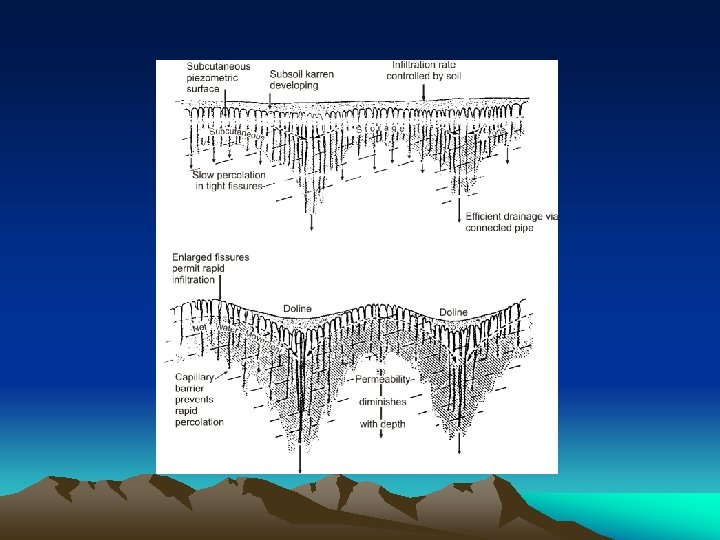

– The degree of karstification is related to the dynamics of the water lens, which in turn is controlled by sea level
 along the perimeter of")
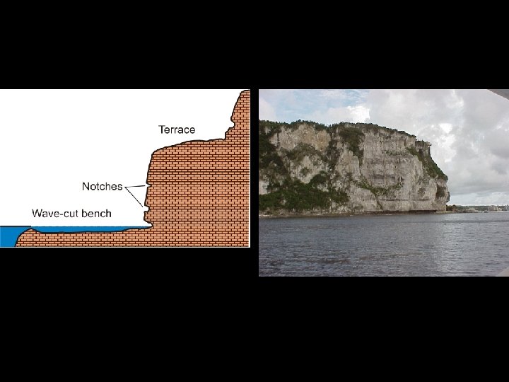
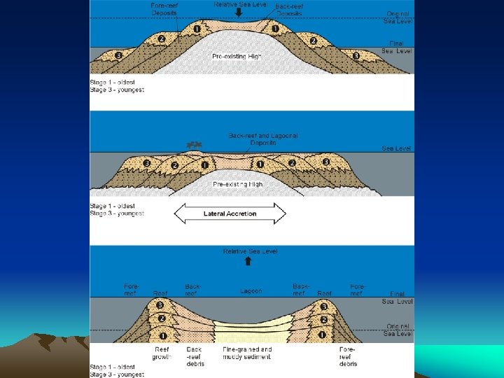
– Terraces • Distinctive, stepped terraces (sometimes with distinct notches) along the perimeter of the northern plateau are testimony to both erosional and depositional processes • Terraces may reflect reef front progradation (depositional) or wave abrasion (erosional) • A terrace feature could conceivably form either as an island emerges or submerges • In addition, some terraces are definitely tilted
, Macheche Hill, and the cliff running above")
– Mt. Barrigada (= Barrigada Hts. ), Macheche Hill, and the cliff running above Harmon (below the airport) behind the Hafa Adai Theaters, Ben Franklin, etc. are normal fault scarps

• Fena basin – The Fena Basin is the Naval Magazine area – Bedrock in the Fena Basin consists of older limestones (Oligocene-Middle Miocene) and soft, poorly cemented volcaniclastic formations – The limestones are very compact, hard rocks that are shot through with fractures – Volcanic rocks are also generally tuffaceous in composition; these tuffs weather to clay – Fena Basin has been emergent for at least 10 million years.
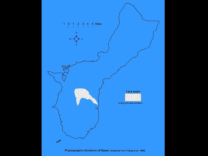

– The geomorphology in the Fena Basin is mature karst – Where limestones crop out or are immediately beneath volcanics, large dolines, uvalas, "lost rivers" and haystacks (towers) are common geomorphic features, especially immediately north of Fena Lake – Streams occur on the surface only where the bedrock is highly tuffaceous or volcaniclastic

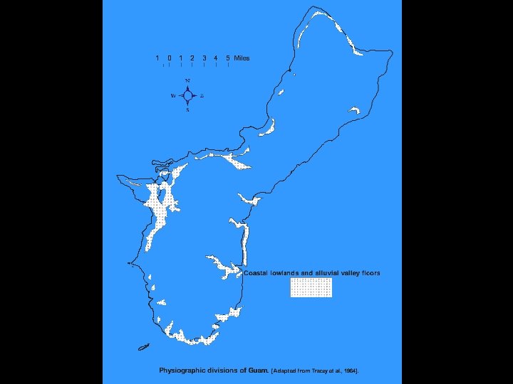
• Coastal lowlands and alluvial valley floors – Coastal lowlands are characterized by fault controlled drainage and geomorphology, e. g. , Talofofo River valley – The Talofofo watershed occupies down-faulted blocks (graben? ) along the Talofofo-Santa-Rita fault line – Topography of coastal lowlands is dominated by eroded fault line scarps – The Talofofo watershed has been emergent for about 1– 2 million years

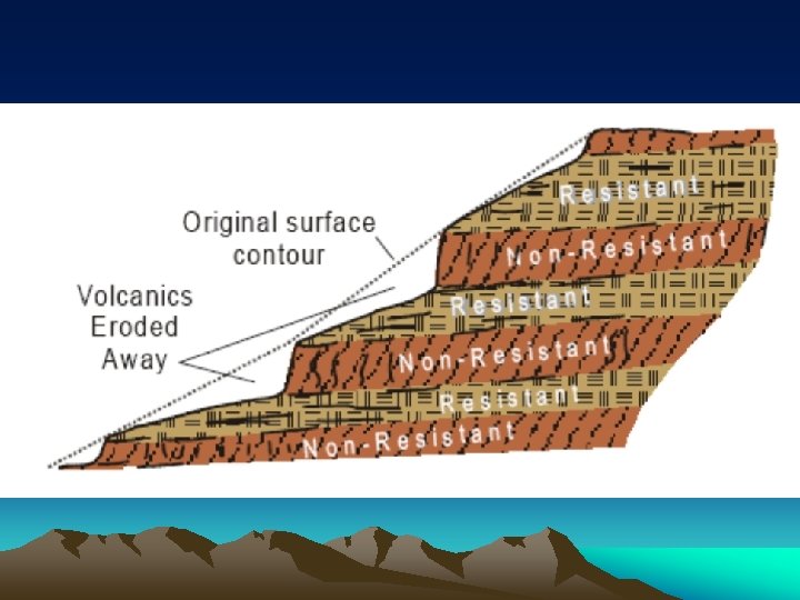
• Volcanic uplands – Most of southern Guam and several small eroded outliers in the north are volcanic uplands – This terrain is highly dissected, mature topography with slopes dependent upon volcanic bedrock resistance to weathering and erosion • Volcaniclastics erode more rapidly than flows • Saprolite mantled bedrock is stripped away rapidly when slopes are unvegetated, exposing fresh volcanic debris • High clay content of the watershed slows percolation
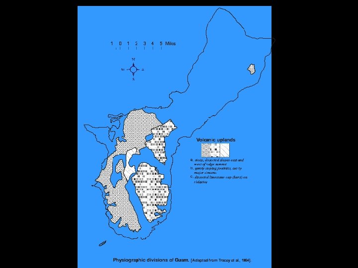

• In several notable cases, drainage is joint controlled (e. g. , Bubulao River) • Highlands have been emergent for at least 8 million years.

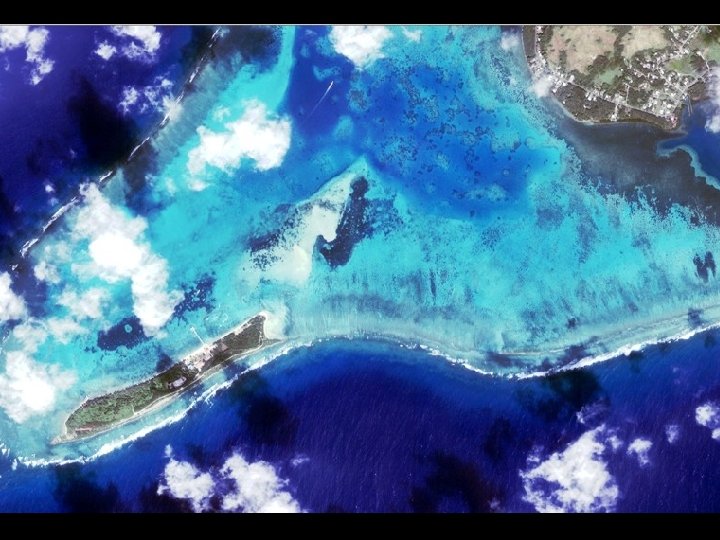
• Coral reefs – Reefs build upon existing topography, which on Guam is either a volcanic or limestone bench or terrace – The antecedent topography (substrate) of limestone is likely to be karren or karst, while volcanics tend to be planed off – Because Guam is generally emerging, the reef platforms tend to be shallow subtidal to intertidal, and lack good lagoonal development

Fringing reef in Tumon Bay

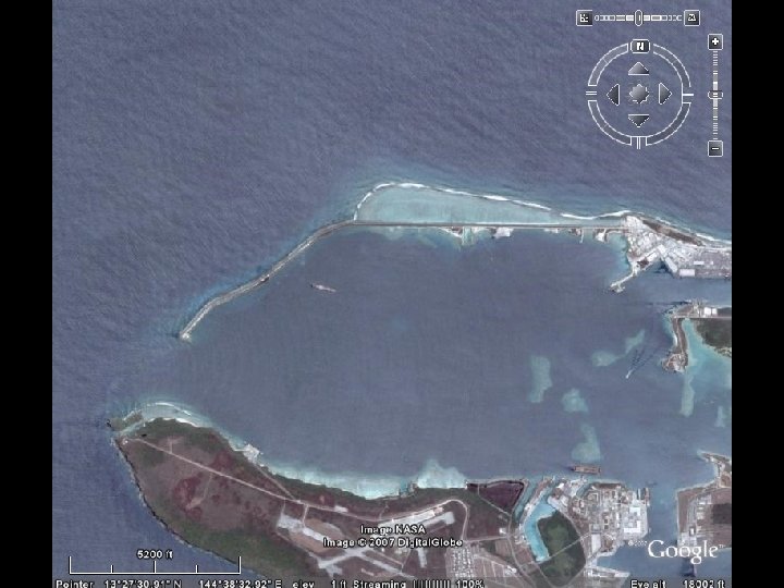
– The vast majority of reefs around Guam are fringing and apron reefs – The only true barrier reefs are on the north side of the Glass Breakwater (Luminao barrier reef) and Cocos barrier reef – Cocos Island is built upon a fossil barrier reef margin – Emergence destroys coral reefs; submergence preserves coral reefs
- Slides: 30