GEOGRAPHY THE PLACE WHERE HISTORY HAPPENS Globea scale

GEOGRAPHY THE PLACE WHERE HISTORY HAPPENS

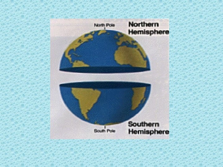
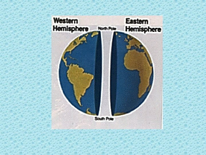
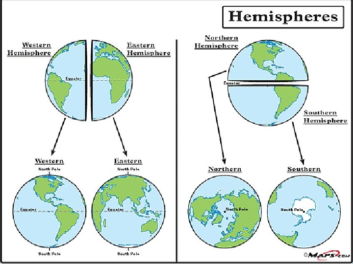
Globe-a scale model of the Earth. Globes show the actual shapes, sizes, and locations of all Earth’s landmasses and bodies of water.

ACTIVITY: THINK ABOUT IT…. .

E H T S I E B O L G A * E T A R U C C A Y ONL N O I T A T N E S E REPR. H T R A E E H T OF

1. What is a map? 1. A map is a drawing that shows regions of the Earth on flat surfaces.

2. What is a map projection? 2. It is the way cartographers transfer the curved surface of the earth onto a flat map.

3. What are the four main properties of a map? 3. The 4 properties are: area distance direction shape (ADDS!)

* ALL TYPES OF PROJECTIONS AND COMBINATIONS OF PROJECTIONS HAVE DISTORTIONS. NONE OF THEM SHOW ALL FOUR PROPERTIES ACCURATELY AT THE SAME TIME!!!

*Mercator Projection *Robinson Projection accurately shows shape and direction but distorts distance and size; ship’s navigators use it to chart a straight line course between two ports. Compromise between Mercator and equal-area; gives a useful overall picture of the world; accurately shows size and shape of most continents and oceans but distorts size of polar regions.

*Compass Rose *Key *Scale Bar This shows direction; letters N, S, E, W are displayed. Shows symbols and colors used on map and what each one means. Helps you find actual distance between points; most show miles and kilometers.

Political Maps Physical Maps Show political borders; countries, continents and divisions within countries. Represent what a region looks like by showing its major physical features Such as hills and plains; also shows elevation.

Special Purpose Maps Four types of Special Purpose Maps 1. Climate 2. Language 3. Human Migration 4. World Land Use

1. What are parallels? 1. Parallels are horizontal lines that run from east to west. The Equator is O degrees latitude.

2. What are meridians? 2. Meridians are vertical lines that run from north to south. The Prime Meridian is O degrees longitude.

3.

4.

5.

6. Parallels vs Meridians • Parallels show us the LATITUDE of a location • Meridians show us the LONGITUDE of a location

7. LATITUDE vs LONGITUDE • LATITUDE measures distance NORTH and SOUTH of the EQUATOR Longitude measures distance EAST and WEST of the Prime Meridian

8. Citing Latitude & Longitude • Latitude ALWAYS comes before Longitude (Latitude comes first alphabetically too!) • Example: Cairo, Egypt is found at 30°N Latitude, 30°E Longitude • (It is 30°N of the Equator and 30°E of the Prime Meridian)
Use the MERIDIANS to find LONGITUDE. • 2)Trace a vertical")
10. Finding LONGITUDE • 1)Use the MERIDIANS to find LONGITUDE. • 2)Trace a vertical line from the target city to the top or bottom of the map. • 3)Identify the meridians closest to your city and estimate its LONGITUDE. 4)Decide if it lies EAST or WEST of the Prime Meridian.
- Slides: 24