Geography of Maine New Hampshire Massachusetts Connecticut Rhode


- Slides: 36

Geography of Maine, New Hampshire, Massachusetts, Connecticut, Rhode Island Kelly Hall Beth Reimer

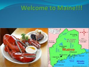
Maine Coastline length: 367 km (228 mi) n Shoreline length: 5, 597 km (3, 478 mi) n

Geography of Coastline Mount Desert Island Penobscot Bay

Character of shoreline Rugged rocky shoreline, some sandy beaches, natural harbors, >1, 300 rocky islands n Largest island: Mount Desert Island – Impt. Islands: Vinalhaven Island, Islesboro, Swans Island, Deer Island, Isle au Haut, Monhegan Island n Largest Harbor: Portland – Impt. Harbors: Boothbay, Rockland, Bar, Eastport n

Major Rivers/Estuaries Penobscot River flows East/South to Penebscot Bay n Kennebec River flows South to Atlantic n Androscoggin River flows South to join Kennebec River

Character of Coastal Region Industries: fishing, shipbuilding, trading center n Wildlife: many sea birds, saltwater fish & shellfish – lobster n Geology: exposed bedrock, glacial terrain and soils n Climate: humid – moderate summers/long winters – 24 F – 80 F – 40 in. precip. n

Tidal Range

Development of Shoreline Coastal Population: 885, 703 n U. S. rank: 21 st of 35 n

New Hampshire Coastline length: 21 km (13 mi) n Shoreline length: 211 km (131 mi) n

Geography of Coastline Piscataqua River Inlet

Character of Shoreline Rocky shores, sandy dunes, some sandy beaches, few islands n Isles of Shoals – 10 mi SE of Portsmouth n Largest inlet: harbor at Portsmouth n

Major Rivers/Estuaries n Piscataqua River forms natural harbor at Portsmouth

Character of Coastal Region n Industries: tourism, fishing, shipping n Wildlife: bald eagles, ospreys n Geology: granite, glacial terrain and soils n Climate: humid – short summers/long winters – 26 F – 70 F – 40 in. precip.

Development of Shoreline Coastal Population: 350, 078 n U. S. rank: 29 th of 35 n

Connecticut Shoreline length: 995 km (618 mi)

Geography of Coastline Thames River Connecticut River Housatonic River New Haven Harbor

Character of Shoreline Rocky inlets, many sandy beaches, stretches of tidal marshes, few small islands n Several good natural harbors, coves n Most impt. Harbor – New Haven n

Major Rivers/Estuaries Connecticut River flows S to Long Island Sound n Housatonic River flows SE to Sound n Thames River – very long tidal estuary n

Character of Coastal Region Industries: shellfish, tourism, marine commerce, defense-related manufacturing Wildlife: Atlantic Salmon, piping pover Climate: Long hot summers, cold winters 30 F – 72 F 50 in. precip.

Tidal Range

Development of Shoreline Coastal population: 2, 030, 017 n U. S. rank: 16 th of 35 n

Massachusetts Coastline length: 309 km (192 mi) n Shoreline length: 2, 445 km (1, 519 mi) n

Geography of Coastline Merrimack River Charles River

Character of Shoreline n n n NE coast: jagged, forested, coves/bays Mid. Atlantic coast: sandy beaches, grassy dunes, marshes Impt. Islands: Martha’s Vineyard, Cape Cod, Nantucket, Elizabeth Island Largest bays: Mass. Bay, Cape Cod Bay, Buzzards Bay Largest harbors: Boston, New Bedford, Salem, Gloucester, Plymouth

Major Rivers/Estuaries n Charles River flows to Boston Bay, joins w/ Mystic River n Merrimack River flows to Atlantic at Newburyport

Character of Coastal Region n n Industries: tourism, fishing, shipping, aquaculture Wildlife: Whales Geology: edge of glacial extent, glacial terrrain and soils Climate: humid – long hot summers, cold winters – 32 F – 90 s F – 46 in. precip.

Tidal Range

Development of Shoreline n Coastal population: 4, 494, 398 n U. S. rank: 7 th of 35

Rhode Island Coastline length: 64 km (40 mi) n Shoreline length: 618 km (364 mi) n

Geography of Coastline Narrangasett Bay Prudence Island

Character of Shoreline Inlets, islands in Bay, shallow lagoons, salt marshes, long sandy barrier beaches, rocky haedlands w/ sandy beaches n Narragansett Bay extends 26 mi inland – Impt. Islands: Block Island, Rhode, Connecticut, Prudence – 30 smaller islands n

Major Rivers/Estuaries Northern R. I. drained by river systems flowing to Narragansett Bay n South drains to Atlantic n

Character of Coastal Region Industries: Tourism n Wildlife: piping plover n Climate: humid n – 30 F – 80 s F – 46 in. precip.

Tidal Range

Development of Shoreline Coastal population: 685, 478 n U. S. rank: 20 th of 35 n

References: http: //www. ocrm. nos. noaa. gov/pdf/statestats. pdf http: //www. nescenicphoto. com/ http: //www. netstate. com/states/maps/md_maps. htm http: //www. state. me. us/mcp/online_resources/data_and_maps. html http: //encarta. msn. com/encnet/refpages/Ref. Article. aspx? refid=761577633 http: //www. state. nh. us/coastal/ http: //encarta. msn. com/encnet/refpages/Ref. Article. aspx? refid=761577742 http: //www. seacoastnh. com/arts/photosbook/ http: //www. state. ma. us/czm/ http: //encarta. msn. com/encnet/refpages/Ref. Article. aspx? refid=761577045 http: //kd. mysearch. myway. com/jsp/GGimg. jsp? st=bar&ptnr. S=KD&searchfo r= n http: //tidesonline. nos. noaa. gov/ n n n
 Both new hampshire and new york desire more territory
 Leanne keene french ambassador arrives from paris
 Principle of separation of powers
 Nh scholars
 Facsimiles ltd nashua new hampshire
 New hampshire lobbying
 Length of maine coastline
 New hampshire department of administrative services
 Pratt and whitney new hampshire
 New hampshire state budget
 Ri small business development center
 Ride ngsa portal
 Rhode island board of governors for higher education
 Interesting facts rhode island
 Dr chopra rhode island
 Summit rhode islands toursism
 Pombo torcaz vias extinção
 Ri eohhs transportation
 Rigl §44-30-12(c)(8)
 Rhode island environmental police
 Rhode island
 Stem cell therapy rhode island
 Ricas practice test math
 Ricas accommodations
 Rhode island comprehensive assessments system
 Rhode island stormwater manual
 Logisticare itp claim form
 Ex post facto law
 Connecticut division of criminal justice
 Decd
Decd Connecticut college transfer
 Connecticut common core state standards
 Ct state sex offender registry
 Willimantic ct map
 Ctsavin
 Ct j1 waiver
 Ct alternate assessment


