Geography of Ancient China Chinas harsh deserts u


 Fertile soil called LOESS u Known as “China’s Sorrow” for")


- Slides: 15
Geography of Ancient China
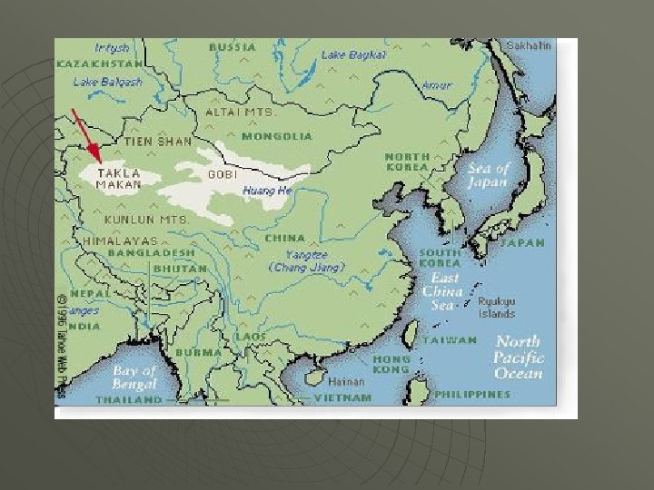
China’s harsh deserts… u GOBI DESERT to the east Not as dry as Taklamakan desert u Natural barrier from the Mongols to the north u u TAKLAMAKAN DESERT to the west “Sea of Death” u 2 nd largest in the world u Poisonous snakes, sandstorms, boiling days, freezing nights u Natural barrier from Mongols u
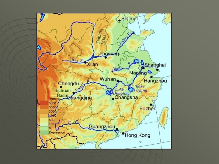
Bodies of Water u u Many rivers flow through China, most running west to east The 3 major rivers are: 1. CHANG RIVER (YANGTZE) 2. HUANG RIVER (YELLOW) 3. XI (pronounced SHEE)
u HUANG RIVER (yellow) Fertile soil called LOESS u Known as “China’s Sorrow” for the devastating floods u Ancient Chinese built DIKES (wall) u These walls cause the river level to rise and flood the fields ruining crops u
China’s Sorrow: Huang He River
u CHANG RIVER Over 3, 000 miles long u Central China u Important commercial waterway for trade within China u u XI RIVER Southern China u Important commercial waterway within China u
Chinese pollution
Clothing Recommendations based upon China’s climate
CLIMATE u Temperatures are more extreme in NORTH, causing more rainfall
AGRICULTURAL MAP u Climate in the south is better for agriculture
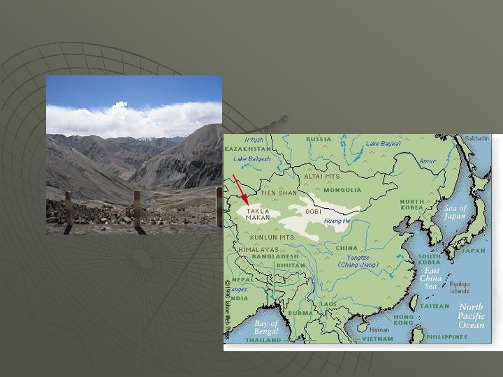
More isolation…China’s Mountains u KUNLUN MOUTAINS Runs eastward along Tibetan plateau u Stretch along southern edge of Taklimakan and Gobi deserts u u HIMALAYA MOUNTAINS u Natural barrier from INDIA u TIEN SHAN MOUTAINS u To the north of the deserts