
Geography Its nature and perspectives UNIT I At



- Slides: 51
Geography: Its nature and perspectives UNIT I
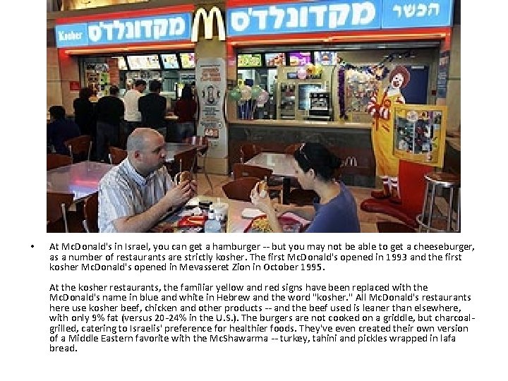
• At Mc. Donald's in Israel, you can get a hamburger -- but you may not be able to get a cheeseburger, as a number of restaurants are strictly kosher. The first Mc. Donald's opened in 1993 and the first kosher Mc. Donald's opened in Mevasseret Zion in October 1995. At the kosher restaurants, the familiar yellow and red signs have been replaced with the Mc. Donald's name in blue and white in Hebrew and the word "kosher. " All Mc. Donald's restaurants here use kosher beef, chicken and other products -- and the beef used is leaner than elsewhere, with only 9% fat (versus 20 -24% in the U. S. ). The burgers are not cooked on a griddle, but charcoalgrilled, catering to Israelis' preference for healthier foods. They've even created their own version of a Middle Eastern favorite with the Mc. Shawarma -- turkey, tahini and pickles wrapped in lafa bread.
Geography • “Write about Earth” • Greek roots • Tries to find the “Why of where? ”
Spatial Perspective • Concerned with SPACE… rooms, countries, parks, continents, cyberspace, rivers, etc… • AND the PATTERNS contained within • SPATIAL PERSPECTIVE – Identifying, explaining, and predicting human and physical patterns in space and the interconnectedness of various spaces – Utilize GEOGRAPHIC MODELS
Geographic Models • Simplified versions of what exists on the earth and what might exist in the future • Can be used by others to help explain what they see • Ex. Demographic Transition Model, Von Thunen Model, Concentric Zone Model
Physical vs. Human Geo • Physical – is concerned with spatial analysis of earth’s natural phenomenon • Human geography – Is concerned with Earth’s Human creations and their interactions
5 Themes of Spatial Perspective • • • Location Human/Environment interaction Region Place Movement
Themes… • Think of them like lenses
1 st Theme: Location • Analyzing WHERE something is and the effects that position has on Human life • ABSOLUTE vs. RELATIVE
Absolute location • Position on the global grid – Lines of Latitude • Never intersect • N and S of the Equator • North pole is 90 degrees N latitude – Lines of Longitude • E and W of the Prime Meridian (Greenwich, England) • International date line is opposite the Prime Meridian – May be influenced by Politics • Is this ANGLOCENTRIC?
Cont… • Each “line” can be broken down into minutes (60 min per degree) and Seconds (60 seconds per minute) • 1 degree is about 69 miles, minute=1. 1 miles, 1 second=100’
GMT or Universal time • • • Baseline 24 timezones… 15 degrees each May be based on politics China… one time zone (centripetal) Great circles
Relative location • Location as described in relation to places around it • Site: Internal physical and cultural characteristics • Situation: the context of a place relative to the physical and cultural characteristics around it. – Strong vs. Weak
2 nd theme: Human/Environ Interaction • Cultural Ecology • How we affect the environment and vice versa
3 rd theme: Region • Regions-spatial units that share some similar characteristics – Formal regions- have common cultural or physical features – Functional region- (nodal) places linked by a functional influence • Central node – Perceptual Region-(vernacular) determined by people’s beliefs
4 th theme: Place • Unique combo of physical and cultural attributes that gives a location its “stamp” • Religion, language, politics, artwork, etc… • Sense of Place – Persons perception of a location
5 th theme: movement • • Movement in space Information, people, goods, etc… Spatial interaction Friction of Distance – Degree to which distance interferes with some interaction – Space-Time compression • Increasing connectivity and accessibility • Distance decay-as distance increases interaction decreases
How Do Geographers Describe Where Things Are?
I. By using Maps
Geography • Word invented by Greek scholar – Eratosthenes • “Geo” means earth • “graphy” means to write • Human Geography vs. Physical – Study of where and why human activities are located where they are
Distortion • • Shape Size Distance Direction
Cardinal Points • N, S, E, W • Vs. Intermediate directions • Vs. Relative directions
Types of maps • Equal area • Conformal/orthomorphic – Maintain shape • Azimuthal – Maintain Direction • Equidistant – Maintain distance
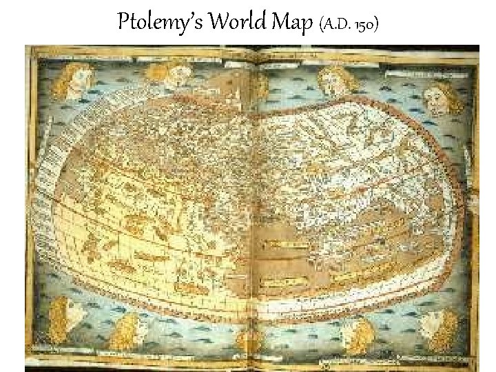
Ptolemy’s World Map (A. D. 150)
First Chapter • Geographers “where” and “why” questions – Mapping • What is a map? – Uniqueness • Place vs. Region – Similarties • Scale, Space, and connections – Space- gap – Connections- relationships across space
Which of the following is a “where” category? • 1) Mapping • 2) Uniqueness • 3) Similarities
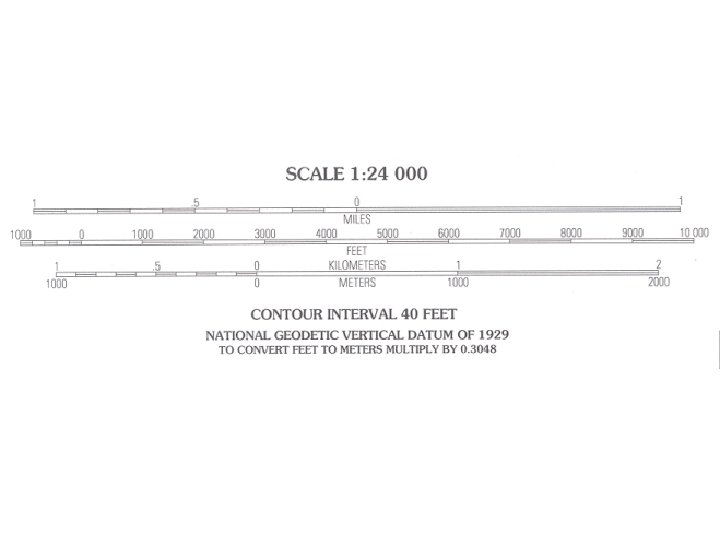
Map Scale • the relationship between a feature’s map size and actual size • Map scale is shown in 3 ways: – fractional (1: 24, 000) – written/verbal • (one inch = 24, 000 inches) – graphic or bar line
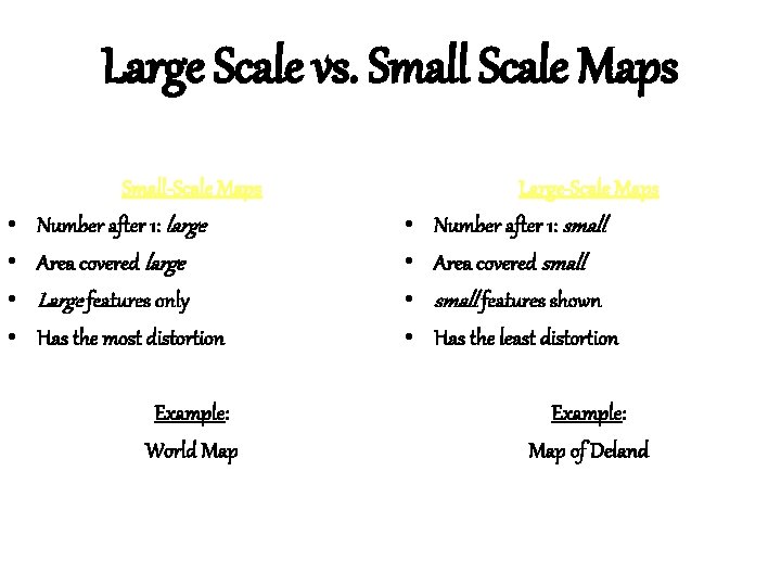
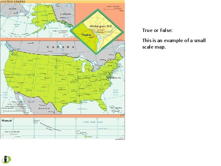
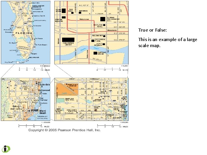
Large Scale vs. Small Scale Maps • • Small-Scale Maps Number after 1: large Area covered large Large features only Has the most distortion Example: World Map • • Large-Scale Maps Number after 1: small Area covered small features shown Has the least distortion Example: Map of Deland
True or False: This is an example of a small scale map.
True or False: This is an example of a large scale map.
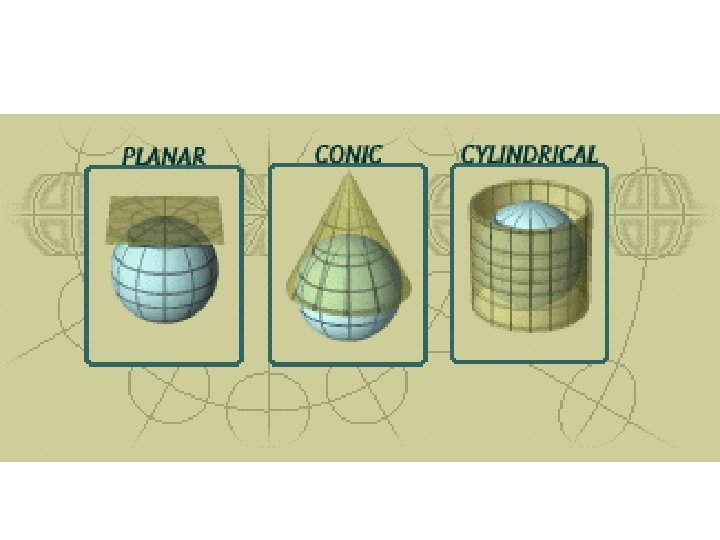
Map Projections • A systematic method of transferring the globe grid system from the earth’s curved surface to the flat surface of a map. • This results in 4 types of distortion: - shape - distance - relative size - direction
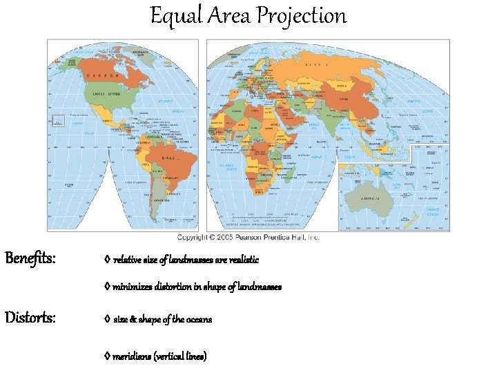
Equal Area Projection Benefits: ◊ relative size of landmasses are realistic ◊ minimizes distortion in shape of landmasses Distorts: ◊ size & shape of the oceans ◊ meridians (vertical lines)
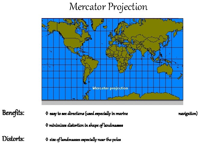
Mercator Projection Benefits: ◊ easy to see directions (used especially in marine ◊ minimizes distortion in shape of landmasses Distorts: ◊ size of landmasses especially near the poles navigation)
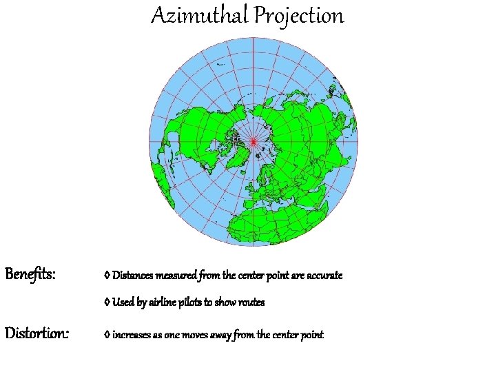
Azimuthal Projection Benefits: ◊ Distances measured from the center point are accurate ◊ Used by airline pilots to show routes Distortion: ◊ increases as one moves away from the center point
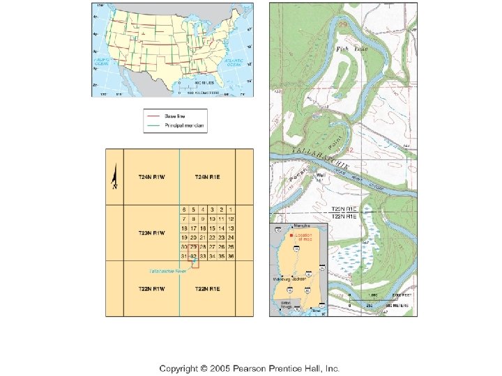
Township & Range System • Land Ordinance of 1787 – Divided U. S. into sections to make land sales in the west easier. • Townships – a 6 x 6 mile area (36 square miles) – divided into 36 sections – the principal meridian in Florida runs through Tallahassee.
II. By using Contemporary Tools
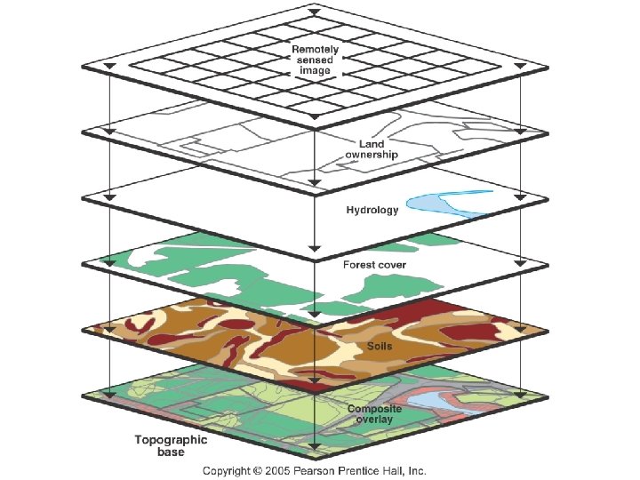
GIS • Geographic Information System – a computer program that displays geographic data. – information is stored in layers – can be used to compare spatial data – shows relationships among different kinds of information
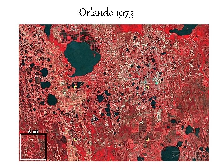
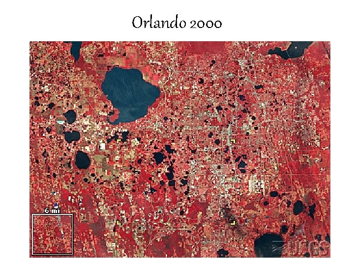
Remote Sensing • The acquisition of data about Earth’s surface from a satellite. – used in navigation (GPS) – especially good at locating heat sources…growing plants, animals, currents, air temperatures.
Orlando 1973
Orlando 2000
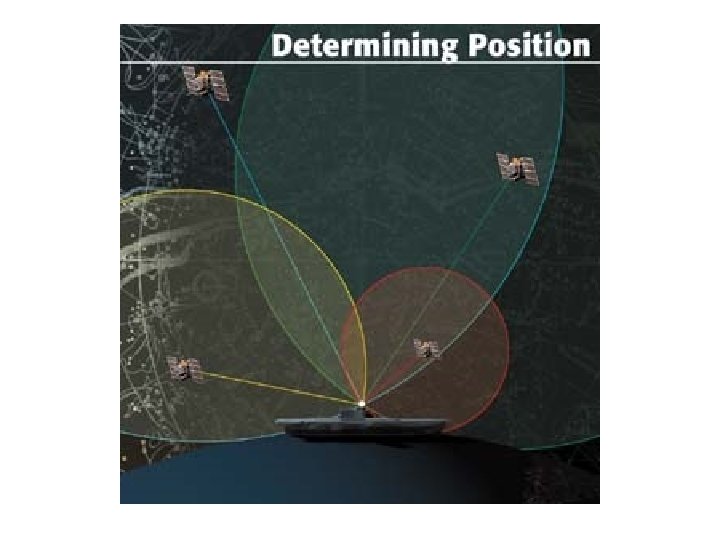
GPS • • • Global Positioning System 24 satellites Rely on timing…atomic clocks Receivers only receive Can be used with GIS