Geography In The Western Hemisphere 5 4 GEOGRAPHY


- Slides: 15
Geography In The Western Hemisphere
� 5. 4 GEOGRAPHY IN THE WESTERN HEMISPHERE: The diverse geography of the Western Hemisphere has influenced human culture and settlement in distinct ways. Human communities in the Western Hemisphere have modified the physical environment.
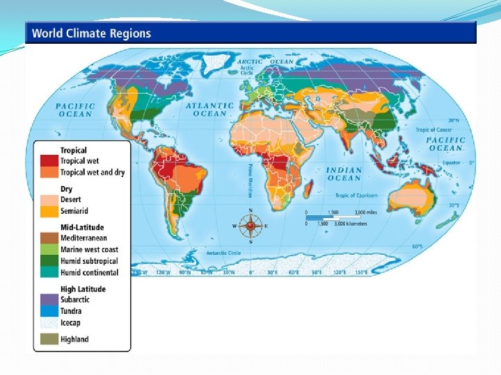
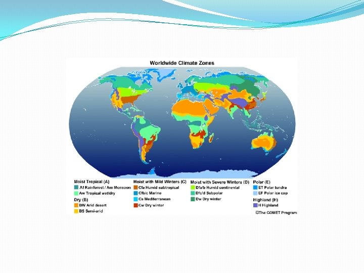
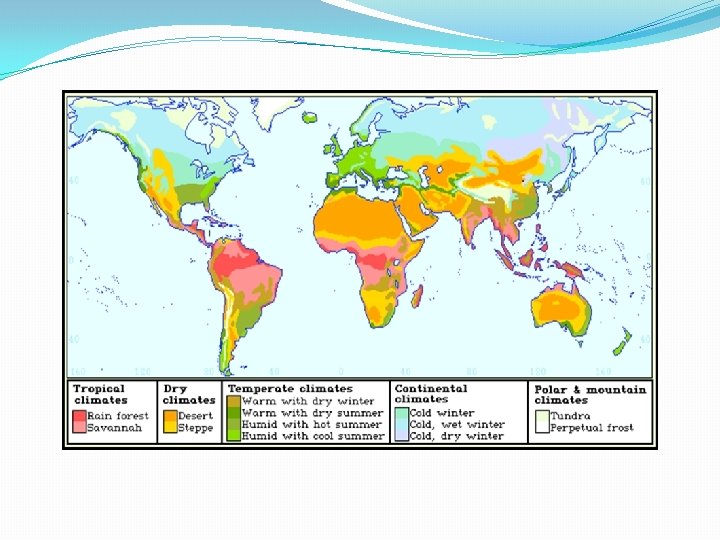
� 5. 4 a Physical maps reflect the varied climate zones, landforms, bodies of water, and natural resources of the Western Hemisphere.
� 5. 4 b The Western Hemisphere can be divided into regions. Regions areas that share common identifiable characteristics such as physical, political, economic, or cultural features. Regions within the Western Hemisphere include: �North America (Canada and the United States) �Mesoamerica (Mexico and Central America) �Caribbean �South America
� 5. 4 c The physical environment influences human population distribution, land use, and other forms of economic activity.
�Students will map the regions within the Western Hemisphere and locate major physical features within each region.
�Assignment: Label the map using the attached website. �Countries of the Western Hemisphere Activity �Countries in Western Hemisphere Labeled Map
�Western Hemisphere Movie
�Students will create a political map of the Western Hemisphere noting which countries are in which region and a political map of the United States showing the location of the states.
�Political Map �Western Hemisphere Blank Political Map
�Students will use physical, climate, and vegetation maps in combination with population density, land use, and resource distribution maps to discern patterns in human settlement and types of economic activity.
�Maps �http: //go. hrw. com/atlas/norm_htm/namerica. htm �http: //go. hrw. com/atlas/norm_htm/samerica. htm �http: //www. worldatlas. com/ �http: //education. nationalgeographic. com/education/ encyclopedia/vegetation-region/? ar_a=1