Geography Geo Earth Graphy DrawingRecording Mercator Projection Whats


")


")
")
")


")


 to these")


")
- Slides: 48
Geography Geo = Earth + Graphy = Drawing/Recording
Mercator Projection
What’s wrong with Mercator? • The North is 18. 9 million square miles. • The South is 38. 6 million square miles.
What’s wrong with Mercator? • Greenland: 0. 8 million sq. miles • Africa: 11. 6 million sq. miles
What’s wrong with Mercator? • Greenland is 0. 8 million square miles. • China is 3. 7 million square miles.
What’s wrong with Mercator? • The former Soviet Union is 8. 7 million square miles. • Africa is 11. 6 million square miles.
What’s wrong with Mercator? • Europe is 3. 8 million square miles. • South America is 6. 9 million square miles.
Robinson Projection
Peters Projection
Homolosine Projection
Dymaxion Projection
Dymaxion Projection
What other choices affect how we view the world?
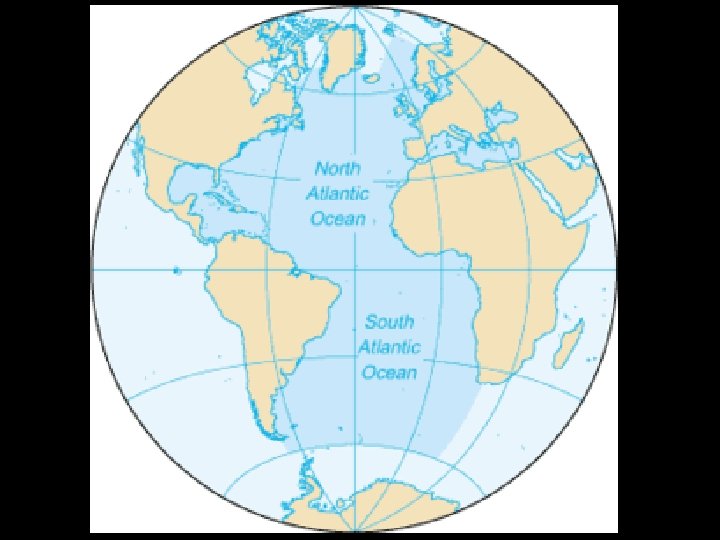
Centering: Americas
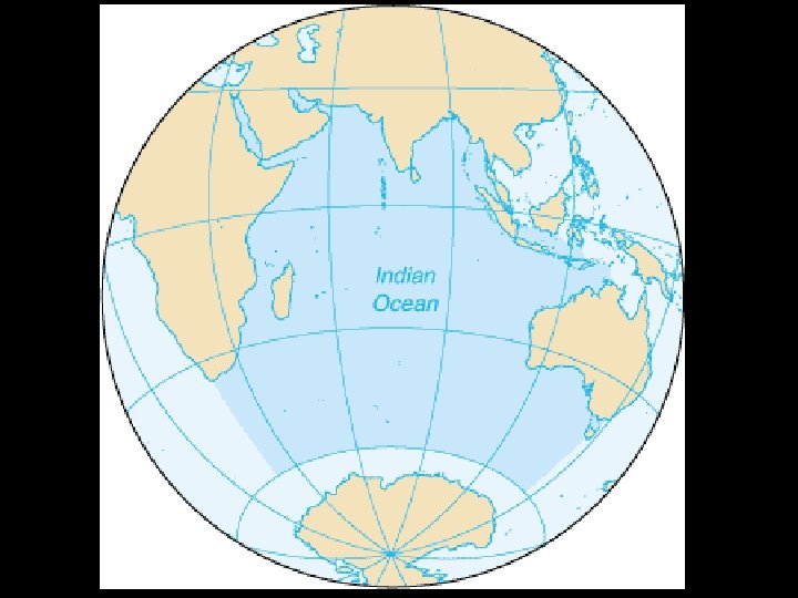
Centering: Europe/Africa (aka Prime Meridian)
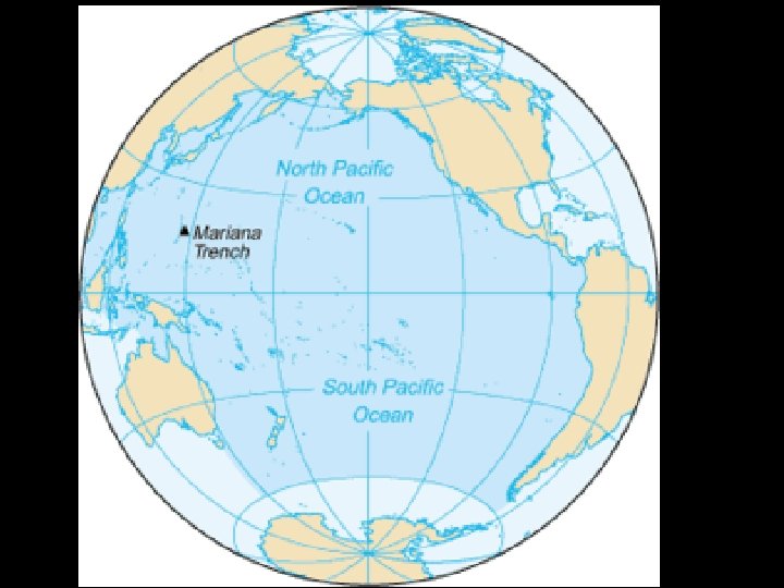
Centering: Asia/Pacific
Continents… Wait, what? ? ?
Four Continent System Americas Australia Afro-Eurasia Antarctica (not pictured)
Five Continent System Americas Eurasia Africa Australia Antarctica (not pictured)
Six Continent System North America South America Eurasia Australia Africa Antarctica (not pictured)
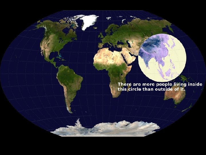
Map of the world divided into 7 regions equal in population
OK Mr. Dwyer, what do I REALLY need to know? ? ?
Official World Continents
Official World Regions
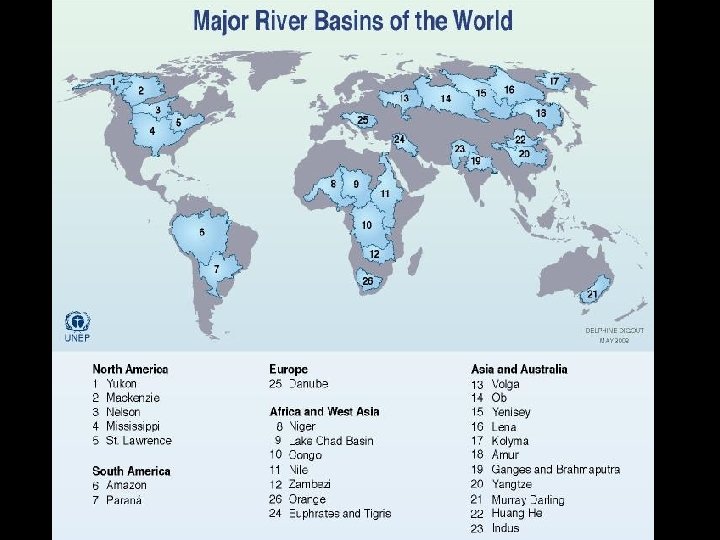
Water Regions Too…
Other important Geographic Features
Barriers
Highways
But Most Important… (to “civilized”people)
Now Let’s Put This Knowledge to Work • Take out something to write with and a piece of paper No, this is not for points!
Name a modern country in: 1. 2. 3. 4. 5. 6. 7. 8. North Africa South Asia The Mediterranean Basin The Tigris/Euphrates Basin Central Asia Latin America The Indus River basin The Middle East
1. 2. 3. 4. 5. 6. 7. 8. Give geographic labels (continent/region/basin) to these countries China India Egypt Mexico Italy Canada Thailand Australia
Name a modern country in: 1. North Africa – Morocco, Algeria, Tunisia, Libya, Egypt (Egypt counts as many things!) 2. South Asia – Pakistan, India, Sri Lanka, Nepal, Bangladesh 3. The Mediterranean Basin – Spain, France, Italy, Malta. Croatia, Bosnia, Montengro, Albania, Greece, Turkey, Cyprus, Syria, Lebanon, Israel, Egypt, Libya, Tunisia, Algeria, Morocco 4. The Tigris/Euphrates Basin – Iraq, Kuwait, Syria 5. Central Asia – Kazakhstan, Turkmenistan, Kyrgyzstan, Tajikistan, Uzbekistan, Afghanistan, Iran, Russia 6. Latin America – Mexico, Guatemala, Honduras, Belize, El Salvador, Niaragua, Costa Rica, Panama, Colombia, Venezuela, Brazil, Guyana, Suriname, French Guyana, Ecuador, Peru, Chile, Bolivia, Paraguay, Uruguay, Argentina 7. The Indus River basin – Pakistan, India 8. The Middle East – Egypt (AGAIN!), Isreal, Lebanon, Syria, Turkey, Jordan, Saudi Arabia, Yemen, Oman, Qatar, UAE,
Give geographic labels to these countries 1. China – Asia, East Asia, Pacific, South China Sea, Huang He, Yangzi 2. India – Asia, South Asia, Indian Ocean, Arabian Sea, Bay of Bengal, Indus, Ganges 3. Egypt – Africa, North Africa/Middle East, Mediterranean, Red Sea, Nile 4. Mexico – North America, Latin America, Pacific, Gulf of Mexico, Caribbean 5. Italy – Europe, Southern Europe, Mediterranean 6. Canada – North America, Pacific, Arctic, Atlantic 7. Thailand – Asia, Southeast Asia, Indian Ocean, South China Sea 8. Australia – Australia, Oceania, Indian Ocean, Pacific Ocean
Changes in History!
Dating Systems BC/AD or BCE/CE? BCE = BC CE = AD
Historiography
Which Afro-Eurasians discovered the New World first?
Types of History
“Great Man” History Political History Economic History
Social History Environmental History Cultural / Religious History
What’s the right answer?
SPI CE- Why not use them all? Social Political Interaction Cultural Economic (with Environment)