Geographic Regions AR Tourism Industry Unit 1 What


- Slides: 32
Geographic Regions AR Tourism Industry Unit 1
What do you know about Arkansas? • https: //www. youtube. com/watch? v=Chr 1 u 23 J 6 ro&list=PLi 01 Xo. E 8 j. Y oh. Hx 8 MEpq. M 9 z. Yny 9 RNs. CTas&in dex=1 • AR Floor Map Activity • Name that city activity
1. 1 Identify, analyze, and explain the various geographic regions in the State of Arkansas
1. 1. 1 Identify the different geographic regions
• There actually six geographic subregions, three in both the uplands and the lowlands. • The northwestern uplands are made up of three distinctive sub-regions: The Ozark Mountains, the Arkansas River Valley, and the Ouachita Mountains. • The southeastern lowlands are comprised of the Gulf Coastal Plain (The Timberlands), the Mississippi Alluvial Plain (the Delta), and Crowley's Ridge.
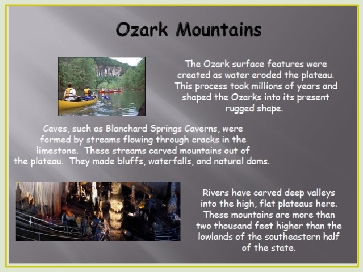
• The Ozark region of Arkansas is located in the extreme northern and western portions of the state. This area is marked by flat-topped mountains, or plateaus, which have been eroded over millions of years.
• Color the region • http: //www. aetn. org/programs/six regionjourney • Questions
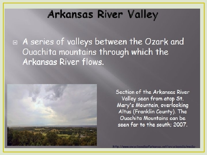
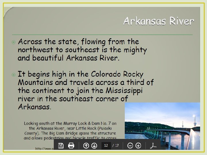
• The Arkansas River Valley is the area carved by the river long ago. This 40 mile wide trough divides the Ozark and Ouachita Mountains. Most of Arkansas's larger cities can be found in the river valley-Fort Smith, Little Rock, and several others.
• Color the region • http: //www. aetn. org/programs/six regionjourney • Questions
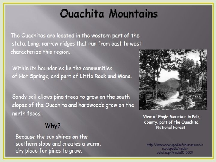
• The Ouachita Mountains lie south of the river valley. These mountains run east to west and are largely covered in pine trees. The soil here is even worse than that of the Ozarks. There are many unusual features here including Hot Springs and the diamond crater at Murfreesboro.
• Color the region • http: //www. aetn. org/programs/six regionjourney • Questions
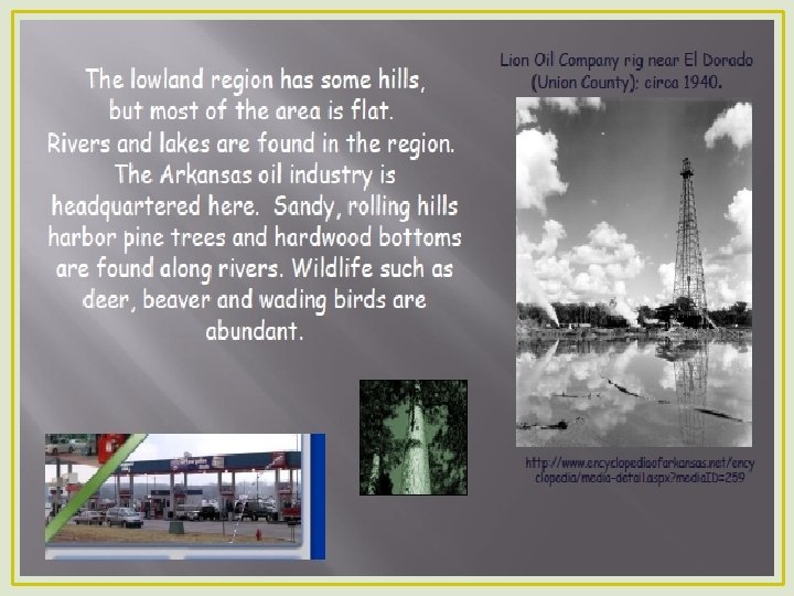
• The southern part of Arkansas is part of the Gulf Coastal Plain. This area was once covered by the Gulf of Mexico and emerged from the sea 50 million to 100 million years ago. Today there is much agriculture and timber in this area, as well as oil and natural gas deposits.
• Color the region • http: //www. aetn. org/programs/six regionjourney • Questions
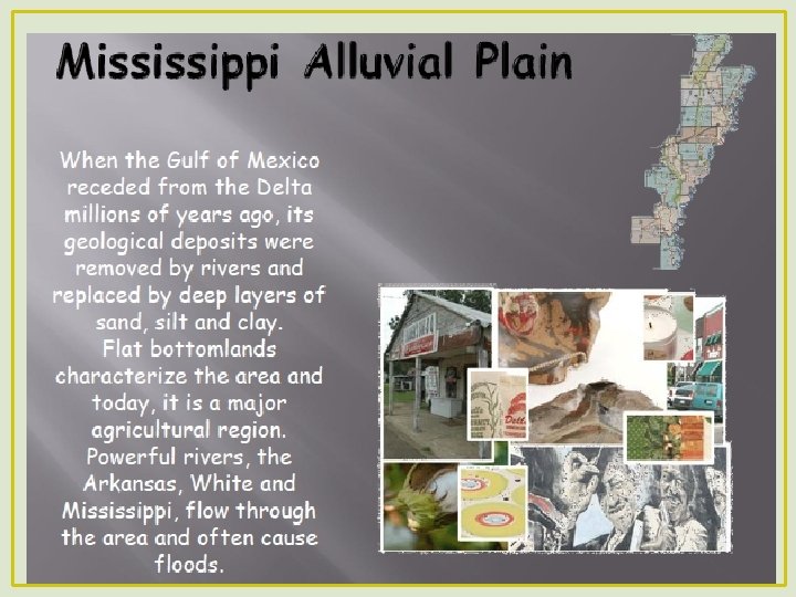
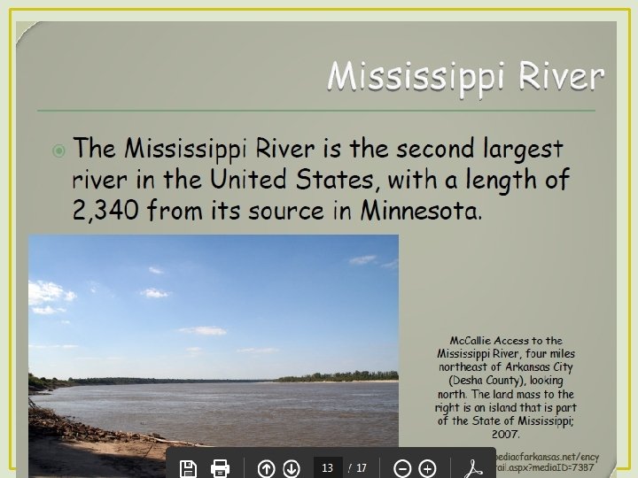
• The Delta, or Mississippi Alluvial Plain , covers the eastern portion of Arkansas. Here the Mississippi and numerous other rivers have deposited rich soils over millions of years. This area has swamps, prairies, and rich farmland where the soil is very deep. Today this region is the primary agricultural part of Arkansas.
• Color the region • http: //www. aetn. org/programs/six regionjourney • Questions
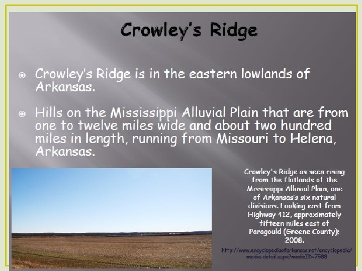
• Crowley's Ridge divides the eastern part of Arkansas. The ridge is composed of loess (windblown soil) and runs for 150 miles north from Helena. It varies in height from 250 to 500 feet above sea level. Crowley's ridge was originally an island between the Mississippi and Ohio rivers. When these rivers shifted their courses millions of years ago, Crowley's ridge was left behind as a long, low hilly formation. Most of the major cities of the Arkansas Delta can be found on or near Crowley's Ridge.
• Color the region • http: //www. aetn. org/programs/six regionjourney • Questions
• Color by region • Identify the rivers • Identify the main interstates and highways
1. 1. 2 Examine the various demographics in each geographic region and how this affects consumer behavior in each region. • Top populated cities puzzle • www. Arkansas-demographics. com • Look at state then county
1. 1. 3 Research and explain the economic conditions of each region • Go to https: //www. arkansaseconomist. c om/ • We will scroll through the charts and tables to discuss the various economic changes in the various cities • Note the following industries on one of your maps
• Census. gov activity • County vs. state
1. 1. 4 Identify and label the counties in each region • County seat puzzle • Use map to identify city • Label city on county map • Counties word search • Use map to identify location • Label on county map
• Online county map games
1. 2 Describe the parks and tourist attractions in each region. • Regional Park Brochure Project • 1. 2. 1 Locate and list the city, state and national parks in each region • 1. 2. 2 Describe the main characteristics of each park • • • camping, hiking, historical information, activities, etc. and discuss how these features relate to consumer wants/ needs • 1. 2. 3 Identify and describe the major tourist attractions in each region and discuss how these features relate to consumer wants/needs