Geographic Information Systems How GIS technologies improve regional


- Slides: 46
Geographic Information Systems How GIS technologies improve regional or local energy plans Emanuela Caiaffa caiaffa@casaccia. enea. it UNESCO Casaccia, 2006 28 th July
The present lecture is divided in two parts The first one concerns the GIS technology and how it is a good support tool for managers, designers and operators who want approach, in a territorial way, their studies for renewable energy solutions The second one concerns the e-learning course SIGEO that is a distance learning course on GIS and on Geographic Information Science
Renewable energy
GIS: a common language to connect policy-makers with scientific community
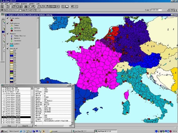
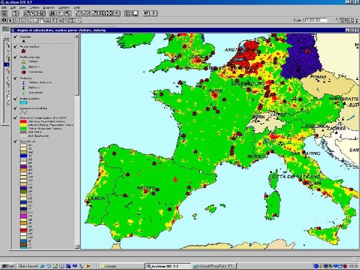
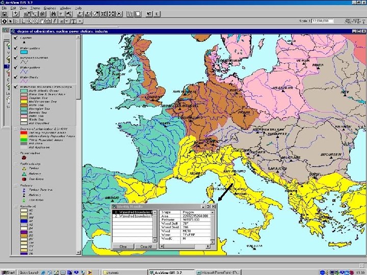
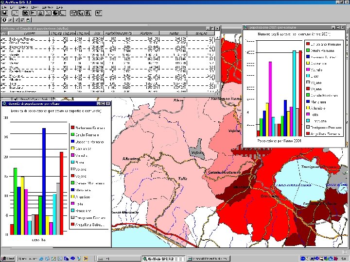
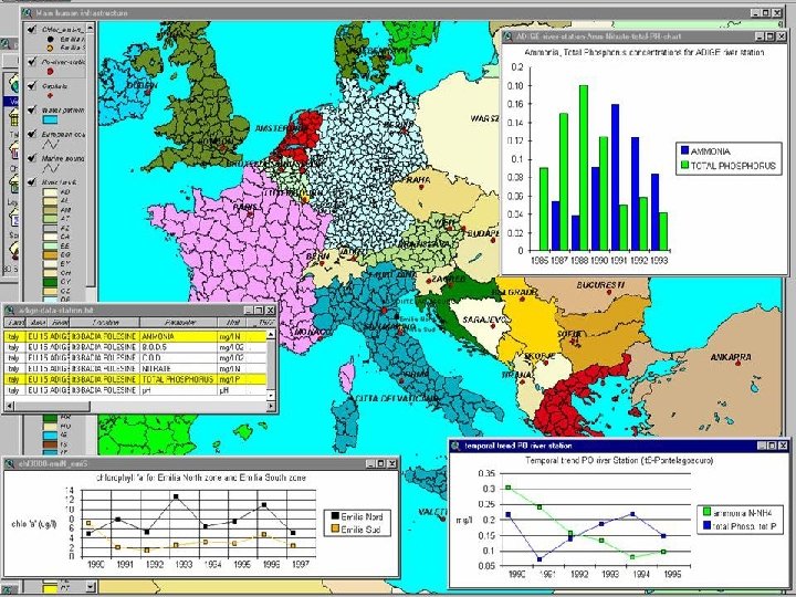
GIS: a tool for producing integrated and dynamic Knowledge
Integrated knowledge in a sense of a lot of different data type, different data format, and so on, all in one
dynamic knowledge in sense of information dynamically linked to the territory like orthoimages…
…like text files dynamically linked to the concerning territory
http: //www. itctsatta. it/ http: //www 2. minambiente. it/ http: //www. ecodibergamo. it/ http: //www. governodelterritorio. it/ http: //www. bellagiopoint. com/
SIGEO is an educational course for the dissemination of ØGeographic Information theory ØGeographic Information Systems
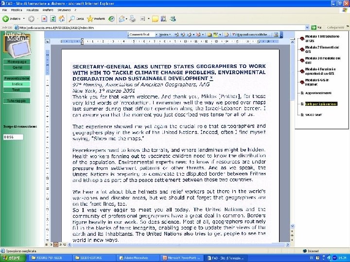
SIGEO is working on ENEA web site devoted to Distance Learning: www. odl. casaccia. enea. it Project in charge: Ing. Anna Moreno Web site in charge: Ing. Flavio Fontana
SIGEO addresses Ødecision makers Øadvisor institution for policy makers and stakeholders working for public administration Øanyone would start own knowledge about GIS and its applications
SIGEO looks to furnish theoretical and practical fundamental elements useful for Øto acquire a basic knowledge of the GIS meaning Øto evaluate effective GIS designing and building opportunity having clear in mind what are the final objectives Øto be able “to read” and to interpret elaborated data through thematic maps that represent the GIS top achievement
Methodological approach SIGEO as a product of both GIS and methodological expertise combination SIGEO course contents are structured following KM 2 methodology
Module 1 Lecture 2 Unit Lecture 3 Module 4 Lecture 1 Lecture 2 Unit Lecture 3 Module 2 Lecture 2 Unit Module 5 Lecture 1 Lecture 2 Lecture 3 Unit Lecture 4 Unit Lecture 5 Unit Studies in depth Lecture 4 Unit Lecture 5 Terminology Self-assessment Link for curiosity
MODULE 1: GIS Introduction Lecture 1: What is a GIS Lecture 2: How to build a GIS Lecture 3: What a GIS does Lecture 4: What is a GIS application Lecture 5: 5 Real examples of GIS applications
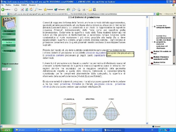
MODULE 2: GIS elements Lecture 1: GIS components Lecture 2: Data/geographic information concept. Spatial Relations Lecture 4: Digital cartography meaning Lecture 5: Coordinate reference systems, projection reference system
Earth shape
MODULE 3: Data models Lecture 1: Data vectorial model Lecture 2: Data raster model Lecture 3: Data tree dimensional model Lecture 4: What are data structures in a GIS Lecture 5: Data model object oriented: Geodatabase
MODULE 4: GIS functions and operators Lecture 1: GIS functions Lecture 2: GIS operators MODULE 5: Internet GIS Lecture 1: Involved technologies in Internet GIS Lecture 2: Internet GIS
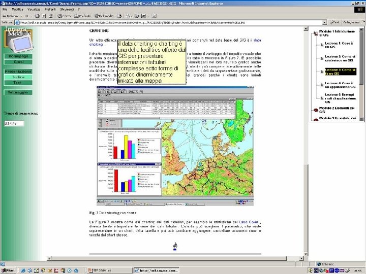
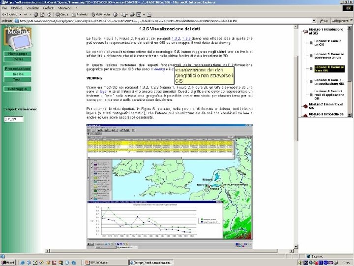
in depth Studies in depth makes able users to enter a fine collection of articles GIS involved as well as to get acquainted with scientific communications, technical notes, and so on.
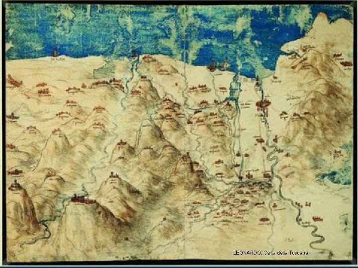
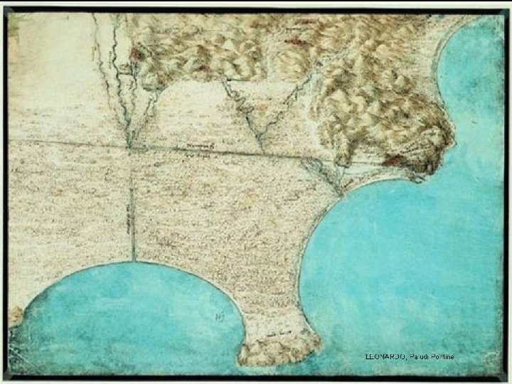
LEONARDO GENIUS AND CARTOGRAPHER: territory representation between LEONARDO GENIO E CARTOGRAFO science and art Rappresentazione del territorio tra scienza ed arte: oltre a renderci partecipi del mirabile percorso nella evoluzione dei simboli e dei mezzi con cui di epoca in epoca l’uomo ha inventato la rappresentazione del territorio, ci informa su un Leonardo che iniziò la sua attività di cartografo dopo aver studiato la geometria di Euclide dal 1496 al 1504 Editore: IGM Scheda: Arezzo, Palazzo Comunale, 21 giugno - 30 settembre 2003. A cura di A. Catile. Firenze, 2003; br. , pp. 384, ill. b/n col. num n. t. , cm 23 x 30. (Disponibile anche in edizione rilegata Euro 70). ISBN: 88 -523 -0001 -5 Soggetto: Codici Miniati e Manoscritti Periodo: XV-XVIII sec. Rinascimento
CONCLUSIONS Before concluding my lecture let me express some conclusions The aim of the today lecture was to give you some starting points to approach a new way to face the renewable energy plans realization conducted by using GIS: by analysing thematic maps, it is possible to find solutions to critical environmental, social, economic, anthropogenic and other situations; in other words, all kinds of situations related to the territory management, or its governance.
CONCLUSIONS Growing interest in Geographic Information and the success of GIS technologies have stimulated the development of new application fields, technologies, hardware and software to meet a very wide range of requests from both the scientific research community and the environmental policymaking community.
Urban planners and decision makers must take into account the use of renewable sources for the energetic plans definition. A tool as GIS could be important to help them in power plants design as regards their location, shape, size. On the other hand GIS can help to individuate areas that, for different reasons, could not sustain a renewable font plant as well as through GIS analysis it could result that a certain area is not convenient by logistic point of view. GIS use can also help to accomplish national safety standards, according to Local Authorities mandatory rules and to verify the state of the technical art as well as of the technological solutions.
At least I should like also to express some conclusions about the SIGEO course. SIGEO distance learning GIS course was ideated and implemented in order to fill a gap in GI and GIS dissemination often affected by too professional treatment or too basic notional treatment. The e-learning tool permits us to reach several kinds of students and users having different cultural level and extraction. On our intention SIGEO should furnish a power tool to induce the highest number of people to access GIS technologies and to familiarize with difficult concepts, often new, that are the basic principia of the Geographic Information Science.
Thank you for your attention! caiaffa@casaccia. enea. it