GEF Project Enabling Transboundary Cooperation and Integrated Water

GEF Project “Enabling Transboundary Cooperation and Integrated Water Resources Management in the Extended Drin River Basin” Drin Information Management System

GEF Project “Enabling Transboundary Cooperation and Integrated Water Resources Management in the Extended Drin River Basin” • UNECE has been promoting transboundary water cooperation in the Drin River basin since 2008. • Drin Dialogue 2009 -2011 – multi-stakeholder consultation process supported by GWP-Med and UNECE • The signature of the Mo. U IN 2011 by the Riparians on a Shared Strategic Vision for the Sustainable Management of the Drin River Basin • The GEF project will support the further development of cooperation in the Drin Basin and the achievement of the objectives of the Drin Mo. U • A Drin Basin Water Monitoring Program, which will be established under the project is compatible with the UNECE Guidelines on Monitoring and Assessment of Transboundary Rivers and the Shared Environmental Information System
 • Sustainable development in the")
Technical Support for Development of Information Management System (IMS) • Sustainable development in the Drin basin identified in the Drin Mo. U: The need for “improving access to comprehensive data and adequate information to fully understand the current state of the environment and water resources and the hydrological system (including surface and coastal waters) as well as ecosystems of the Drin Basin” (Drin Mo. U Article 3 i). • Priority actions:

Drin IMS Aims Establish: • Repository of data collected and produced through Transboundary Diagnostic Analysis (TDA) • Platform to enable joint data collection, storage and exchange, including GIS functions (as per Drin Mo. U and Drin project)

Expert Working group on Monitoring and Information Exchange

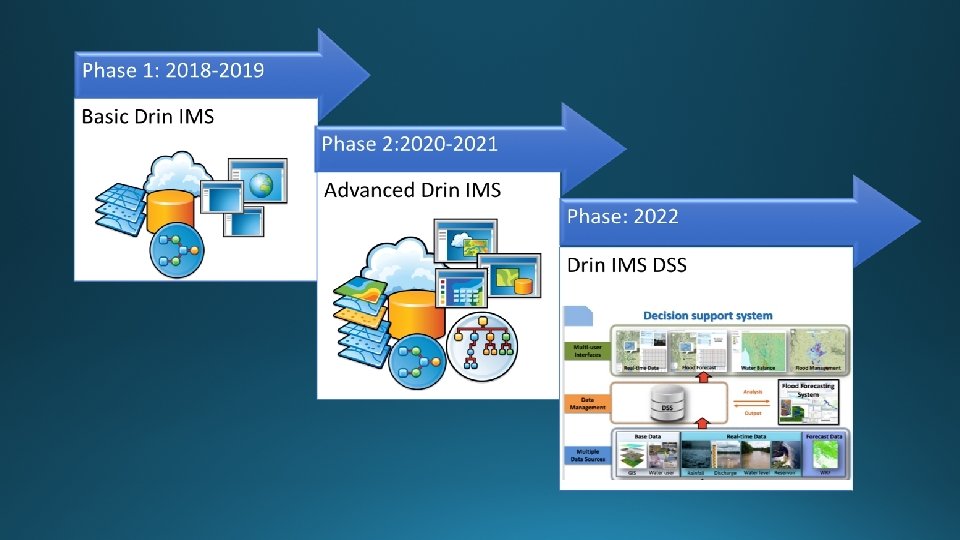
Tasks completed Task 1. Analysis of the “present state” and definition of “desired state” for basin and water data management in each of the beneficiary Riparians ü Detailed analysis report regarding current state and desired state Task 2. Determine IMS thematic datasets and set of standards for exchanging basin and water management data ü List and specifications of IMS themes, data-sets objects and layers ü The feature catalogue ü IMS data model ü Standards to be used within IMS ü IMS data exchange protocols Task 4: Develop the IMS Implementation plan • Implementation plan for the development of the IMS • Report from the Implementation plan meeting(s) with the beneficiary Riparians Task 3: Development of the IMS Architecture ü Specifications of the IMS ü Draft proposal regarding the architecture of the IMS ü Design the system architecture Task 5: Develop To. R for the development of the IMS • Terms of reference for the phased development of the IMS (work/service/supply)

Gaps in data / information exchange Continuous data acquisition and regular update, sufficient data quality control, data verification and validation is not in place, matter of routine and performed to the prescribed extent and frequency. Hydrological monitoring is not available for all catchments, wetlands and floodplains Quality of hydrological monitoring data is often hindered by a number of factors including fragmentation of data. Water quantity and quality and other important hydrological data are needed especially for the calibration of hydrological models.

On-going developments • Agreement on the exchange of priority datasets • hydrological, meteorological, pollution and water level – Drin Core Group • Finalization of thematic reports - Hydrology - Pollution - Institutional and legal setting - Biodiversity and ecosystems - Water-Food-Energy-Ecosystems Nexus - Socio-economics (completed) • Terms of Reference for Development of the Drin IMS

2018 – 2019 • Drin Geodatabase developed and populated with all collected data; • Application modules, tools and geoportal for data processing, analysis and dissemination designed, developed, tested and deployed in operational (Drin IMS production) environment; • Information services for data exchange and metadata flow are established; • Users trained to use and administrate of Drin Geodatabase and Geoportal; • Technical and user documentation prepared and delivered.
- Slides: 10