
GAVESHANA GEOSCIENCES PRIVATE LIMITED An ISO 9001 2008
- Slides: 13
GAVESHANA GEOSCIENCES PRIVATE LIMITED (An ISO 9001: 2008 Certified Company)
WHO WE ARE Gaveshana Geosciences Private Limited, a company registered under the Companies Act 1956, provides consultancy and services in various near surface investigations, geo-technical studies, exploration activities and energy. Organized and managed by a team of experienced professionals, the company provides services in the following application areas: Ground Penetrating Radar (GPR) Survey Seismic Refraction / Reflection Survey Electrical Resistivity Survey Seismic Crosshole / Downhole Test Cable & Pipe Locator Survey Geodetic Survey Mineral Exploration Energy & Exploration Consultancy
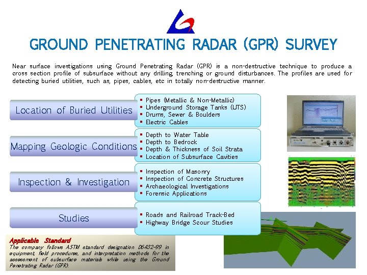
GROUND PENETRATING RADAR (GPR) SURVEY Near surface investigations using Ground Penetrating Radar (GPR) is a non-destructive technique to produce a cross section profile of subsurface without any drilling, trenching or ground disturbances. The profiles are used for detecting buried utilities, such as, pipes, cables, etc in totally non-destructive manner. Location of Buried Utilities § § Pipes (Metallic & Non-Metallic) Underground Storage Tanks (UTS) Drums, Sewer & Boulders Electric Cables Mapping Geologic Conditions § § Depth to Water Table Depth to Bedrock Depth & Thickness of Soil Strata Location of Subsurface Cavities Inspection & Investigation § § Inspection of Masonry Inspection of Concrete Structures Archaeological Investigations Forensic Applications Studies Applicable Standard § Roads and Railroad Track-Bed § Highway Bridge Scour Studies The company follows ASTM standard designation D 6432– 99 in equipment, field procedures, and interpretation methods for the assessment of subsurface materials while using the Ground Penetrating Radar (GPR).
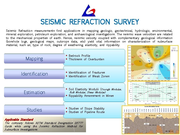
SEISMIC REFRACTION SURVEY Seismic Refraction measurements find applications in mapping geologic, geotechnical, hydrologic, environmental, mineral exploration, petroleum exploration, and archaeological investigations. The seismic wave velocities are related to the mechanical properties of earth. Hence, seismic velocity coupled with complementary geological information (borehole logs, geological maps, outcrops data, etc) yield vital information on characterization of subsurface material, such as, type of rock, degree of weathering, elasticity, and rippability. Mapping Identification Estimation Studies Applicable Standard § Bedrock Profile § Thickness of Overburden § Identification of Fractures § Identification of Weak Zones § Soil Elasticity Modulii (Young’s Modulus, Bulk Modulus, Shear Modulus) § Rippability Assessment in Mines § Studies of Slope Stability § Studies of Pipeline Route The company follows ASTM Standard Designation D 5777 Guide while using the Seismic Refraction Method for Subsurface Investigations.
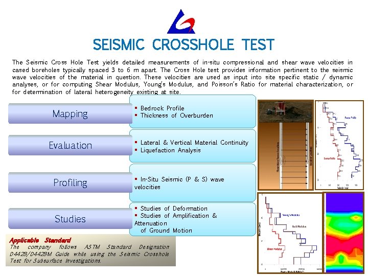
SEISMIC CROSSHOLE TEST The Seismic Cross Hole Test yields detailed measurements of in-situ compressional and shear wave velocities in cased boreholes typically spaced 3 to 6 m apart. The Cross Hole test provides information pertinent to the seismic wave velocities of the material in question. These velocities are used as input into site specific static / dynamic analyses, or for computing Shear Modulus, Young’s Modulus, and Poisson’s Ratio for material characterization, or for determination of lateral heterogeneity existing at site. Mapping Evaluation Profiling Studies Applicable Standard § Bedrock Profile § Thickness of Overburden § Lateral & Vertical Material Continuity § Liquefaction Analysis § In-Situ Seismic (P & S) wave velocities § Studies of Deformation § Studies of Amplification & Attenuation of Ground Motion The company follows ASTM Standard Designation D 4428/D 4428 M Guide while using the Seismic Crosshole Test for Subsurface Investigations.
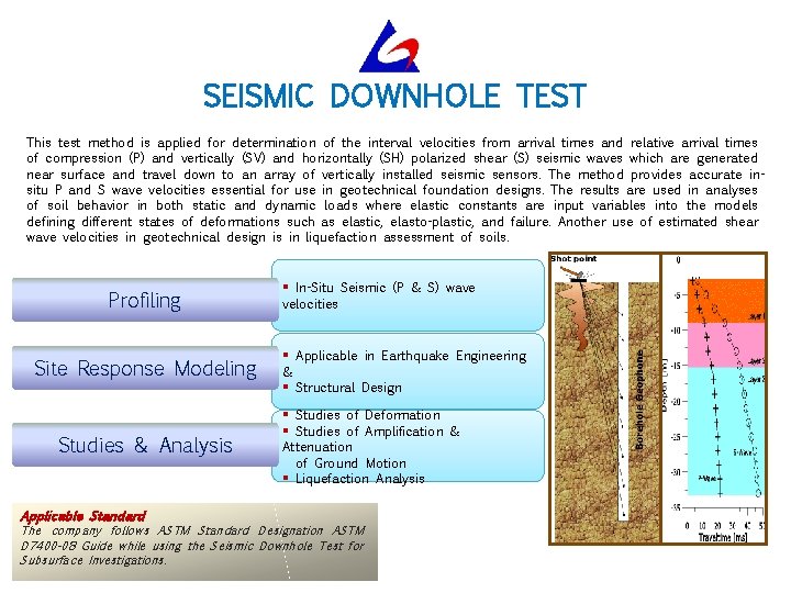
SEISMIC DOWNHOLE TEST This test method is applied for determination of the interval velocities from arrival times and relative arrival times of compression (P) and vertically (SV) and horizontally (SH) polarized shear (S) seismic waves which are generated near surface and travel down to an array of vertically installed seismic sensors. The method provides accurate insitu P and S wave velocities essential for use in geotechnical foundation designs. The results are used in analyses of soil behavior in both static and dynamic loads where elastic constants are input variables into the models defining different states of deformations such as elastic, elasto-plastic, and failure. Another use of estimated shear wave velocities in geotechnical design is in liquefaction assessment of soils. Profiling Site Response Modeling Studies & Analysis Applicable Standard § In-Situ Seismic (P & S) wave velocities § Applicable in Earthquake Engineering & § Structural Design § Studies of Deformation § Studies of Amplification & Attenuation of Ground Motion § Liquefaction Analysis The company follows ASTM Standard Designation ASTM D 7400 -08 Guide while using the Seismic Downhole Test for Subsurface Investigations.
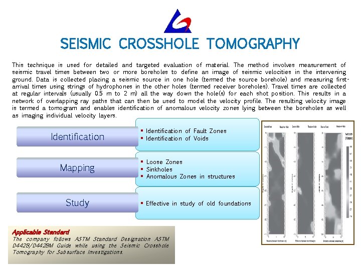
SEISMIC CROSSHOLE TOMOGRAPHY This technique is used for detailed and targeted evaluation of material. The method involves measurement of seismic travel times between two or more boreholes to define an image of seismic velocities in the intervening ground. Data is collected placing a seismic source in one hole (termed the source borehole) and measuring firstarrival times using strings of hydrophones in the other holes (termed receiver boreholes). Travel times are collected at regular intervals (usually 0. 5 m to 2 m) all the way down the hole(s) for each shot position. This results in a network of overlapping ray paths that can then be used to model the velocity profile. The resulting velocity image is termed a tomogram and enables identification of anomalous velocity zones lying between the boreholes as well as imaging individual velocity layers. Identification Mapping Study Applicable Standard § Identification of Fault Zones § Identification of Voids § Loose Zones § Sinkholes § Anomalous Zones in structures § Effective in study of old foundations The company follows ASTM Standard Designation ASTM D 4428/D 4428 M Guide while using the Seismic Crosshole Tomography for Subsurface Investigations.
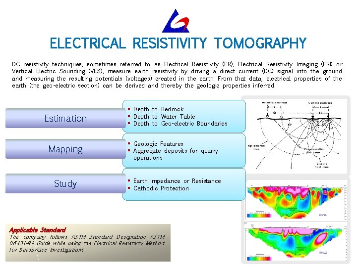
ELECTRICAL RESISTIVITY TOMOGRAPHY DC resistivity techniques, sometimes referred to as Electrical Resistivity (ER), Electrical Resistivity Imaging (ERI) or Vertical Electric Sounding (VES), measure earth resistivity by driving a direct current (DC) signal into the ground and measuring the resulting potentials (voltages) created in the earth. From that data, electrical properties of the earth (the geo-electric section) can be derived and thereby the geologic properties inferred. Estimation § Depth to Bedrock § Depth to Water Table § Depth to Geo-electric Boundaries Mapping § Geologic Features § Aggregate deposits for quarry Study § Earth Impedance or Resistance § Cathodic Protection Applicable Standard operations The company follows ASTM Standard Designation ASTM D 6431 -99 Guide while using the Electrical Resistivity Method for Subsurface Investigations.
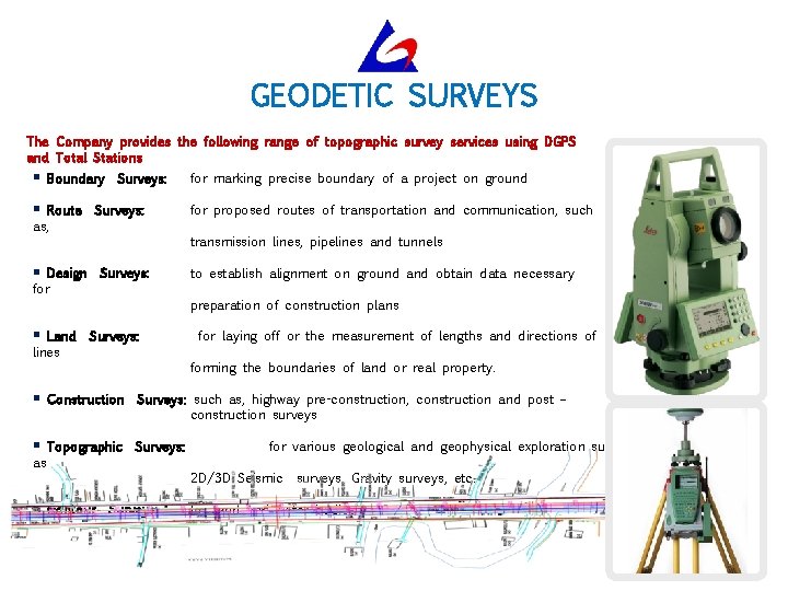
GEODETIC SURVEYS The Company provides the following range of topographic survey services using DGPS and Total Stations § Boundary § Route as, Surveys: Design for Land lines for marking precise boundary of a project on ground for proposed routes of transportation and communication, such transmission lines, pipelines and tunnels § § Surveys: to establish alignment on ground and obtain data necessary preparation of construction plans Surveys: for laying off or the measurement of lengths and directions of forming the boundaries of land or real property. § Construction Surveys: such as, highway pre-construction, construction and post – construction surveys § Topographic Surveys: as § for various geological and geophysical exploration surveys such 2 D/3 D Seismic Contour Surveys: surveys, Gravity surveys, etc. for land water bodies
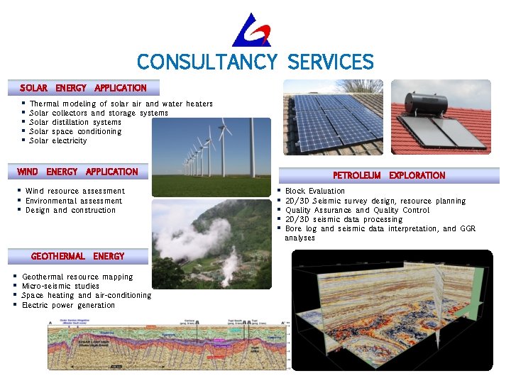
CONSULTANCY SERVICES SOLAR § § § ENERGY APPLICATION Wind resource assessment Environmental assessment Design and construction GEOTHERMAL § § APPLICATION Thermal modeling of solar air and water heaters Solar collectors and storage systems Solar distillation systems Solar space conditioning Solar electricity WIND § § § ENERGY Geothermal resource mapping Micro-seismic studies Space heating and air-conditioning Electric power generation PETROLEUM § § § EXPLORATION Block Evaluation 2 D/3 D Seismic survey design, resource planning Quality Assurance and Quality Control 2 D/3 D seismic data processing Bore log and seismic data interpretation, and GGR analyses
Quality Health Safety and Environment We are an ISO 9001: 2008 Certified Company registered by Det Norske Veritas (DNV). We endeavor to excel through the quality of our services. We follow the ‘safety first' rule in all work practices. We are committed to the goal of a "Zero Accident” operation. We strive to minimize pollution and waste generation in all our work practices. SALIENT § § FEATURES OF OUR QHSE PROCEDURES We conduct our practices as per the standard quality norms. We continually improve upon the quality of our services through regular internal training and technology absorption. § We strictly adhere to safety rules and usage of mandatory PPEs. We follow hazard identification and risk mitigation practices. § § We consciously make efforts to minimize pollution and waste generation at work places. We encourage routine inter-group and intra-group QHSE communications.
OUR CLIENTELE Gaveshana Geosciences Pvt Ltd enjoys the confidence and continued patronage of its valued Clientele. Some of the main end Clients for whom the Company has been providing various services are: § § § § Gujarat Gas Company Ltd § § § Uranium Corporation of India Ltd Green Gas Ltd § PWD Delhi Development Corporation of Goa Northern Railways § § § Delhi TRANSCO Ltd Rail Vikas Nigam Ltd Delhi Jal Board Municipal Corporation of Delhi DLF Himachal Futuristic Communications Sewerage and Infrastructural Mos Metro India Oil India Limited UP Jal Nigam
CONTACT US GAVESHANA GEOSCIENCES PRIVATE LIMITED Head Office: 101, Pankaj Chambers, H-Pocket Market, Sarita Vihar, New Delhi – 110 076 Ph: +91 11 46709986, Email: inquiry@gaveshanageo. com, gaveshanageo@gmail. com Cell: +91 99710 03022, 97172 39993 Branch Office: 944, Indira Nagar, Dehradun – 248 006 (Uttarakhand) Ph: +91 135 2762863, Cell: +91 94120 75734 Visit us at www. gaveshanageo. com