Fusion of MODIS VIIRS and Landsat snow cover


- Slides: 14

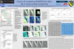
Fusion of MODIS, VIIRS, and Landsat snow cover data to create estimates of snow water equivalent Edward Bair 1, Karl Rittger 2, Rajagopolan Balaji 2, William Kleiber 2, Kat Bormann 3, and Bill Doan 4 1 University of California, Santa Barbara; 2 University of Colorado, Boulder; 3 Jet Propulsion Laboratory; 4 Army Engineer R&D Center MODIS VIIRS Science Team Meeting, MODIS Land Science Analysis, Cypress Ballroom 10/17/18 10: 10 am

Why do we need accurate snow cover estimates? Selkowitz et al. (2014) • A billion people worldwide depend on snow and ice melt for water (Barnett et al. 2005) • Snow cover in the mountains varies dramatically, both spatially and temporally • For water resources, that variability needs to be captured to accurately model basin-wide snow water equivalent (SWE) 2

The general problem • Satellite-borne sensors can have high temporal or high spatial resolution, but not both. • For example, consider fractional snow-covered area (f. SCA) from this imagery over the Himalaya. The left image is from daily MODIS Terra at 500 m while the right image is from Land. Sat 8 at 30 m, but is only available every 16 days. 3

SWE reconstruction • Basin-wide SWE reconstructed with Par. Bal and measurements from ASO in the upper Tuolumne Basin, CA USA 4

A summary of our current approach for f. SCA Dozier et al. 2008 1. We use spectral unmixing for f. SCA and other snow surface properties, specifically MODIS Snow Covered Area and Grain Size (Painter et al. 2009) and VIIRSCAG (MODSCAG for VIIRS). 2. MODSCAG shows 9% vs. 23% RMSE when compared to a standard product f. SCA (MOD 10 A 1 v 5), validated using Land. Sat 7 (Rittger et al. 2013). 3. We also smooth and gapfill using weighted splines based on viewing geometry (Dozier et al. 2008). 5

Problems with our current approach that can be helped with improved spatial & temporal resolution • Snow cloud discrimination remains an issue, see D. Hall et al. poster #127: • Optically thick clouds are brighter in all bands than snow, but thin clouds/snow can be spectrally inseparable from other non-snow mixtures, especially at 0. 5 -1 km resolution. • MODSCAG grain sizes are too small at lower elevations (see image to the right) • Snow albedo retrievals need work, and perform best on pure (unmixed) pixels • no snow albedo standard product for mixed pixels 6

MODIS and VIIRS both perform similarly at mapping f. SCA, validation with Land. Sat 8 7

Our proposed approach: Bayesian fusion • 8

Bayesian fusion example (a) (b) (c) Example of downscaled MODIS imagery using Bayesian fusion: • (a) Original, MODIS f. SCA at 500 m spatial resolution; (b) Fused product, trained off data from other days; (c) Validation, Land. Sat 8 f. SCA at 30 m spatial resolution. 9

Fused f. SCA products have been tried before • Durand et al. (2008) used a linear program approach to fuse MOD 10 A V. 4 binary snow cover with f. SCA from Land. Sat 7. • Compared to using MODIS f. SCA alone, they report a 51% reduction in Mean Absolute Error when run through a SWE reconstruction model (more on this later). • This study showed promising results for f. SCA fusion, but has several significant drawbacks: • Linear program is simple – constraints are linear and uncertainty is not addressed • Binary f. SCA is inherently biased • Land. Sat 7 saturates issues in snow (8 bit vs 12 bit radiances) Durand et al. (2008) Small circles – MOD 10 A V. 4 Large circles – Land. Sat 7 Dotted line – fused product 10

Study areas Snow covered MODIS imagery of study areas: upper Colorado River Basin (a), upper Indus River Basin (b) 11

Five planned phases 1. 2. 3. 4. Fusion of MODIS and VIIRS: 500 m f. SCA and albedo Downscaling and fusion with Land. Sat: 30 m f. SCA and albedo Reconstructed SWE in both study areas Leveraging other funded work: machine-learning based SWE estimates in both study areas 5. Leveraging other funded work: Model ready (HEC HMS) snow and ice estimates for upper Indus Annual melt in the upper Indus, 2014 12

Where does machine learning fit ? To predict today’s SWE • Reconstruction is accurate but can only be done after all the snow melts • Use reconstructed SWE to train machine learning models that use predictors available for today • Specifically, bagged trees (random forests) and neural networks were used • Those models were used to predict today’s SWE throughout Afghanistan • 20% of training data (reconstructed SWE) was held out for validation • Nash-Sutcliffe efficiency is 0. 68 for all years, indicating substantial improvement over a mean forecast Bair et al. (2018) Top: Bagged tree predictor importance Bottom: Bagged tree bias and RMSE, validated using 20% hold out 13

References • Bair, E. H. , A. Abreu Calfa, K. Rittger, and J. Dozier (2018), Using machine learning for real-time estimates of snow water equivalent in the watersheds of Afghanistan, The Cryosphere, 12(5), 1579 -1594, doi: 10. 5194/tc-12 -15792018. • Barnett, T. P. , Adam, J. C. , and Lettenmaier, D. P. (2005). Potential impacts of a warming climate on water availability in snow-dominated regions. Nature 438, 303309. doi: 10. 1038/nature 04141. • Dozier, J. , Painter, T. H. , Rittger, K. , and Frew, J. E. (2008). Time-space continuity of daily maps of fractional snow cover and albedo from MODIS. Advances in Water Resources 31, 1515 -1526. doi: 10. 1016/j. advwatres. 2008. 011. • Durand, M. , Molotch, N. P. , and Margulis, S. A. (2008). Merging complementary remote sensing datasets in the context of snow water equivalent reconstruction. Remote Sensing of Environment 112, 1212 -1225. doi: 10. 1016/j. rse. 2007. 08. 010. • Painter, T. H. , Rittger, K. , Mckenzie, C. , Slaughter, P. , Davis, R. E. , and Dozier, J. (2009). Retrieval of subpixel snowcovered area, grain size, and albedo from MODIS. Remote Sensing of Environment 113, 868 -879. doi: 10. 1016/j. rse. 2009. 01. 001. • Rittger, K. , Painter, T. H. , and Dozier, J. (2013). Assessment of methods for mapping snow cover from MODIS. Advances in Water Resources 51, 367 -380. doi: 10. 1016/j. advwatres. 2012. 03. 002. 14
