Fundamentals of MAPS and Topographic maps Book 1

Fundamentals of MAPS and Topographic maps Book -1 Std -10

What is a Map? • Pictorial Representation • Part or whole of the earth’s surface • Drawn to scale • On a flat sheet of paper

Elements of a map 1. 2. 3. 4. 5. Title Scale Grid Direction Key

Title • Represents – Name of the region depicted – Theme of the map • Example – INDIA (Name of region) – PHYSICAL (Theme of the map)

Scale • Ratio – Distance between two places on map – Distance between same two places on ground • Can be expressed as • Statement (2 cm = 1 km OR 2 cm to 1 km) • Representative Fraction (1: 50000) • Linear Scale
 Distance between the")
Understanding Scale • Scale Distance between two places on map (a) Distance between the same two places on ground (b)

Statement to R. F. • If a = 2 cm; b = 1 km • Scale = 2 cm / 1 km 2 cm / 1 X 1000 X 100 cm 1 cm / 50000 cm 1 : 50000 OR OR OR

Large Scale Maps v/s Small Scale Maps Small Scale Large Scale Smaller number Larger number Example of Scale 1 cm = 100 km 2 cm = 1 km OR OR 1/10000000 2/100000 OR OR 1: 10, 000 1: 50, 000 Area depicted More Less Details Less More Example India Rajkot

Grid • Set of – Vertical lines – Horizontal lines – Examples • Latitudes & Longitudes • Northings & Eastings • Used to locate places • Draw an area to proportion on map • Could be used to determine area

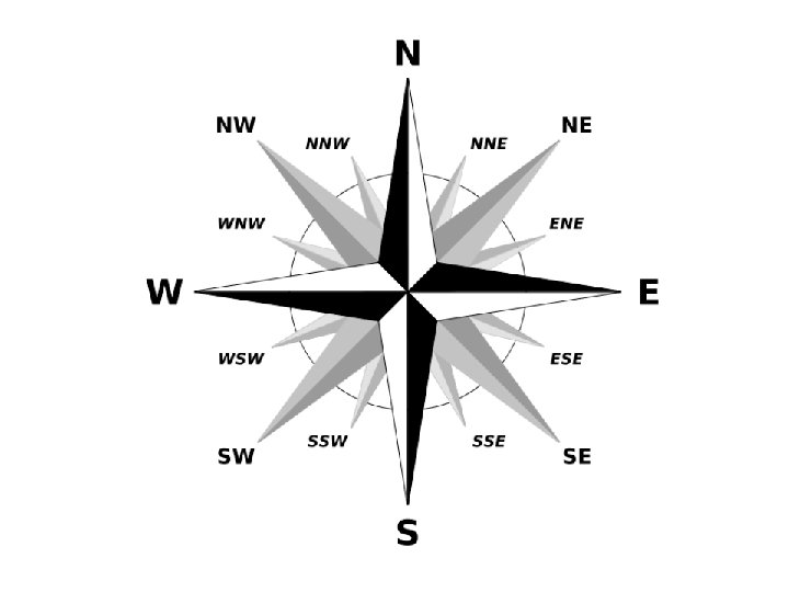
Direction • Angular distance – From observer’s position – To any place on map – With respect to NORTH (Position of Pole Star) • Can be expressed as – Conventions (N, S, E, W, etc. ) – Bearing OR Azimuth (Angle)

Direction Angle NOP is the direction Can be expressed as N P 45° (0 to 360; clockwise) OR NE O

N W N NNE NE E W SW S SE

Key or Legend • Set of – Colours – Symbols – Shading patterns • Used to depict ground features on the map

How is a Topographical Map different?
 is shown using contours •")
Features of Topographical Maps • Height (and it distribution) is shown using contours • Helps one to visualise the pattern of unevenness (topography) of the land

Features of Topographical Maps • Large scale map – Details are included – Covers a smaller area • Could be used for a number of purposes – Millitary – Building bridges, roads, railways, dams, canals, etc – Research (geology, botany, etc. )

Showing Topography using hachures + contours

Title of Topographical Maps • 45 D/7 • 45 D/10 • 67 F/9 • Does it make sense?

Bifurcation of Toposheet

Bifurcation of Toposheet

Title of a Topographical Map 1 7 2 7 3 9 1 M TOPOSHEET Extent 4 43 5 44 6 45 46 4° latitude X 4° longitude Scale (Statement) 1 inch = 16 miles Scale (R. F. ) 47 1 : 1000, 000 Type 1 M Toposheet Title (Example) 45

Title of a Topographical Map 45 A 45 E 45 I 45 M 45 B 45 F 45 J 45 N QUARTER INCH TOPOSHEET Extent 1° latitude X 1° longitude Scale (Statement) 1 inch = 4 miles 45 C 45 G 45 K 45 0 Scale (R. F. ) 1 : 250, 000 45 D 45 H 45 L 45 P Type Quarter Inch Toposheet Title (Example) 45 D

Title of a Topographical Map 45 D/1 45 D/5 45 D/9 45 D/13 ONE INCH TOPOSHEET Extent 15’ latitude X 15’ longitude 45 D/2 45 D/6 45 D/3 45 D/7 45 D/4 45 D/8 45 D/10 45 D/14 45 D/11 45 D/15 45 D/12 45 D/16 Scale (Statement) 1 inch = 1 mile Scale (R. F. ) 1 : 50, 000 Type One Inch Toposheet Title (Example) 45 D/7, 45 D/10

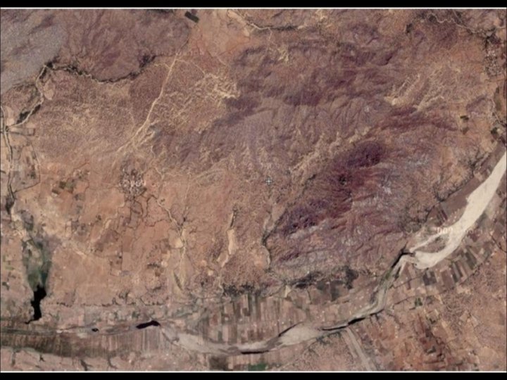
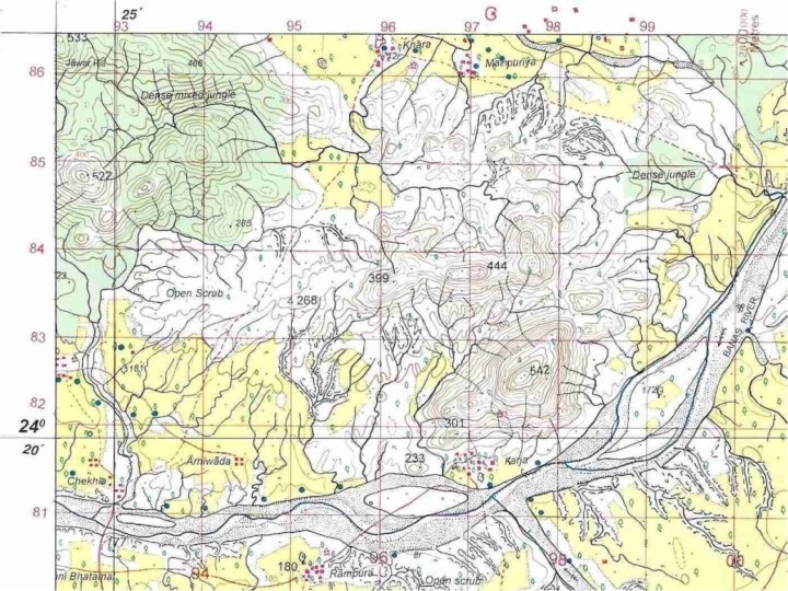
Topographical Maps in ICSE syllabus 45 D / 7 45 D / 10 Type One Inch Map Scale 2 cm = 1 km OR 1: 50, 000 Contour Interval 20 m Area covered NE Gujarat (Banaskantha Dist) NE Gujarat & SW Rajasthan (Banaskantha & Sirohi Dist)

End of the presentation
- Slides: 28