Functional Subsystems of GIS GIS has four main

Functional Subsystems of GIS

GIS has four main functional subsystems 1. Data Input Subsystem 2. Data Storage and Retrieval Subsystem 3. Data Manipulation and Analysis Subsystem 4. Output Display subsystem

Data Input Subsystem

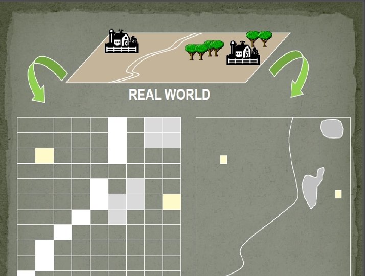
Data Input Subsystem n A data input subsystem allows the user to capture, collect, and transform spatial and thematic data into digital form. The data inputs are usually derived from a combination of hard copy maps, aerial photographs, remotely sensed images, reports, survey documents, etc.

Data Input Subsystem n Input subsystem functions in three phases: conceptualization, modeling and measurement of reality. Conceptualization is the phase where humans organize and structure their concept of reality

Data Input Subsystem In order to analyze the real world's features its necessary to reduce its infinite complexity and continuous variation to discrete. Third input phase includes the measurement of spatial objects according to the data model developed in the second input phase so called spatial data modeling phase.

Functions n Data Capture Data Inputs Hard copy Maps Ariel Photographs n n Data Collection Remotely Sensed Images Data Transformation Reports Survey Documents etc

Data Storage and Retrieval Subsystem

Data Storage and Retrieval Subsystem n n The data storage and retrieval subsystem organizes the data, spatial and attribute, in a form which permits it to be quickly retrieved by the user for analysis, and permits rapid and accurate updates to be made to the database. This component usually involves the use of a database management system (DBMS) for maintaining attribute data. Spatial data is usually encoded and maintained in a proprietary file format.

Data Manipulation and Analysis

Data Manipulation and Analysis n The data manipulation and analysis subsystem allows the user to define and execute spatial and attribute procedures to generate derived information. This subsystem is commonly thought of as the heart of a GIS.

Output and Display Subsystem

Output and Display Subsystem n The data output subsystem allows the user to generate graphic displays, normally maps, and tabular reports representing derived information products.

GIS DATA MODELS

GIS Data Models In GIS, a mathematical construct for representing geographic objects or surfaces as data. The real world can only be depicted in a GIS through the use of models that define phenomena in a manner that computer systems can interpret, as well perform meaningful analysis.

Data Models Data Structure n Practical Description of the phenomenon, not concern with entities but deals with saving space storage. n File Structure n A structure for organizing data in a computer file. It may be unique to a specific computer program or may conform to a general standard.
 unit (existing) or conceive (projected)")
Categories of information Entity: Primitive spatial (possible non spatial) unit (existing) or conceive (projected) For instance “School” n Object: Physical Representation of an Entity Instance: A particular occurrence of given type For instance “St. Anthony School”
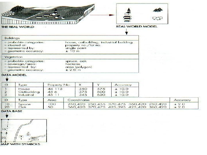
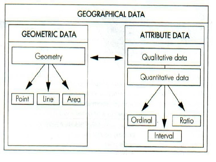

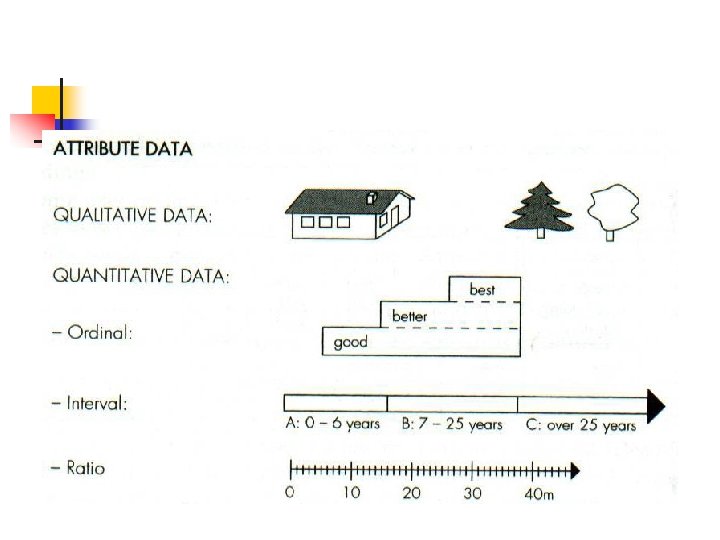
Modeling attribute data Each entity type may have one or more attributes n e. g. …buildings may have attributes characterizing material n For Example “masonry", "Wooden”, as well number of stories n Attributes may describe quantitative data ranked in three levels of accuracy
 – Good Better Best n –Ratio (scale) – Length")
Modeling attribute data Ordinal (Ranks) – Good Better Best n –Ratio (scale) – Length – Area n Interval (numeric) age , income

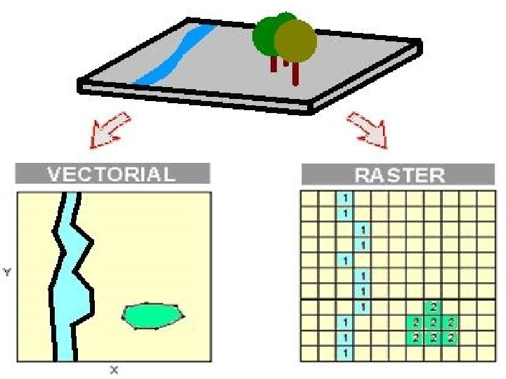
Spatial Data Models n n n There are two basic types of Data Models in GIS are ; Raster Data Models Vector Data Models
- Slides: 25