Fronts Chapter 21 Section 2 Front boundary between

Fronts Chapter 21 Section 2
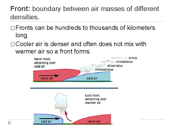
Front: boundary between air masses of different densities. � Fronts can be hundreds to thousands of kilometers long. � Cooler air is denser and often does not mix with warmer air so a front forms.
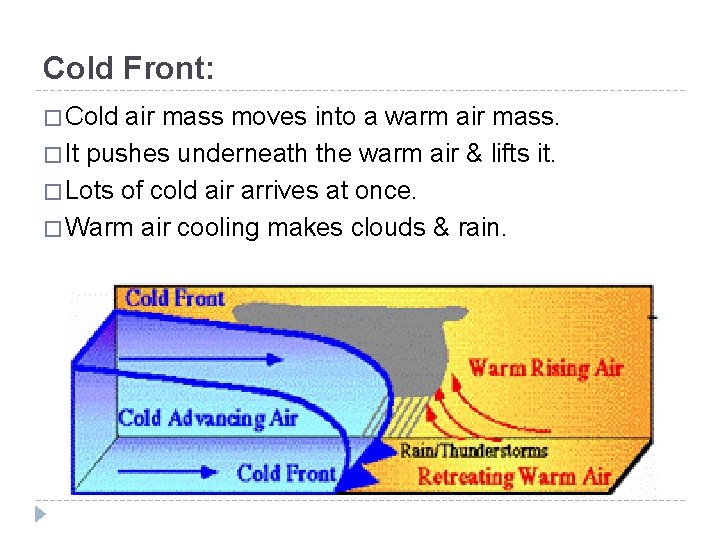
Cold Front: � Cold air mass moves into a warm air mass. � It pushes underneath the warm air & lifts it. � Lots of cold air arrives at once. � Warm air cooling makes clouds & rain.
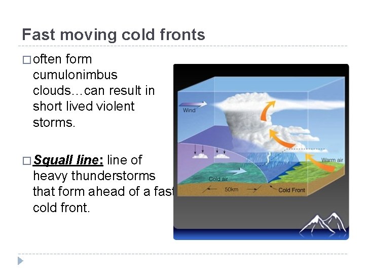
Fast moving cold fronts � often form cumulonimbus clouds…can result in short lived violent storms. � Squall line: line of heavy thunderstorms that form ahead of a fast cold front.

Cold front: shown as a blue line with triangles pointing toward warmer air.
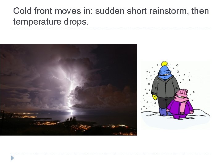
Cold front moves in: sudden short rainstorm, then temperature drops.
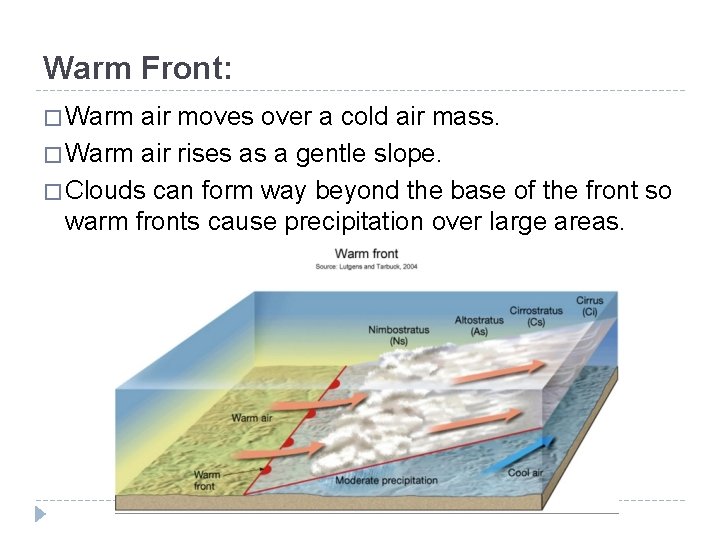
Warm Front: � Warm air moves over a cold air mass. � Warm air rises as a gentle slope. � Clouds can form way beyond the base of the front so warm fronts cause precipitation over large areas.
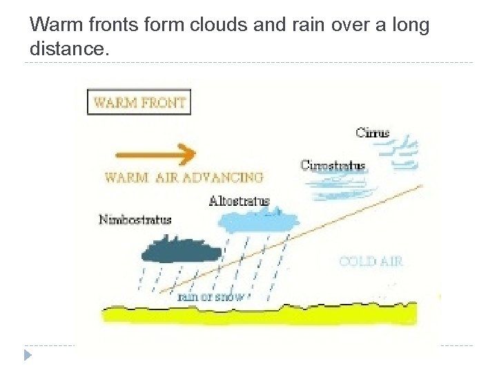
Warm fronts form clouds and rain over a long distance.
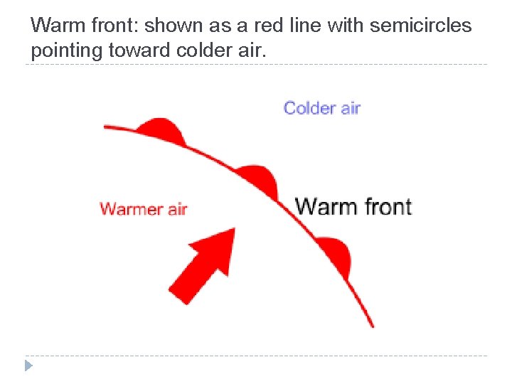
Warm front: shown as a red line with semicircles pointing toward colder air.
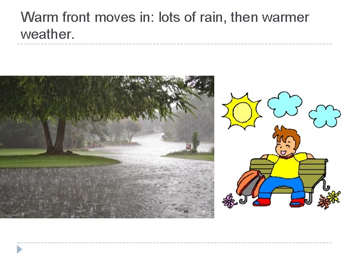
Warm front moves in: lots of rain, then warmer weather.
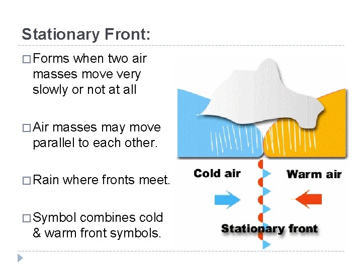
Stationary Front: � Forms when two air masses move very slowly or not at all � Air masses may move parallel to each other. � Rain where fronts meet. � Symbol combines cold & warm front symbols.
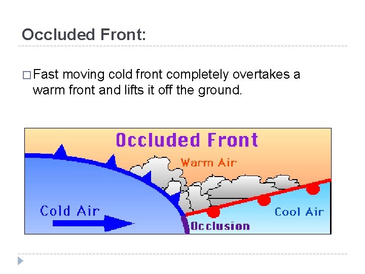
Occluded Front: � Fast moving cold front completely overtakes a warm front and lifts it off the ground.
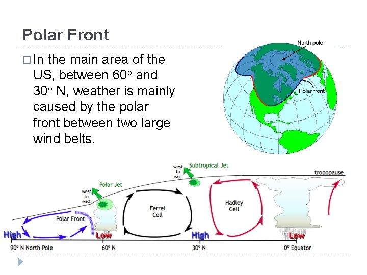
Polar Front � In the main area of the US, between 60 o and 30 o N, weather is mainly caused by the polar front between two large wind belts.
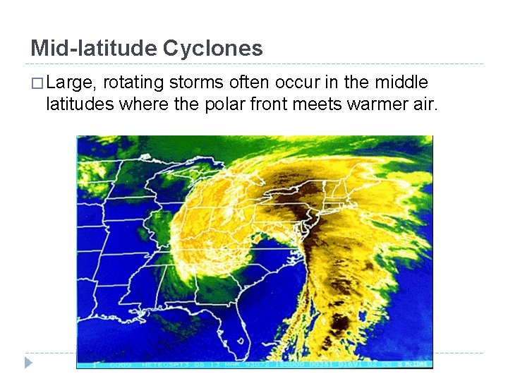
Mid-latitude Cyclones � Large, rotating storms often occur in the middle latitudes where the polar front meets warmer air.
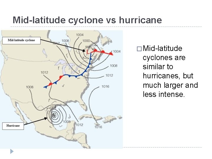
Mid-latitude cyclone vs hurricane � Mid-latitude cyclones are similar to hurricanes, but much larger and less intense.

Anticyclones � Anticyclones blow outward from a high pressure area, the opposite of a cyclone.
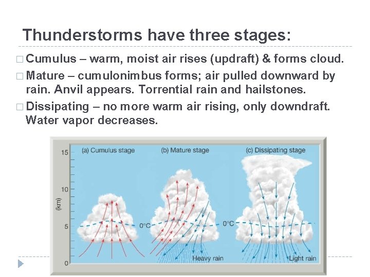
Thunderstorms have three stages: � Cumulus – warm, moist air rises (updraft) & forms cloud. � Mature – cumulonimbus forms; air pulled downward by rain. Anvil appears. Torrential rain and hailstones. � Dissipating – no more warm air rising, only downdraft. Water vapor decreases.
Lightning – go to NOAA for animations � http: //www. lightningsafety. noaa. gov/science- overview. shtml
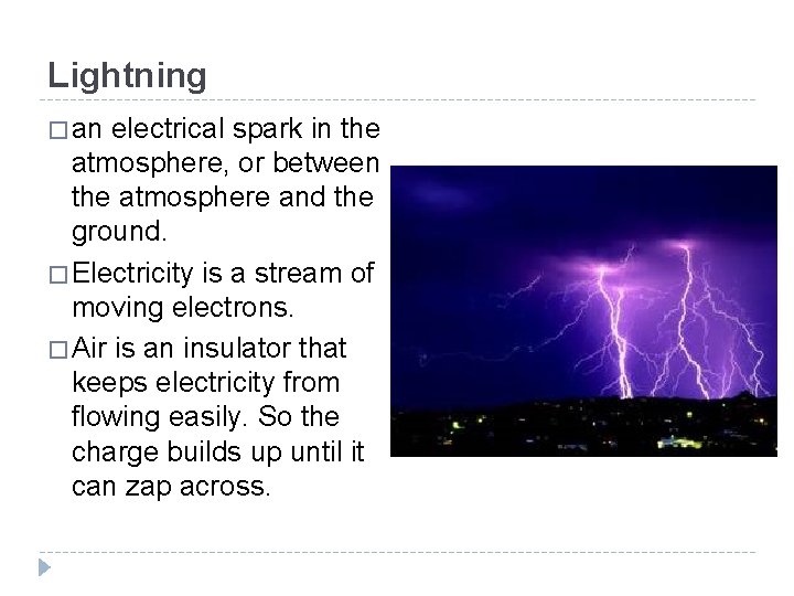
Lightning � an electrical spark in the atmosphere, or between the atmosphere and the ground. � Electricity is a stream of moving electrons. � Air is an insulator that keeps electricity from flowing easily. So the charge builds up until it can zap across.
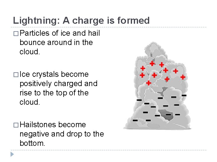
Lightning: A charge is formed � Particles of ice and hail bounce around in the cloud. � Ice crystals become positively charged and rise to the top of the cloud. � Hailstones become negative and drop to the bottom.
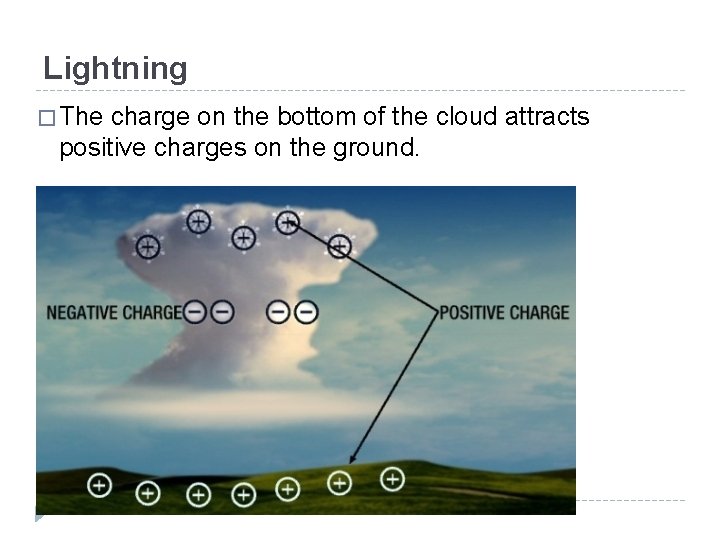
Lightning � The charge on the bottom of the cloud attracts positive charges on the ground.
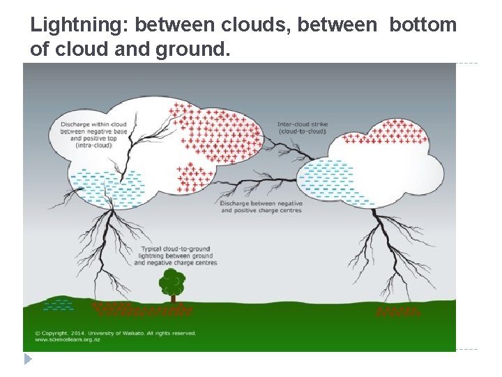
Lightning: between clouds, between bottom of cloud and ground.
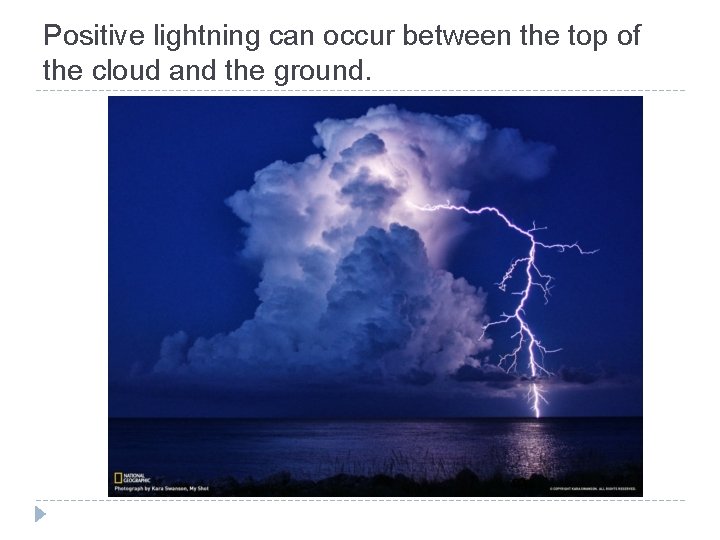
Positive lightning can occur between the top of the cloud and the ground.
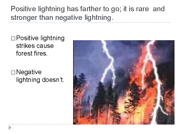
Positive lightning has farther to go; it is rare and stronger than negative lightning. � Positive lightning strikes cause forest fires. � Negative lightning doesn’t.
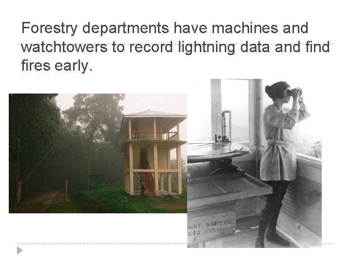
Forestry departments have machines and watchtowers to record lightning data and fires early.
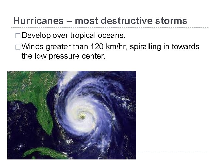
Hurricanes – most destructive storms � Develop over tropical oceans. � Winds greater than 120 km/hr, spiralling in towards the low pressure center.
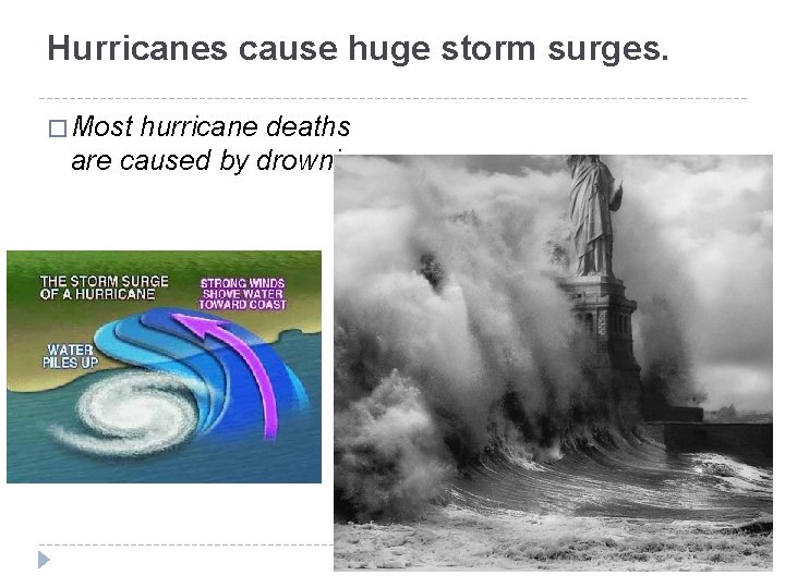
Hurricanes cause huge storm surges. � Most hurricane deaths are caused by drowning.
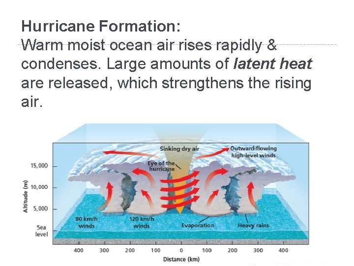
Hurricane Formation: Warm moist ocean air rises rapidly & condenses. Large amounts of latent heat are released, which strengthens the rising air.
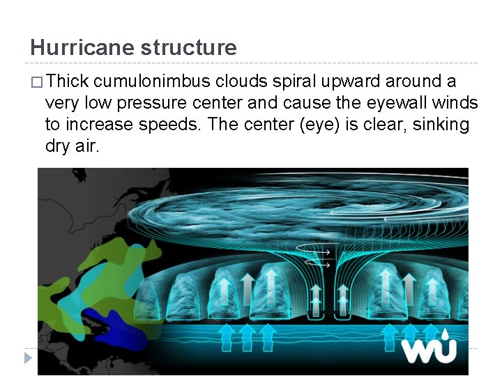
Hurricane structure � Thick cumulonimbus clouds spiral upward around a very low pressure center and cause the eyewall winds to increase speeds. The center (eye) is clear, sinking dry air.
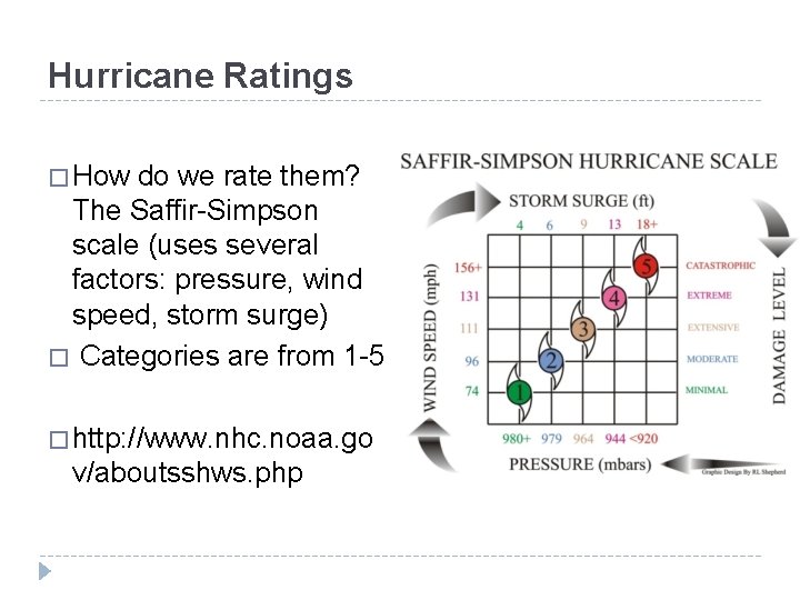
Hurricane Ratings � How do we rate them? The Saffir-Simpson scale (uses several factors: pressure, wind speed, storm surge) � Categories are from 1 -5 � http: //www. nhc. noaa. go v/aboutsshws. php
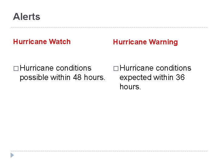
Alerts Hurricane Watch Hurricane Warning � Hurricane conditions possible within 48 hours. conditions expected within 36 hours.
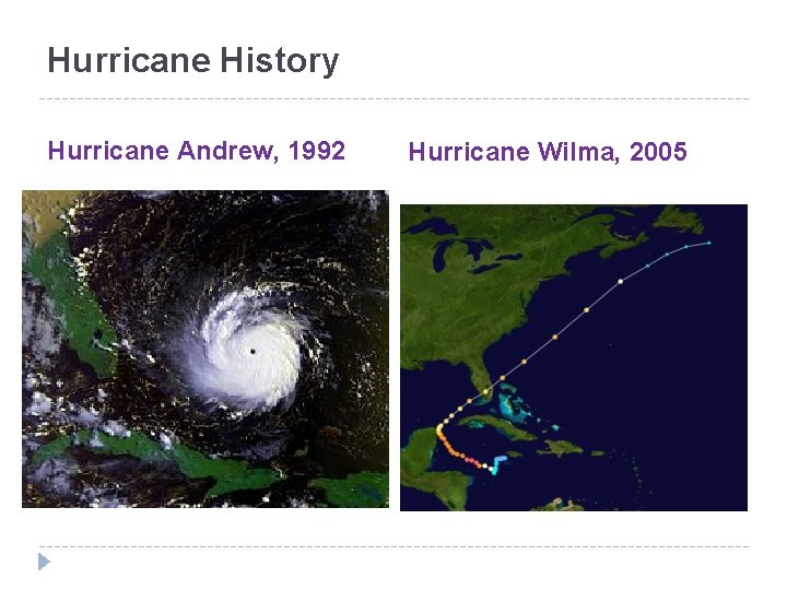
Hurricane History Hurricane Andrew, 1992 Hurricane Wilma, 2005
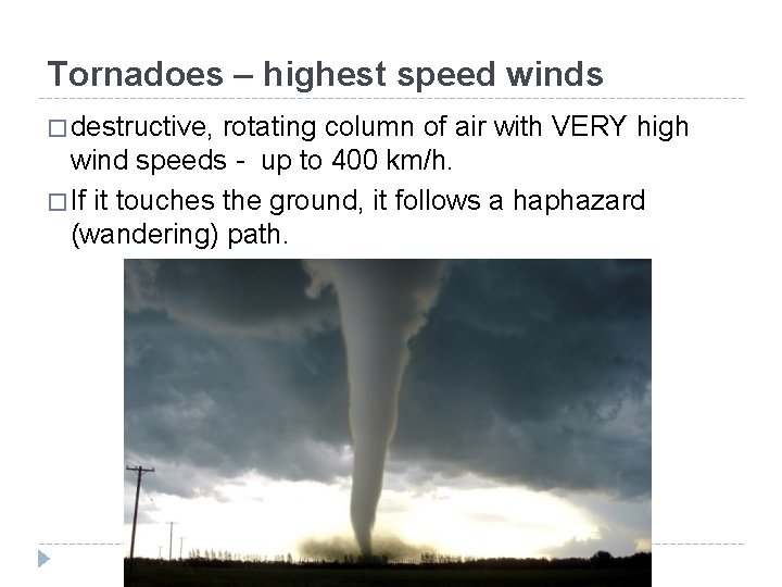
Tornadoes – highest speed winds � destructive, rotating column of air with VERY high wind speeds - up to 400 km/h. � If it touches the ground, it follows a haphazard (wandering) path.
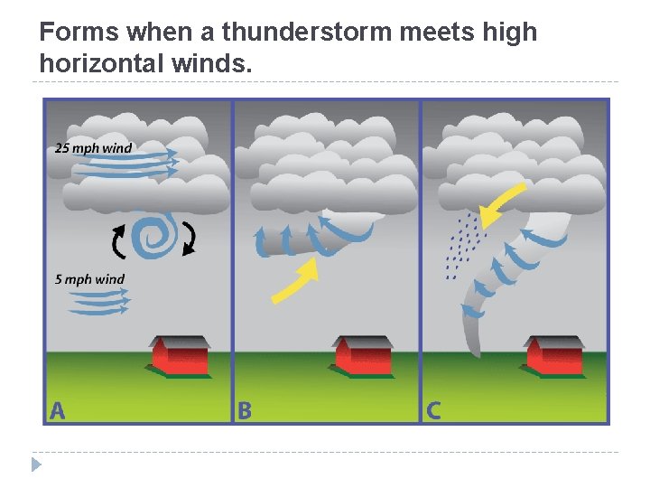
Forms when a thunderstorm meets high horizontal winds.
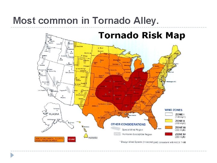
Most common in Tornado Alley.

Most deaths are from being trapped in collapsing buildings and flying debris.
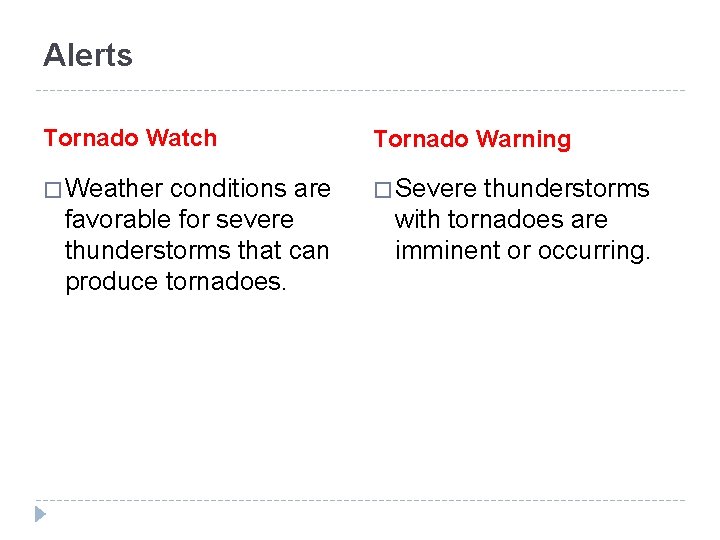
Alerts Tornado Watch Tornado Warning � Weather � Severe conditions are favorable for severe thunderstorms that can produce tornadoes. thunderstorms with tornadoes are imminent or occurring.

Tornado In Coconut Creek, Broward County, FL Jan 27, 2016
- Slides: 38