Fronts 2009 Air Masses n n Air masses
- Slides: 15

Fronts 2009

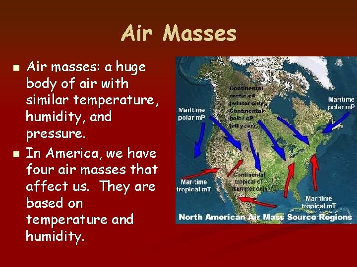
Air Masses n n Air masses: a huge body of air with similar temperature, humidity, and pressure. In America, we have four air masses that affect us. They are based on temperature and humidity.

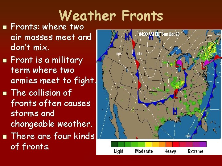
n n Weather Fronts: where two air masses meet and don’t mix. Front is a military term where two armies meet to fight. The collision of fronts often causes storms and changeable weather. There are four kinds of fronts.

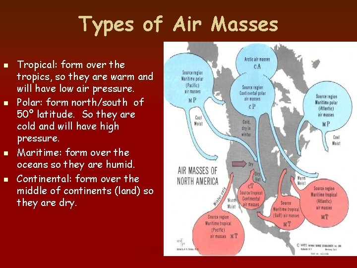
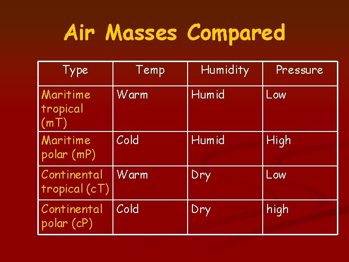
Types of Air Masses n n Tropical: form over the tropics, so they are warm and will have low air pressure. Polar: form north/south of 50º latitude. So they are cold and will have high pressure. Maritime: form over the oceans so they are humid. Continental: form over the middle of continents (land) so they are dry.

Air Masses Compared Type Maritime tropical (m. T) Maritime polar (m. P) Temp Humidity Pressure Warm Humid Low Cold Humid High Continental Warm tropical (c. T) Dry Low Continental polar (c. P) Dry high Cold

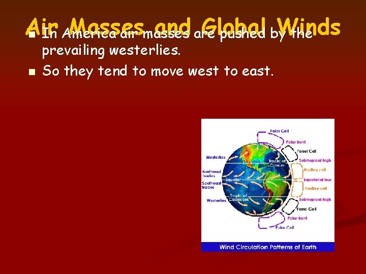
Air Masses and are Global Winds n In America air masses pushed by the n prevailing westerlies. So they tend to move west to east.

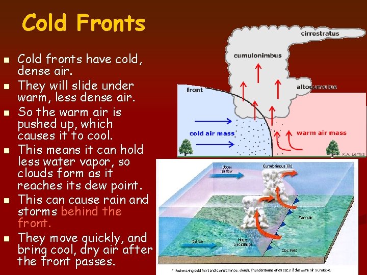
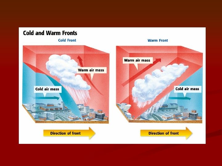
Cold Fronts n n n Cold fronts have cold, dense air. They will slide under warm, less dense air. So the warm air is pushed up, which causes it to cool. This means it can hold less water vapor, so clouds form as it reaches its dew point. This can cause rain and storms behind the front. They move quickly, and bring cool, dry air after the front passes.

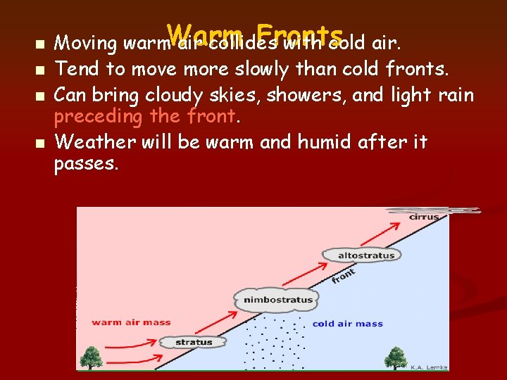
n n Fronts Moving warm. Warm air collides with cold air. Tend to move more slowly than cold fronts. Can bring cloudy skies, showers, and light rain preceding the front. Weather will be warm and humid after it passes.


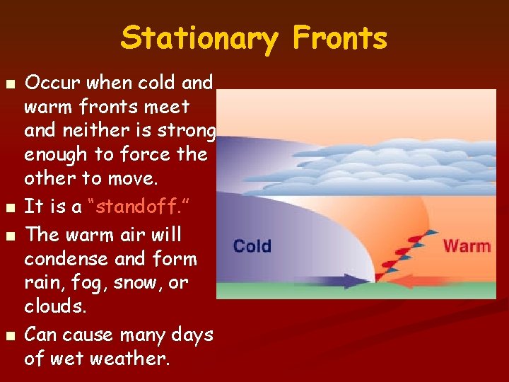
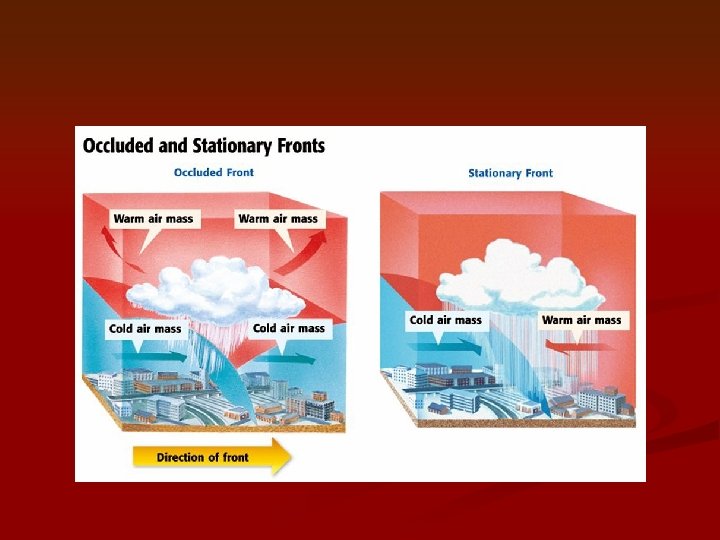
Stationary Fronts n n Occur when cold and warm fronts meet and neither is strong enough to force the other to move. It is a “standoff. ” The warm air will condense and form rain, fog, snow, or clouds. Can cause many days of wet weather.

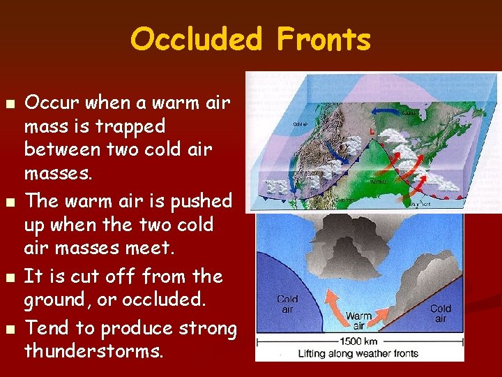
Occluded Fronts n n Occur when a warm air mass is trapped between two cold air masses. The warm air is pushed up when the two cold air masses meet. It is cut off from the ground, or occluded. Tend to produce strong thunderstorms.


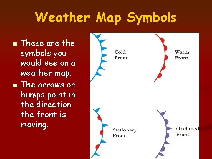
Weather Map Symbols n n These are the symbols you would see on a weather map. The arrows or bumps point in the direction the front is moving.

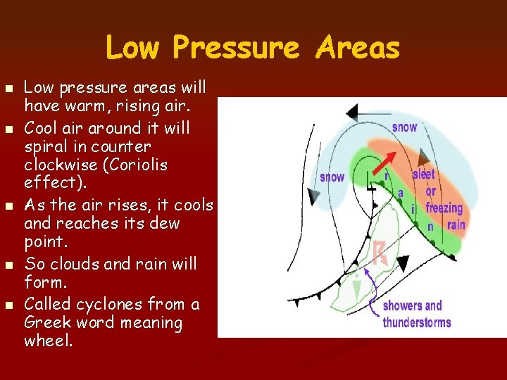
Low Pressure Areas n n n Low pressure areas will have warm, rising air. Cool air around it will spiral in counter clockwise (Coriolis effect). As the air rises, it cools and reaches its dew point. So clouds and rain will form. Called cyclones from a Greek word meaning wheel.

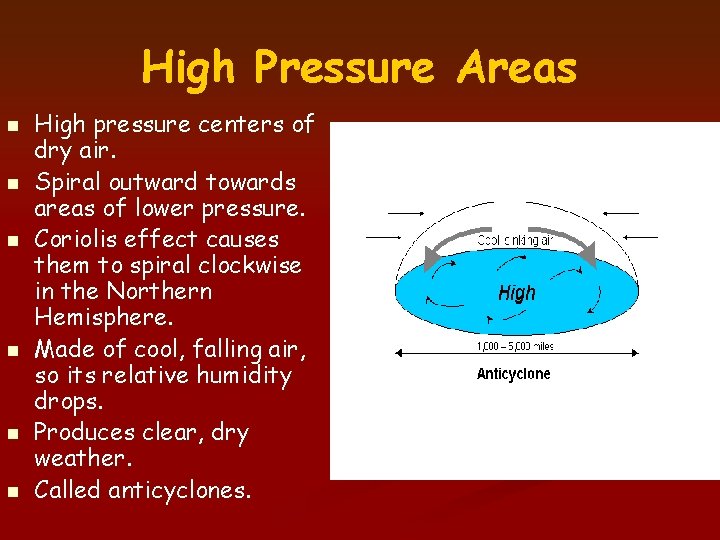
High Pressure Areas n n n High pressure centers of dry air. Spiral outward towards areas of lower pressure. Coriolis effect causes them to spiral clockwise in the Northern Hemisphere. Made of cool, falling air, so its relative humidity drops. Produces clear, dry weather. Called anticyclones.