Frontogenesis strengthening of temperature gradients Frontolysis weakening of


 were essential features of the Norwegian Cyclone Model")


 clockwise Counterclockwise) Anticyclonic (NH) Cyclonic")
")


 was the first to show that fronts could form/strengthen when deformation acts")

 showed that convergence can also cause frontogenesis cool warm")

 •")


 tend to develop in regions of naturally strong horizontal temperature gradients")
- Slides: 55
Frontogenesis: strengthening of temperature gradients Frontolysis: weakening of temperature gradients
The Norwegian or Bergen School Meteorologists in the early 20 th century were the first to describe fronts and their evolution Bjernkes, 1919
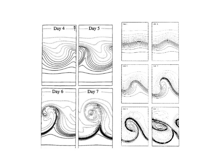
Concept of Evolution of Cyclones Bjerknes and Solberg 1922
Stationary Polar Front Wave Forming on Polar Front
Wave Amplifies Occlusion as Cold Front Catches Up to Warm Front
Occlusion Lengthens and System Weakens
Frontogenesis (and Frontolysis) were essential features of the Norwegian Cyclone Model
Why are there fronts? • First attempts were based on the kinematic description of frontogenesis • Kinematics regards the description of motions rather than the forces • How do wind and temperature fields interact to increase temperature gradients?
Kinematics 101: the wind around a point can be linearly decomposed into four key components • • Translation Rotation Divergence Deformation
Translation: movement in one direction
Rotation (cyclonic or anticyclonic) clockwise Counterclockwise) Anticyclonic (NH) Cyclonic
Divergence (or convergence)
Deformation
The flow around a point can be decomposed into these kinematic components. Combining them can produce many important flow fields
Deformation Plus Translation Results in Confluence
Vorticity Plus Convergence
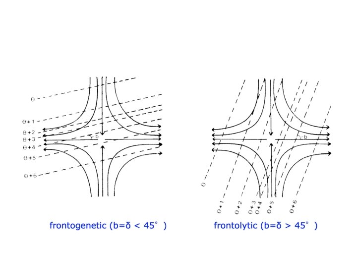
Bergeron (1928) was the first to show that fronts could form/strengthen when deformation acts on a preexisting temperature gradient. T-DT T T+DT T+2 DT T+3 DT T+4 DT
Bergeron also showed that the orientation of isotherms was important: had to be within 45°of the axis of dilation to get frontogenesis
Peterssen (1936) showed that convergence can also cause frontogenesis cool warm
Peterssen Created a Frontogenesis Function •
Frontogenesis Function (2 D) •
Both convergence and deformation contribute to frontogenesis for a typical midlatitude cyclone
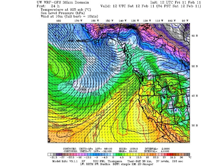
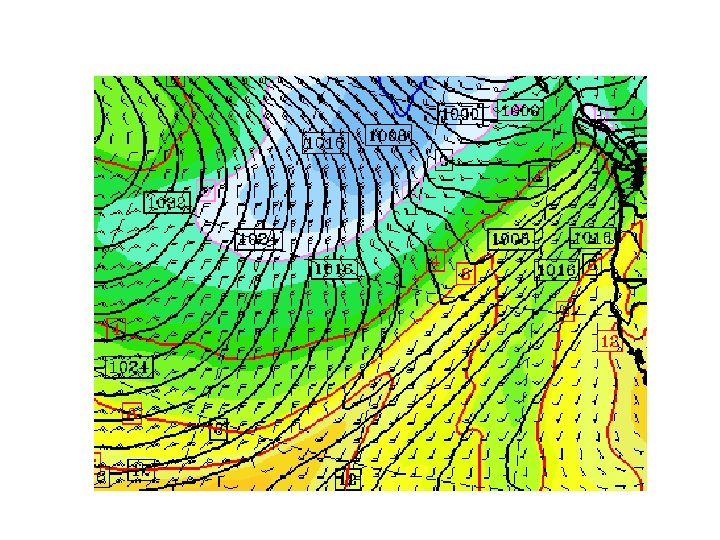
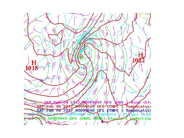
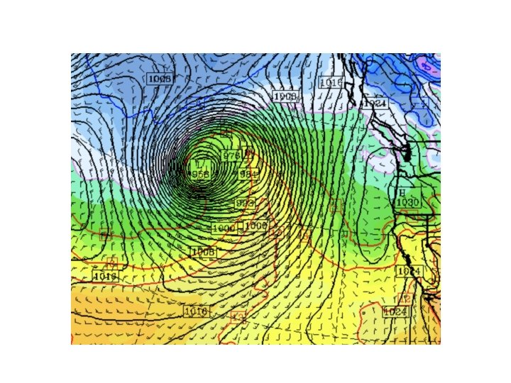
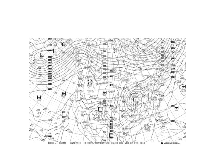
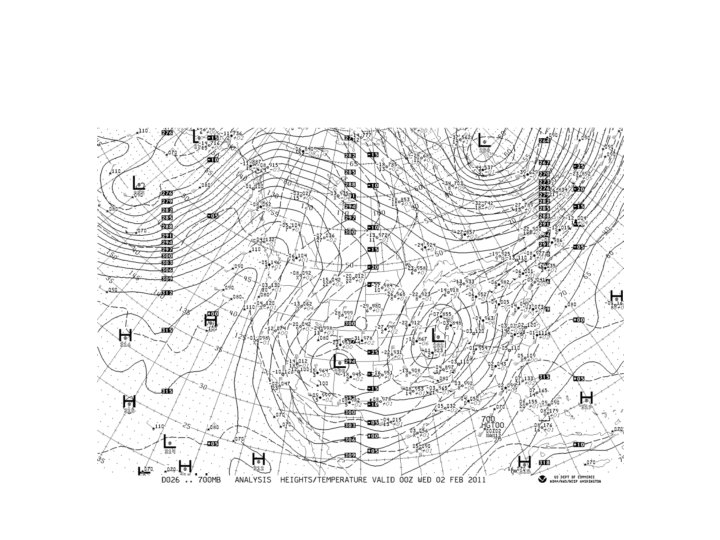
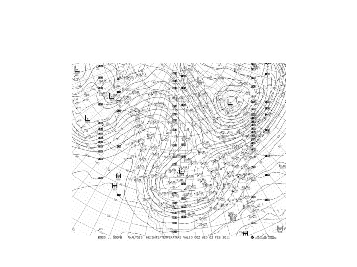
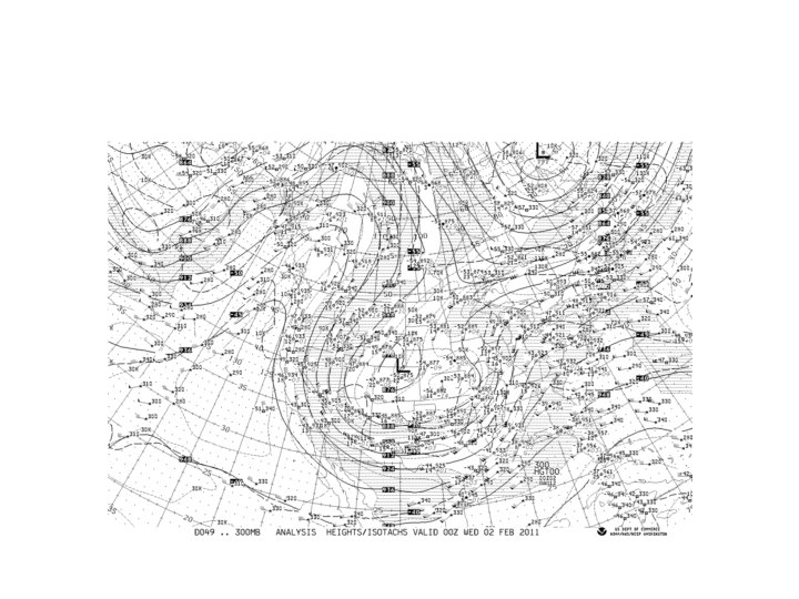
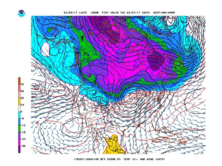
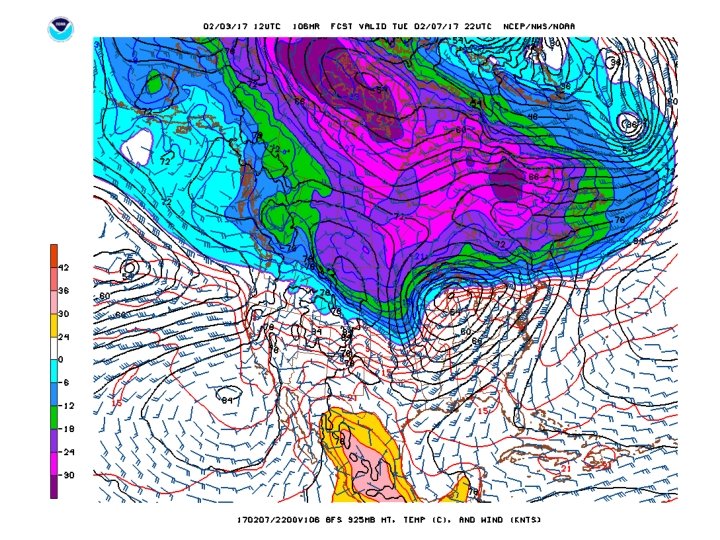
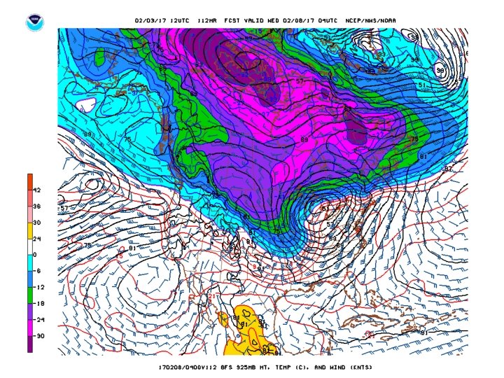
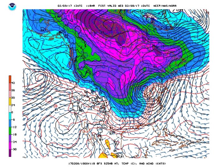
Let’s Check Out Real Examples!
Light Blue is Frontogenesis
Theoretical Studies in the 1940 s and 1950 s Showed That Synoptic Scale Deformation and Convergence Was NOT Enough to Rapidly Produce Mesoscale Fronts • The “secret” was learned in the 1950 s. • Mesoscale processes are needed for the final and rapid concentration of temperature gradients.
Synoptic Scale Alone Cold air Warm air
Secondary Circulations: Help Tighten Up Front! Cold air Warm air
Typical low level fronts typically weaken with height
Why do fronts weaken away from the surface? Vertical motions!
Vertical motions increase with height Adiabatic cooling on warm side Adiabatic warming On cold side Cold air Warm air Thus, the effects of vertical motions on temperature increase with height
As we shall learn, vertical motions can also create and maintain fronts in some locations • Near the tropopause, vertical motions can create upper-level fronts. • The more stable the atmosphere, the stronger the effect. • The mechanism where variations in vertical motion can produce horizontal temperature gradients is called tilting.
Higher Potential Temperature Adiabatic warming UP Adiabatic cooling Lower Potential Temperature Vertical Motions Can Create a Temperature Gradient Called tilting frontogenesis
Fronts Often Develop and Strengthen during midlatitude cyclone development • Frontogenesis and cyclogenesis go hand in hand! • Early work did not appreciate this fact
Frontal Width • Typically, most of the temperature drop occurs over 100 -200 km. • In very sharp fronts the majority of the change can occur in 1 -10 km • Over the oceans the frontal temperature change can weaken and expand.
Some Fronts Are Very Sharp Particularly Near the Surface
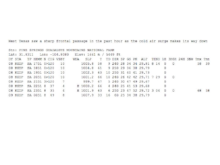
Colorado Event
Fronts are strongest near surfaces • Near the ground, where weak vertical motions don’t reduce temperature gradients. • Aloft near the tropopause (upper-level fronts), where distortions of the strong vertical potential temperature gradients can produced horizontal temperature gradients.
Fronts (and cyclones) tend to develop in regions of naturally strong horizontal temperature gradients (e. g. , SE US)