Frontal Systems Lessons 353637 Definition of a Front



- Slides: 56

Frontal Systems Lessons 35/36/37

Definition of a Front • A front is a zone of transition between two contrasting air masses. • Within the frontal zone exist strong horizontal gradients of temperature and humidity. • The interaction of two air masses at the frontal surface frequently gives rise to a great deal of frontal cloud and weather.

Definition of a Front, cont’d • A frontal surface separating two air masses slopes upwards over the colder air. The surface itself is about 3000 feet in thickness. • Typical frontal surface slopes are between 1: 100 to 1: 150.

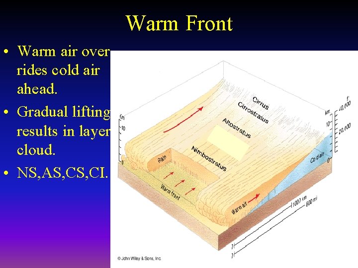
Warm Front • Warm air over rides cold air ahead. • Gradual lifting results in layer cloud. • NS, AS, CI.

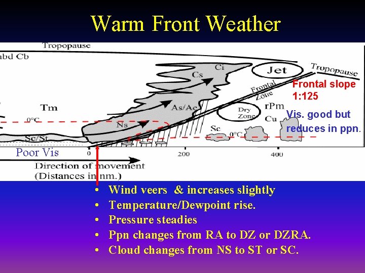
Warm Front Weather Frontal slope 1: 125 Vis. good but reduces in ppn. Poor Vis • • • Wind veers & increases slightly Temperature/Dewpoint rise. Pressure steadies Ppn changes from RA to DZ or DZRA. Cloud changes from NS to ST or SC.

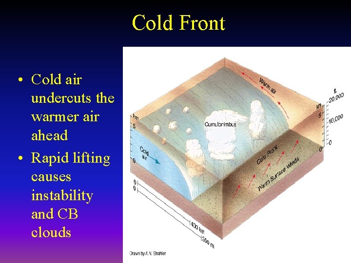
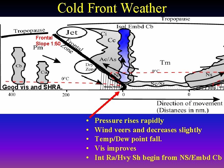
Cold Front • Cold air undercuts the warmer air ahead • Rapid lifting causes instability and CB clouds

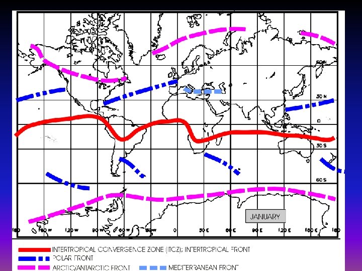
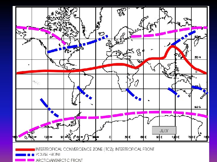
Global Distribution of Fronts • • Polar Fronts The Arctic/Antarctic Fronts Mediterranean Front Inter-tropical Convergence Zone (ITCZ), or Inter-tropical Front (FIT).


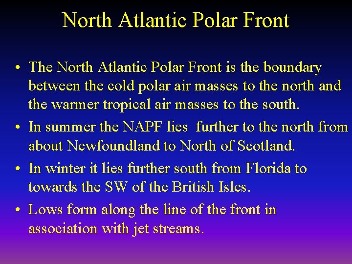
North Atlantic Polar Front • The North Atlantic Polar Front is the boundary between the cold polar air masses to the north and the warmer tropical air masses to the south. • In summer the NAPF lies further to the north from about Newfoundland to North of Scotland. • In winter it lies further south from Florida to towards the SW of the British Isles. • Lows form along the line of the front in association with jet streams.

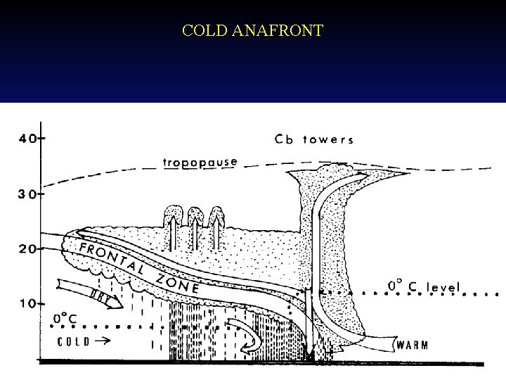
Classification of Fronts • Generally classified as cold/warm and as kata/ana fronts. • Ana-fronts: – are active fronts associated with pronounced vertical motion (lifting) along the frontal surface. – pronounced temperature contrast across the frontal surfaces and substantial cloud layers with associated precipitation.

Classification of Fronts con’t • Katafronts: – associated with subsidence aloft and a downward components at the frontal surface. – Thus any lifting is confine close to the surface and vertical cloud development is curtailed – Most of the cloud will be SC and ST with associated drizzle and patchy light rain. – The temperature contrast across katafronts are small and they are less active and slow moving.

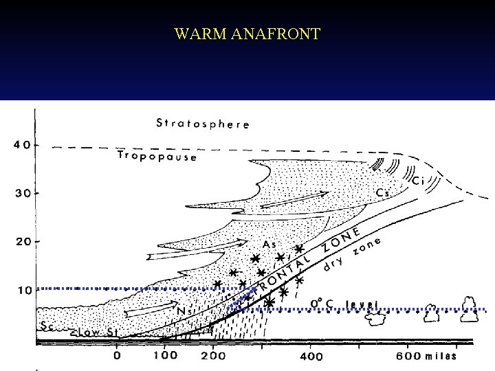
WARM ANAFRONT

Summary of Weather ahead of a Warm Front • Increasing cloud cover (CI, CS, AS, NS and CU/SC ahead with BKN ST in rain band) base gradually lowering. • Pressure falls then steadies on frontal passage. • Wind gradually backs to SW and freshens ahead of front, then veers on frontal passage. • Temp and Dew point steady ahead, but rise rapidly to meet each other on passage of front.

Summary of Weather ahead of a Warm Front, cont’d • Visibility good but moderate in rain with prob of frontal fog just ahead of front. • Low level wind shear just ahead of front • Light to moderate continuous rain 100 - 150 nm (200 -400 km) ahead of warm front. • Probability of rain ice below frontal inversion.

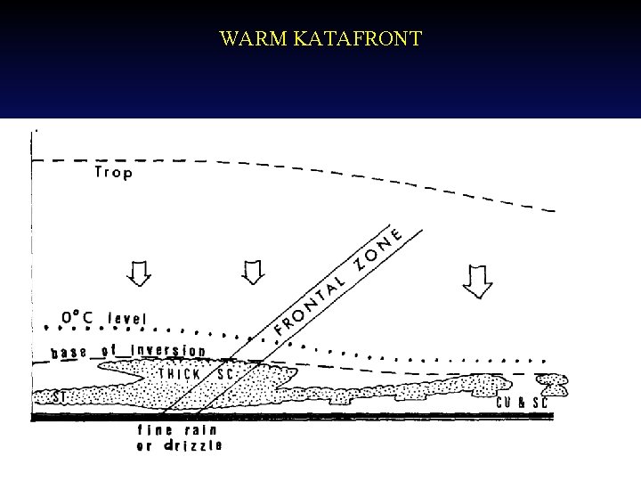
WARM KATAFRONT

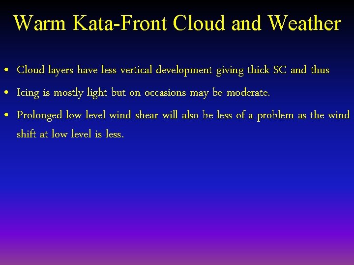
Warm Kata-Front Cloud and Weather • The weather hazards will be less severe due to the fact that it is less active. • Main precipitation is drizzle or a mix of drizzle and rain. Drizzle is far more restrictive for visibility.

Warm Kata-Front Cloud and Weather • Cloud layers have less vertical development giving thick SC and thus • Icing is mostly light but on occasions may be moderate. • Prolonged low level wind shear will also be less of a problem as the wind shift at low level is less.

Cold Front Weather Frontal Slope 1: 50 Good vis and SHRA. • • • Pressure rises rapidly Wind veers and decreases slightly Temp/Dew point fall. Vis improves Int Ra/Hvy Sh begin from NS/Embd Cb

COLD ANAFRONT

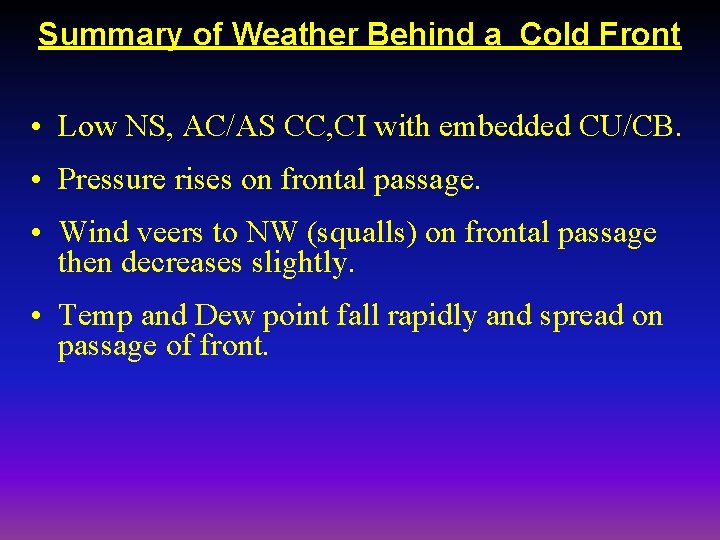
Summary of Weather Behind a Cold Front • Low NS, AC/AS CC, CI with embedded CU/CB. • Pressure rises on frontal passage. • Wind veers to NW (squalls) on frontal passage then decreases slightly. • Temp and Dew point fall rapidly and spread on passage of front.

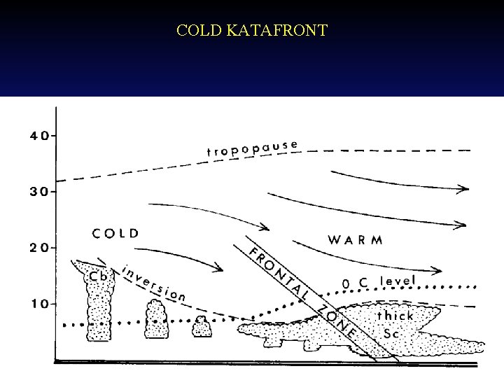
COLD KATAFRONT

Cold Kata-Front Weather • Occurs when there is a relative downward component along the frontal surface. • This happens when the air ahead has a greater velocity than the air behind.

Cold Kata-Front Weather. cont’d • Extensive layers of medium and upper layer cloud are absent and • Mostly stratocumulus and low altocumulus layers up to about 3 to 4 km altitude. • The shallow cloud tends to spread out on either side of the frontal zone rather than being mostly in the warm air mass.

Cold Kata-Front Weather (contd) • Any precipitation is light and patchy. • Temperature contrasts may still be high across the front even if rain is slight. • Only a small change in wind direction across the front. • Turbulence and icing are much less due to the lack of strong vertical motion in the cloud structures.

Summary of Weather Behind a Cold Front • Visibility moderate in heavy rain but good behind front. • Low level wind shear just behind front • Mod/heavy intermittent rain or rain showers 50 100 NM wide. • Probability of rain ice below frontal inversion. • Clear slot behind rain band. • TCU/CB and SHRA follow about behind cold front.

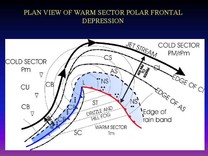
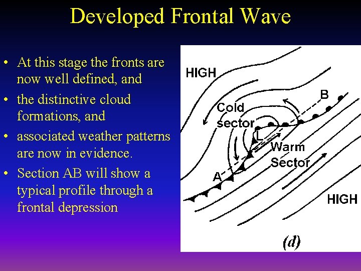
PLAN VIEW OF WARM SECTOR POLAR FRONTAL DEPRESSION

Summary of Weather in the Warm Sector • Low ST or SC • Pressure steady. • Surface wind generally steady westerly. • Temp and Dew point steady, little or no spread. • Visibility poor especially in DZ, possibility of hill fog. • Light to moderate intermittent DZ or DZRA.

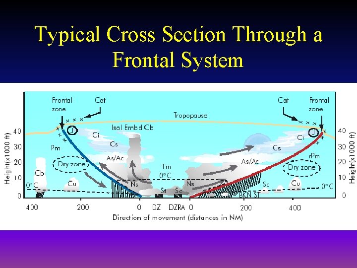
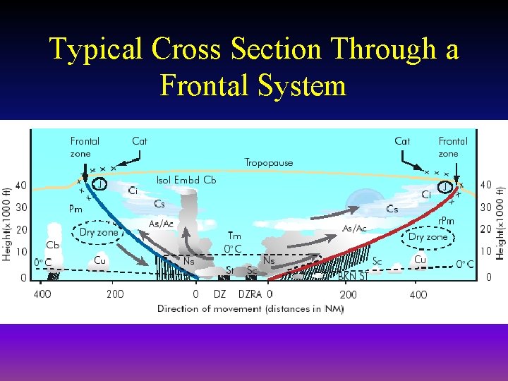
Typical Cross Section Through a Frontal System

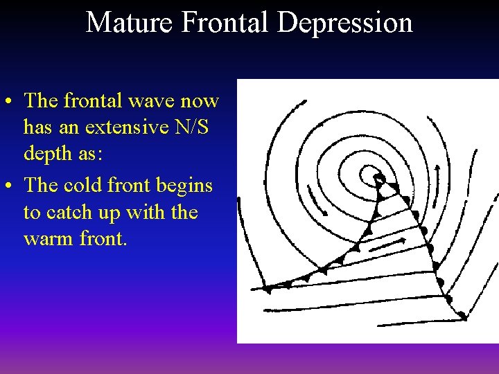
Mature Frontal Depression • The frontal wave now has an extensive N/S depth as: • The cold front begins to catch up with the warm front.

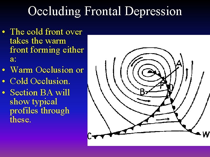
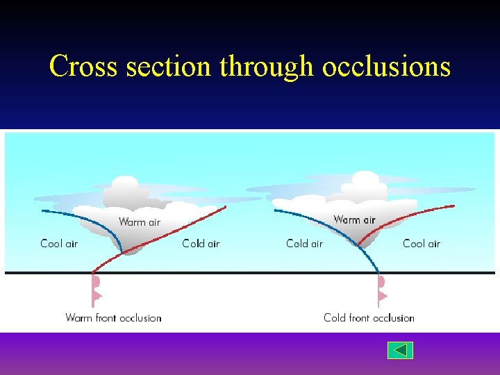
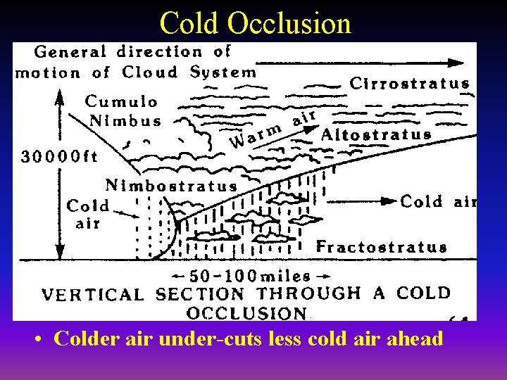
Occluding Frontal Depression • The cold front over takes the warm front forming either a: • Warm Occlusion or • Cold Occlusion. • Section BA will show typical profiles through these.

Cross section through occlusions

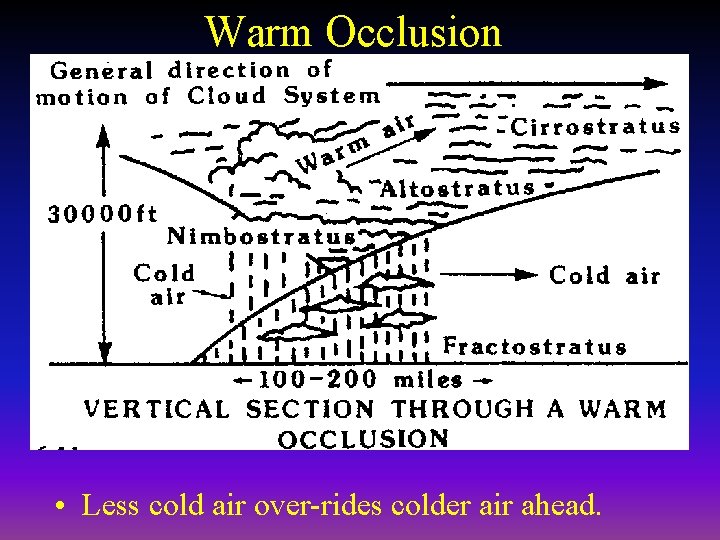
Warm Occlusion • Less cold air over-rides colder air ahead.

Cold Occlusion • Colder air under-cuts less cold air ahead

Additional Frontal Facts • Secondary lows may form at triple point of an occlusion. • Weather in these may be worse than primary low.

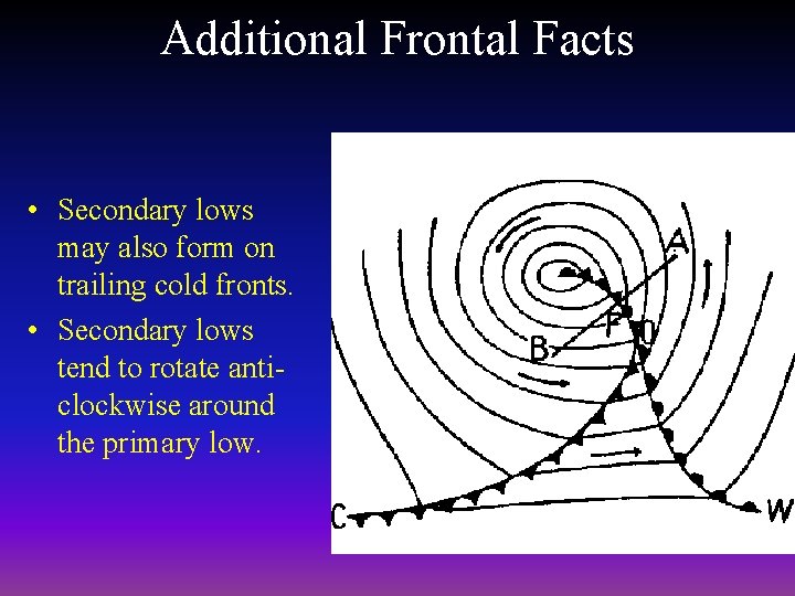
Additional Frontal Facts • Secondary lows may also form on trailing cold fronts. • Secondary lows tend to rotate anticlockwise around the primary low.

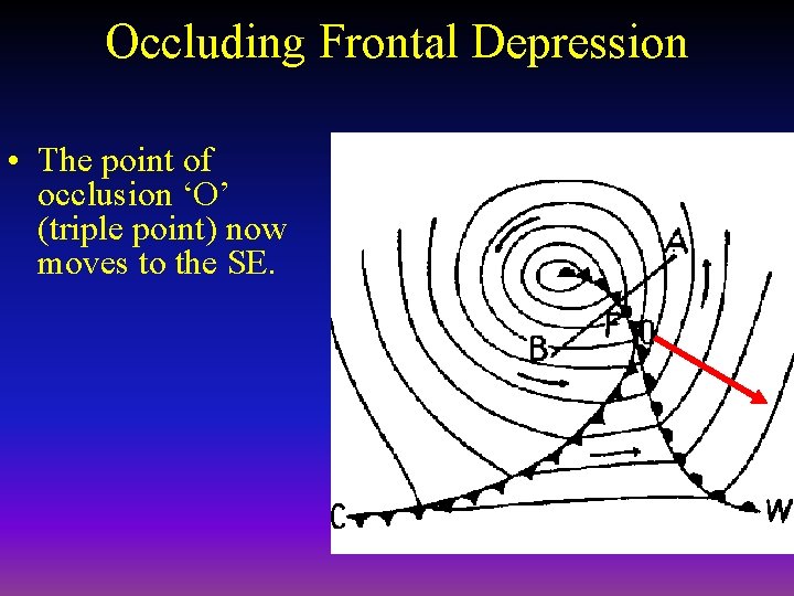
Occluding Frontal Depression • The point of occlusion ‘O’ (triple point) now moves to the SE.

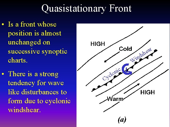
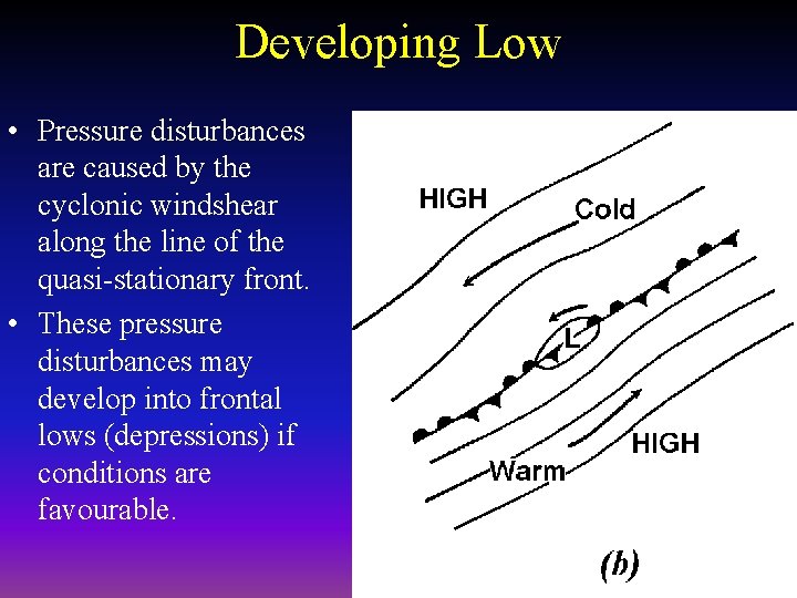
Quasistationary Front • Is a front whose position is almost unchanged on successive synoptic charts. • There is a strong tendency for wave like disturbances to form due to cyclonic windshear. ar e sh ind W c y C ic L n lo

Developing Low • Pressure disturbances are caused by the cyclonic windshear along the line of the quasi-stationary front. • These pressure disturbances may develop into frontal lows (depressions) if conditions are favourable.

Why do surface lows deepen? • Lows are convergent at the surface which produce: – Wide spread ascent within the low. – An area of divergence must exist aloft. • If upper level divergence exceeds surface convergence then the low will deepen. – If not then the low will quickly fill. • The upper airflow, mainly the PF Jetstream provides the upper level divergence and convergence to sustain the surface pressure systems.

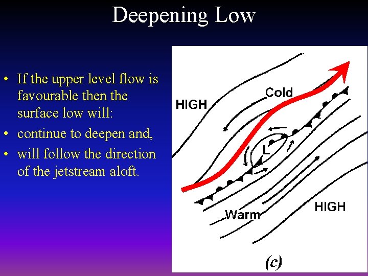
Deepening Low • If the upper level flow is favourable then the surface low will: • continue to deepen and, • will follow the direction of the jetstream aloft.

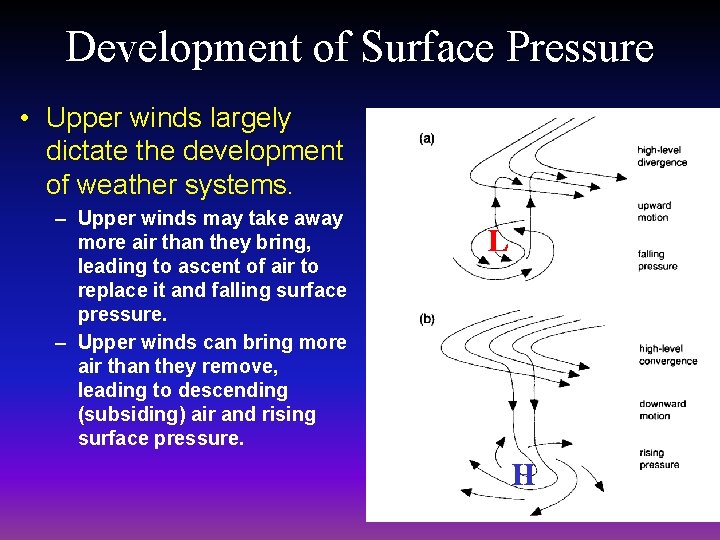
Development of Surface Pressure • Upper winds largely dictate the development of weather systems. – Upper winds may take away more air than they bring, leading to ascent of air to replace it and falling surface pressure. – Upper winds can bring more air than they remove, leading to descending (subsiding) air and rising surface pressure. L H

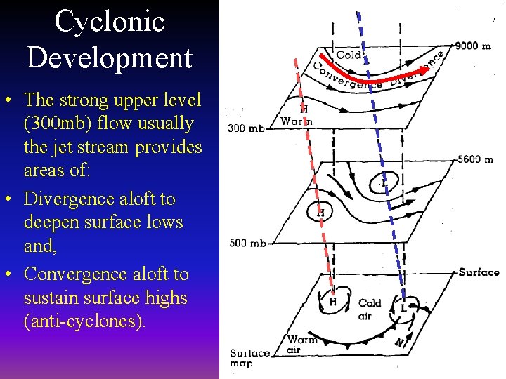
Cyclonic Development • The strong upper level (300 mb) flow usually the jet stream provides areas of: • Divergence aloft to deepen surface lows and, • Convergence aloft to sustain surface highs (anti-cyclones).

How do fronts form? • A front is a boundary between air masses of different temperature properties. • The warm air to the east of the low moves northward over-riding the cold air to the north causing a: – Warm Front. • The cold air to the west of the low moves southward undercutting the warm air ahead causing a: – Cold Front.

Developed Frontal Wave • At this stage the fronts are now well defined, and • the distinctive cloud formations, and • associated weather patterns are now in evidence. • Section AB will show a typical profile through a frontal depression

Typical Cross Section Through a Frontal System

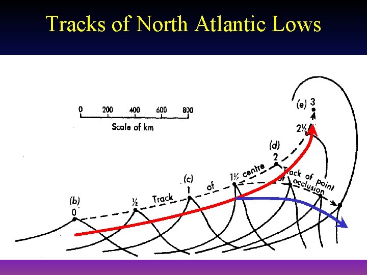
Tracks of North Atlantic Lows


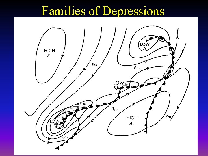
Families of Depressions

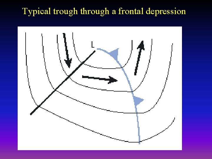
Typical trough through a frontal depression

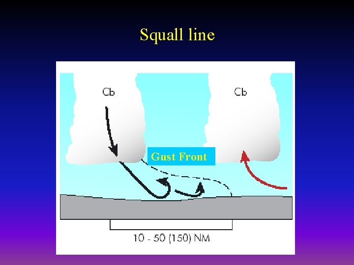
Squall line Gust Front

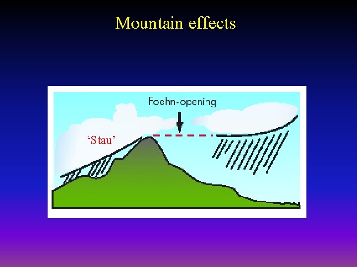
Mountain effects ‘Stau’

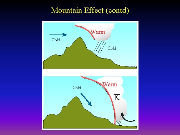
Mountain Effect (contd) Warm

Additional Frontal Facts • In winter a front exist in the Mediterranean. Between the cold polar air to the north and the warmer tropical continental air to the south. • Arctic Maritime air usually advances behind an Arctic Front.