Forecasting Tropical cyclones Regional Training Workshop on Severe

- Slides: 40

Forecasting Tropical cyclones Regional Training Workshop on Severe Weather Forecasting and Warning Services (Macao, China, 9 April 2013)

Contents 1. Outline of TC forecasting process 2. TC Analysis 3. TC Forecasting 4. Verification of TC forecast and models

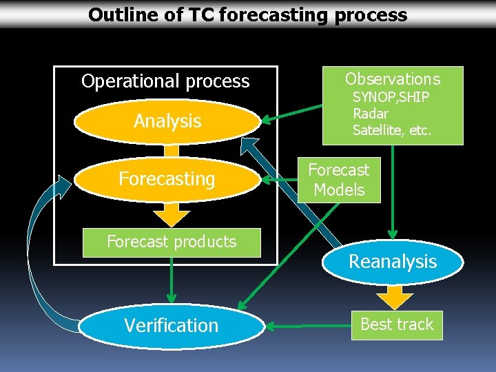
Outline of TC forecasting process Operational process Analysis Forecasting Forecast products Verification Observations SYNOP, SHIP Radar Satellite, etc. Forecast Models Reanalysis Best track

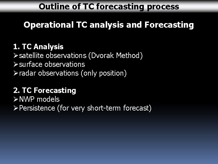
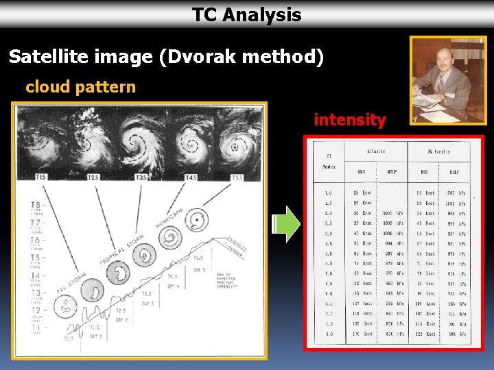
Outline of TC forecasting process Operational TC analysis and Forecasting 1. TC Analysis Øsatellite observations (Dvorak Method) Øsurface observations Øradar observations (only position) 2. TC Forecasting ØNWP models ØPersistence (for very short-term forecast)

Contents 1. Outline of TC forecasting process 2. TC Analysis 3. TC Forecasting 4. Verification of TC forecast and models

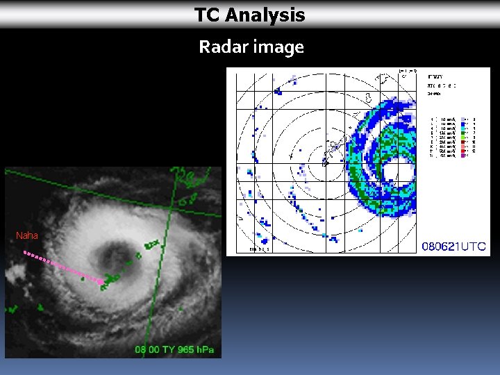
TC Analysis of current position and intensity Øsatellite observations Øsurface observations Øradar observations (position only) TC analysis is important for TC forecasting. With a wrong TC analysis of current position and intensity, TC forecast will be wrong even if the NWP model performance is excellent.

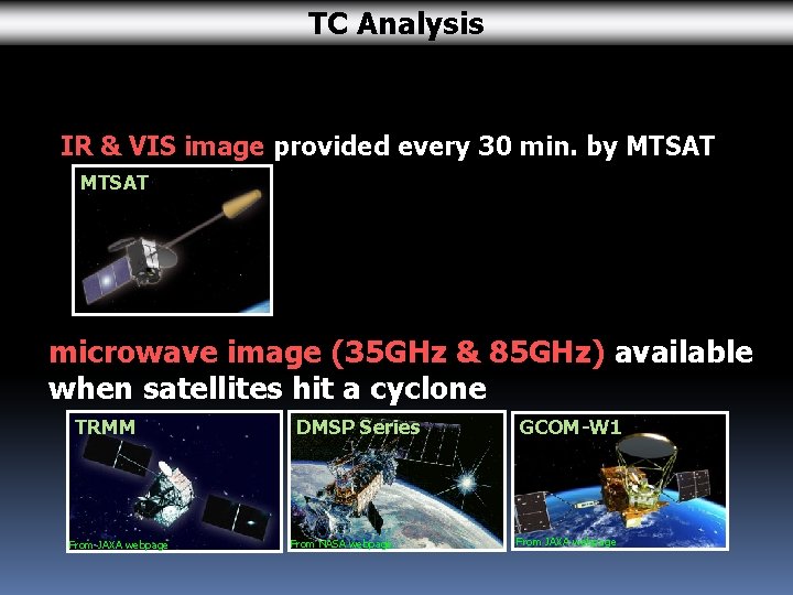
TC Analysis IR & VIS image provided every 30 min. by MTSAT microwave image (35 GHz & 85 GHz) available when satellites hit a cyclone TRMM From JAXA webpage DMSP Series From NASA webpage GCOM-W 1 From JAXA webpage

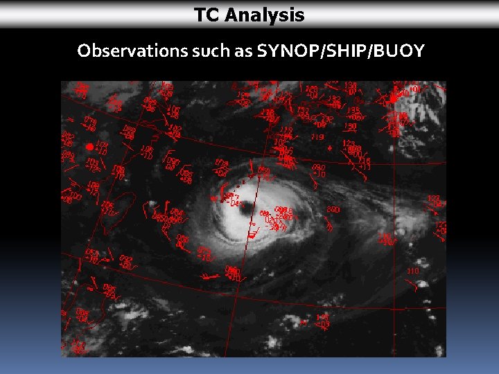
TC Analysis Observations such as SYNOP/SHIP/BUOY

TC Analysis Radar image Naha

TC Analysis Satellite image (Dvorak method) cloud pattern intensity

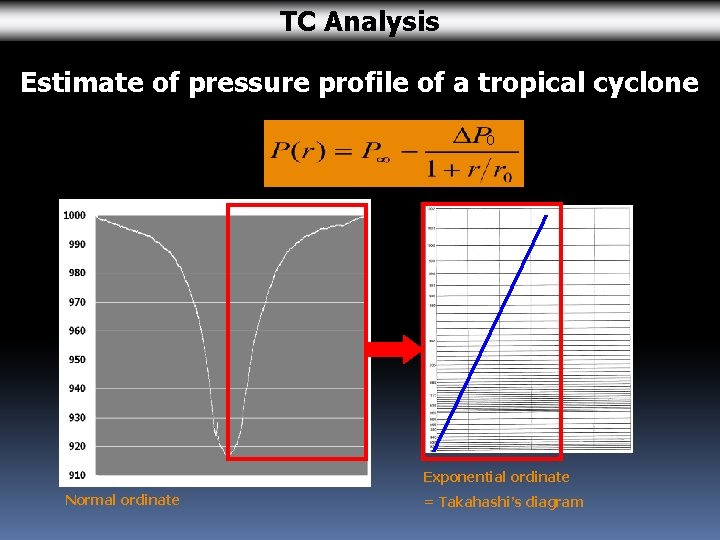
TC Analysis Estimate of pressure profile of a tropical cyclone 0 Exponential ordinate Normal ordinate = Takahashi’s diagram

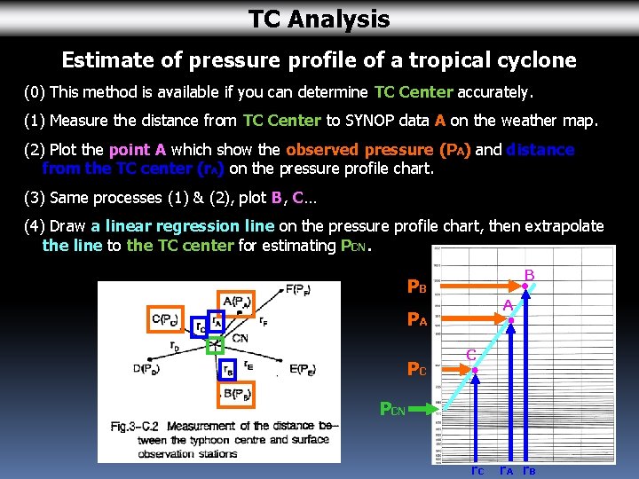
TC Analysis Estimate of pressure profile of a tropical cyclone (0) This method is available if you can determine TC Center accurately. (1) Measure the distance from TC Center to SYNOP data A on the weather map. (2) Plot the point A which show the observed pressure (PA) and distance from the TC center (r. A) on the pressure profile chart. (3) Same processes (1) & (2), plot B, C… (4) Draw a linear regression line on the pressure profile chart, then extrapolate the line to the TC center for estimating PCN. B PB A PA PC C PCN r. C r. A r. B

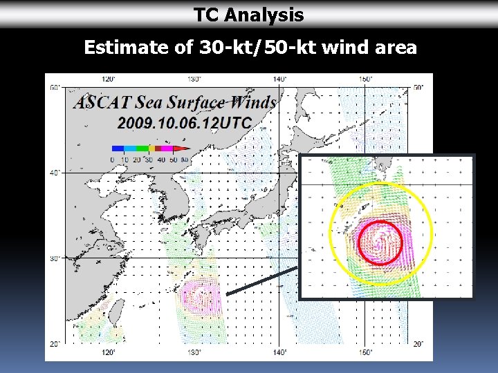
TC Analysis Estimate of 30 -kt/50 -kt wind area

Contents 1. Outline of TC forecasting process 2. TC Analysis 3. TC Forecasting 4. Verification of TC forecast and models

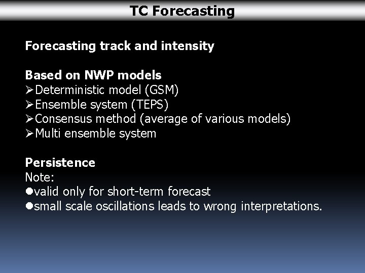
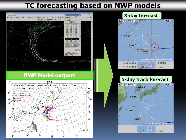
TC Forecasting track and intensity Based on NWP models ØDeterministic model (GSM) ØEnsemble system (TEPS) ØConsensus method (average of various models) ØMulti ensemble system Persistence Note: lvalid only for short-term forecast lsmall scale oscillations leads to wrong interpretations.

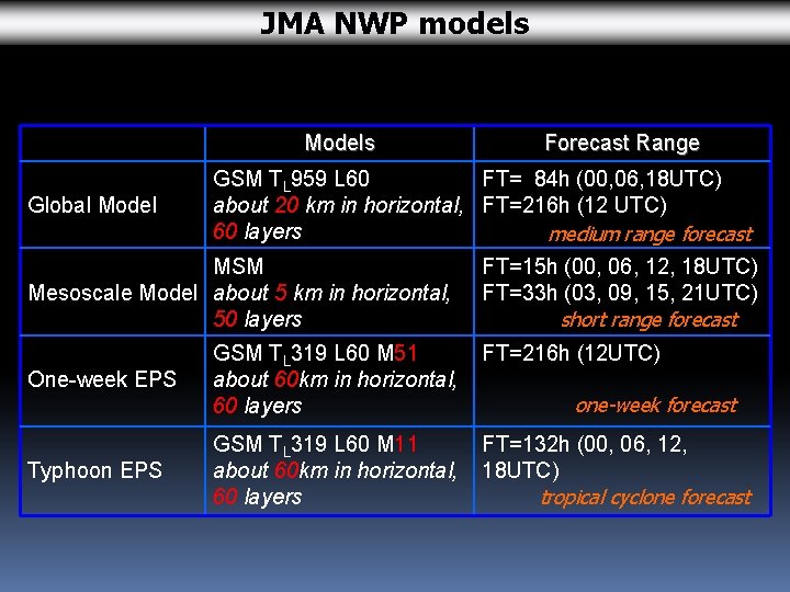
JMA NWP models Models Global Model Forecast Range GSM TL 959 L 60 FT= 84 h (00, 06, 18 UTC) about 20 km in horizontal, FT=216 h (12 UTC) 60 layers medium range forecast MSM Mesoscale Model about 5 km in horizontal, 50 layers FT=15 h (00, 06, 12, 18 UTC) FT=33 h (03, 09, 15, 21 UTC) short range forecast FT=216 h (12 UTC) One-week EPS GSM TL 319 L 60 M 51 about 60 km in horizontal, 60 layers Typhoon EPS GSM TL 319 L 60 M 11 about 60 km in horizontal, 60 layers FT=132 h (00, 06, 12, 18 UTC) tropical cyclone forecast one-week forecast

TC forecasting based on NWP models 3 -day forecast NWP Model outputs 5 -day track forecast

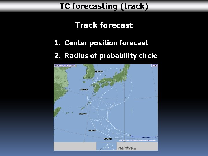
TC forecasting (track) Track forecast 1. Center position forecast 2. Radius of probability circle

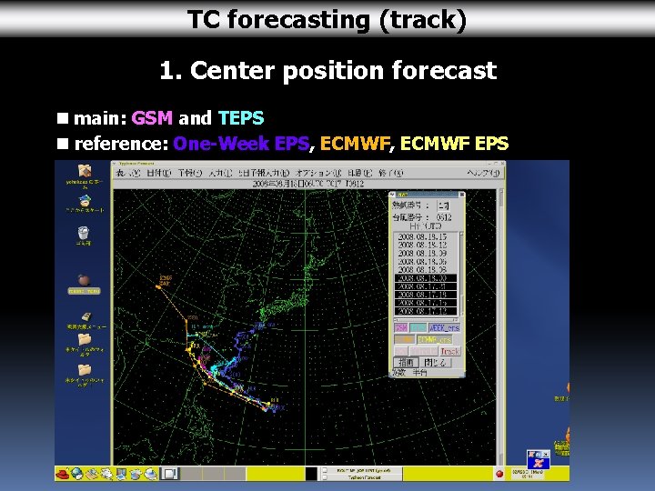
TC forecasting (track) 1. Center position forecast n main: GSM and TEPS n reference: One-Week EPS, ECMWF EPS

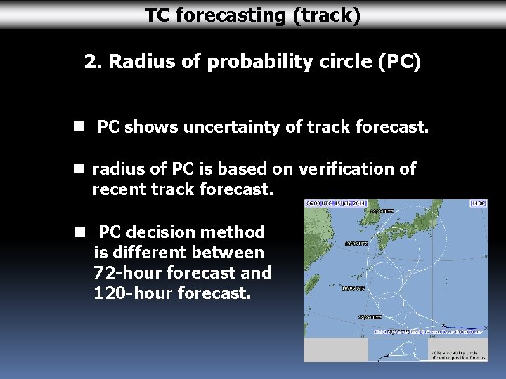
TC forecasting (track) 2. Radius of probability circle (PC) n PC shows uncertainty of track forecast. n radius of PC is based on verification of recent track forecast. n PC decision method is different between 72 -hour forecast and 120 -hour forecast.

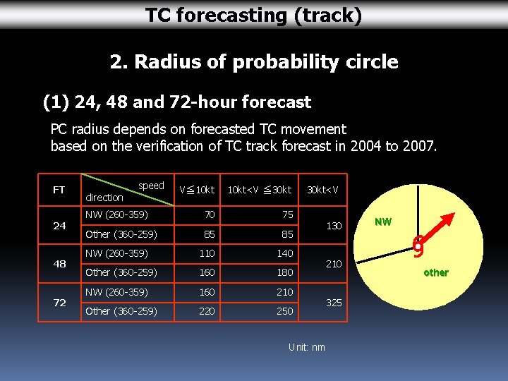
TC forecasting (track) 2. Radius of probability circle (1) 24, 48 and 72 -hour forecast PC radius depends on forecasted TC movement based on the verification of TC track forecast in 2004 to 2007. FT 24 48 72 speed V≦ 10 kt<V ≦ 30 kt direction NW (260 -359) 70 75 Other (360 -259) 85 85 NW (260 -359) 110 140 Other (360 -259) 160 180 NW (260 -359) 160 210 Other (360 -259) 220 250 30 kt<V Unit: nm 130 210 325 NW other

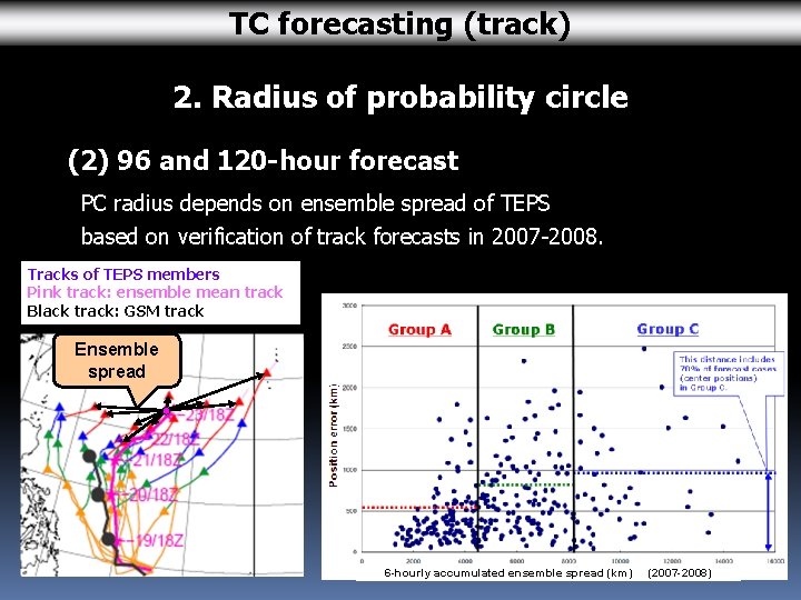
TC forecasting (track) 2. Radius of probability circle (2) 96 and 120 -hour forecast PC radius depends on ensemble spread of TEPS based on verification of track forecasts in 2007 -2008. Tracks of TEPS members Pink track: ensemble mean track Black track: GSM track Ensemble spread 6 -hourly accumulated ensemble spread (km) (2007 -2008)

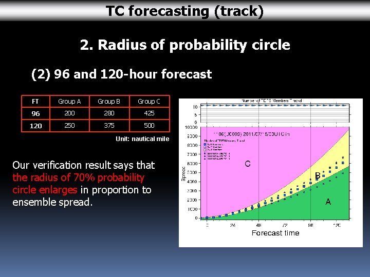
TC forecasting (track) 2. Radius of probability circle (2) 96 and 120 -hour forecast FT Group A Group B Group C 96 200 280 425 120 250 375 500 Unit: nautical mile Our verification result says that the radius of 70% probability circle enlarges in proportion to ensemble spread.

TC forecasting (Intensity) Intensity forecast 1. Central pressure (CP) 2. Maximum sustained wind (MSW) 3. Peak gust 4. Storm warning area

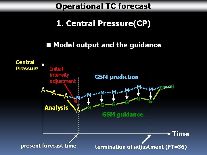
Operational TC forecast 1. Central Pressure(CP) n Model output and the guidance Central Pressure Initial intensity adjustment A Analysis GSM prediction M A M G M M G GSM guidance Time present forecast time termination of adjustment (FT=36)

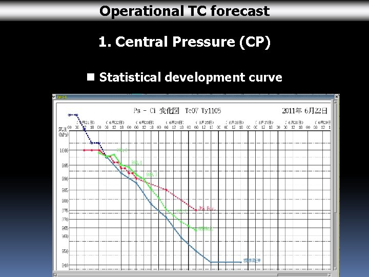
Operational TC forecast 1. Central Pressure (CP) n Statistical development curve

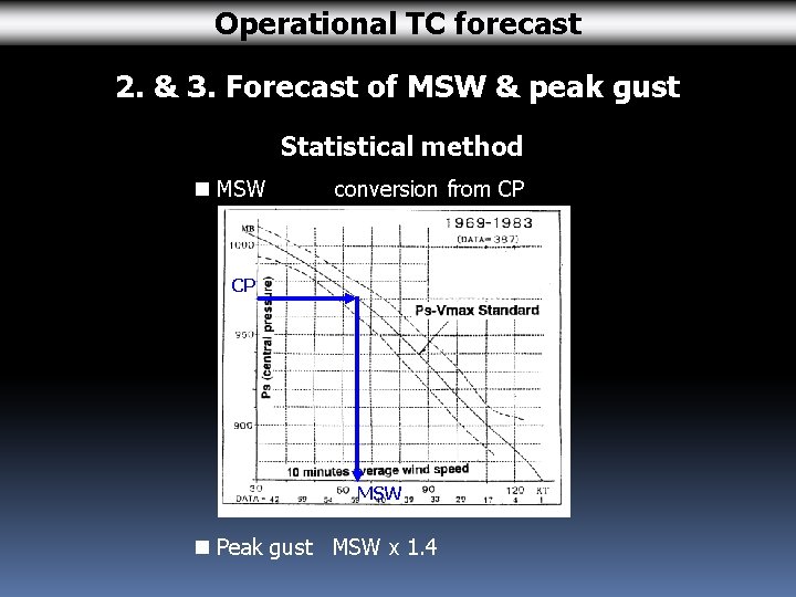
Operational TC forecast 2. & 3. Forecast of MSW & peak gust Statistical method n MSW conversion from CP CP MSW n Peak gust MSW x 1. 4

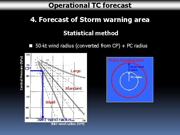
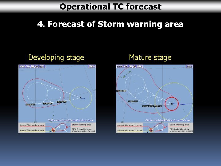
Operational TC forecast 4. Forecast of Storm warning area Statistical method Central Pressure (h. Pa) n 50 -kt wind radius (converted from CP) + PC radius Storm Warning Area CP Large 50 -kt wind radius PC radius Standard Small 50 kt-wind radius 50 kt wind radius (NM)

Operational TC forecast 4. Forecast of Storm warning area Developing stage Mature stage

Contents 1. Outline of TC forecasting process 2. TC Analysis 3. TC Forecasting 4. Verification of TC forecast and models

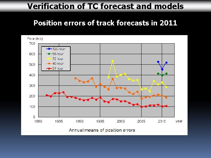
Verification of TC forecast and models Position errors of track forecasts in 2011

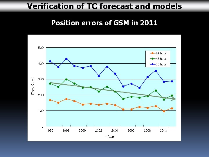
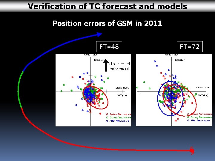
Verification of TC forecast and models Position errors of GSM in 2011

Verification of TC forecast and models Position errors of GSM in 2011 FT=48 direction of movement FT=72

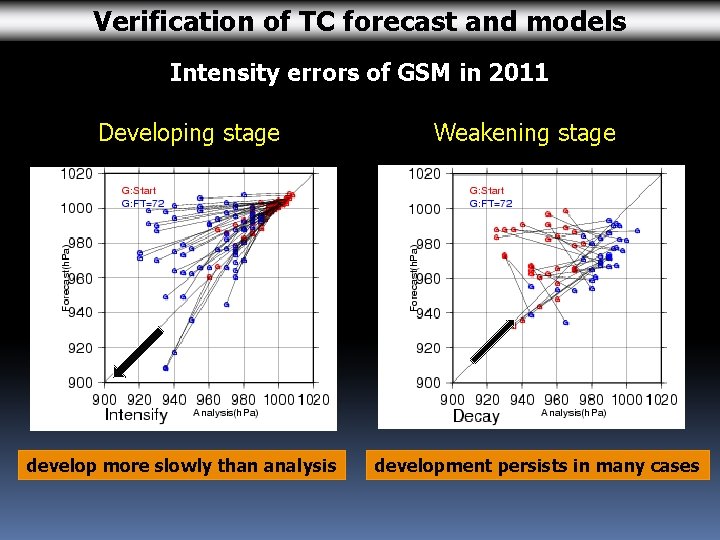
Verification of TC forecast and models Intensity errors of GSM in 2011 Developing stage develop more slowly than analysis Weakening stage development persists in many cases

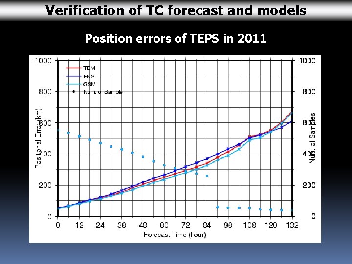
Verification of TC forecast and models Position errors of TEPS in 2011

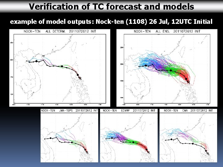
Verification of TC forecast and models example of model outputs: Nock-ten (1108) 26 Jul, 12 UTC Initial

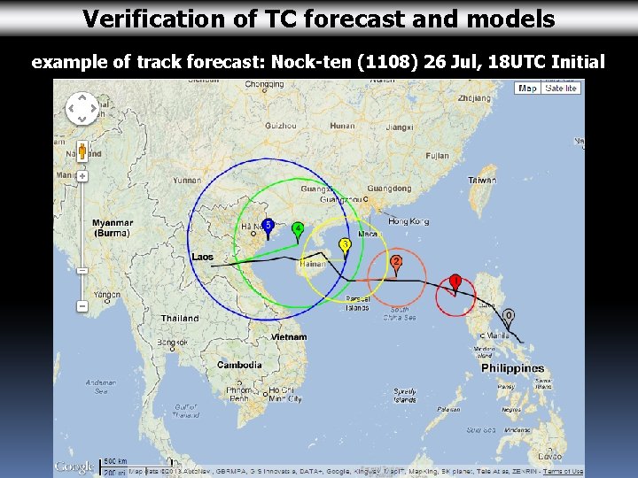
Verification of TC forecast and models example of track forecast: Nock-ten (1108) 26 Jul, 18 UTC Initial

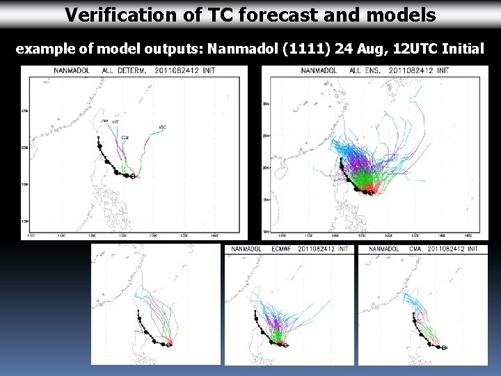
Verification of TC forecast and models example of model outputs: Nanmadol (1111) 24 Aug, 12 UTC Initial

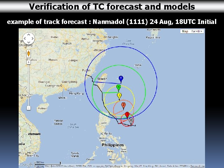
Verification of TC forecast and models example of track forecast : Nanmadol (1111) 24 Aug, 18 UTC Initial

End