Forecasting Surface Wind Gusts in Positively Stable Environments
Forecasting Surface Wind Gusts in Positively Stable Environments Stas Speransky Florida State University James E. Lee National Weather Service, Sterling, VA Brian La. Sorsa National Weather Service, Sterling, VA
Outline • • • Problem Statement Background Unstable/Stable Cases Hypothesis + Goal Methodology Results Testing Model Equation Demo Conclusions Limitations Future Research
Problem Statement • Wind maxima between 0. 5 km and 3 km above the earth’s surface frequently bring in warm air over a colder earth’s surface in the mid-Atlantic region, producing a positively static stable environment. • This environment inhibits mixing • However, it has been observed that a portion of the low level wind max does mix to the surface in the form of Wind Gusts • Meteorologists are in need of a predictive technique to assist them in forecasting wind gusts in this environment
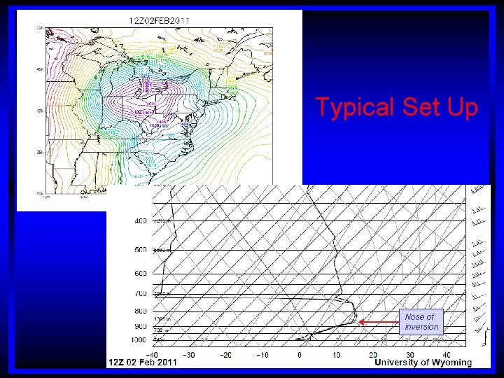
Typical Set Up Nose of inversion
Background • Prior research (Lee and Girodo, 1997) showed that in environments exhibiting negative static stability, determining the depth of the mixed layer is important in forecasting surface wind gusts. • It was found that the wind at the top of the mixed layer frequently mixes down to the earth’s surface • This research led to the inclusion of the “Momentum Transfer” function in BUFKIT • There is currently no known technique to determine the surface wind gusts in stable environments

Unstable/Stable Unstable Stable
Hypothesis + Goal • Correlations can be developed between surface Wind Gust and: 1. Depth of Stable Layer » Surface to nose of the inversion 2. Magnitude of Low Level Jet » Wind at nose of the inversion 3. Stability Index » Lapse rate between surface and nose of the inversion • Apply correlations to develop a predictive technique to forecast surface wind gusts in stable environments
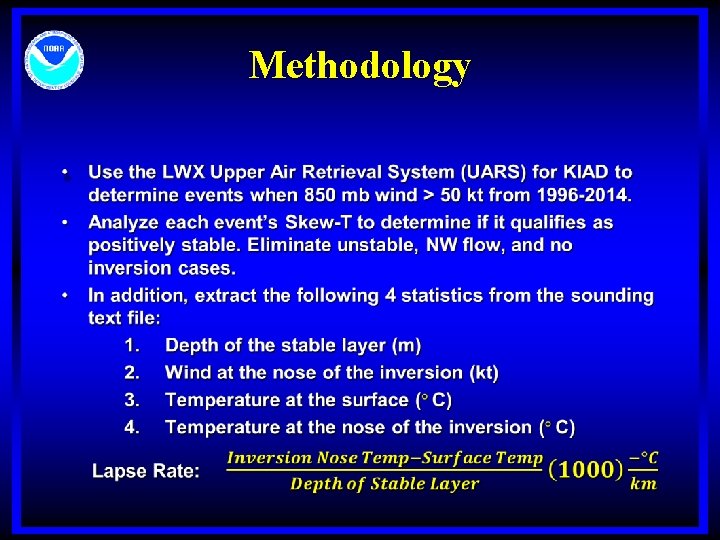
Methodology •
Methodology (cont. ) • Using the LWX Climate Data Retrieval System (CDRS), go through each event to retrieve surface gust measurements from KIAD ASOS system at +/ - 2 hours from upper air release (5 hour window) • If no wind gusts reported, eliminate event from study • Calculate and plot results using Excel
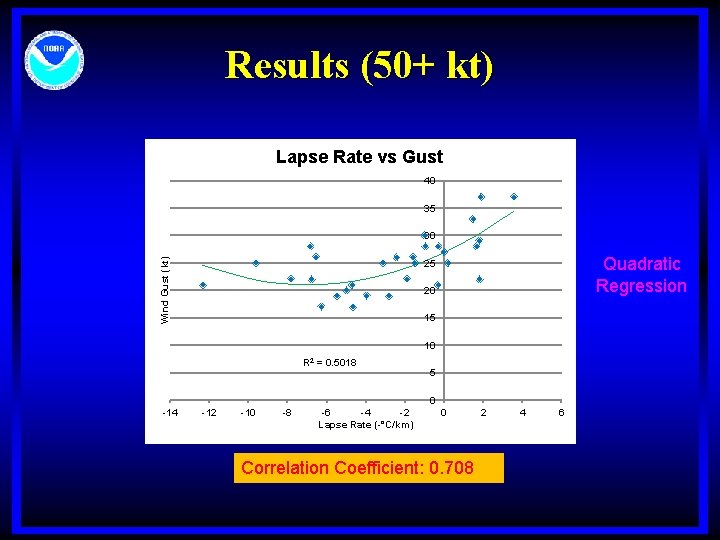
Wind Gust (kt) Results (50+ kt) Lapse Rate (-°C/km)
Good correlation! • However, many events did not have reported gusts within the 5 hour timeframe, so in 18 years – only 30 events • So…lets lower the LLJ criteria to 45 kt to have more data more confidence in the model equation
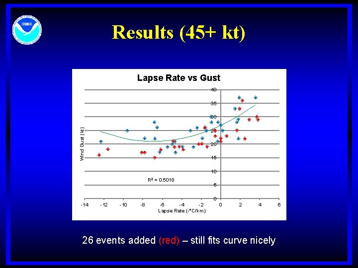
Wind Gust (kt) Results (45+ kt) Lapse Rate (-°C/km)
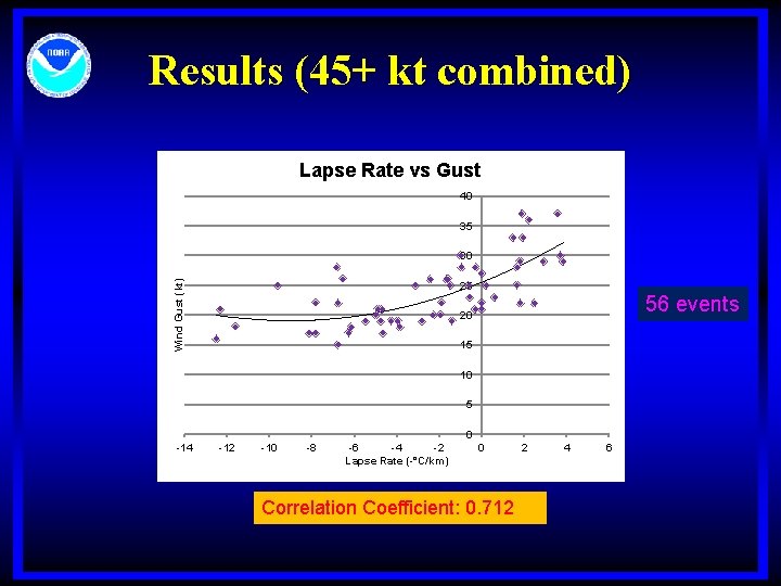
Results (45+ kt combined) Lapse Rate vs Gust 40 35 Wind Gust (kt) 30 25 56 events 20 15 10 5 0 -14 -12 -10 -8 -6 -4 -2 Lapse Rate (-°C/km) 0 Correlation Coefficient: 0. 712 2 4 6
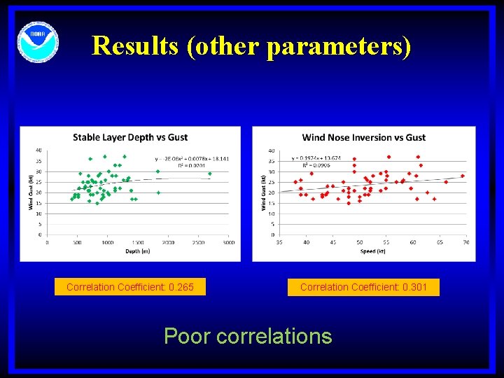
Results (other parameters) Correlation Coefficient: 0. 265 Correlation Coefficient: 0. 301 Poor correlations
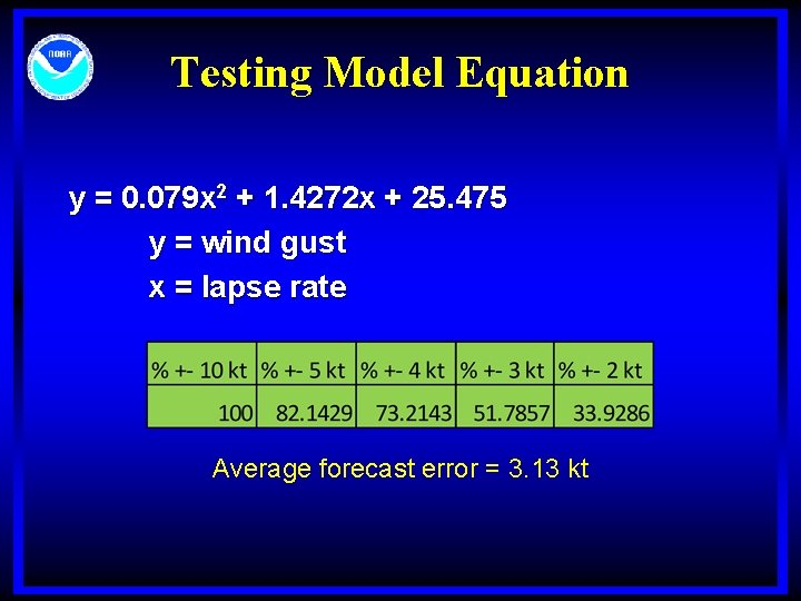
Testing Model Equation y = 0. 079 x 2 + 1. 4272 x + 25. 475 y = wind gust x = lapse rate Average forecast error = 3. 13 kt

Demo “The Stas Stabilizer”
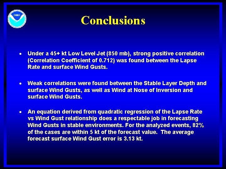
Conclusions Under a 45+ kt Low Level Jet (850 mb), strong positive correlation (Correlation Coefficient of 0. 712) was found between the Lapse Rate and surface Wind Gusts. Weak correlations were found between the Stable Layer Depth and surface Wind Gusts, as well as Wind at Nose of Inversion and surface Wind Gusts. An equation derived from quadratic regression of the Lapse Rate vs Wind Gust relationship does a respectable job in forecasting Wind Gusts in stable environments. For the analyzed events, 82% of the cases are within 5 kt of the forecast value. The average forecast surface Wind Gust error is 3. 13 kt.
Limitations • • • 45+ kts @ 850 mb Absolutely stable environment Average lapse rate doesn’t account for the “kinks”
Future Research • Extend study to other regions of the country in order to see if the equation could be used as a prognostic tool there as well • Explore conditionally unstable environments • Integrate into BUFKIT
Acknowledgements • • • Jim Lee Steve Zubrick Diana Norgaard Jared Klein Brian La. Sorsa

Thank You! Questions/Comments?
- Slides: 21